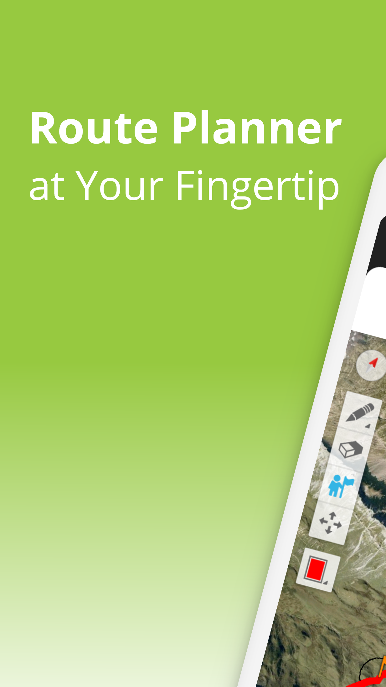
TouchTrails: Route Planner - Route planning & navigation
Plan, trace & navigate outdoor routes easily with detailed distance & elevation info for unforgettable adventures!

- 2.12.0 Version
- 1.3 Score
- 152K+ Downloads
- In-app purchases License
- 3+ Content Rating

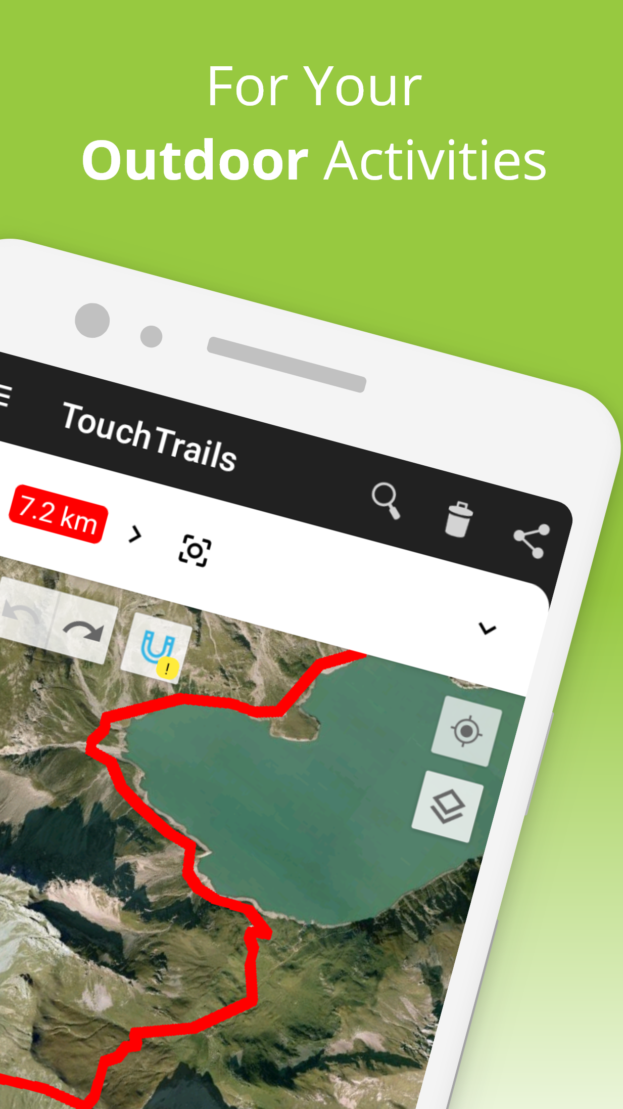
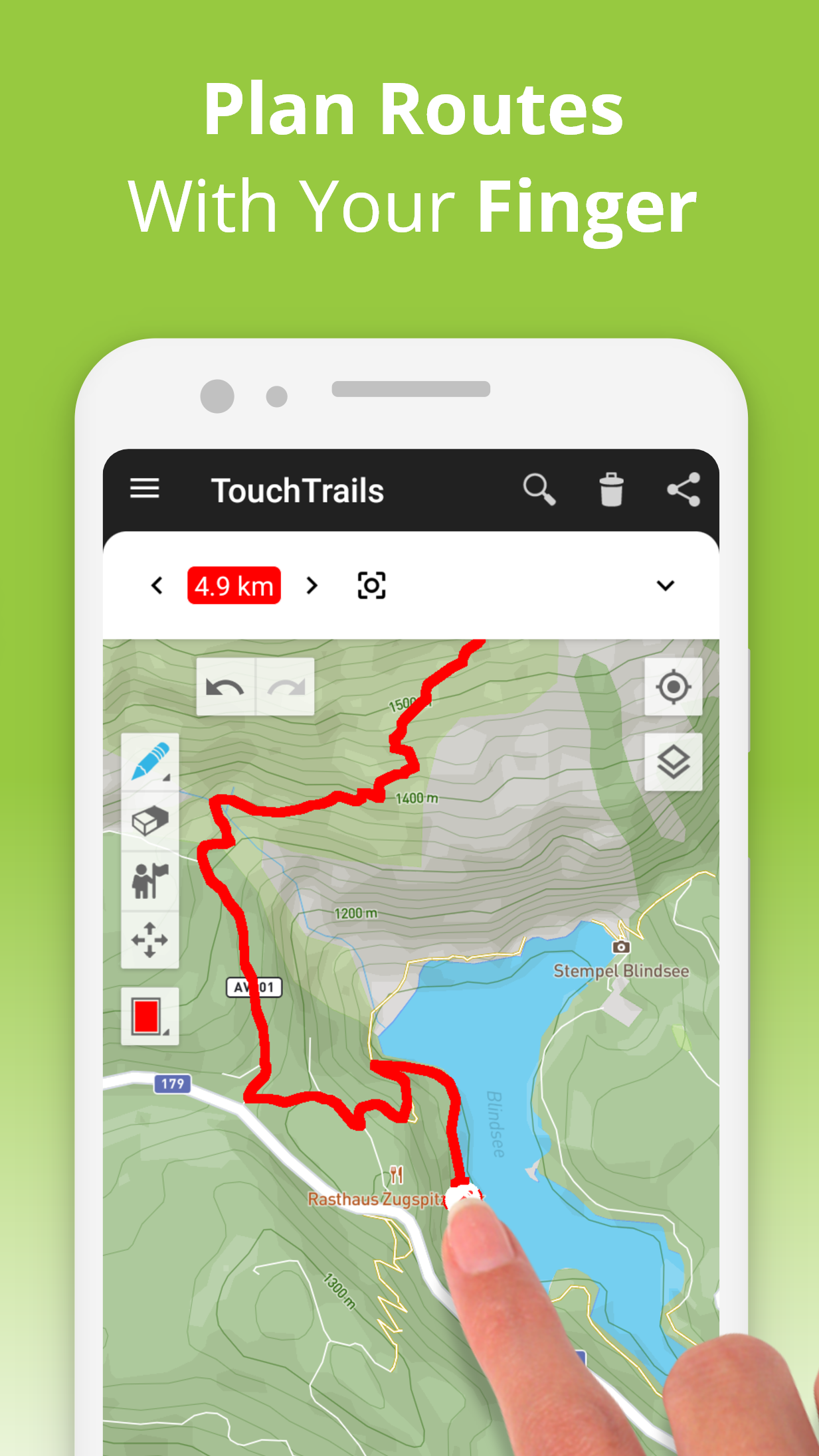
TouchTrails offers a user-friendly way to plan routes for your outdoor excursions. You can easily trace your paths directly on the map with your finger, providing precise distance details and comprehensive elevation profiles.
Design routes for your upcoming biking trip or extended hiking journey, and follow along using turn-by-turn voice navigation.
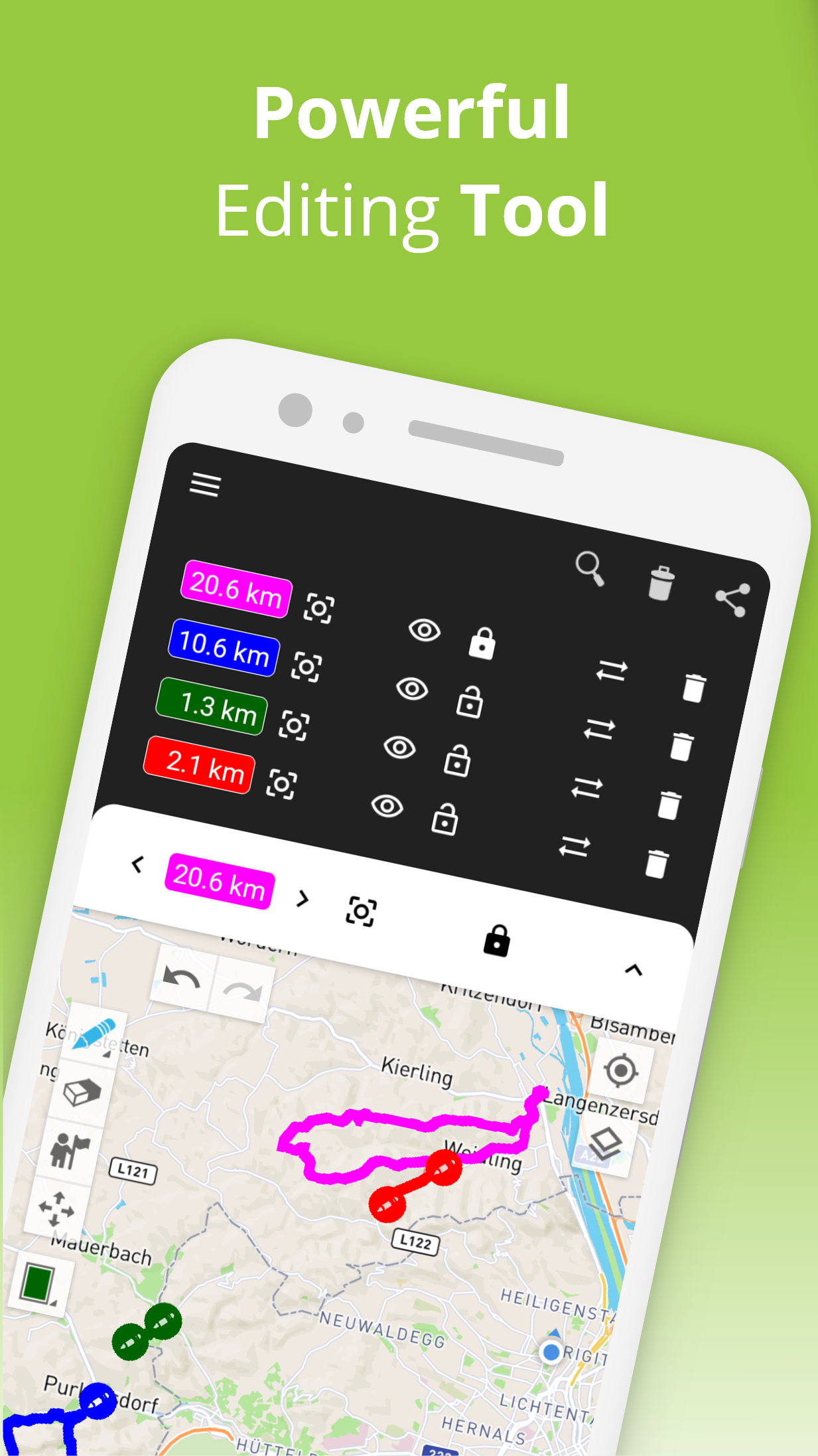
Create and personalize your routes
With the ability to draw routes by hand, you can navigate anywhere. The snap-to-road feature ensures you stay on your designated path, but you also have the freedom to explore off-trail. TouchTrails allows you to tailor routes according to your specific requirements—split pathways, delete sections, or link them together.
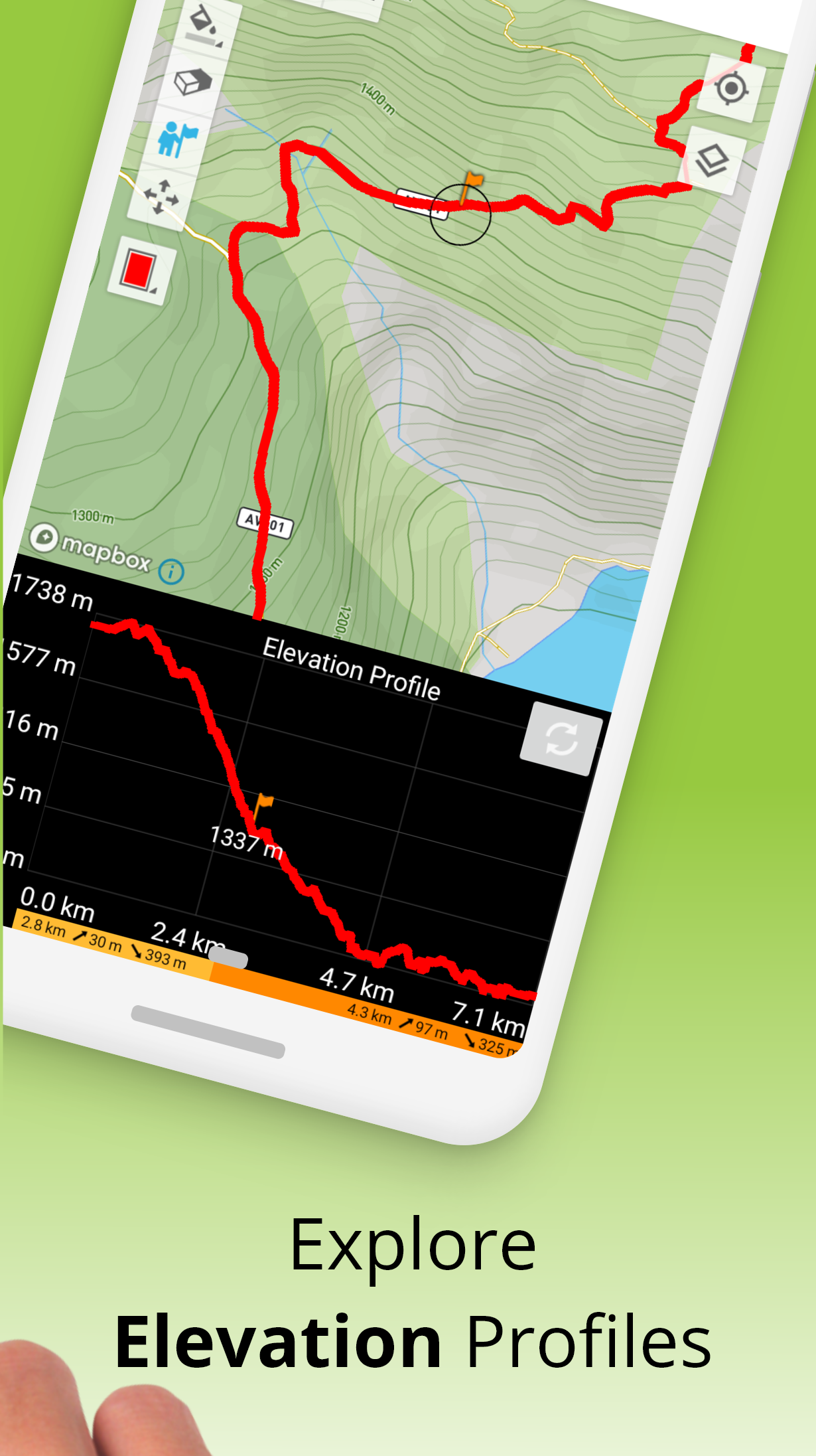
Distance and elevation measurement
Get accurate measurements for distance and detailed information about elevation, so you know how far and high your adventures will lead you.
Add and modify waypoints
Enhance your maps with highlights, insights, and points of interest using waypoints. A vast collection of waypoint icons allows you to customize the appearance of your map.
GPS Tracking
Track your journeys with the built-in GPS feature. You can save, modify, or share your adventures with others.
GPX File Viewing
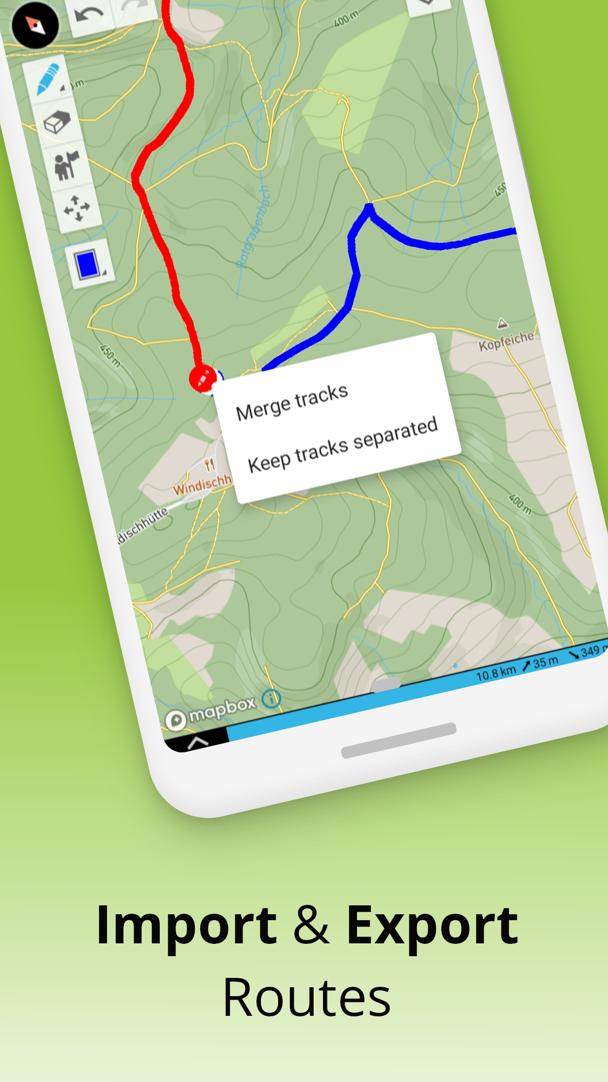
If you’ve discovered the ideal trail online, you can import GPX files from various sources. Navigate through these routes, calculate distances, and examine elevation profiles, with options for edits as needed.
Simultaneous routing on one map
You're not restricted to a single route on your map. TouchTrails enables you to visualize multiple routes at once, offering the flexibility to merge and connect routes from diverse origins.
Route sharing
Easily share your created routes with friends to let them join in on your adventure.
TouchTrails is the ultimate app for route planning, GPS tracking, and navigation tailored for all kinds of outdoor activities, such as:
• Running, walking, and hiking
• Cycling and mountain biking
• Motorcycling
• Overlanding
• Skiing
• Mantrailing
• and many more!
TouchTrails Premium
Elevate your experience with TouchTrails Premium, unlocking additional features!
• Snap to road
◦ Instantly aligns with any road, bike lane, or hiking trail
• Turn-by-turn Navigation
◦ Alerts you when you stray off the path
◦ Provides audio directions
• Access over 100 symbols for enhanced waypoint customization
• Save an unlimited number of routes
• Export GPX files
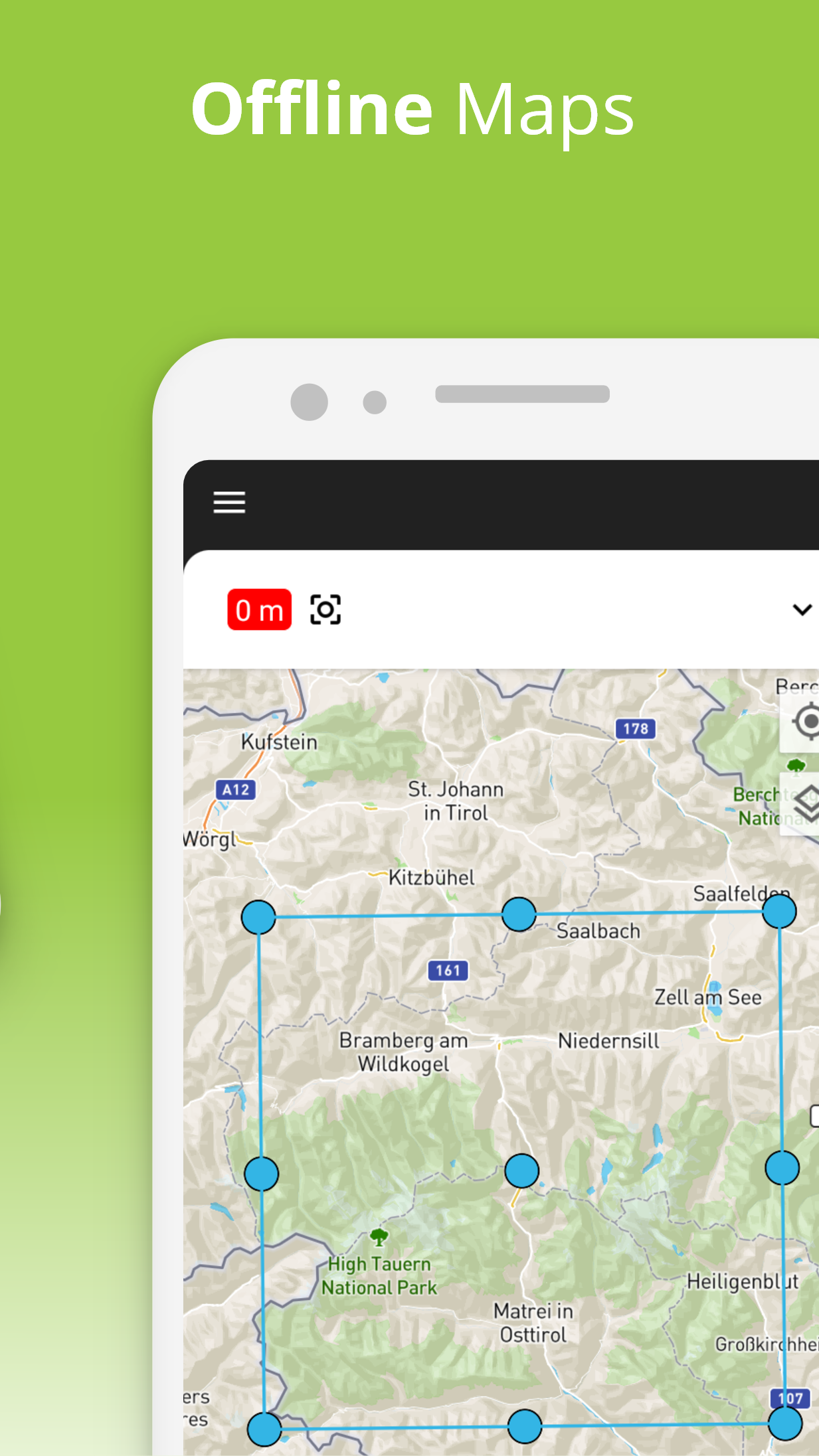
• Offline map access for use without internet connectivity
Download TouchTrails now and embark on unforgettable adventures! 🌲🚴🏃
Title: The Ultimate Outdoor Companion for Precision Route Planning
Having used TouchTrails extensively for planning everything from weekend hikes to extended cycling trips, I can confidently say it has redefined how I prepare for and experience the outdoors. The ability to draw routes directly onto the map with my finger is both intuitive and empowering, allowing me to customize paths with incredible precision—whether sticking to roads with the snap feature or venturing off-trail for more rugged exploration.
The elevation profiles and distance measurements are accurate and incredibly helpful for understanding the demands of a route in advance, while turn-by-turn voice navigation ensures I never lose my way in practice. I especially appreciate the flexibility to overlay multiple routes, add custom waypoints, and even import or export GPX files, making it easy to share adventures with fellow outdoor enthusiasts. The premium features, particularly offline maps and unlimited saves, are well worth the upgrade for serious adventurers. TouchTrails strikes a perfect balance between simplicity and depth, making it an indispensable tool for hikers, bikers, and explorers of all kinds.
FAQ:
Can I use the app without an internet connection?
Yes, with TouchTrails Premium, you can download maps for offline use, ensuring navigation and route access even in remote areas without cellular service.
Is there a limit to how many routes I can create or save?
The free version allows a limited number of saved routes, while Premium removes all restrictions, offering unlimited saves and exports.
Can I share my routes with friends who don’t have the app?
Absolutely. You can export any route as a GPX file and share it via email or messaging apps—recipients can view it in compatible apps or import it directly into TouchTrails.
- Version2.12.0
- UpdateSep 19, 2025
- Developerpixelclash
- CategoryMaps & Navigation
- Requires AndroidAndroid 5.1+
- Downloads152K+
- Package Namecom.wolfgangknecht.sketchatrack
- Signature6169f4e72982d7542cb0e3dafe8e2684
- Available on
- ReportFlag as inappropriate
-
NameSizeDownload
-
34.81 MB
-
17.56 MB
-
17.42 MB


User-friendly route drawing
Accurate tracking for runs and hikes
Helpful for biology and project planning
Convenient for multi-stop route mapping
Detailed elevation profiles available
Responsive customer support
Export functionality for GPX files
Easy to plot routes with intuitive functions
Great tool for discovering new routes worldwide
Buggy rendering and app crashes
Subscription model perceived as a drawback
Limited ability to edit saved tracks
Difficulty in drawing accurate routes
No offline maps available
Confusing user interface
Limited free version features, only three maps allowed
Issues with snap to road feature and turn-by-turn navigation
Lack of flexibility when not starting from the designated start point