Red Regional - Transport info & planning
Stay informed & plan travels effortlessly with real-time transport updates & seamless interactions with authorities.

- 1.5.0 Version
- 2.9 Score
- 416K+ Downloads
- Free License
- 3+ Content Rating

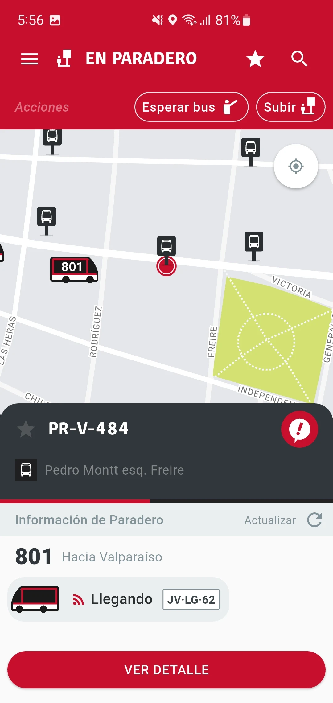
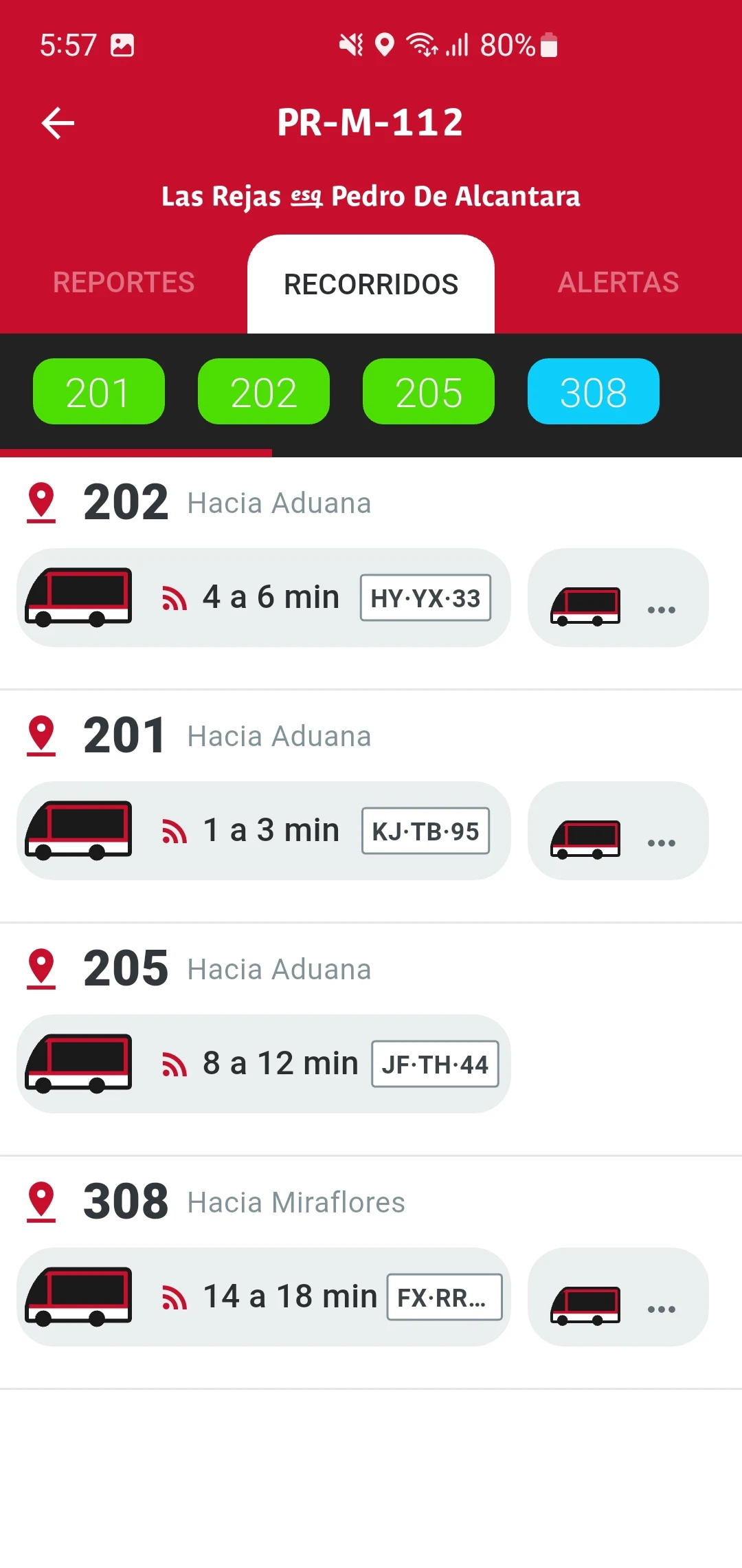
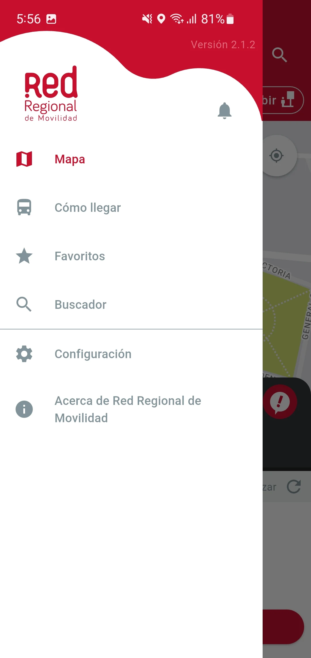
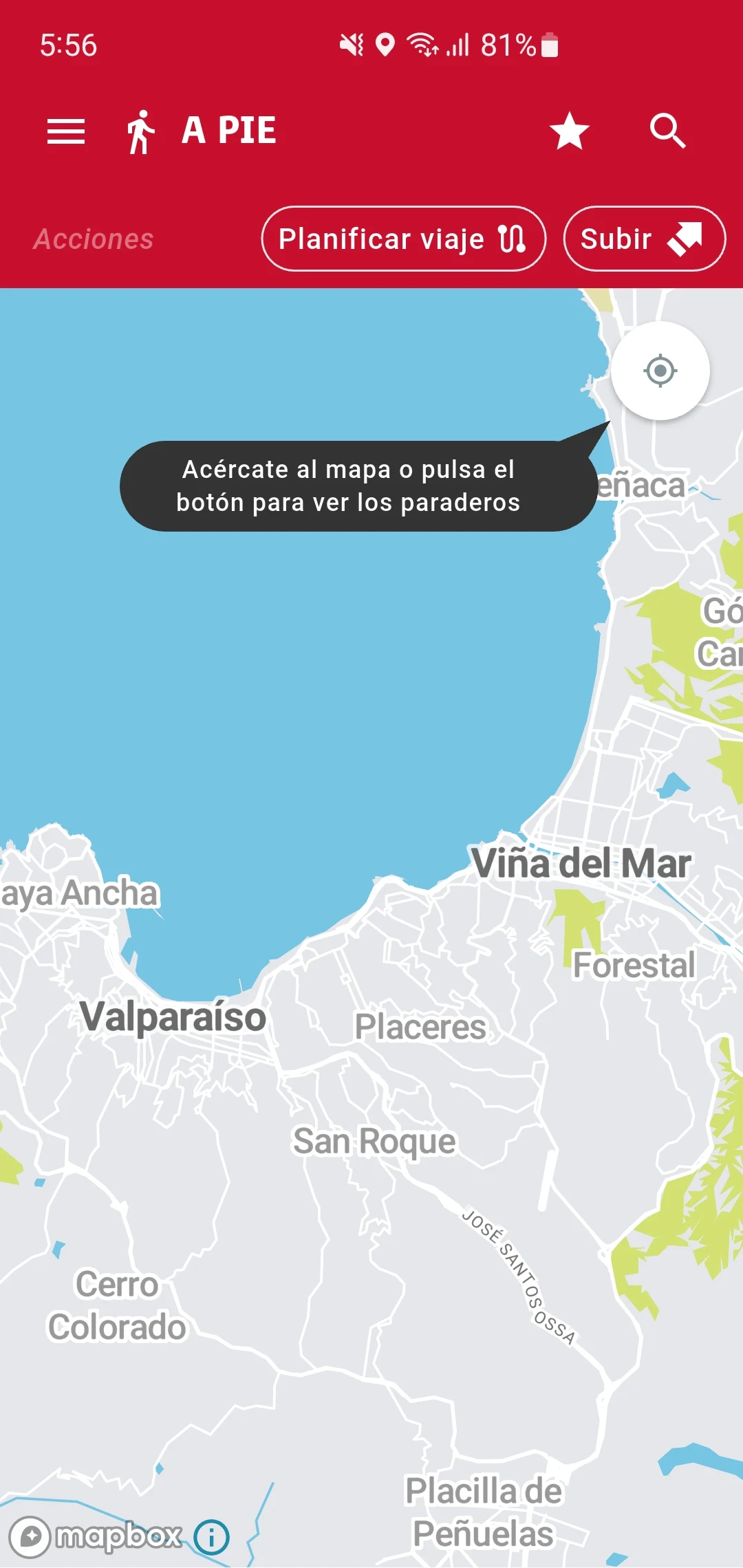
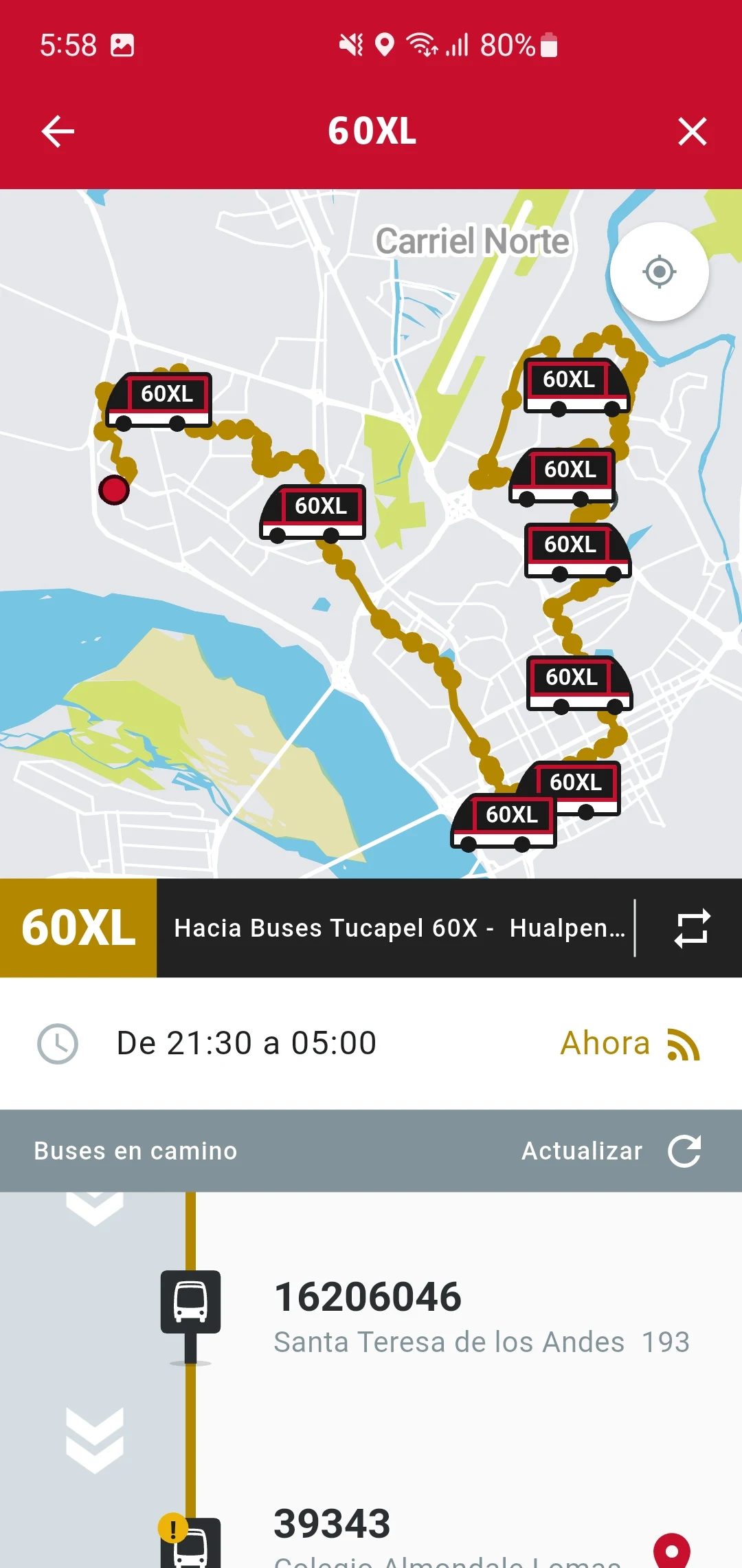
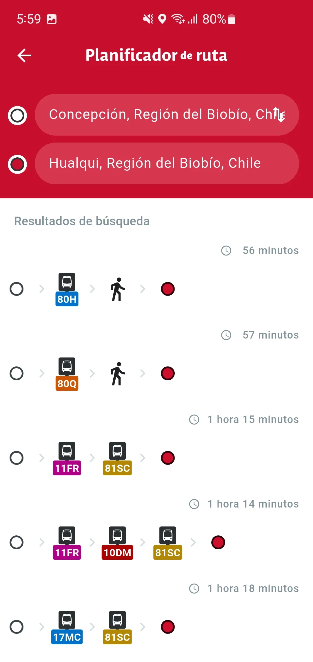
An application designed for users that enables them to monitor the current status of their city's transportation system, offers travel planning features, facilitates interaction between users and authorities/operators, and includes various other functionalities.
Your City's Transportation, Simplified and at Your Fingertips
This application has fundamentally changed how I navigate my city, transitioning daily travel from a source of uncertainty to a seamlessly managed experience. Before using it, my commute was often plagued by guesswork—wondering if my bus was stuck in traffic or if a better route had emerged.
Now, the real-time monitoring feature provides a crystal-clear picture of the entire transport network, allowing me to make informed decisions the moment I wake up. The travel planning is exceptionally intuitive, not just listing theoretical routes but calculating the most efficient journey based on live delays, saving me precious minutes every day.
Perhaps the most underrated feature is the direct channel it opens to the authorities; reporting a missed bus or a malfunctioning ticket machine feels productive, as the in-app feedback system provides confirmation that the issue has been logged, fostering a sense of collaborative problem-solving. It’s more than a simple tracker; it’s an all-in-one mobility platform that empowers you with control, efficiency, and a direct line to improve the system for everyone.
FAQ:
Q: How accurate is the real-time vehicle tracking?
A: In my experience, the real-time data is highly reliable for buses and trains, typically updating every minute. While it can't predict unexpected traffic jams or accidents instantly, it reflects schedule changes and delays reported by the operators very quickly, making it a trustworthy tool for planning.
Q: Can I use the app to plan a trip without an internet connection?
A: The trip planning feature primarily requires an internet connection to access live data and calculate routes. However, I've found that once a route is displayed, you can often still view the step-by-step instructions if you lose connectivity mid-journey, which is a helpful safeguard.
Q: What happens when I report an issue through the app?
A: Submitting a report—be it about a crowded station or a non-functioning vehicle—generates a ticket reference number. While you don't always get a personal response, the status is often updated (e.g., "Issue Received" or "Forwarded to Operator"), which provides more transparency than simply hoping someone notices the problem.
- Version1.5.0
- UpdateSep 26, 2025
- DeveloperDivisión de Transporte Público Regional
- CategoryMaps & Navigation
- Requires AndroidAndroid 4.2+
- Downloads416K+
- Package Namecl.gob.mtt.dtpr.redregional
- Signature2701210f0a1ca133f93cae68f20f4497
- Available on
- ReportFlag as inappropriate
-
NameSizeDownload
-
17.74 MB
-
17.73 MB
-
18.91 MB


Provides destination-specific bus recommendations
Alerts users 300m before their stop
Potential for improvement with added features
Reliable for predicting bus arrival times
Allows for real-time tracking of buses
Offers a good foundation for user feedback and reporting
Useful for planning public transport routes
Frequent functionality issues after updates
Inconsistent information about bus schedules
Lack of user-friendly interface
Missing crucial features like departure timing and frequency
Limited accuracy in mapping bus locations
No option to report problems with bus services
Application stability issues, like map loading glitches
Some areas not adequately covered by the app