New Zealand Topo Maps - Outdoor Navigation & Mapping
Explore the great outdoors with topographic maps, waypoint navigation, and customizable tools for memorable adventures.
- 5.6.1 free Version
- 1.9 Score
- 153K+ Downloads
- In-app purchases License
- 3+ Content Rating

A user-friendly outdoor navigation application featuring the latest topographic maps of New Zealand, Cook Islands, and Tokelau.
This app provides mapping functionalities similar to those found in Garmin or Magellan GPS devices.
Key outdoor navigation features include:
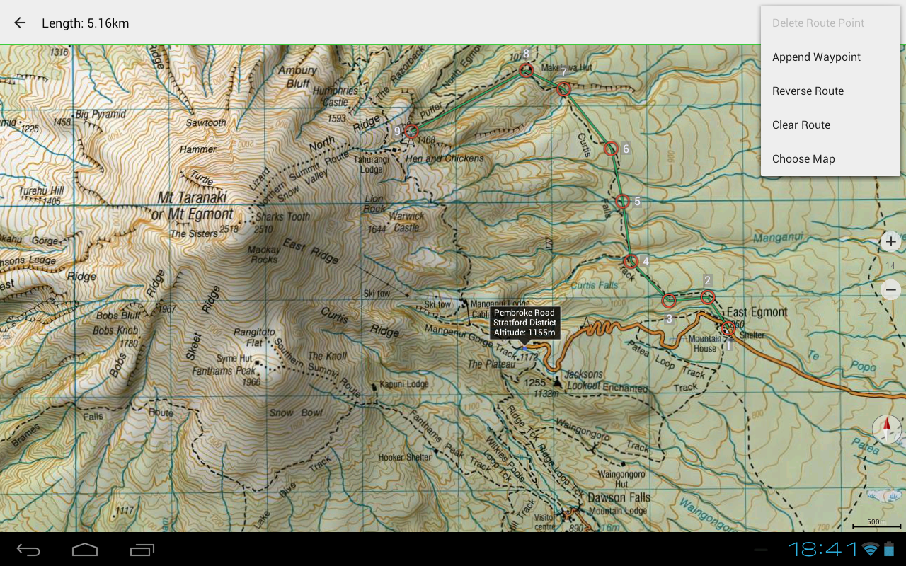
• Ability to create and modify Waypoints
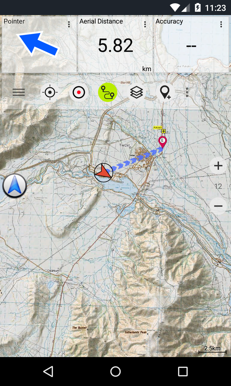
• Navigation to Waypoints using GoTo function
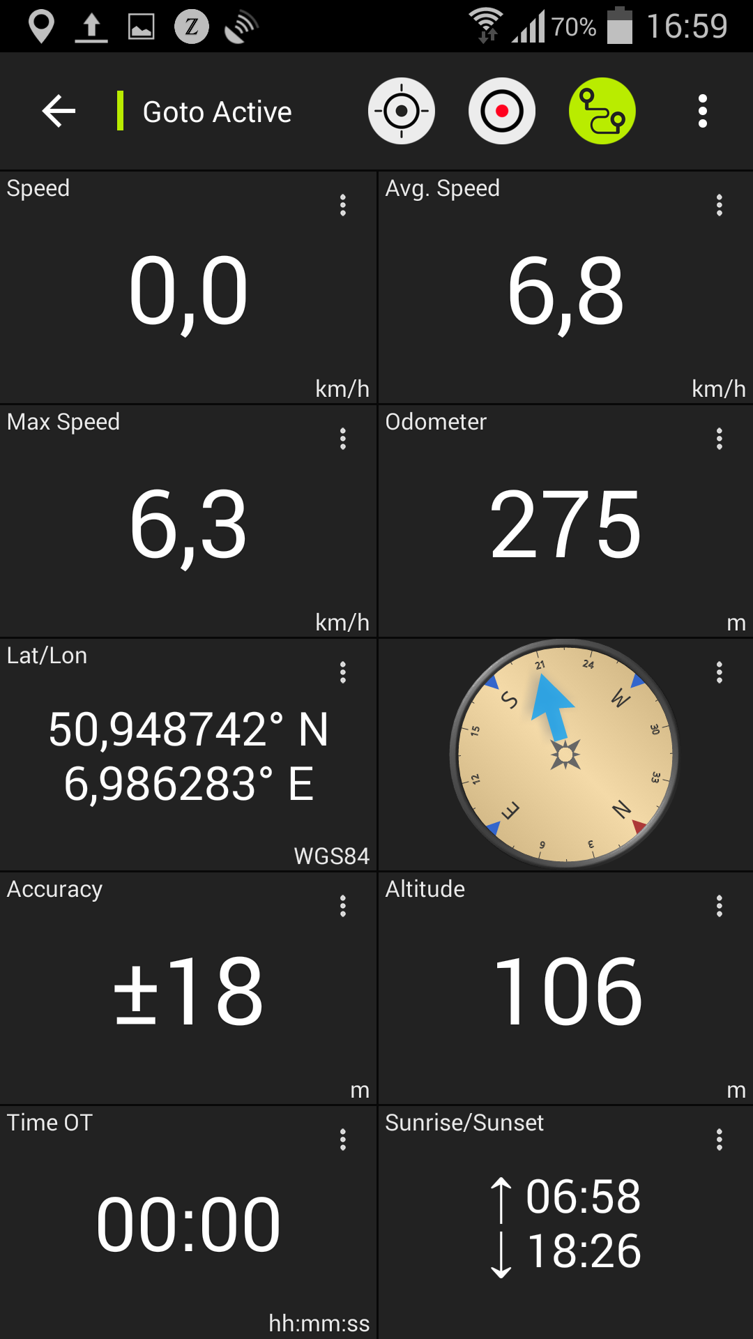
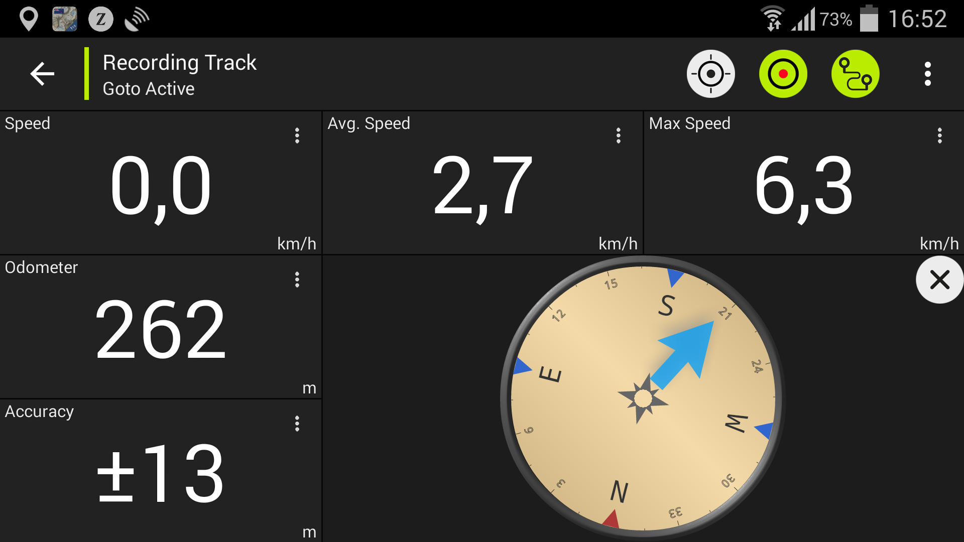
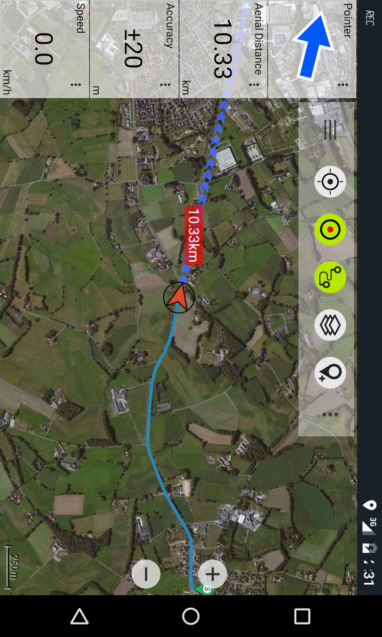
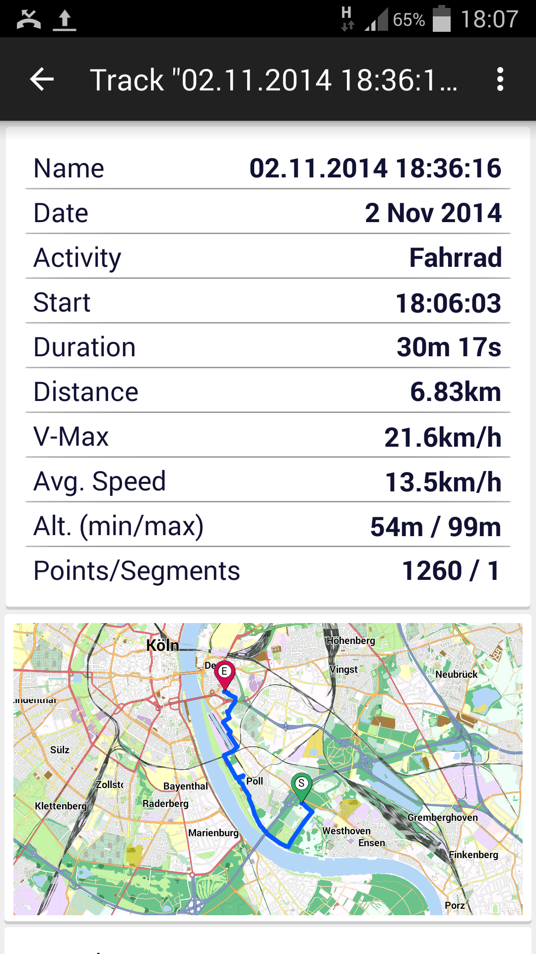
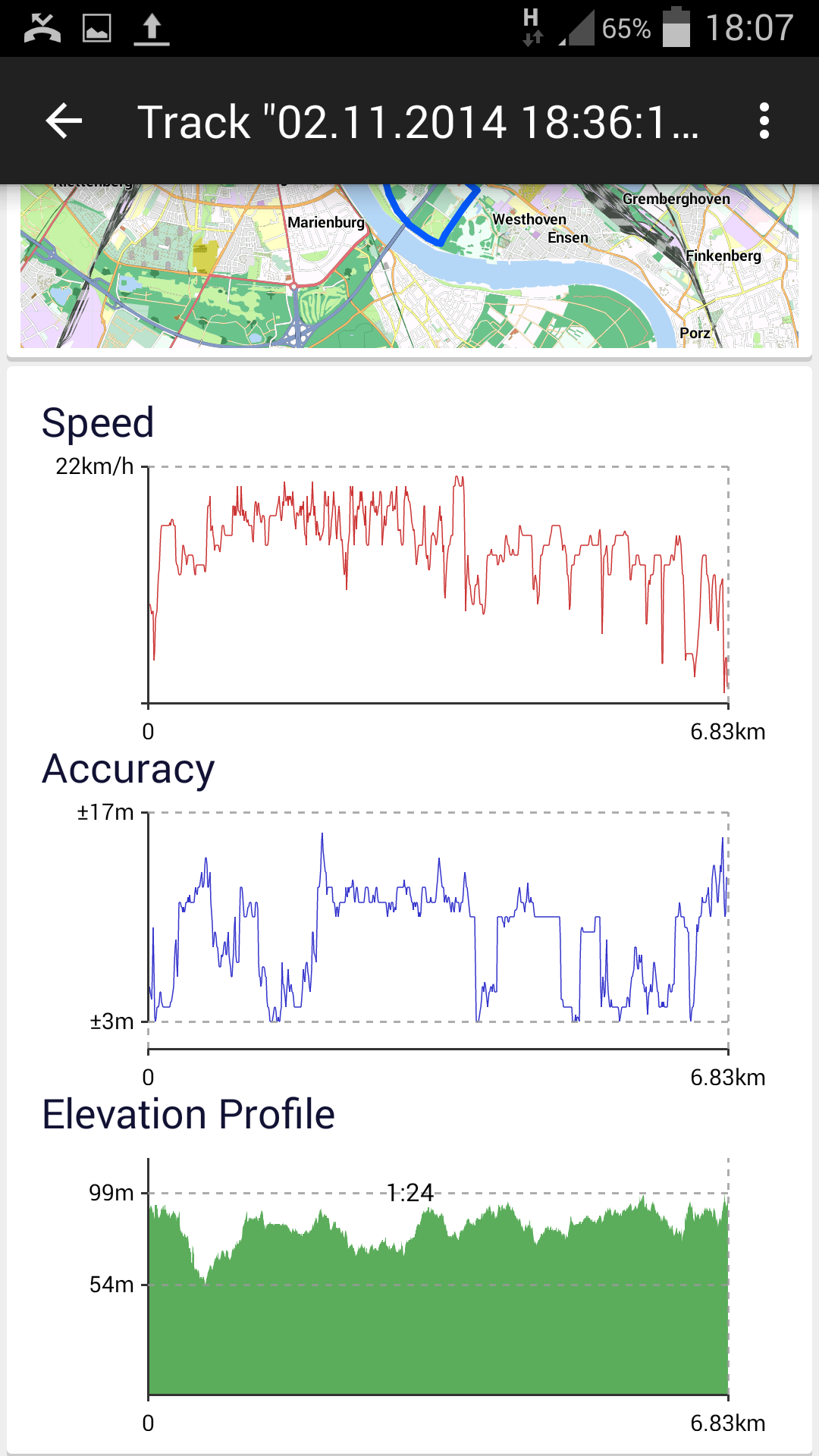
• Track Recording that captures speed, elevation, and accuracy profiles
• Tripmaster with metrics for odometer, average speed, direction, elevation, and more
• GPX import/export and KML export options
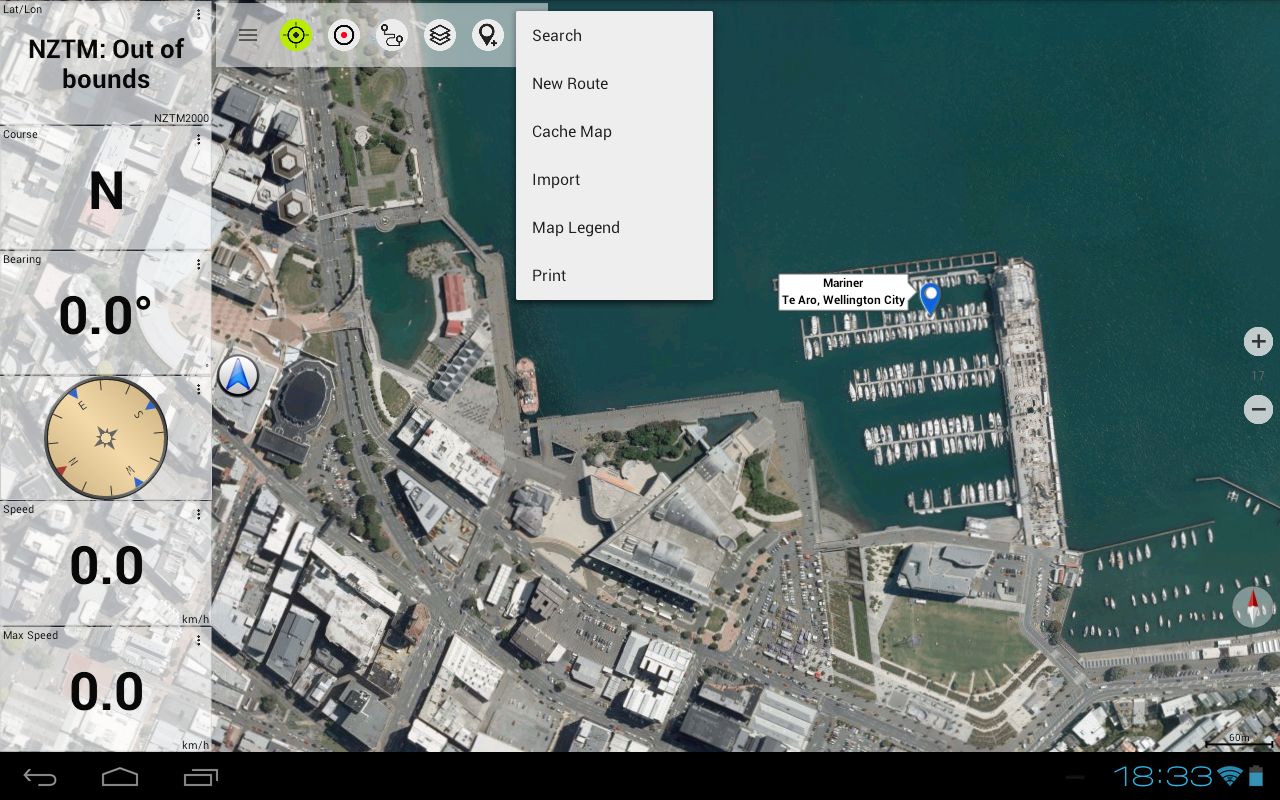
• Place and Point of Interest (POI) search functionalities
• Customizable data fields within Map View and Tripmaster (e.g., Speed, Distance, Compass, etc.)
• Sharing capabilities for Waypoints, Tracks, or Routes
• Support for Coordinates in UTM, WGS84, or MGRS
• Additional features available...
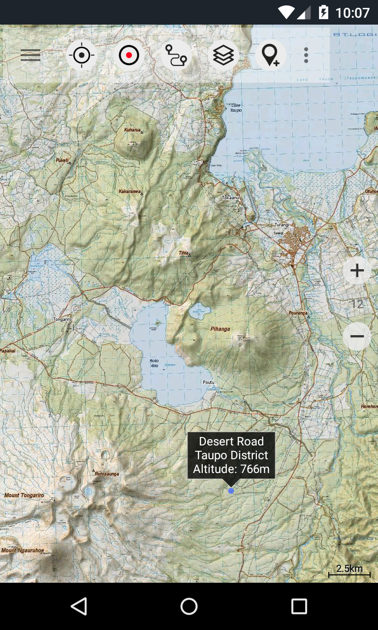
Available base map layers consist of:
• Topomaps of New Zealand (complete coverage at scales 1:250,000 and 1:50,000)
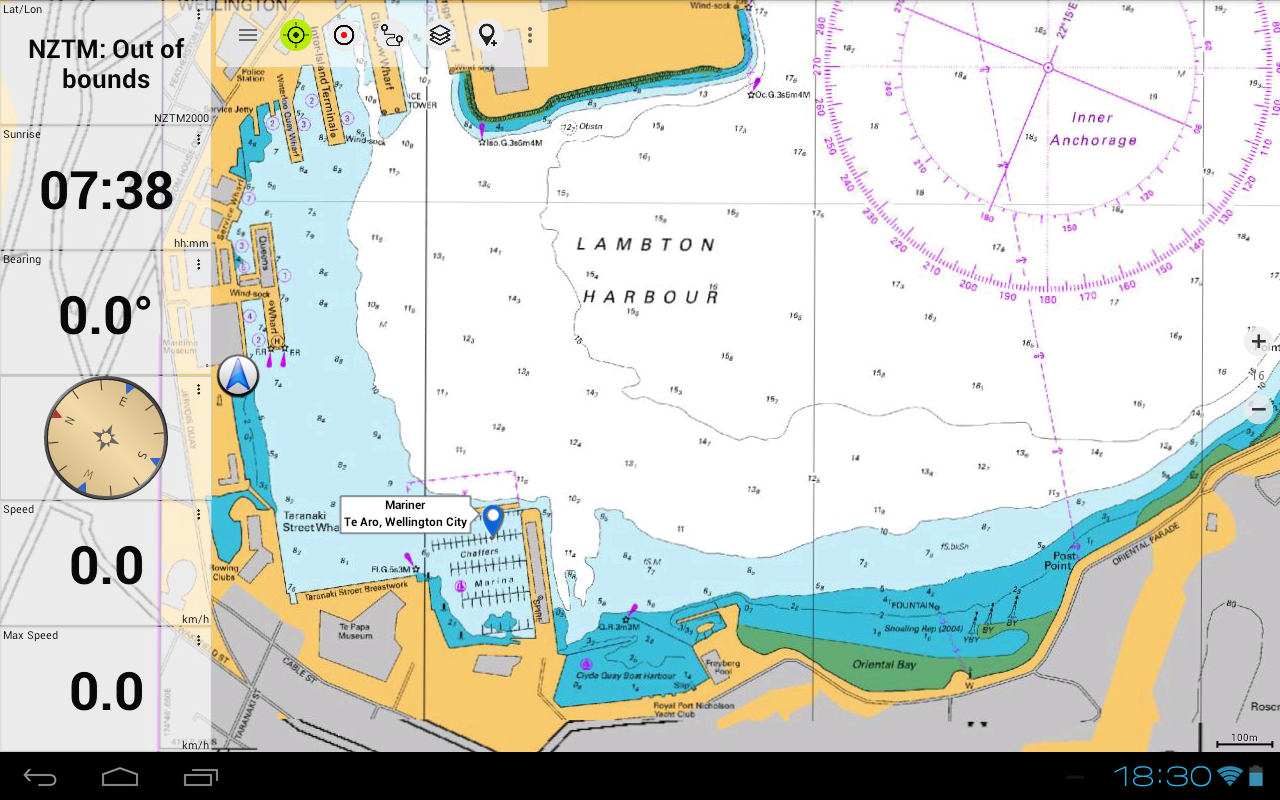
• NZMariner nautical charts
• LINZ aerial imagery
• Google Maps (including satellite images, road maps, and terrain maps)
• Open Street Maps
• Bing Maps
• ESRI Maps
Overlay layers offered include:
• Public Conservation Areas
• Open Hunting Areas
• DOC Camp Sites
• DOC Freedom Camping Restrictions
• DOC Huts
• DOC Tracks
• Taupo Trout Fishing District
• Hillshading
This navigation application is ideal for various outdoor pursuits such as hiking, biking, camping, climbing, riding, skiing, canoeing, or off-road driving.
Users can preload no-cost map data for regions without cellular connectivity. (Pro version recommended)
RESTRICTIONS OF THE FREE VERSION:
• Advertisements present
• Maximum of 3 Waypoints allowed
• Maximum of 3 Tracks permitted
• No creation of Routes
• Importing of waypoints and tracks is not available
• Bulk download option is restricted
• Local City Database (Offline Search) is unavailable
The topographic maps are produced by Land Information New Zealand (LINZ).
Topo50 represents the official topographic mapping series utilized by emergency service agencies in New Zealand.
Applications of topographic data include:
Defence strategy: The New Zealand Defence Forces utilize this information for planning military drills and sharing insights with international collaborators.
Rescue and Response: Topographic data supports a variety of planning and operational needs across Search and Rescue, defence, ambulance, fire services, police, and civil defence scenarios, applicable during everything from natural catastrophes to community safety efforts. Its use spans both field environments and control centers, integrating topographical data with other informational resources.
Land administration: Municipalities leverage topographic details for regional planning and executing operations, which also benefits companies in power, gas, and telecommunications sectors.
Moreover, LINZ mapping serves numerous purposes for businesses and governmental bodies like the Department of Conservation, in addition to recreational enthusiasts such as hikers and tourists.
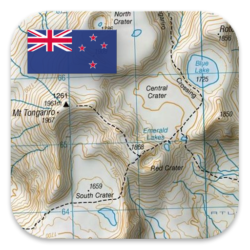
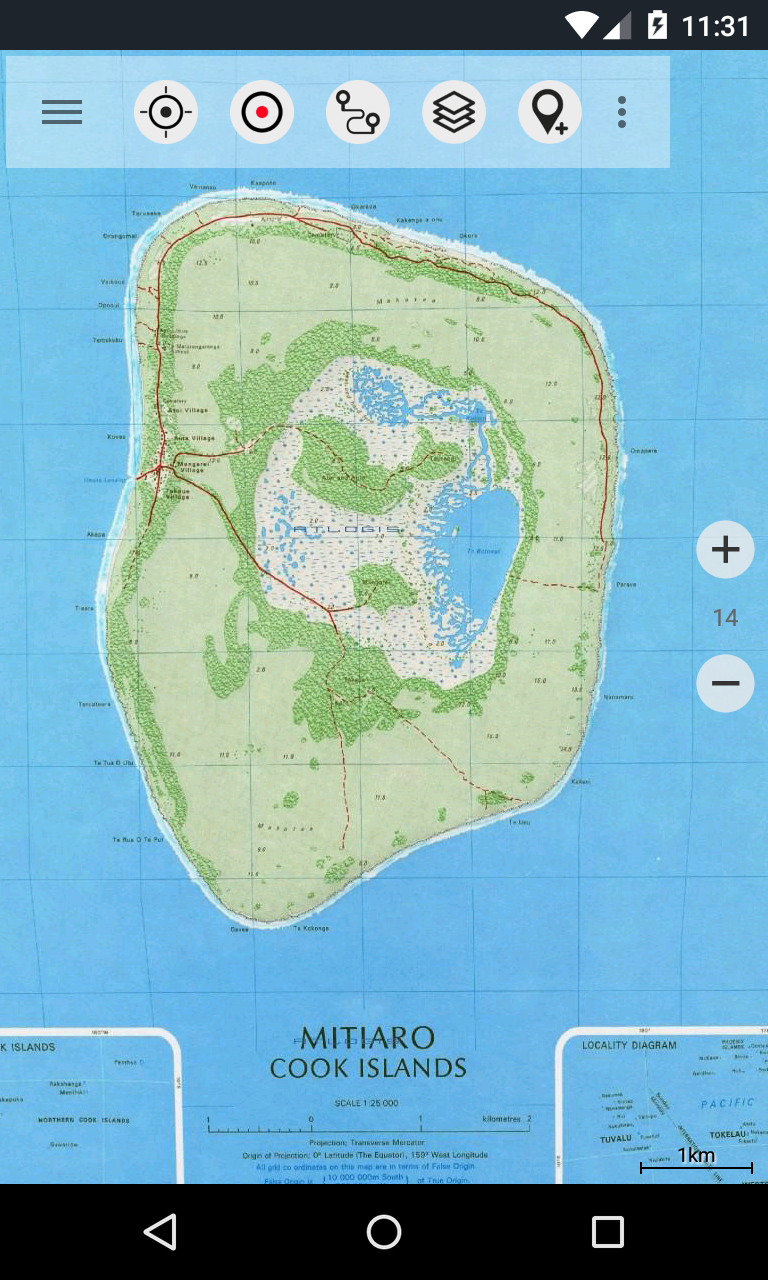
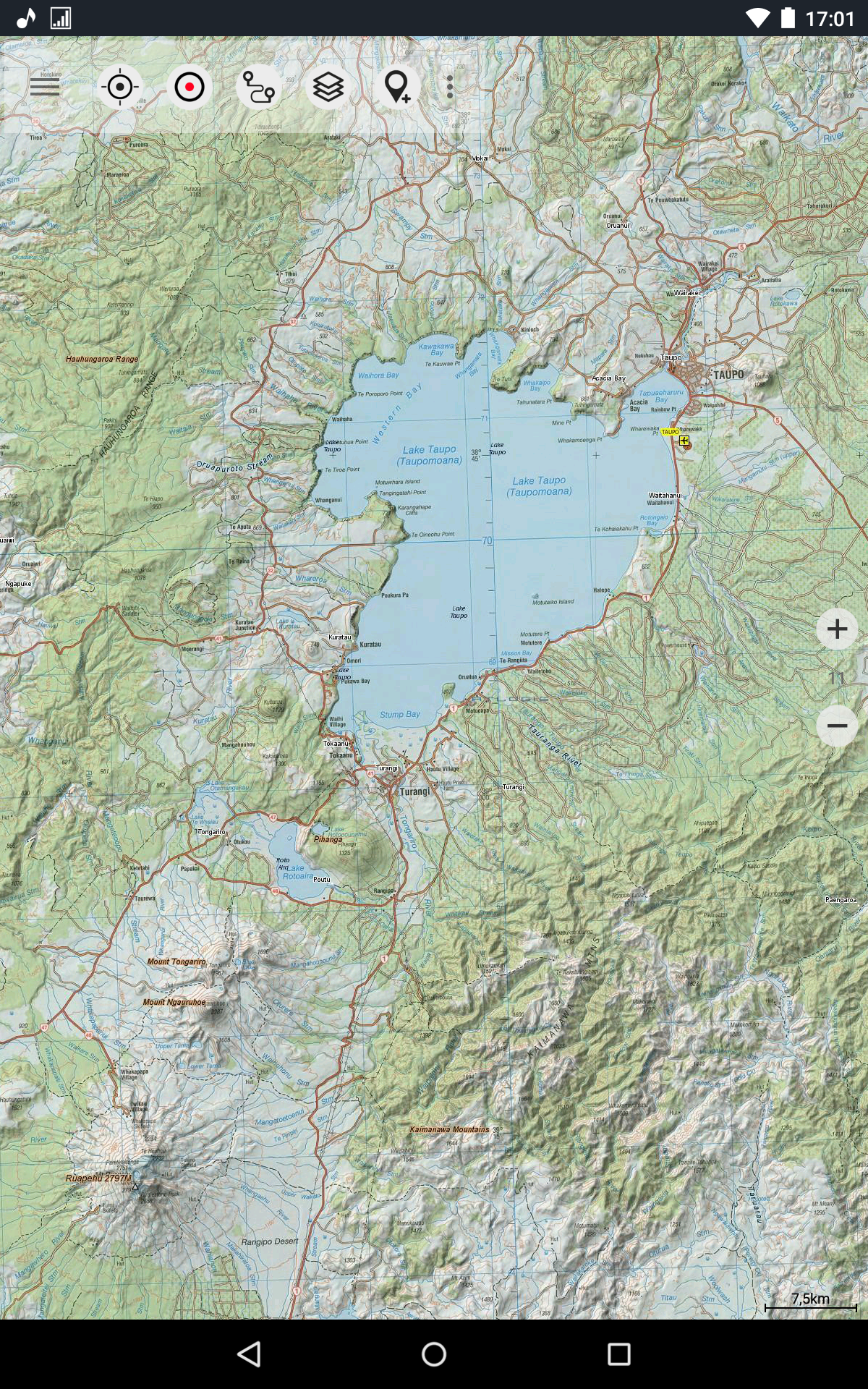
All topographic maps come equipped with supplemental labels for improved clarity at higher zoom levels. The maps feature Atlogis® hillshading to accentuate relief and terrain.
Topo Map Coverage includes:
New Zealand and its islands (Antipodes, Auckland, Bounty, Campbell, Chatham, Kermadec, Raoul, Snares, and Stewart Islands) at scales of 1:50,000 and 1:250,000
Cook Islands (Aitutaki, Atiu, Mangaia, Manihiki, Mauke, Mitiaro, Palmerston, Penrhyn, Pukapuka, Rakahanga, Rarotonga, Suwarrow, Takute) at a scale of 1:25,000
Tokelau Islands (Atafu, Nukunonu, Fakaofo) at a scale of 1:25,000
Title: A Rugged and Indispensable Outdoor Companion That Masters the Wilderness
What truly sets this app apart is its remarkable depth and reliability, transforming any smartphone into a professional-grade navigation tool that feels purpose-built for the demanding landscapes of New Zealand and the Pacific Islands. From the moment I loaded the detailed Topo50 maps—the same used by emergency services—I knew this was more than a simple hiking aid; it was a comprehensive survival tool. The ability to preload high-resolution topographic maps ensured I stayed on course even in the most remote, signal-free valleys of the Southern Alps, while features like track recording with elevation profiles provided invaluable insights into my pace and progress.
I particularly relied on the customizable data fields, which let me monitor everything from current speed to exact coordinates in MGRS format, offering peace of mind during multi-day treks. The overlay layers, such as DOC huts and hunting zones, integrated seamlessly with the base maps, making route planning intuitive and informed. Whether navigating dense bush, crossing unmarked rivers, or simply finding a campsite, the app’s precision and wealth of data—from nautical charts to aerial imagery—made it feel like having a local guide in my pocket. It’s this fusion of military-grade cartography, user-friendly customization, and robust offline capability that elevates it above typical GPS apps, proving essential for anyone serious about exploring the wild.
FAQ:
• Q: How reliable is the app in areas with no cellular coverage?
A: Extremely reliable. Once maps are downloaded, the app operates entirely offline using your device’s GPS, making it ideal for remote expeditions where connectivity is nonexistent.
• Q: Are the topographic maps updated regularly?
A: Yes, the app sources its maps directly from Land Information New Zealand (LINZ), ensuring they reflect the latest changes in terrain, trails, and conservation data.
• Q: Can I share my routes or waypoints with others using different devices or apps?
A: Absolutely. The app supports GPX/KML export, allowing you to share tracks and waypoints with companions or import them into other platforms like Garmin or Google Earth.
• Q: Is the Pro version worth the upgrade for casual hikers?
A: If you frequently venture into the backcountry, the Pro version’s unlimited waypoints, bulk map downloads, and offline search capabilities are invaluable. For occasional use, the free version still offers robust core features.
- Version5.6.1 free
- UpdateOct 25, 2025
- DeveloperATLOGIS Geoinformatics GmbH & Co. KG
- CategoryMaps & Navigation
- Requires AndroidAndroid 4.1+
- Downloads153K+
- Package Namecom.atlogis.nzmaps.free
- Signature22e1d23abdda71caaf83f86f128bf8df
- Available on
- ReportFlag as inappropriate
-
NameSizeDownload
-
5.74 MB
-
5.93 MB
-
4.65 MB


Easy to use with accurate tracking
Helpful for forestry applications
Works well offline, ideal for remote areas
Good for planning trips and navigation
Multiple layers for detailed information
Ability to track journeys by satellite
Useful printing options for maps
User-friendly interface
Regular updates and improvement features
Subscription model increases costs unexpectedly
Issues with offline map caching and loading
Problems with track recording functionality
Limited support for existing pro users
Outdated road information and missing tracks
Confusing user experience with waypoints
Limited response from support team
Buggy performance on certain devices
Ads after previous full purchase frustrate users