Canada Topo Maps - Outdoor GPS & mapping
Explore the great outdoors with maps, routes & all-in-one navigation for hiking, biking & more—offline access included!
- 7.2.1 Version
- 1.5 Score
- 251K+ Downloads
- In-app purchases License
- 3+ Content Rating

An intuitive outdoor navigation application that provides free access to top-notch maps and aerial imagery specifically for Canada.
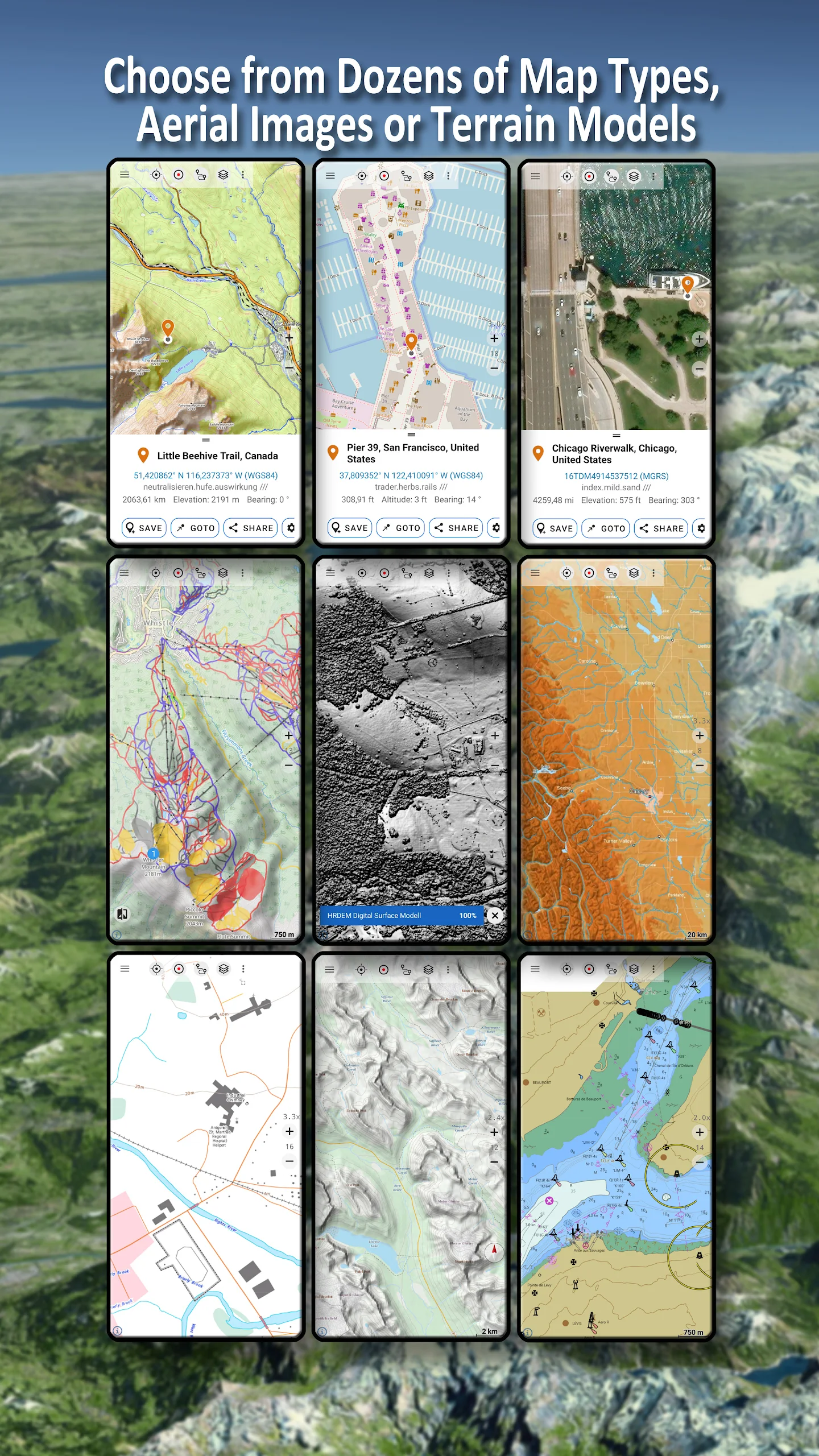
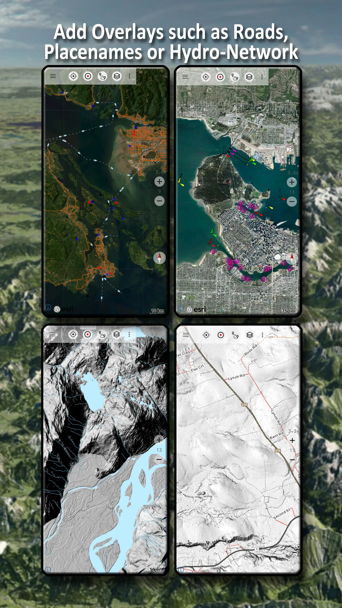
Select from over 30 different map layers (including topographical maps, aerial views, nautical charts, etc.) to effectively plan your adventures.
Transform your Android Phone or Tablet into an offline GPS device ideal for exploring remote areas.
*** Important: For the most current topographic maps, it is recommended to utilize the Canada Base Map, Toporama, or OpenStreetMap layer! ***
Easily incorporate maps from various other sources (like GeoPDF, GeoTiff, online mapping services including WMS, etc.).
The following base map layers are available for Canada:
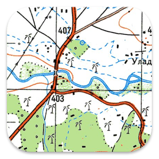
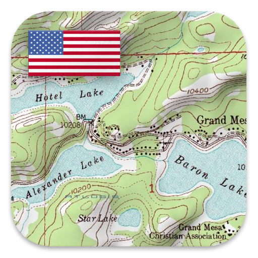
• Topomaps Canada (CanMatrix, complete coverage at scales of 1:50,000 and 1:250,000, also includes USA maps at 1:24,000 - 1:250,000), over 30,000 maps
• Canada Basemap CBMT (CanVec, NTDB, Atlas of Canada)
• Toporama Maps Canada in both English and French (CanVec, NTDB, Atlas of Canada)
• CanTopo (new Canada Topographical maps at 1:50,000, partial coverage mainly in Northern regions)
• Ontario LIO Topo Maps
• Québec Topo Maps 1:20,000
• Saskatchewan Orthophotos
• Nova Scotia Orthophotos
• British Columbia Topo Maps
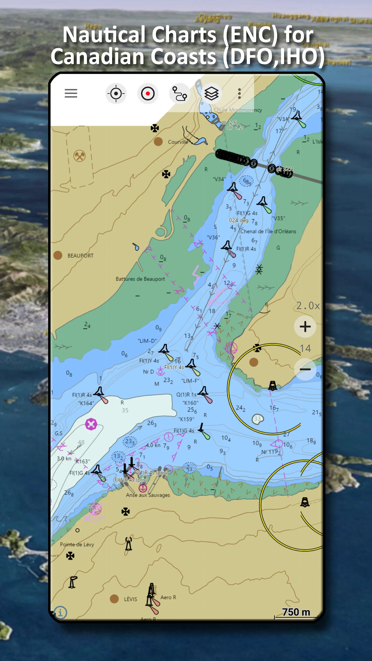
• Nautical Charts ENC
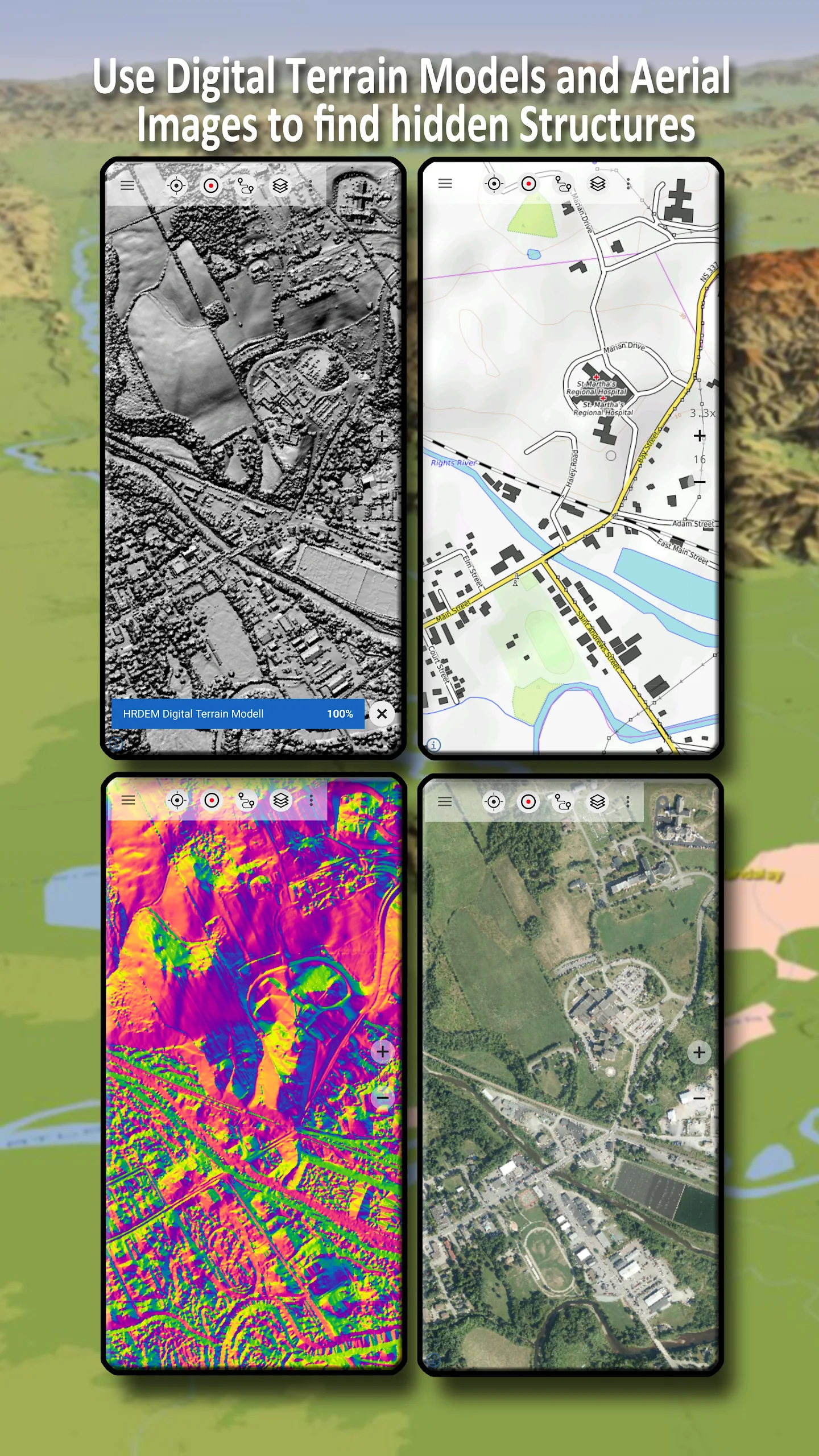
• Digital Elevation Model
• HRDEM (High-Resolution Elevation Model for certain parts of Canada)
Globally available basemap layers include:
• OpenStreetMaps (5 distinct map layouts), which can also be downloaded in a space-efficient vector format
• Google Maps (featuring satellite images, road maps, and terrain maps)
• Bing Maps (providing satellite imagery and road maps)
• Waze Roads
• Earth At Night
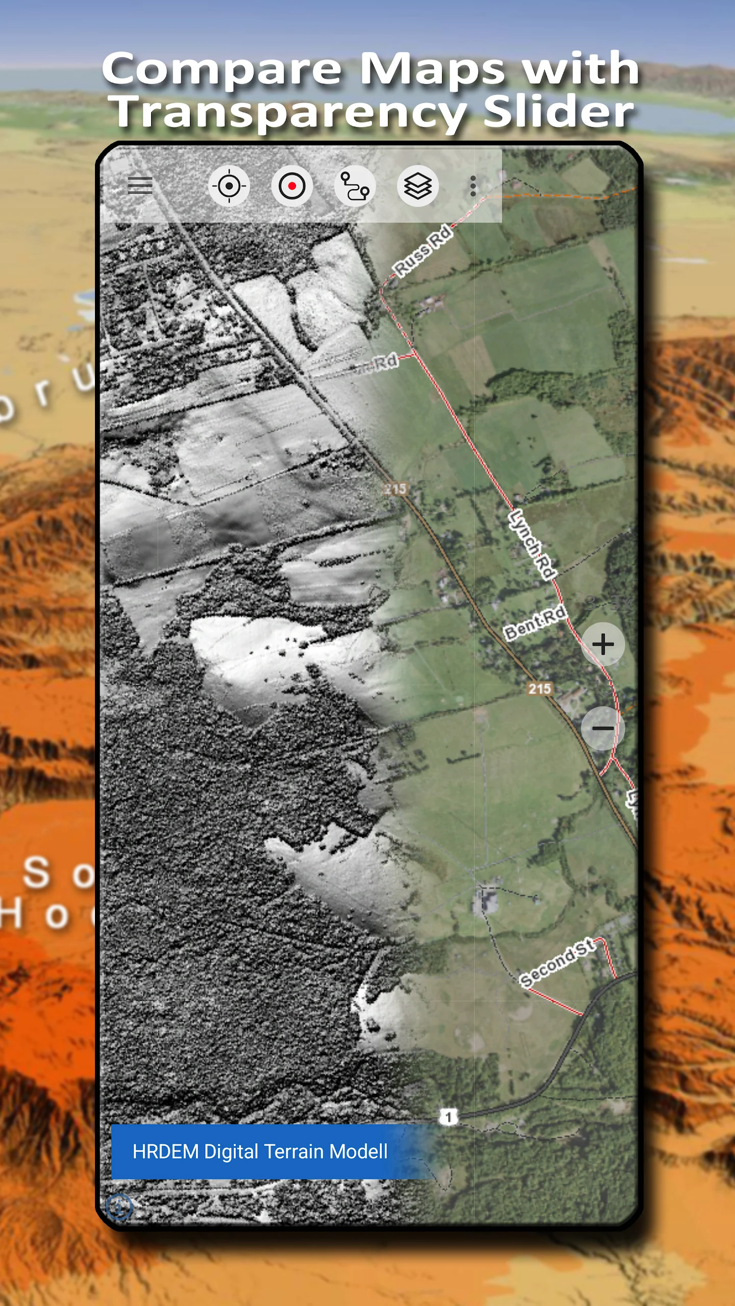
Set up a base map layer as an overlay and adjust transparency easily to compare different maps effortlessly.
Incorporate maps from alternative sources such as:
• Import raster maps in formats like GeoPDF, GeoTiff, MBTiles, or Ozi (Oziexplorer OZF2 & OZF3)
• Add web mapping services through WMS or WMTS/Tileserver
• Import OpenStreetMaps in Vector format—entire USA available for just a few gigabytes of storage
Canada map overlays add supplementary information to any existing base map, such as:
• Features from CanVec including transportation networks, contour lines, hydro features, names of places, etc.
• Nova Scotia Roads
• Yukon Transportation
Worldwide overlays available include:
• Hillshading overlay
• 20-meter contour lines
• OpenSeaMap
No map is without its imperfections. Switch between various map layers or utilize the map comparison tool to discover the most intriguing routes. The older CanMatrix topographical maps may showcase many smaller paths and features that modern maps lack.
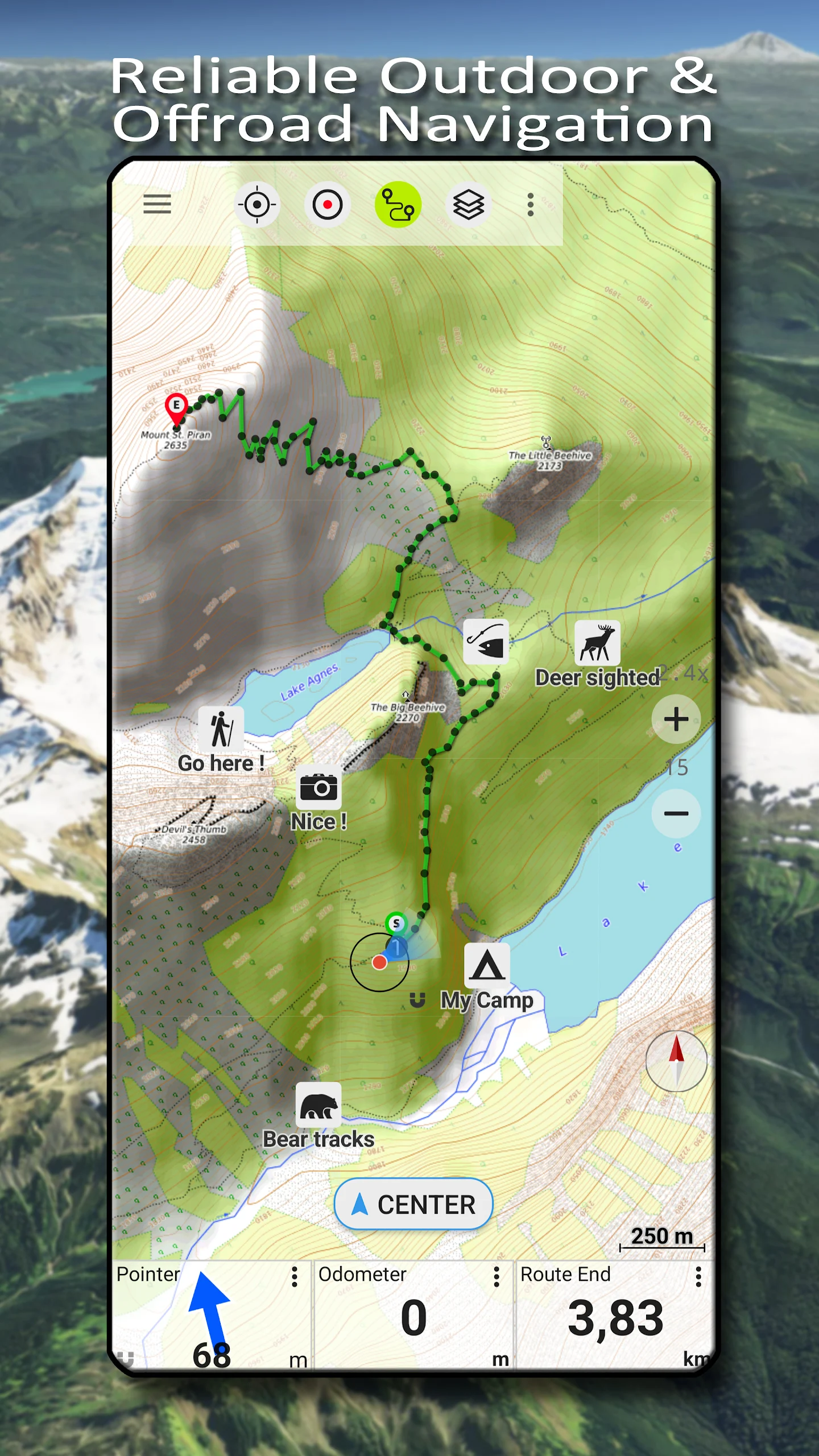
Key functionalities for outdoor navigation include:
• Downloadable map data for offline usage
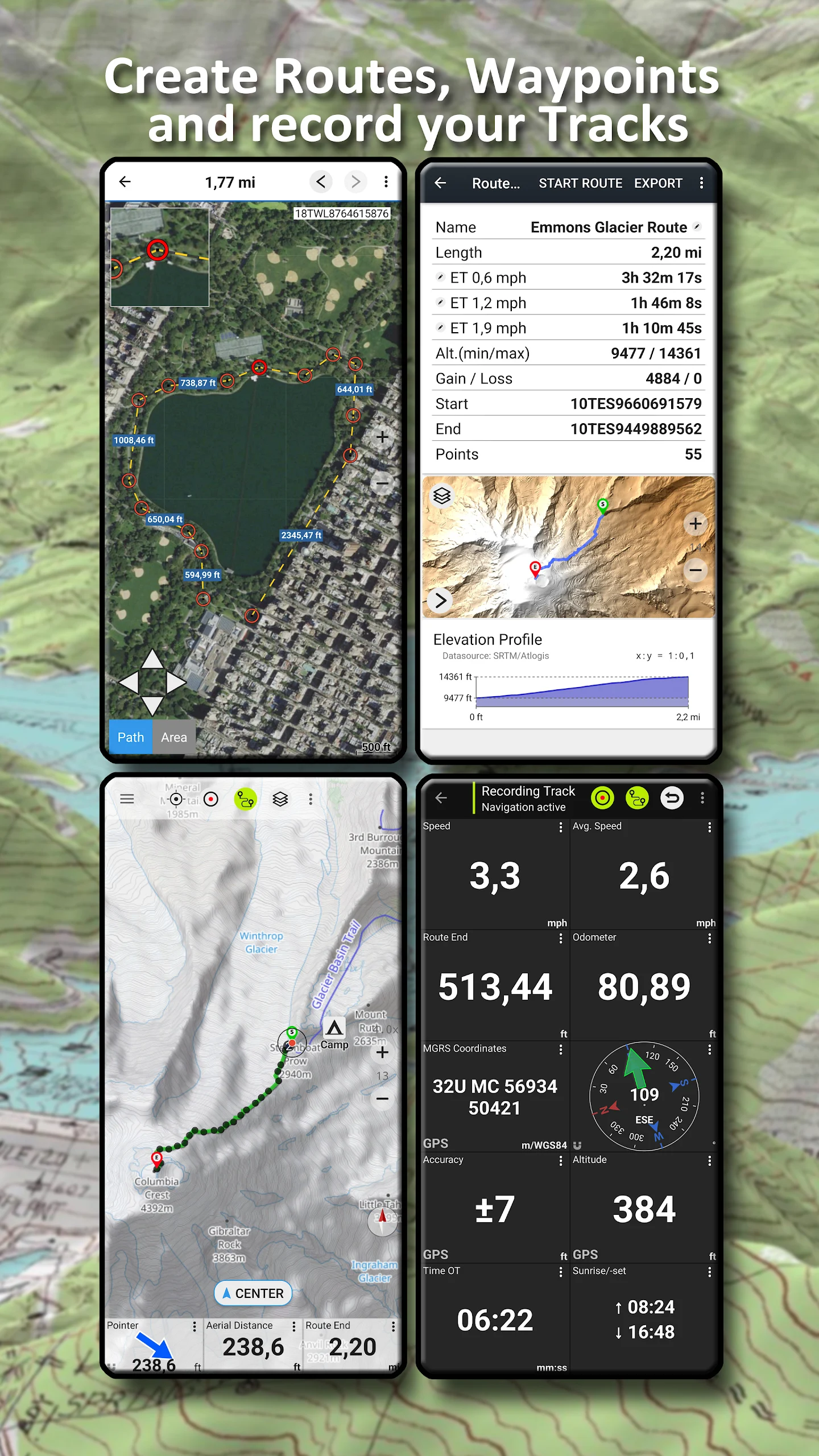
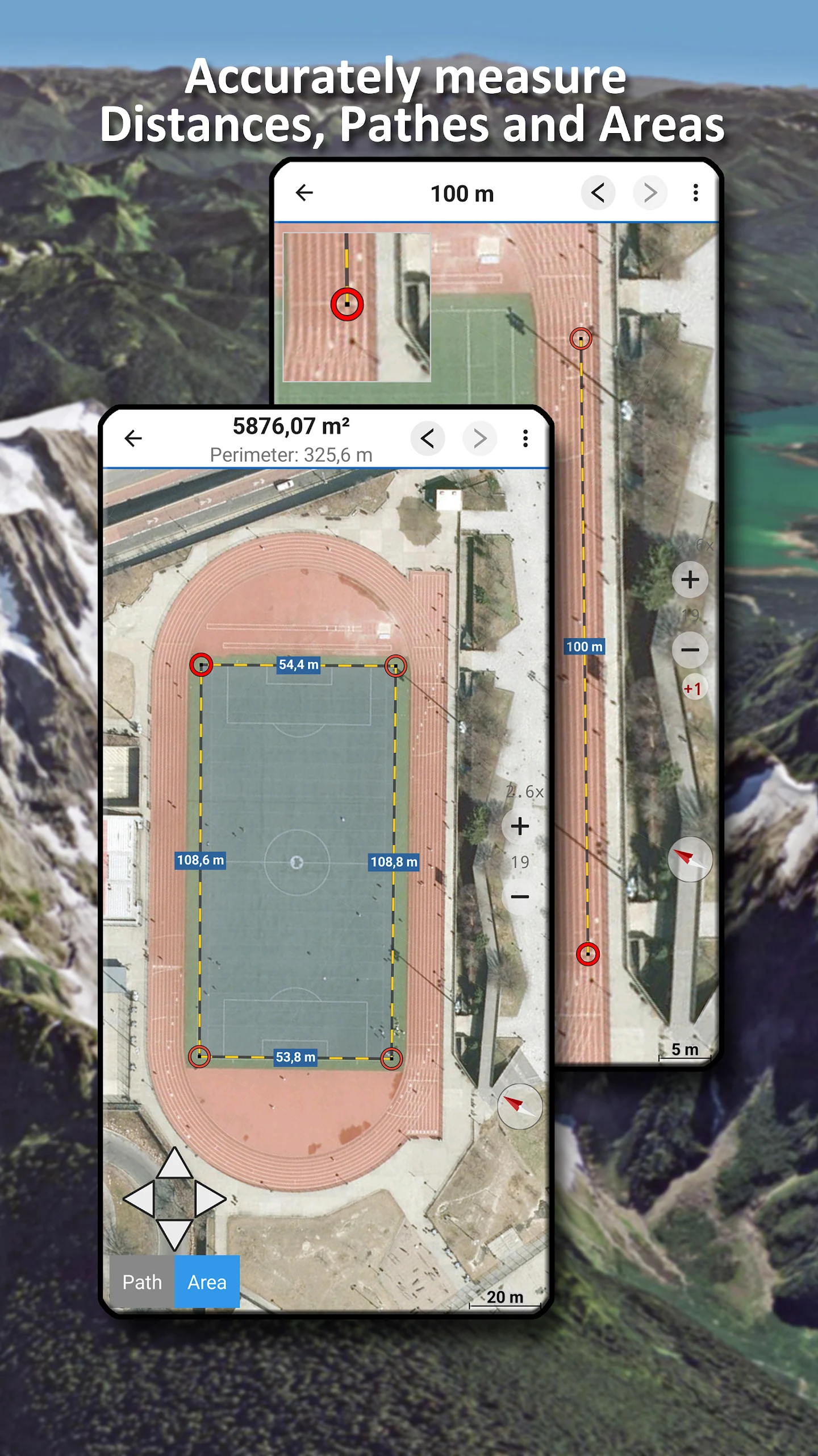
• Ability to measure distances and areas
• Create and modify waypoints
• Navigation to selected waypoints
• Create and edit routes
• Point-to-point route navigation
• Track recording that logs speed, elevation, and accuracy
• Tripmaster with odometer readings, average speed, bearing, elevation, etc.
• GPX/KML/KMZ import and export capabilities
• Search functionality for place names, points of interest, and streets
• Obtain elevation and distance measurements
• Customizable data fields during map viewing and in trip master mode (e.g., Speed, Distance, Compass, and more)
• Share waypoints, tracks, or routes through various platforms
• Support for coordinates in formats such as WGS84, UTM, and MGRS/USNG (Military Grid/US National Grid)
• Replay capability for tracks
• And much more...
This navigation app is perfect for various outdoor pursuits such as hiking, biking, camping, climbing, riding, skiing, canoeing, hunting, snowmobiling, off-road four-wheeling, or search and rescue efforts.
Add custom waypoints using longitude/latitude, UTM, or MGRS/USNG formats while utilizing the WGS84 datum.
Import, export, and share GPS waypoints, tracks, and routes in GPX or Google Earth KML/KMZ formats.
Topographic maps of Canada are enhanced by Atlogis® hill shading and annotated place names.
Attribution for topographic map data: "© Department of Natural Resources Canada. All rights reserved."
Atlogis Geo Maps: My Pocket-Sized Guide Through Canada's Wildest Backcountry
Staring at the maze of glacial valleys in Banff’s backcountry, my expensive GPS unit died – then I discovered Atlogis Geo wasn’t just a backup, but a revelation. This isn’t navigation; it’s cartographic time travel. Switching between the crisp detail of Ontario LIO topo maps revealing abandoned logging trails and the haunting beauty of Earth At Night overlays transformed my solo trek into a layered exploration. I’d pinch-zoom into CanMatrix’s 1:50k scale to spot hidden waterfalls not on modern charts, then overlay Nova Scotia orthophotos to identify boggy areas before setting camp. The magic hit when offline: tracing HRDEM elevation shadows along British Columbia ridges, my finger hovering over contour lines as real-world cliffs materialized outside my tent.
Importing GeoPDFs from local alpine clubs created custom hazard maps that saved me hours detouring around avalanche chutes. What hooked me? Imperfection as a feature – comparing 1980s topo trails against OpenStreetMap’s newer (but sparser) paths felt like deciphering wilderness poetry. For canoe trips, nautical charts synced with tide tables; for ski traverses, transparency-sliding Google terrain over Toporama exposed snowfield gradients. It turned my tablet into a backcountry command center where sharing KMZ routes with rangers became as seamless as brewing morning coffee.
Frequently Asked Questions:
Q: How much storage do full provincial maps require?
A: Ontario’s 1:50k vector maps use ~2GB; entire Canada at 1:250k fits in <1GB. Prioritize regions to save space.
Q: Does offline mode drain battery?
A: GPS tracking consumes typical battery, but cached maps need no data/wifi – airplane mode doubles my device lifespan.
Q: Can I really use this without cell service?
A: Absolutely critical feature! Pre-download maps via Wi-Fi – your position shows via satellite GPS even deep in Yukon wilderness.
Q: How accurate are older CanMatrix topo trails?
A: Shockingly reliable! Found 80% of "abandoned" trails still navigable, though newer Toporama layers better reflect erosion zones.
Q: Can marine charts handle tides/currents?
A: Nautical layers show channels/depths but require third-party apps for real-time tide data syncing via GPX import.
Q: Difference between CanVec vs. Toporama overlays?
A: CanVec details infrastructure (bridges/powerlines); Toporama excels at landforms. Use both!
Q: Emergency waypoint sharing possible?
A: Yes – export any pin to GPX/KML and share via satellite messenger (Garmin inReach sync compatible).
Q: Truly free? What’s the catch?
A: Zero ads/paywalls. Professional map layers (CBMT/CanTopo) are crown-copyrighted and legally free in Canada.
- Version7.2.1
- UpdateAug 06, 2025
- DeveloperATLOGIS Geoinformatics GmbH & Co. KG
- CategoryMaps & Navigation
- Requires AndroidAndroid 5.0+
- Downloads251K+
- Package Namecom.atlogis.camaps.free
- Signature9e53219d79fc2e5a8a8f32288a088c39
- Available on
- ReportFlag as inappropriate
-
NameSizeDownload
-
64.60 MB
-
8.38 MB
-
7.98 MB


Offers diverse map types and overlays
Offline maps available for use
Detailed topographic features
User-friendly interface
Affordable one-time payment for Pro version
Reliable for navigation in remote areas
Excellent customer support
Useful for multiple outdoor activities such as hiking and canoeing
Continuous improvements by developers
Difficulty transferring paid version to new devices
Recent updates may have removed essential features
Confusing user interface with many layer options
Limited functionality in free version
Occasional app crashes and bugs
Maps may be outdated or inaccurate
Issues with caching maps for offline use
Limited zoom capabilities and slow loading times
Advertisements can disrupt usage during critical moments