Russian Topo Maps - Map Russian terrain offline
Navigate Russia's wilderness with detailed topographic maps and offline capabilities
- 7.4.0 free Version
- 4.3 Score
- 3M+ Downloads
- Free License
- 3+ Content Rating


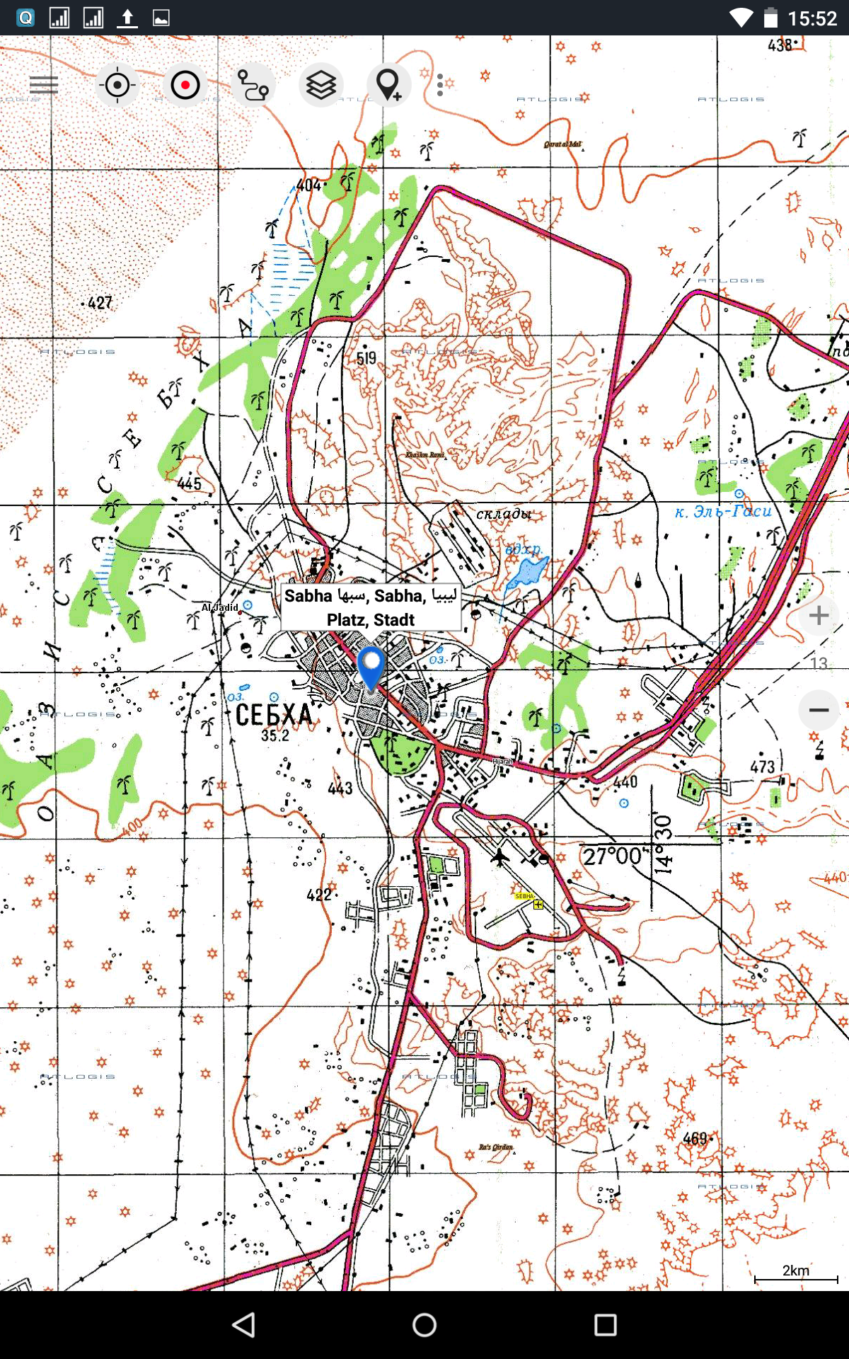
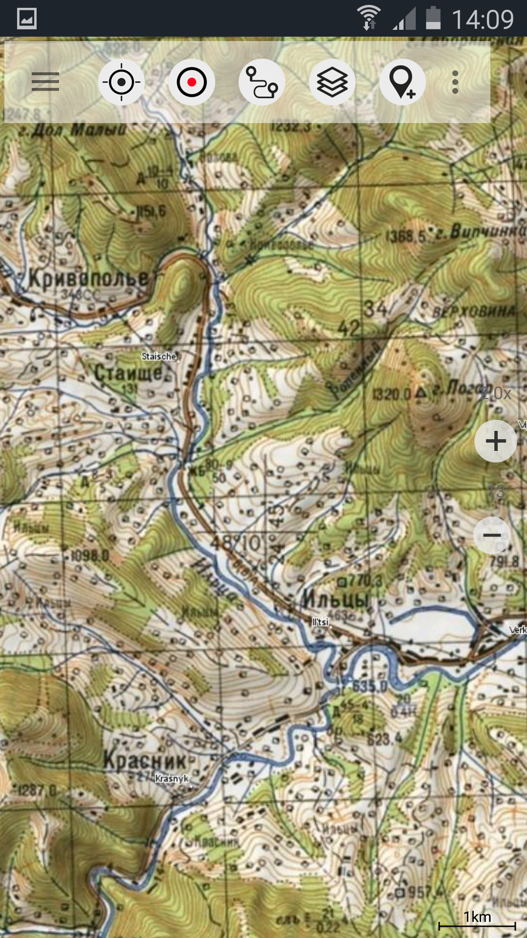
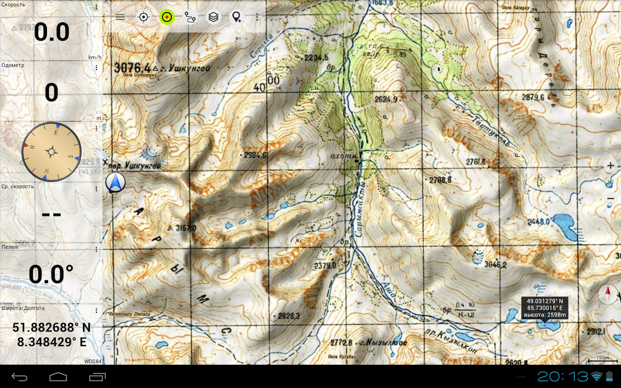
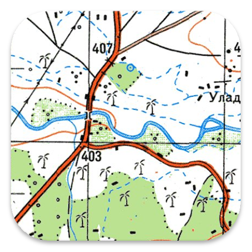
Off-road Navigation App with worldwide topographic maps, primarily Russian General Staff maps. These maps are considered some of the best available in many countries in Africa and Asia.
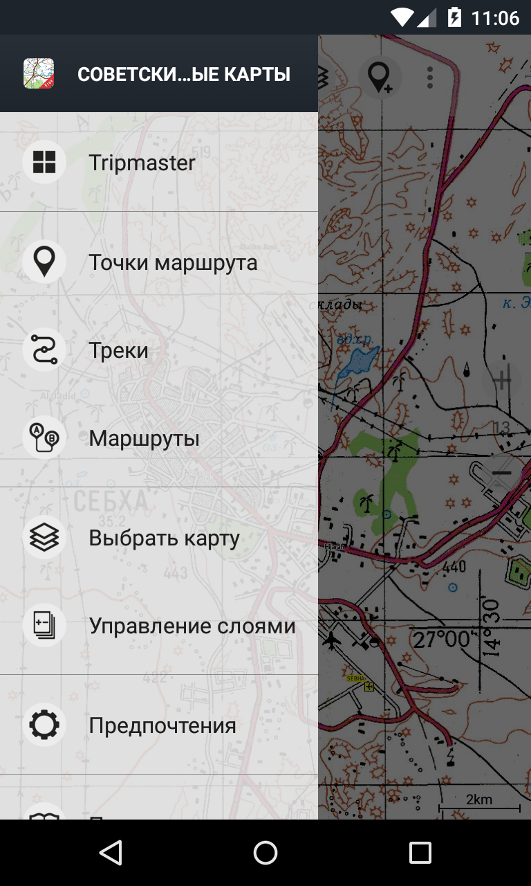
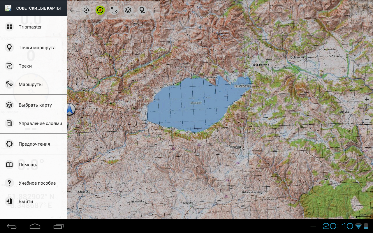
Available map layers include:
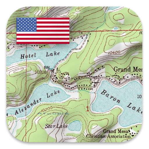
• Topographic maps worldwide (seamless coverage, mainly 1:100,000 scale)
• ROSREESTR - The Federal Service for State Registration, Cadastre, and Cartography
• Google Maps (satellite images, road, and terrain maps)
• OpenStreetMaps (OSM Mapnik, Osmarender, and Cloudemade Cyclemap)
• Bing Maps
• ESRI Maps
This app provides similar mapping options as those found in Garmin or Magellan GPS handheld devices.
Key features for outdoor navigation include:
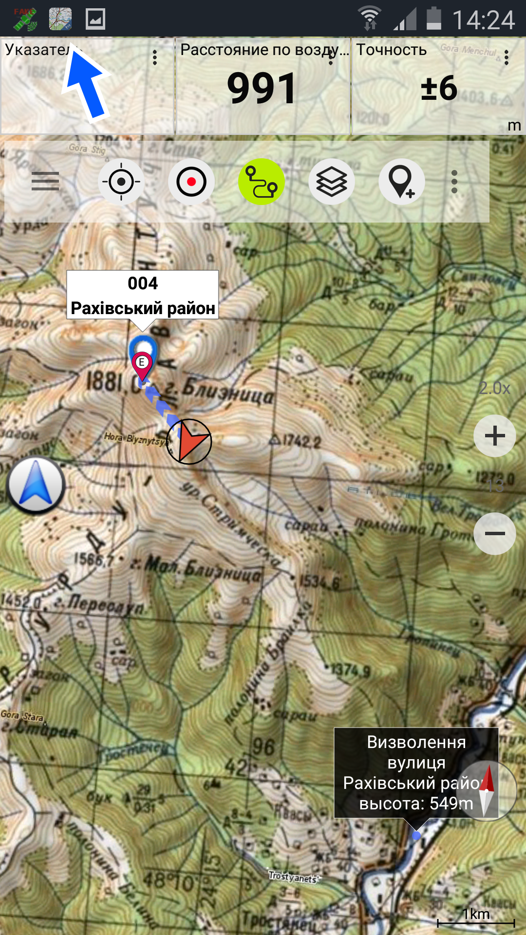
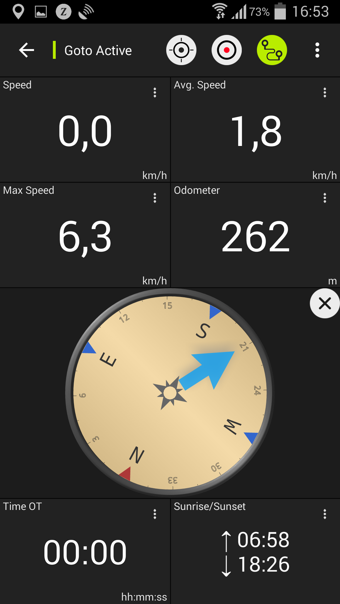
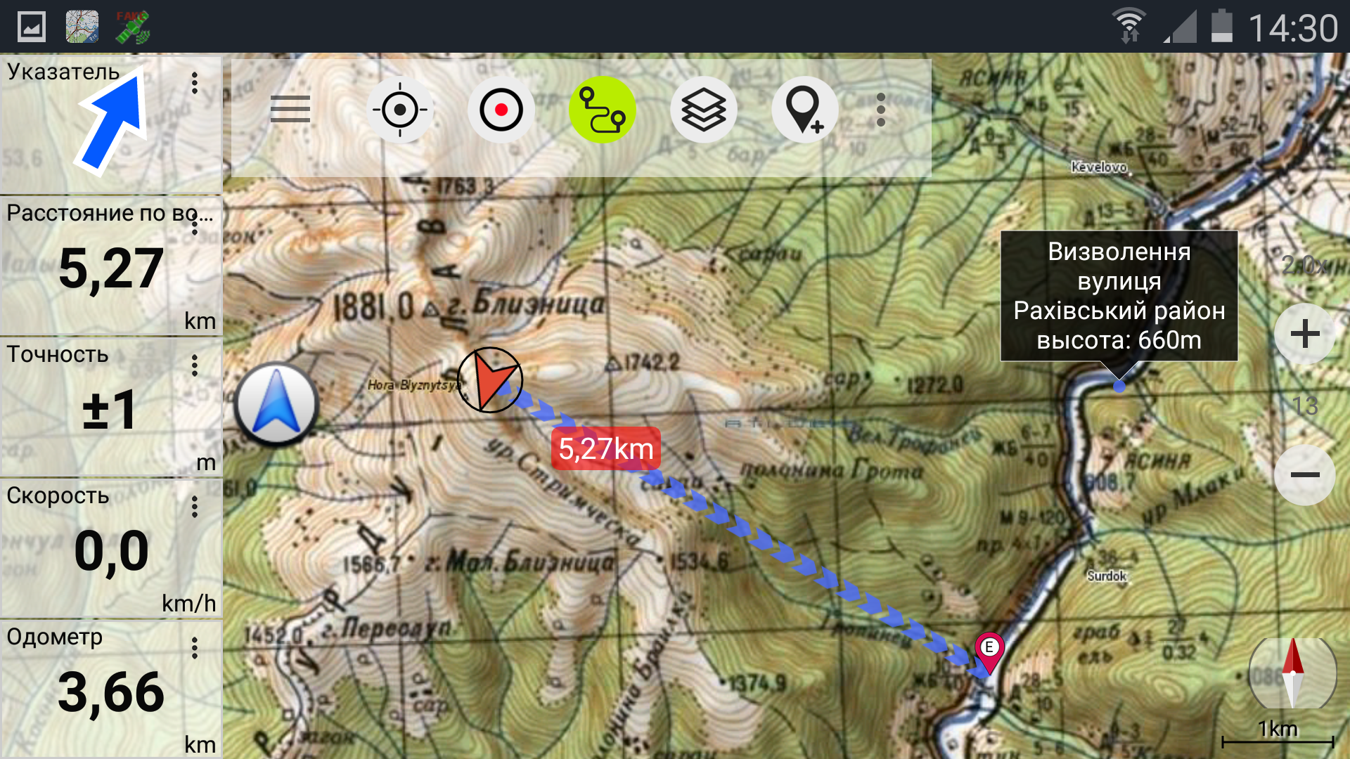
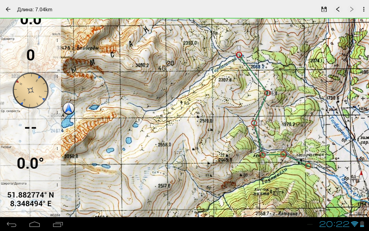
• Waypoint creation and editing
• GoTo-Waypoint navigation
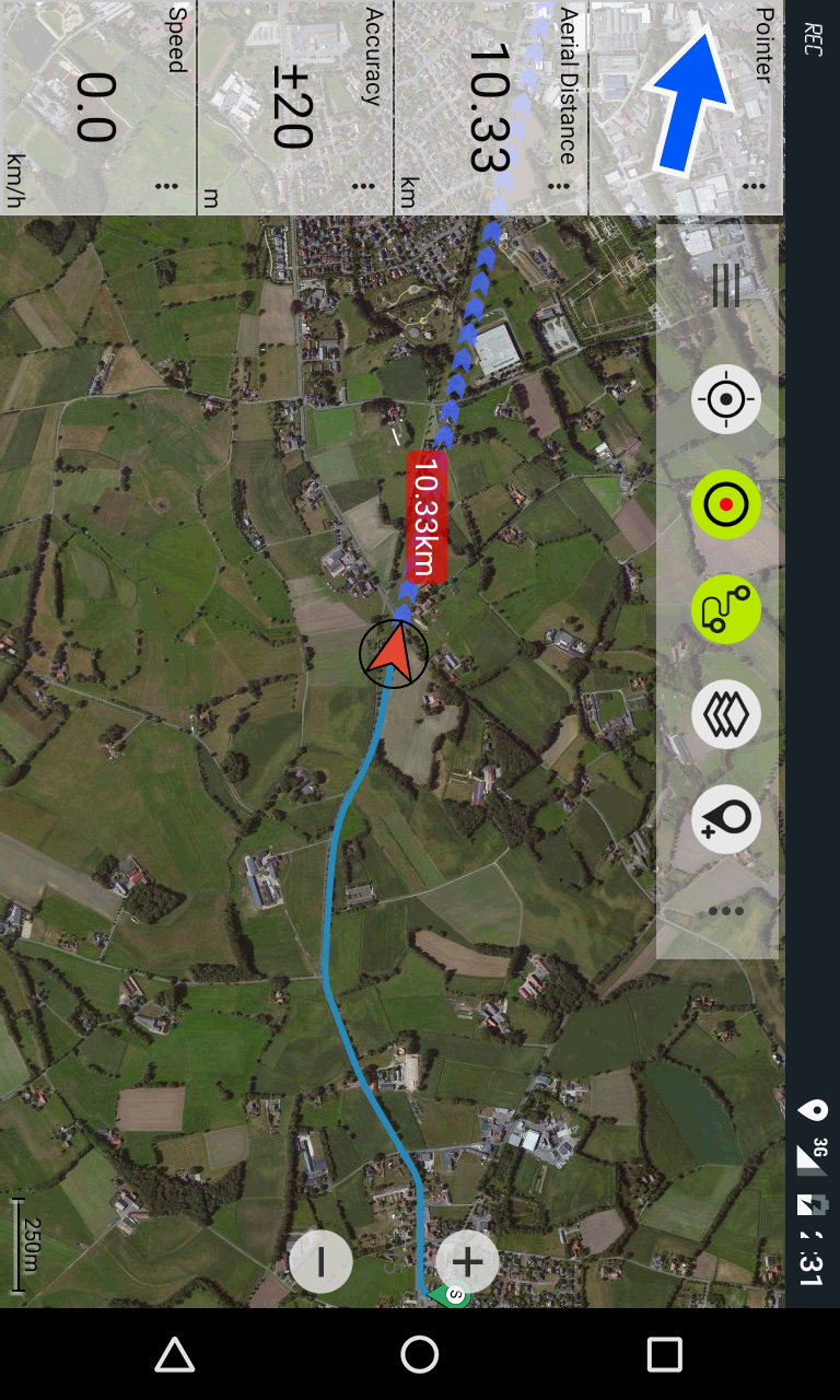
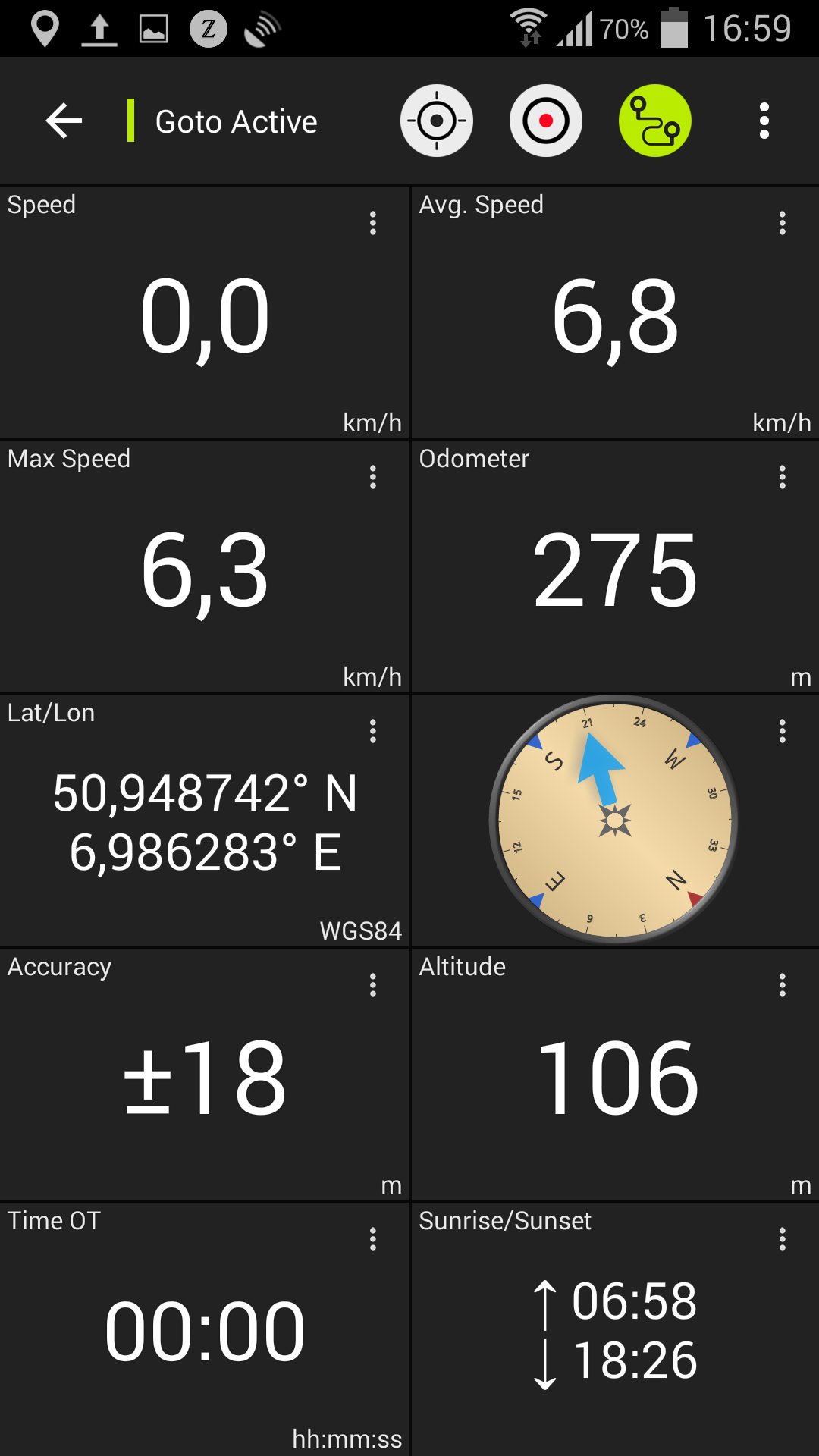
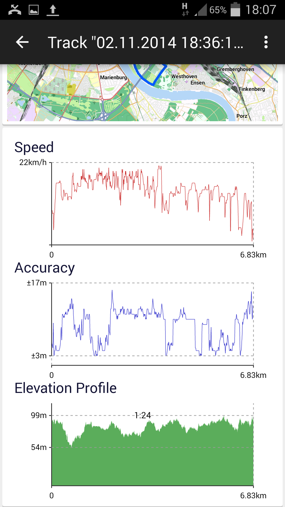
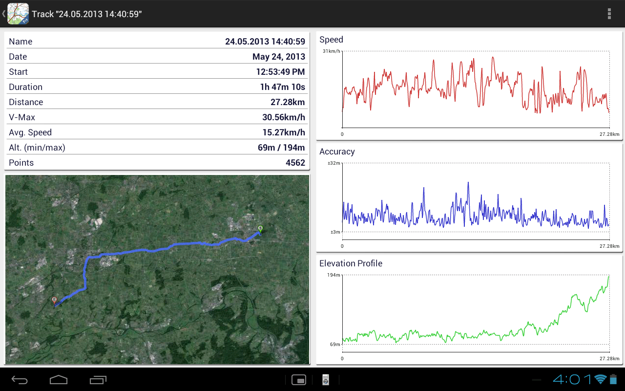
• Track recording with speed and elevation profile
• Tripmaster with fields for odometer, average speed, bearing, elevation, etc.
• GPX, KML import
• Search functionality for place names, POIs, streets
• Customizable data fields in Map View and Tripmaster (e.g., speed, distance, compass)
• Bulk download of map tiles for offline use (not available in the free version)
• Import of Oziexplorer map format in OZF2 OZFX3 extension (not available in the free version)
• Import of OpenStreetMaps in vector format (not available in the free version)
• Waypoint/Track sharing via email, Facebook, and more
Soviet Military Maps is an ideal app for navigating off-road trips, adventure travels, and expeditions. Whether you're planning a cross-country journey in the Sahara desert or a trekking tour in the Himalayas, the Russian topos provide a great alternative with detailed trails and roads missing in other map sets. The Russian maps also feature English labels.
Please note: Soviet Military Maps were predominantly created in the 1980s and may be less relevant for industrialized countries. Outside Africa and Asia, users may find the OSM/Google map layers more beneficial.
Russian Topo Maps FAQ
1. Why can't I install Russian Topo Maps?
The installation of Russian Topo Maps may fail because of the lack of device storage, poor network connection, or the compatibility of your Android device. Therefore, please check the minimum requirements first to make sure Russian Topo Maps is compatible with your phone.
2. What's the file size of Russian Topo Maps?
Russian Topo Maps takes up around 45.3 MB of storage.
3. Is Russian Topo Maps free to download?
Yes, Russian Topo Maps is free to download. And it does not contain in-app purchase.
LIMITATIONS OF THE FREE VERSION:
• Contains ads
• Limited to 3 waypoints and 3 tracks
• No import of waypoints and tracks
• No bulk download
• No local city database for offline search
• No hillshading overlay
For questions, feature requests, or bug reports, please contact us at android@atlogis.com.
Map Coverage:
- Scale 1:100,000 and 1:200,000:
Europe, Afghanistan, Azerbaijan, Georgia, Japan, Jordan, Latvia, Lithuania, Kazakhstan, Kyrgyzstan, Morocco, Mongolia, Pakistan, Russia, Syria, Tajikistan, Turkey, Turkmenistan, Ukraine, Uzbekistan, Belarus
- Scale 1:200,000:
Various countries across Africa, Asia, Europe, and the Middle East
- Scale 1:250,000 (Local maps from USGS, Geoscience Australia, CTIO):
USA, Canada, Australia
- Scale 1:500,000:
All other countries
- Version7.4.0 free
- UpdateMar 06, 2025
- DeveloperATLOGIS Geoinformatics GmbH & Co. KG
- CategoryMaps & Navigation
- Requires AndroidAndroid 7.0+
- Downloads3M+
- Package Namecom.atlogis.sovietmaps.free
- Signature60a3ec141d35d0b9d5626a167f78ddd7
- Available on
- ReportFlag as inappropriate
-
NameSizeDownload
-
20.01 MB
-
20.62 MB
-
18.66 MB


Marks all the roads
Easy to use
Only shows place names in Russian
Information a bit outdated