US Topo Maps - Explore US landscapes
Navigate, hike, and explore the great outdoors with detailed topographic maps
- 7.4.0 Version
- 3.2 Score
- 930K+ Downloads
- In-app purchases License
- 3+ Content Rating
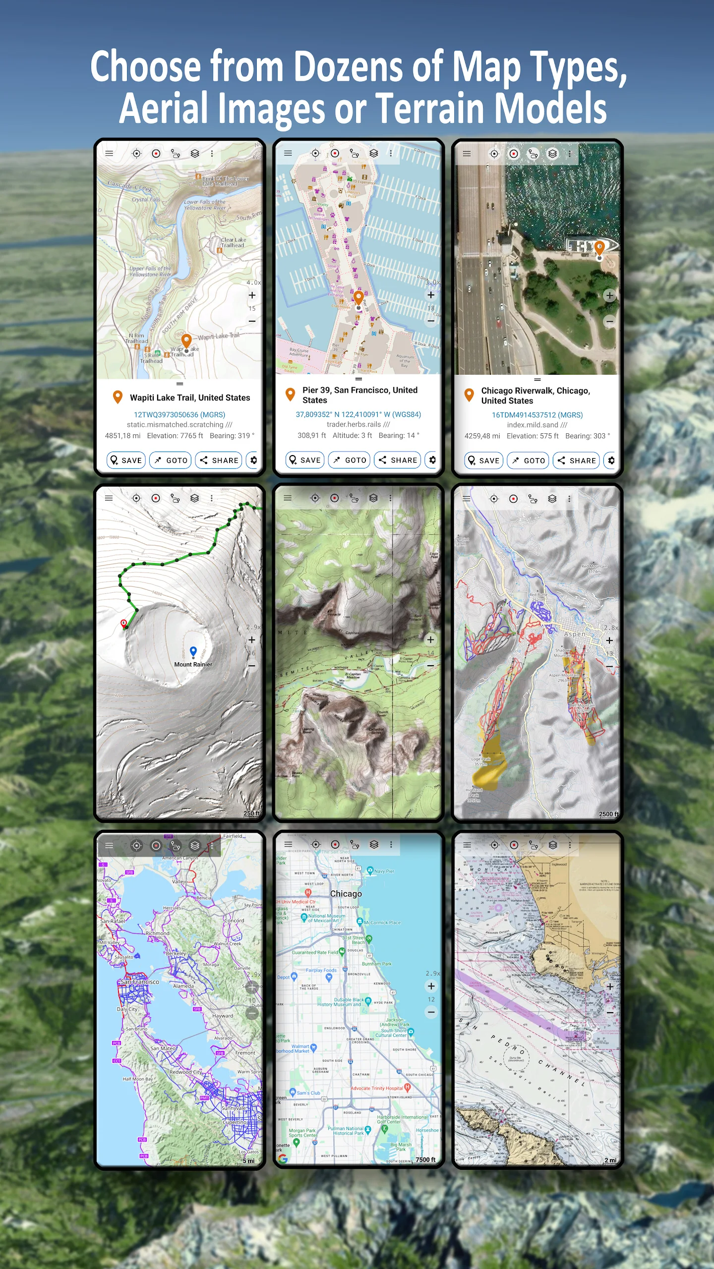
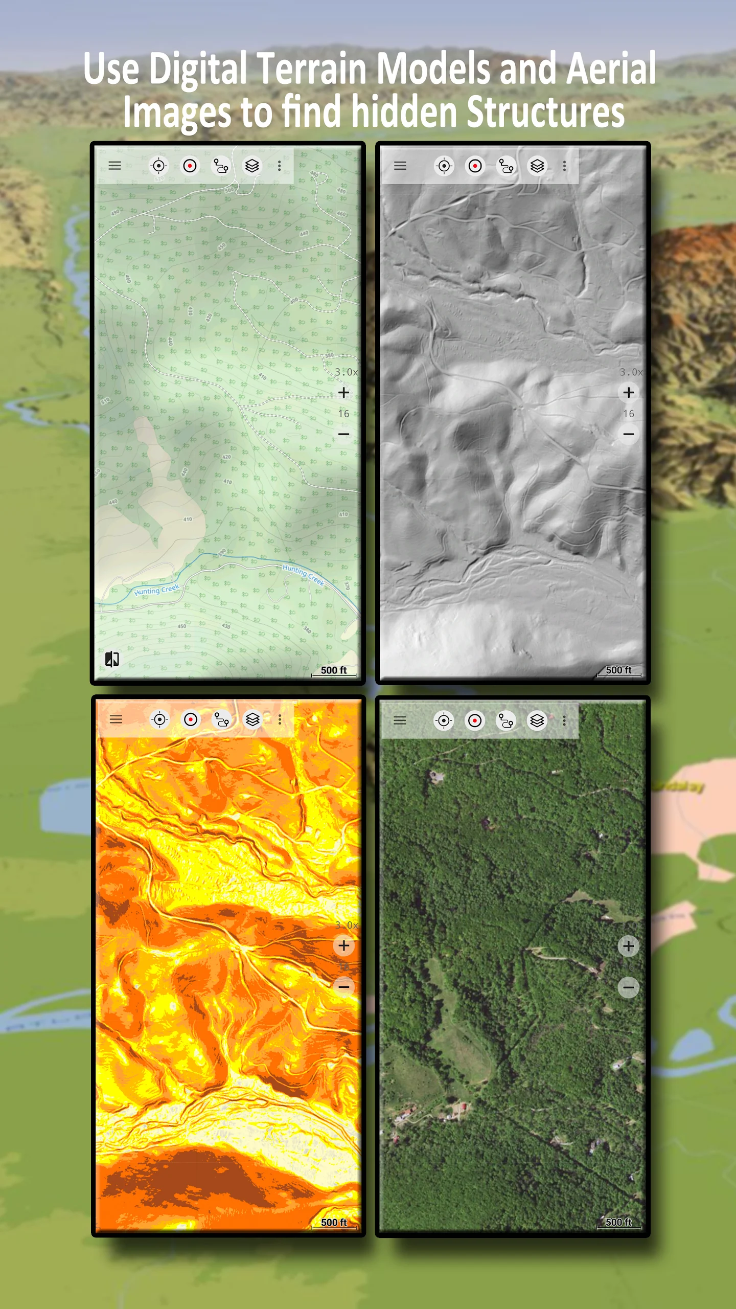
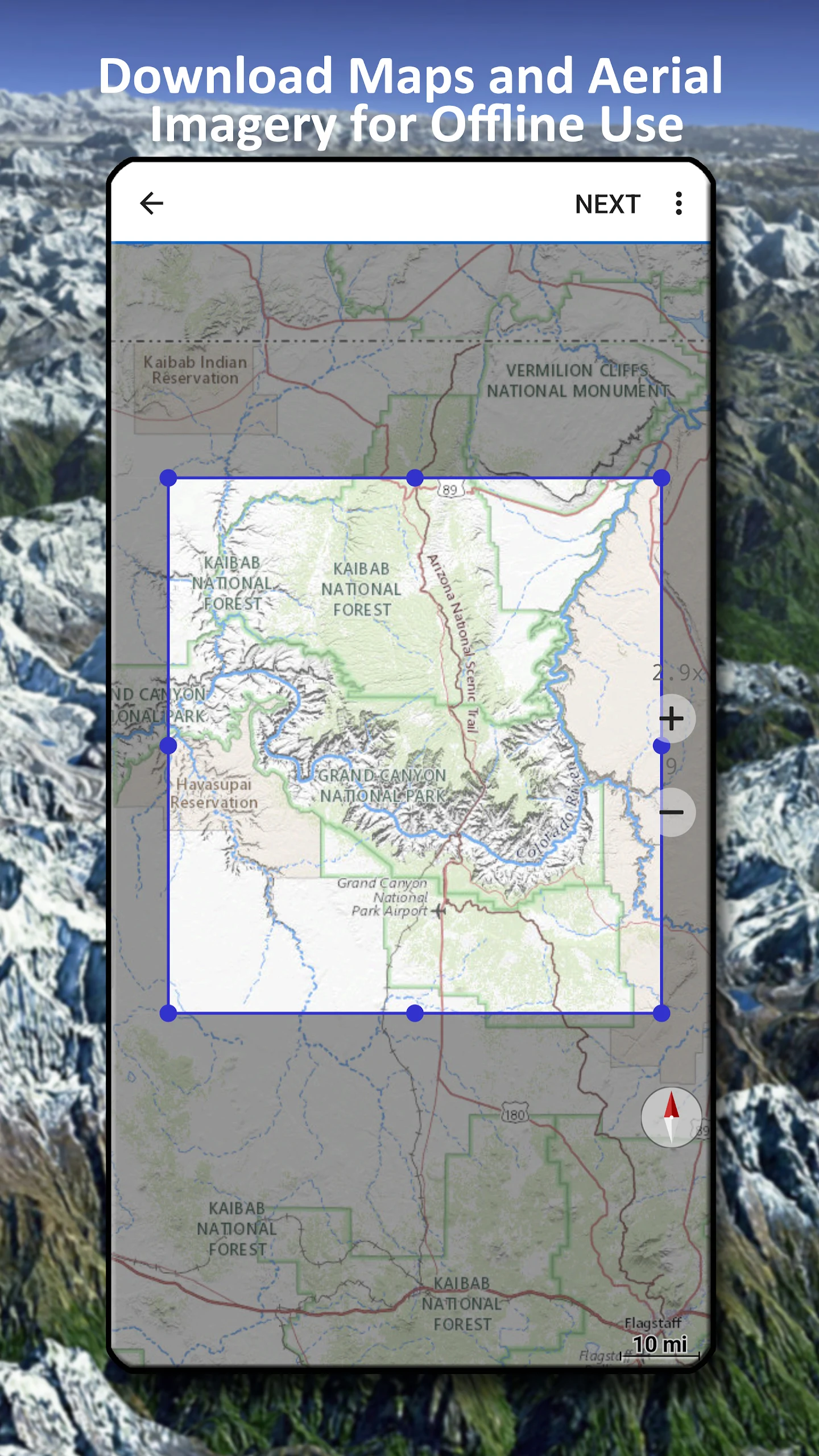
An easy-to-use outdoor navigation app offering free access to premium maps and aerial imagery of the USA. With over 30 map layers to choose from, including topographic, aerial, and sea charts, users can plan their trips effectively and transform their Android Phone/Tablet into an offline GPS for backcountry adventures. This app supports various basemap layers specifically for the USA, such as USGS National Map Topo, FSTopo Forest Maps, NOAA Nautical RNC Charts, and National Elevation Maps.
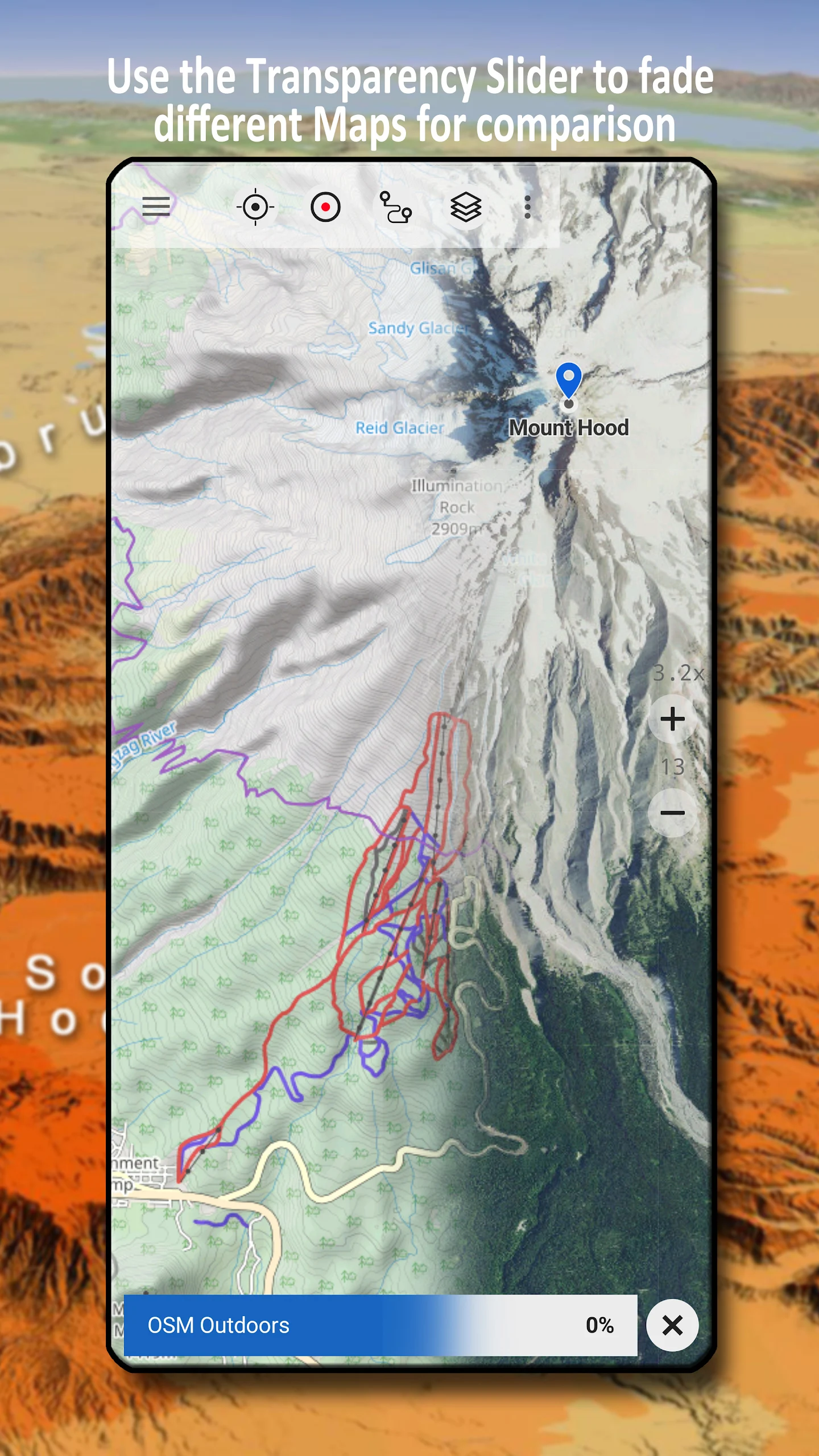
In addition to US-specific basemaps, global basemap layers like OpenStreetMaps, Google Maps, and Bing Maps are also available with options to download in vector format. Users can overlay different map layers and adjust transparency for detailed map comparisons. The app allows for importing various map formats (GeoPDF, GeoTiff, MBTiles) and web mapping services (WMS, WMTS/Tileserver).
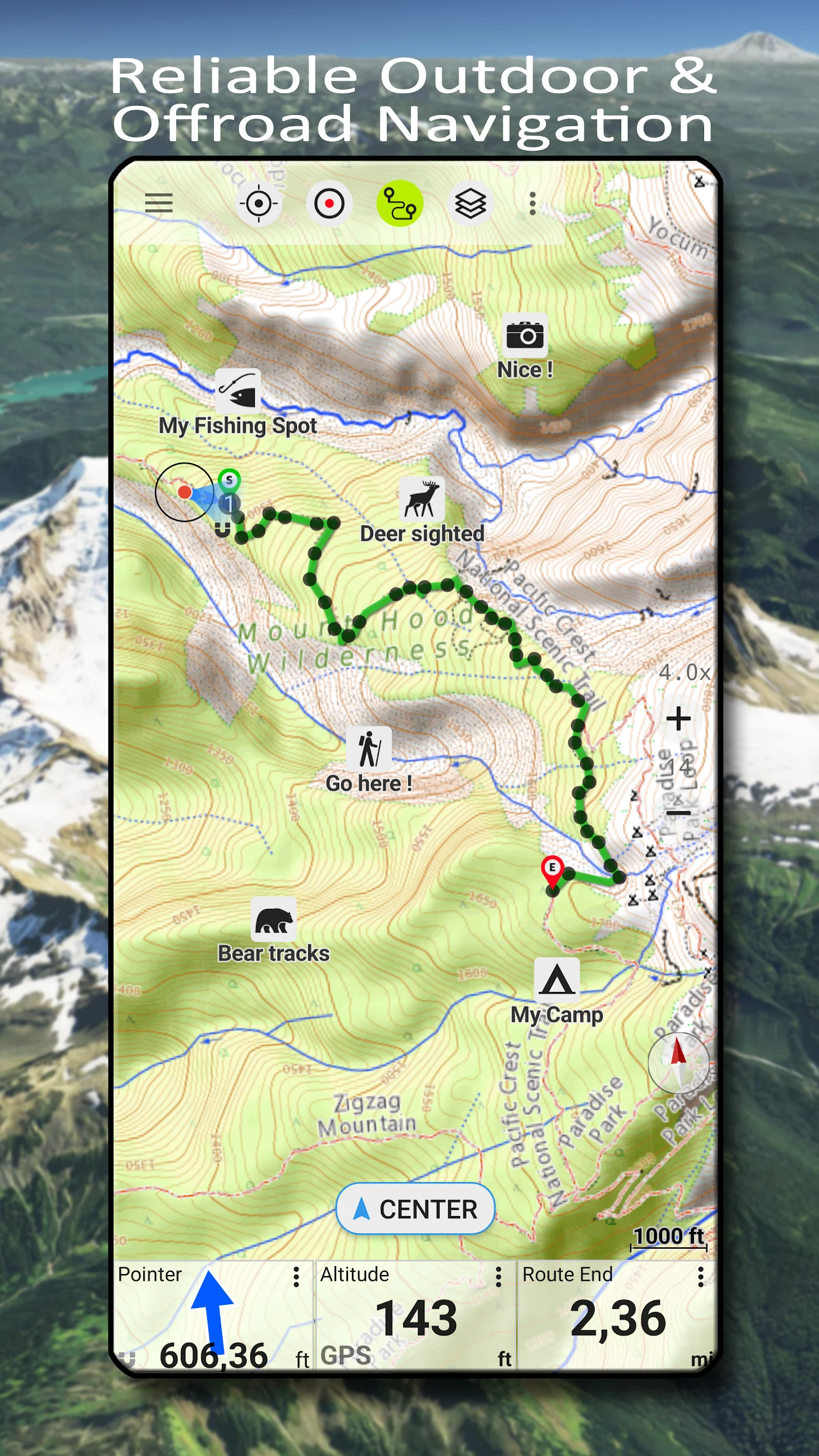
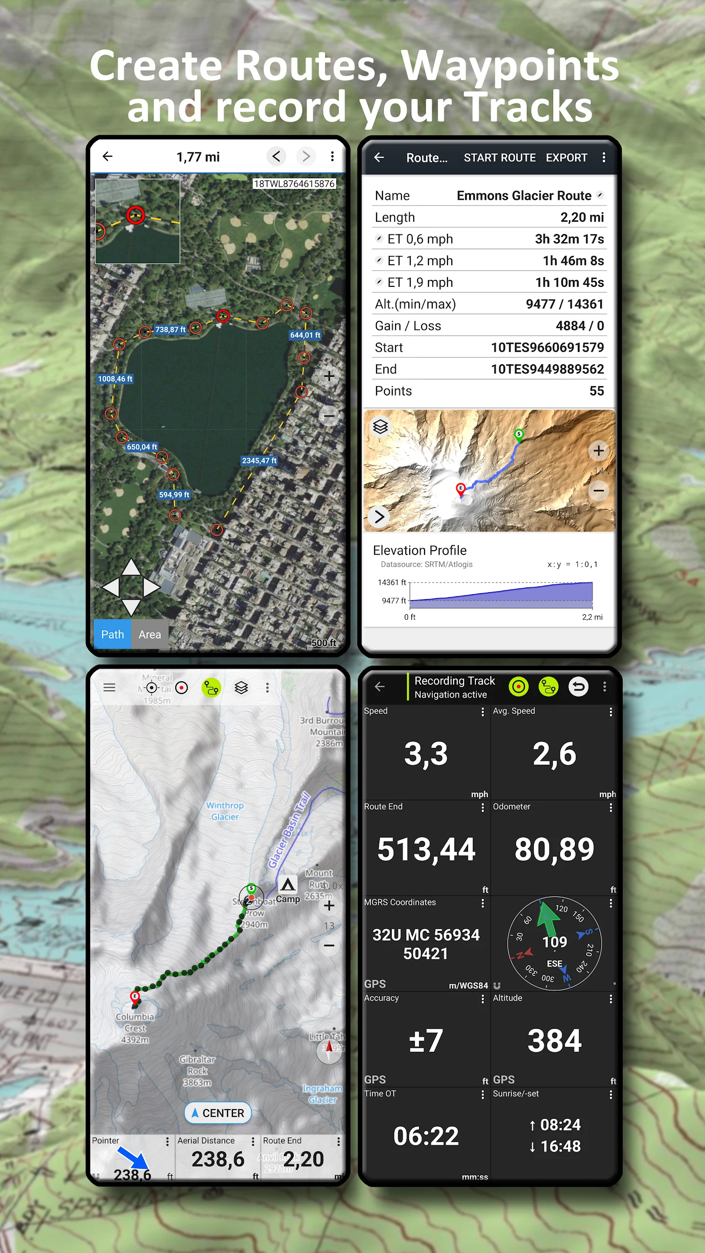
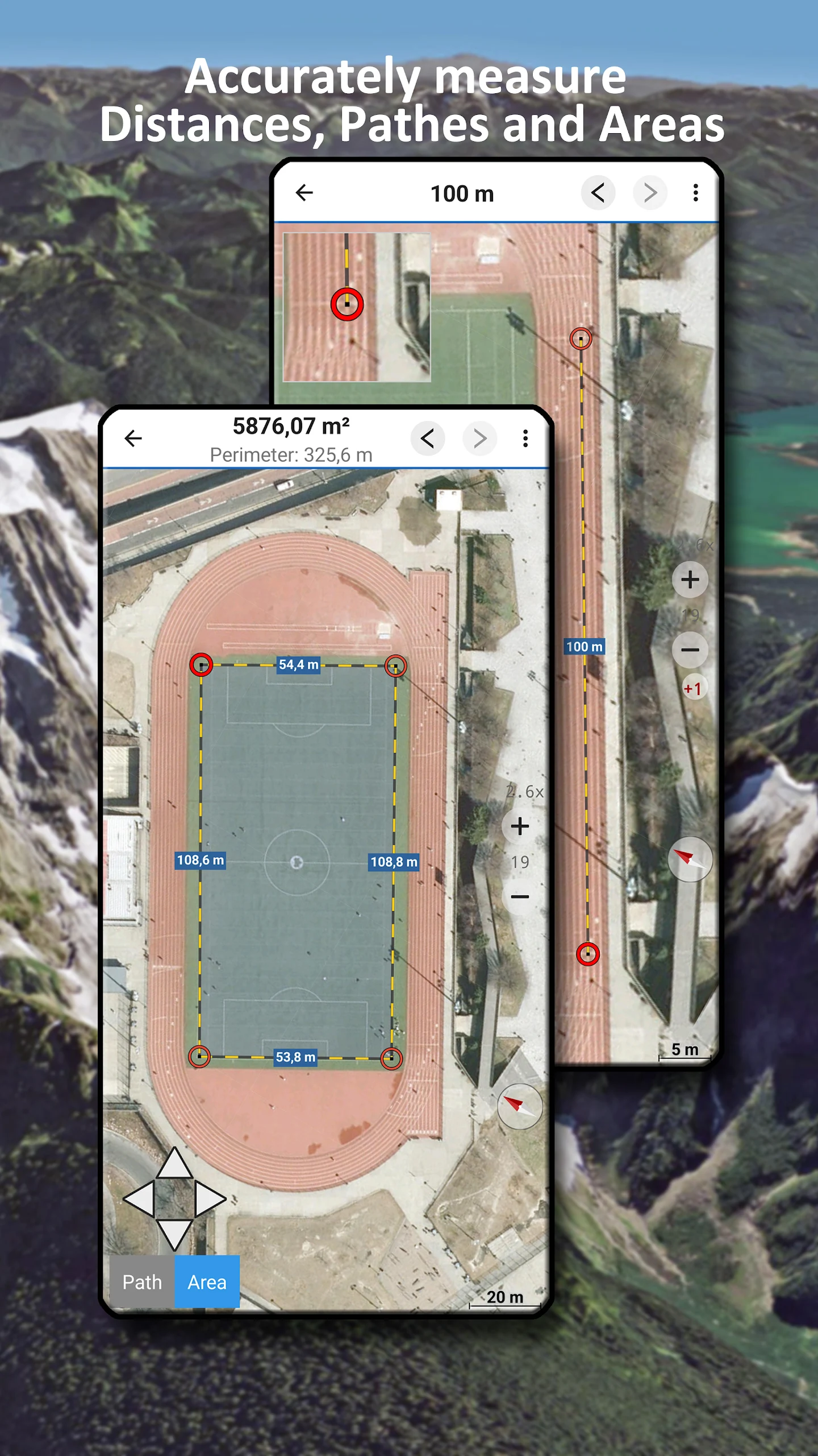
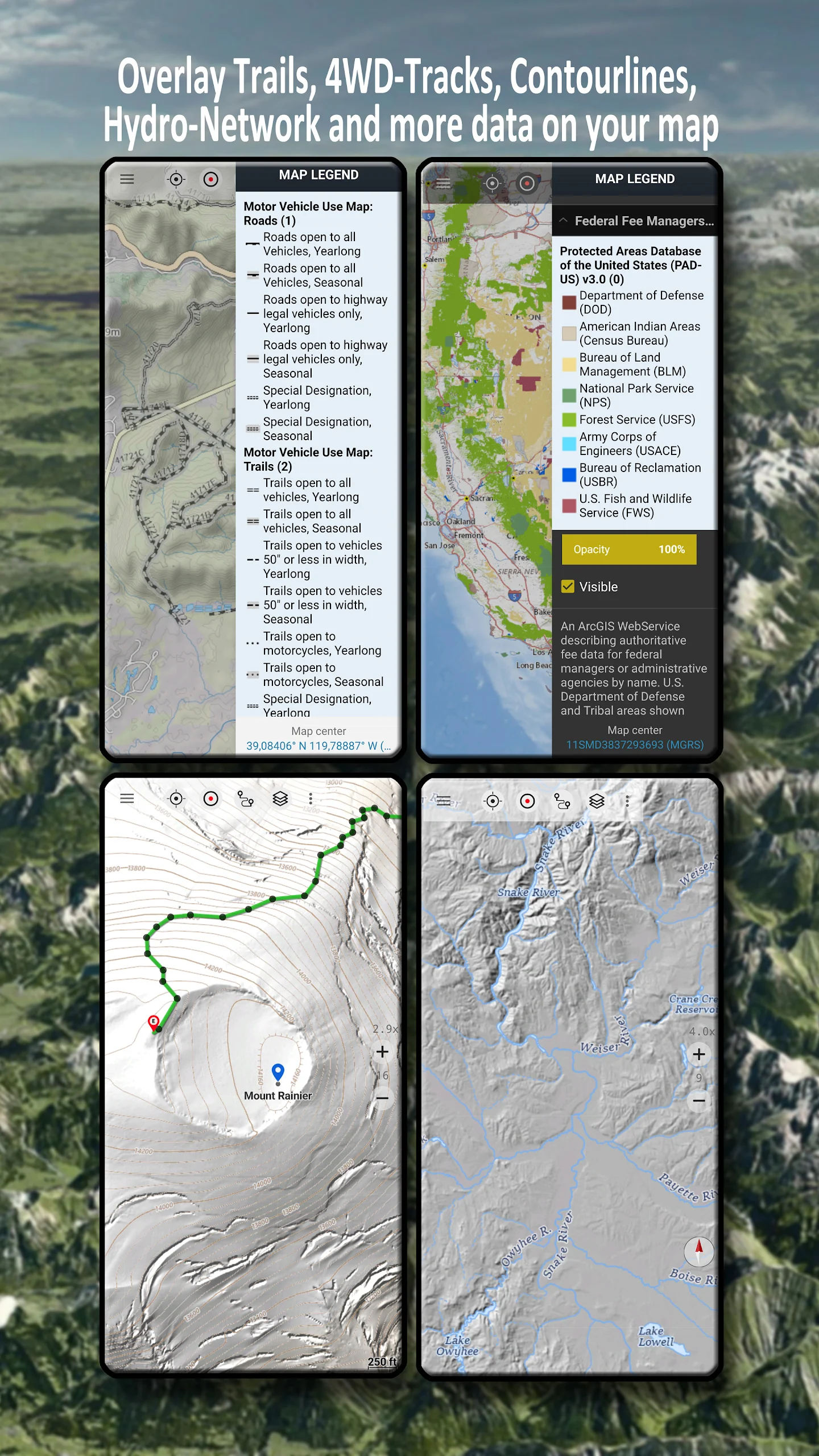
Furthermore, users can add overlays like Public Land Ownership, National Hydrographic Dataset, Elevation Contourlines, and 4WD Trails for additional information on the base maps. Key features include offline map data downloading, path and area measurement tools, waypoint creation and navigation, route planning and navigation, track recording, tripmaster functions, GPX/KML/KMZ Import/Export, elevation and distance calculation, customizable data fields, sharing capabilities, coordinate support in multiple formats, and more.
Designed for outdoor activities such as hiking, biking, camping, climbing, skiing, hunting, and search & rescue missions, this navigation app supports custom waypoints and GPS import/export/sharing in various formats. Users can access animated NEXRAD rain radar for accurate weather predictions.
FAQ
1. How do US Topo maps differ from historical USGS topographic maps?
Historically, USGS topographic maps were made using data from primary sources including direct field observations. Those maps were compiled, drawn, and edited by hand. By today's standards, those traditional methods are very expensive and time-consuming, and the USGS no longer has funding to make maps that way.
A new USGS topographic map series was launched in 2009 and branded "US Topo." Though designed to look like traditional 7.5-minute topographic maps, US Topo maps are mass-produced from secondary sources, primarily The National Map and other government GIS databases. US Topo maps are a repackaging of GIS data in traditional map form for the benefit of non-specialist map users.
One of the main differences is that the historical USGS 7.5-minute topographic map series (produced 1945-1992) included feature classes that are not yet shown on US Topo maps (though more are added each year). Examples include recreational trails, pipelines, power lines, survey markers, many types of boundaries, and many types of buildings.
US Topo maps are, however, superior to historical USGS topographic maps in some ways. Individual layers can be turned on and off to allow map customization and the inclusion of more data. US Topo maps include a high-resolution aerial photograph (orthoimage). Thanks to automated production, US Topos have a rapid national refresh cycle (3 years), as opposed to 45 years for the historical 7.5-minute map series. That leads to continuous and relatively rapid product improvement.
2. How current are US Topo maps?
US Topo maps are updated on a three-year production cycle (maps covering one third of the country are updated each year). The US Topo production schedule follows the U.S. Department of Agriculture's National Agricultural Imagery Program (NAIP) collection schedule. This does not include US Topos for Alaska, which are on a different schedule.
The linework features shown on the maps are generated from the latest data holdings in The National Map and other standard sources. The overall goal of the project is for each map to be current to within three years at the time of publication, though there is considerable variation in actual feature currency due to the variety of data sources used and their varying revision schedules.
- Version7.4.0
- UpdateDec 27, 2024
- DeveloperATLOGIS Geoinformatics GmbH & Co. KG
- CategoryMaps & Navigation
- Requires AndroidAndroid 7.0+
- Downloads930K+
- Package Namecom.atlogis.northamerica.free
- Signaturef1a776820108252c7ea738af8e0346c4
- Available on
- ReportFlag as inappropriate
-
NameSizeDownload
-
124.72 MB
-
65.42 MB
-
62.64 MB


Nice interface and easy to navigate
High quality aerial photography
A little pricey for the Pro version
Occasional lag