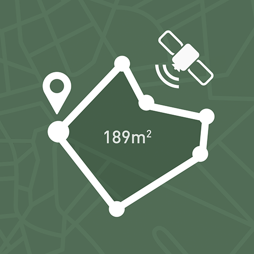
My GPS Area Calculator - Area & distance measuring
Transform how you measure spaces with powerful GPS tools, versatile options, and seamless data sharing for every need.
- 2.49 Version
- 1.2 Score
- 266K+ Downloads
- In-app purchases License
- 3+ Content Rating

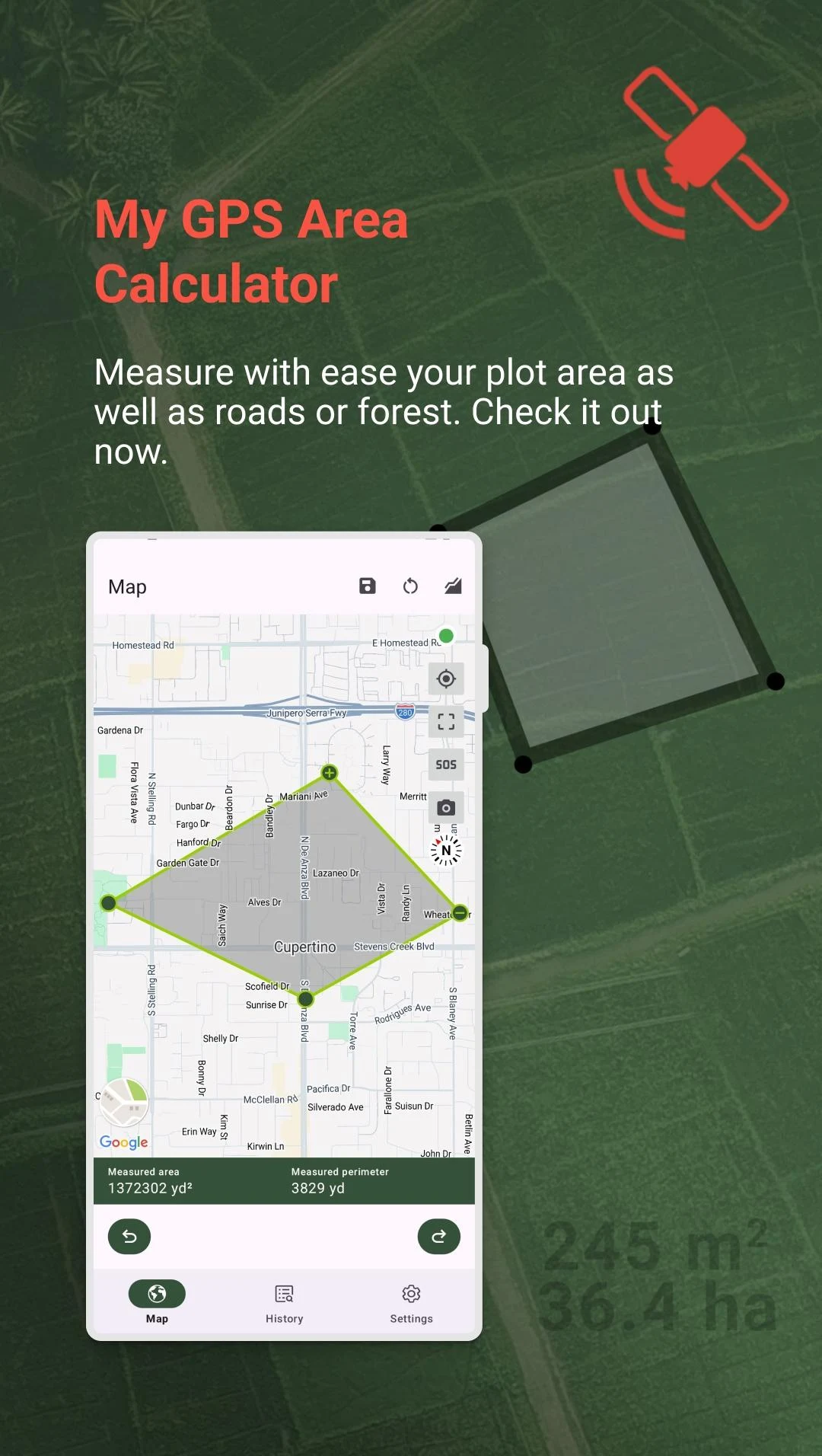


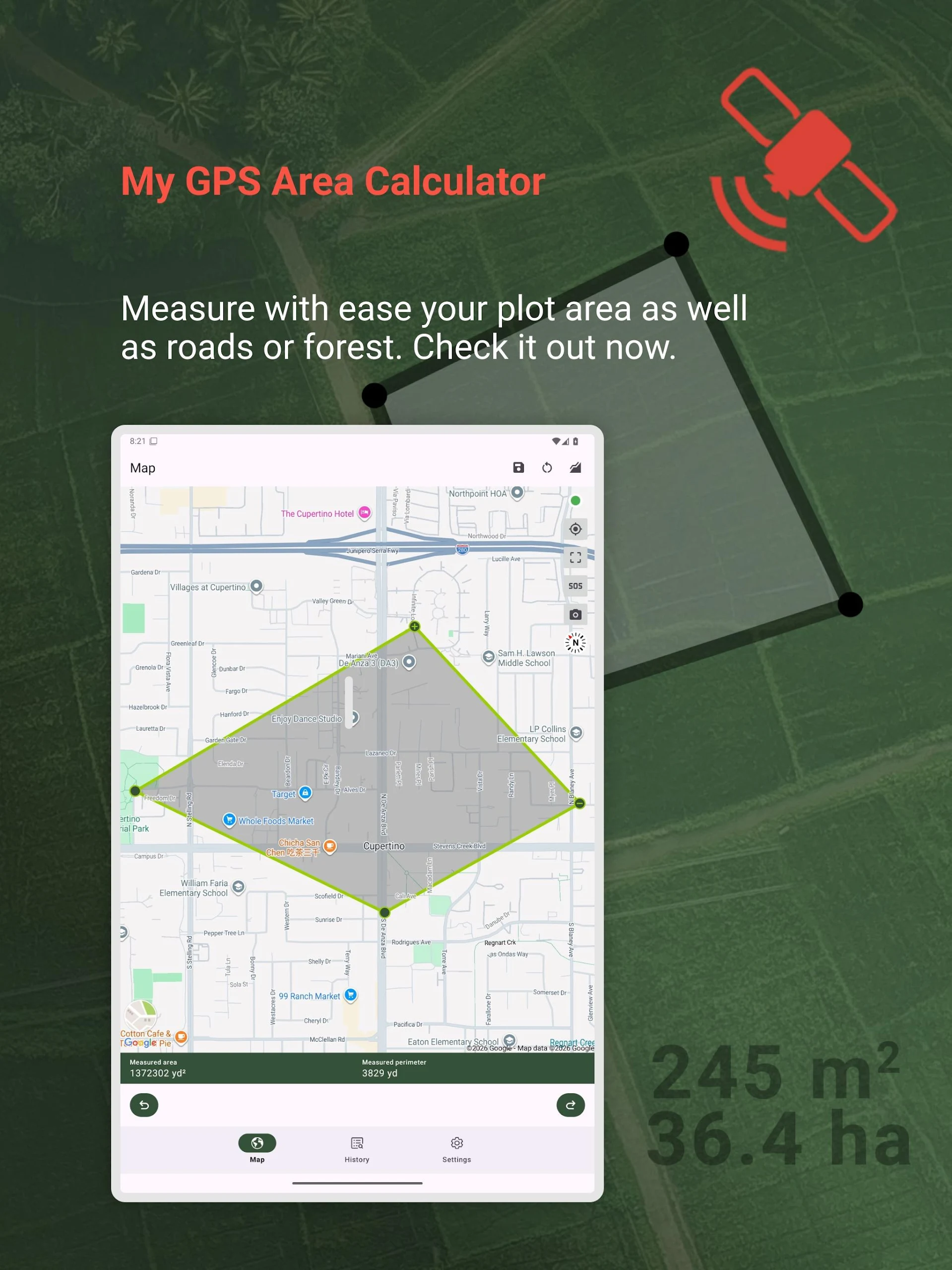
Forget bulky theodolites and expensive drone rigs—My GPS Area Calculator puts professional-grade area and distance measurement in the palm of your hand. Whether you’re a farmer mapping irrigation zones, a runner logging trail distances, or a realtor quoting lot sizes, this single app replaces clipboards, tape measures, and guesswork with centimeter-level precision (when paired with a high-quality GPS receiver). All data is stored, sorted, synced, and shareable, letting you move seamlessly from field work to office report.
KEY FEATURES
Dual-Mode Precision
• GPS Walk-Around Mode – simply walk the perimeter and let the app auto-calculate.
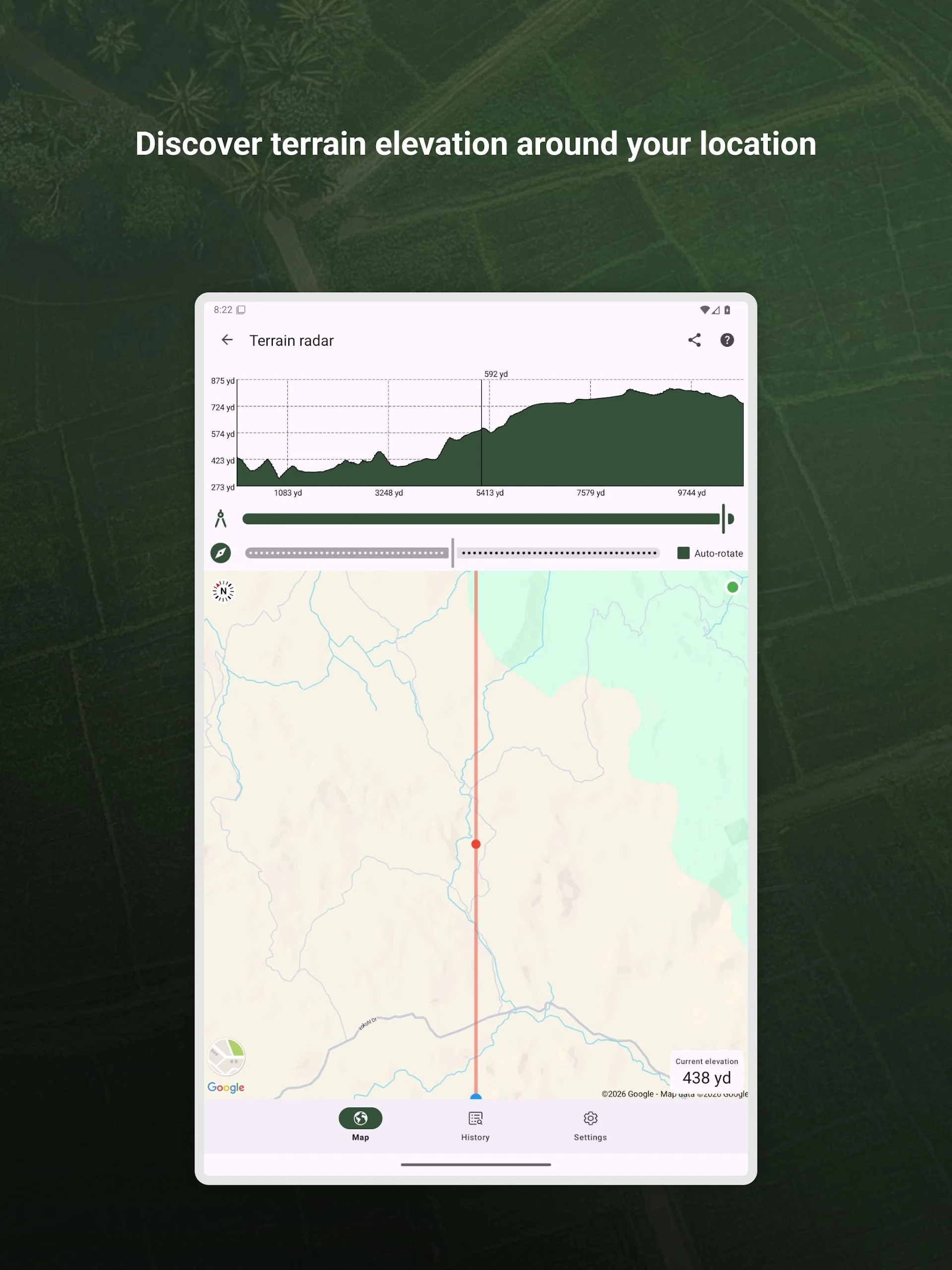
• Sofa Mode – stay indoors and drop pins on high-resolution maps (satellite, terrain, hybrid, or normal).
Unmatched Accuracy
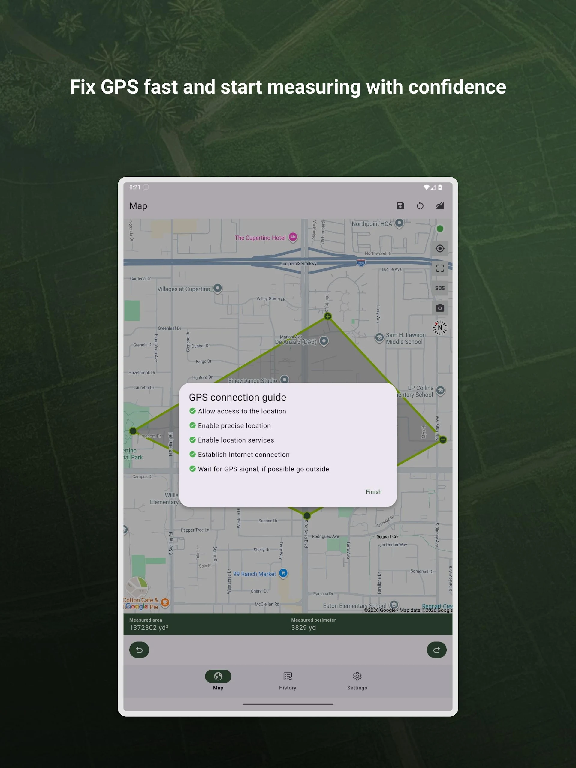
• Raw device GPS: ±5 m typical.
• Garmin GLO / GLO 2 Bluetooth receivers: down to 0.3 m.
• Assisted-GNSS plus network triangulation for urban canyons.
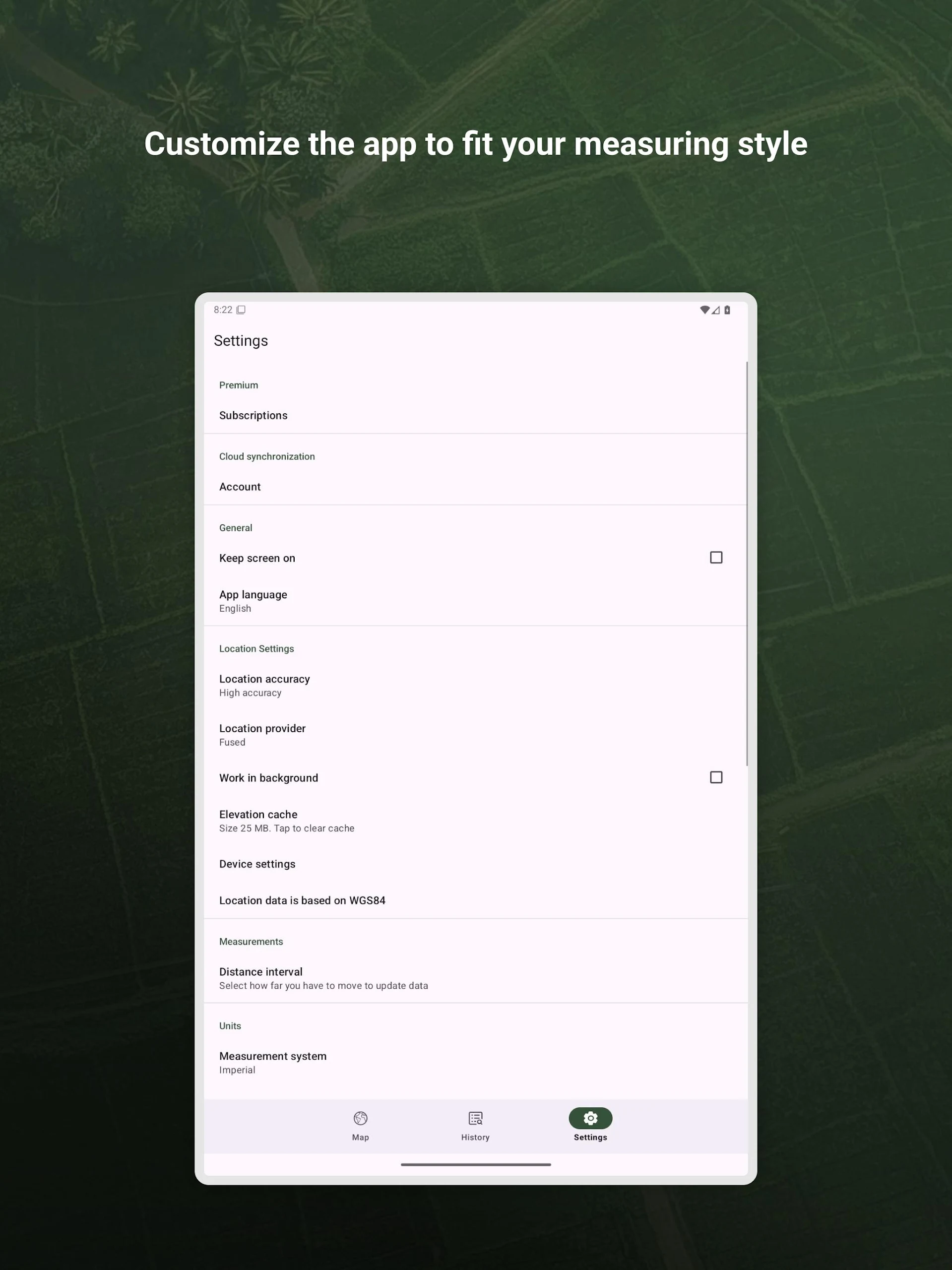
Versatile Units & Conversions
• Area: m², km², ft², yd², acre, hectare, nautical mile².
• Distance: m, km, ft, yd, mile, nautical mile.
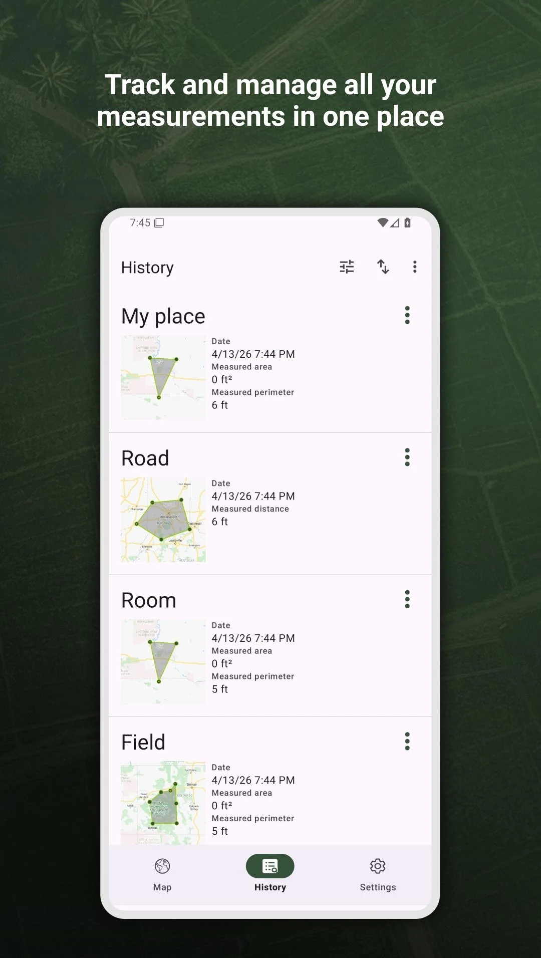
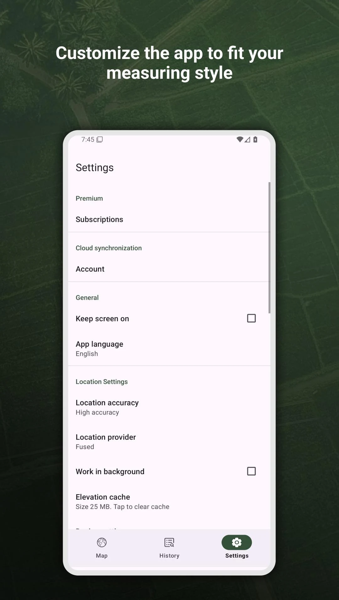
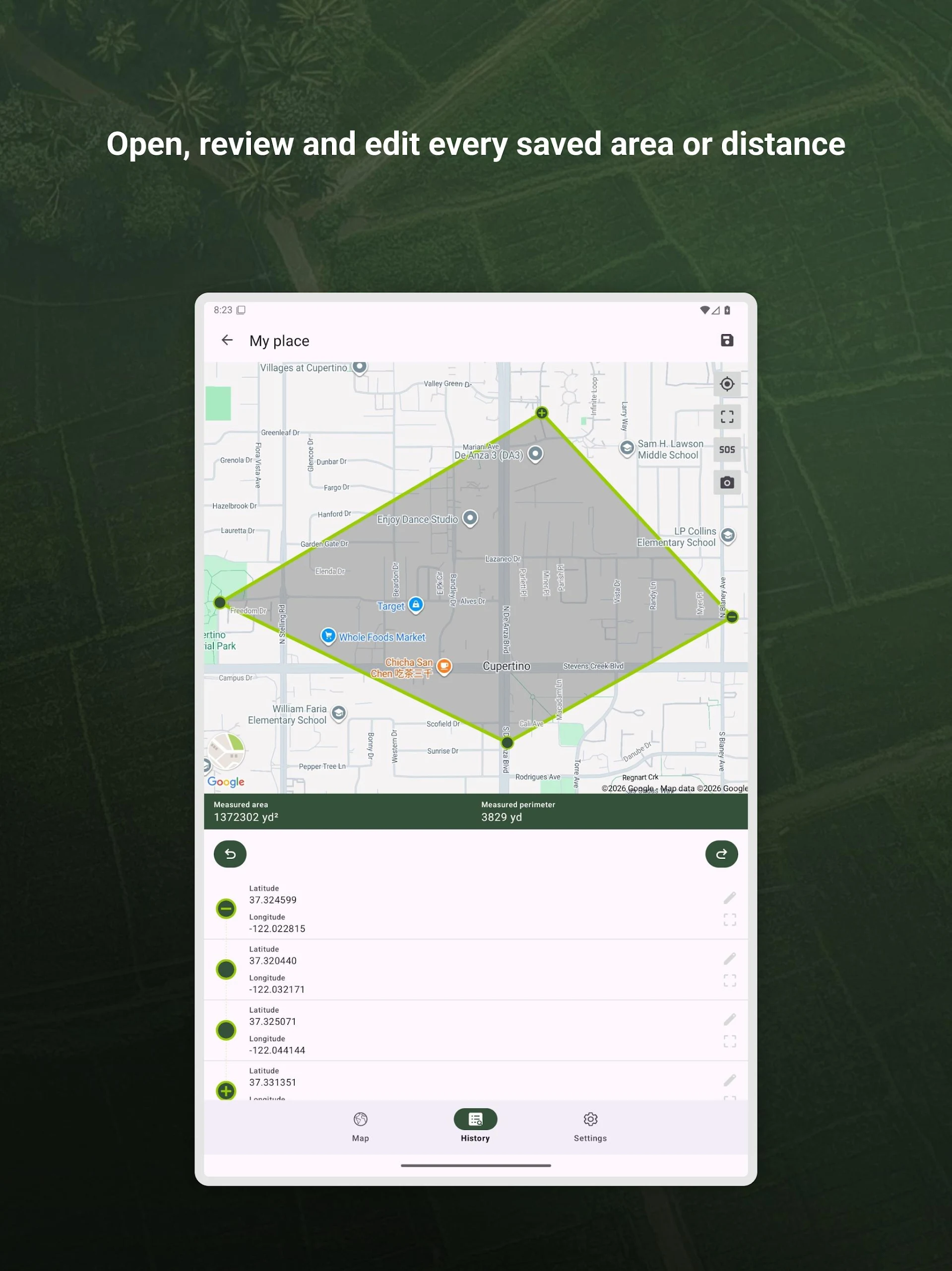
Smart Data Management
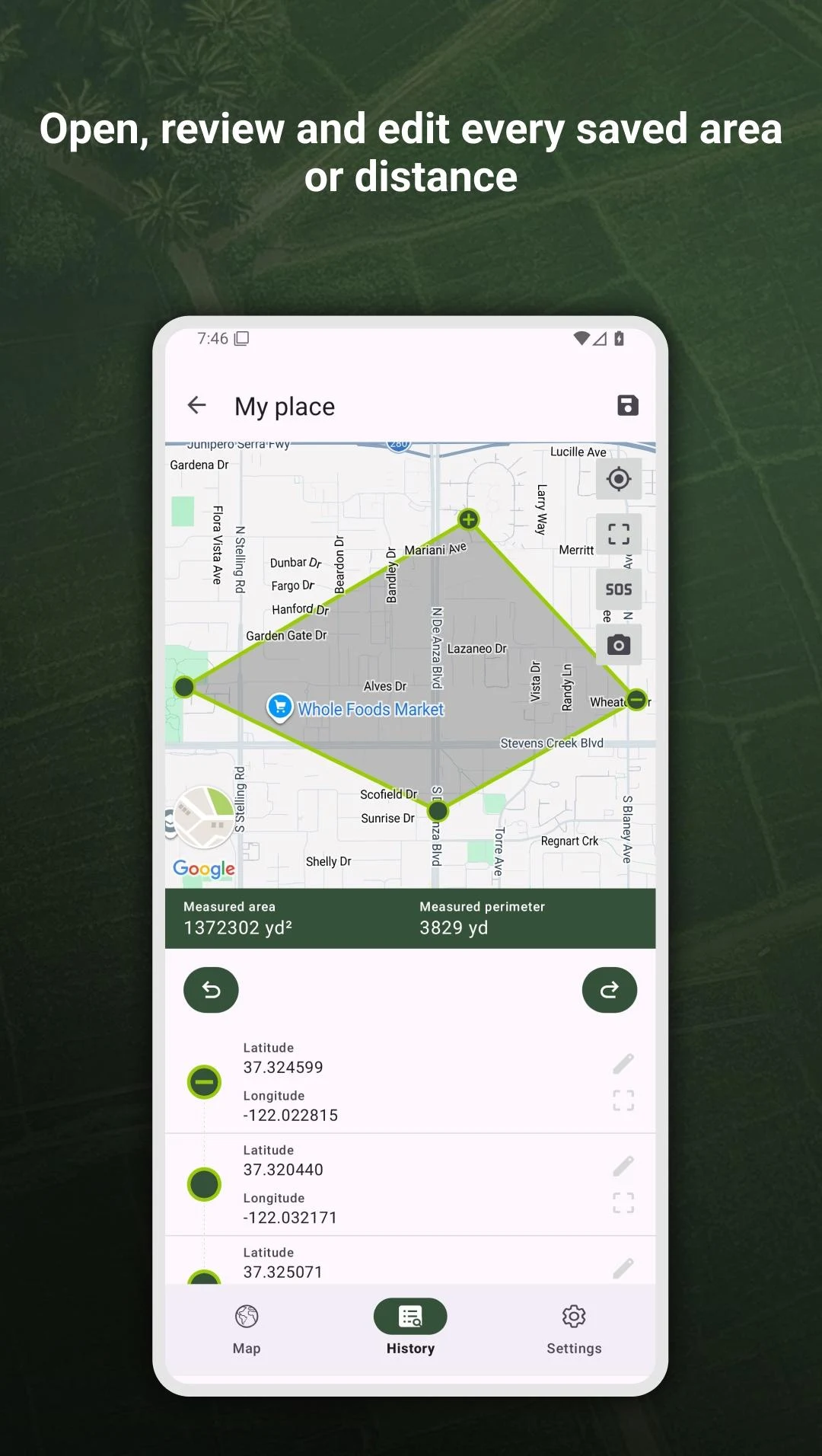
• Unlimited cloud-synced projects with date, name, size, and type tags.
• Sort by name, date, distance, or size; filter by category (field, room, road).
• Export GPX & KML for GIS suites, Google Earth, or CAD software; import colleague files the same way.
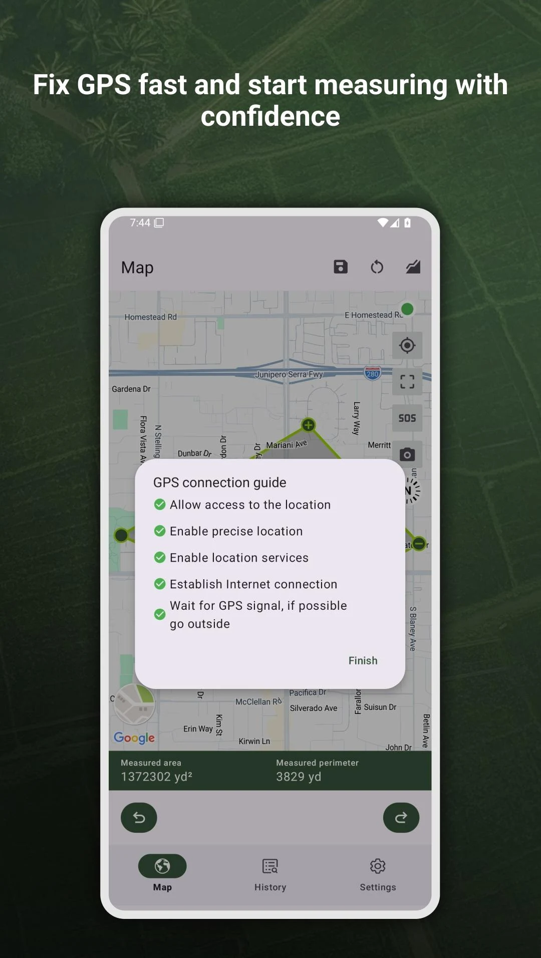
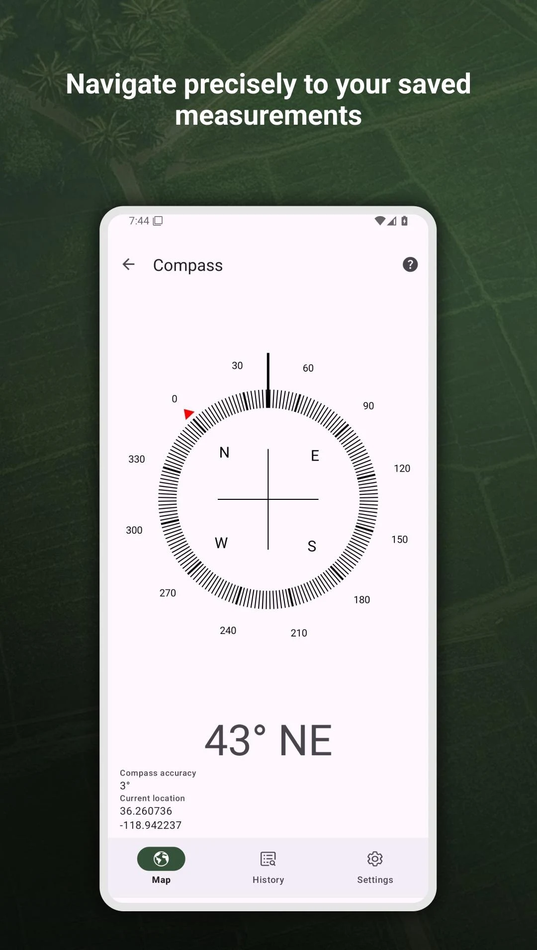
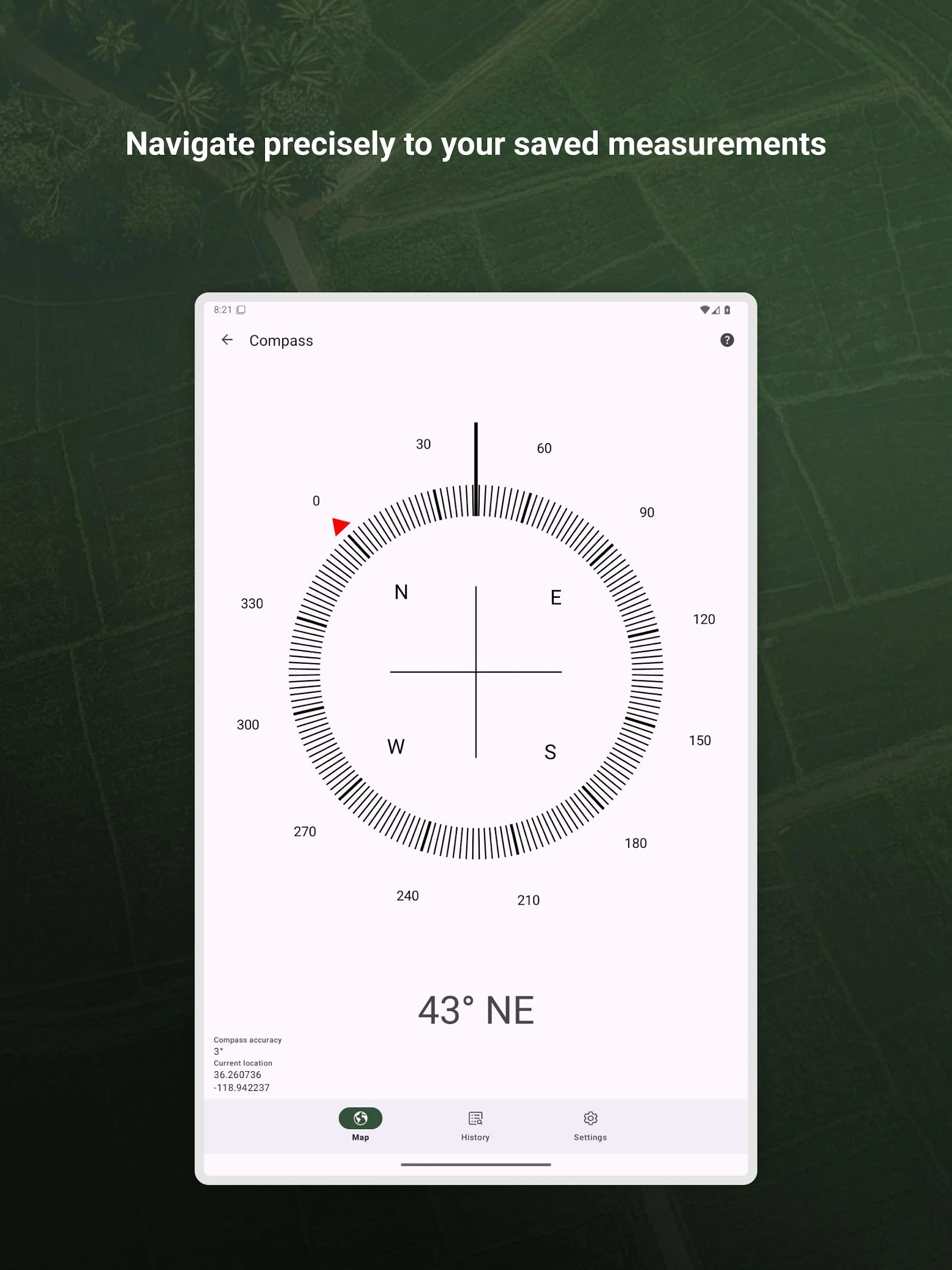
Real-Time Navigation & Safety
• Built-in compass with bearing lock.
• SOS button broadcasts location + emergency message via SMS or email.
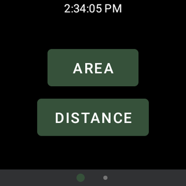
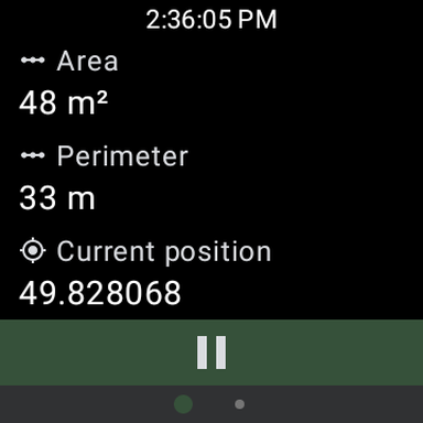
Wear OS Companion
• Leave your phone in the truck—record, pause, and save measurements from your watch, then sync later.
Rich Visual Toolkit
• Snapshot: one-tap PNG export of the map + overlays.
• Background measuring: keeps logging when you answer calls or check messages.
• Battery-aware accuracy slider (high / balanced / power-save).
Accessibility & Help
• In-app illustrated guide and FAQ.
• Voice announcements for distance or area while you walk.
• Dark mode for dawn/dusk fieldwork.
PRO TIPS
• Calibrate First: spend 30 seconds outside with clear sky before critical jobs.
• Use External Garmin GLO when fencing pastures or plotting construction sites—centimeter accuracy saves costly rework.
• Battery Strategy: switch to “Balanced” accuracy during long hikes; toggle “High” only for final corner verification.
• Combine Snapshots & Annotations: take a map screenshot, draw irrigation lines in your phone’s gallery editor, and attach the PNG to your farm manager.
• Keyboard Shortcuts on Tablet: press “S” to save, “C” to clear pins, “E” to export—ideal for surveyors with rugged keyboards.
• Archive Old Projects monthly to keep the list snappy; exported files remain in your cloud folder for future reference.
• Use SOS Sparingly: pre-configure two emergency contacts and test the feature once—no surprises in real emergencies.
MORE ADD-ONS
• Multi-language UI (EN, ES, FR, PT, HI).
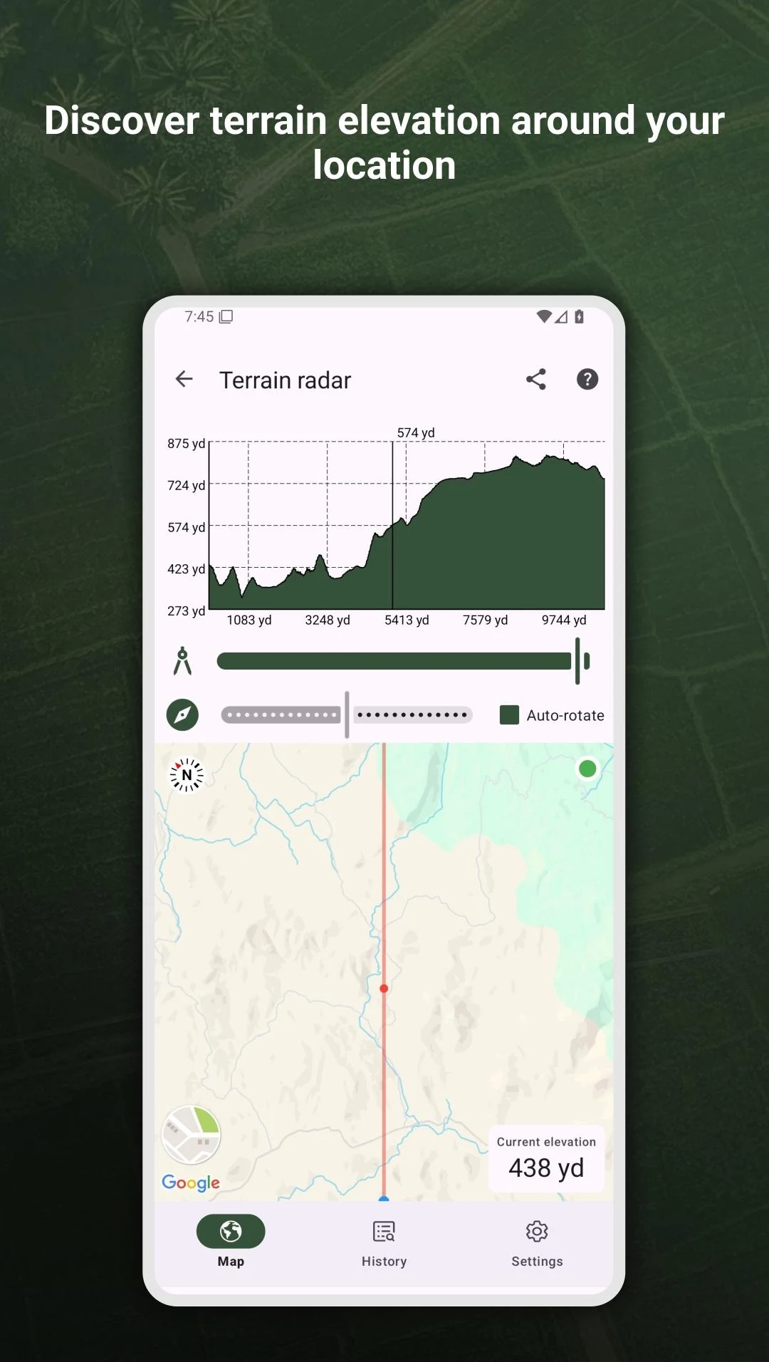
• Barometric altimeter support (on compatible devices) for 3D volume estimation.
• Team Mode: generate shareable QR codes so co-workers can open the same live map on their devices.
• Offline Map Packs: download 10 km² tiles before heading off-grid.
Download My GPS Area Calculator today and spend less time measuring—and more time doing.
- Version2.49
- UpdateAug 28, 2025
- DeveloperMystic Mobile Apps GPS Tools
- CategoryMaps & Navigation
- Requires AndroidAndroid 5.0+
- Downloads266K+
- Package Namecom.mysticmobileapps.gps.area.calculator
- Signature9c01356f1b049b102e04f682efeb8c6b
- Available on
- ReportFlag as inappropriate
-
NameSizeDownload
-
10.88 MB
-
10.39 MB
-
5.66 MB