Live Earth Map - GPS Navigation & Speedometer
Explore stunning live maps & track your speed with precision using this all-in-one GPS navigation and location finder app.
- 2.9 Version
- 1.3 Score
- 1M+ Downloads
- In-app purchases License
- 16+ Content Rating

The Live Earth Map and satellite view allow you to explore the world like never before, enhancing your GPS speedometer application experience. The Live Earth Map app helps you monitor GPS navigation and track distance with a highly accurate odometer and speedometer. Share your location and navigate through the 3D satellite map seamlessly, whether you're traveling or driving with the GPS speedometer.
How to use
🚀 The speed limit application features an easy-to-use GPS speedometer and odometer for any vehicle, including bikes and cars, measuring car speed on a heads-up display using a digital speedometer. The route finder tool offers a live Earth Map view that provides high-definition exploration of top cities around the globe.
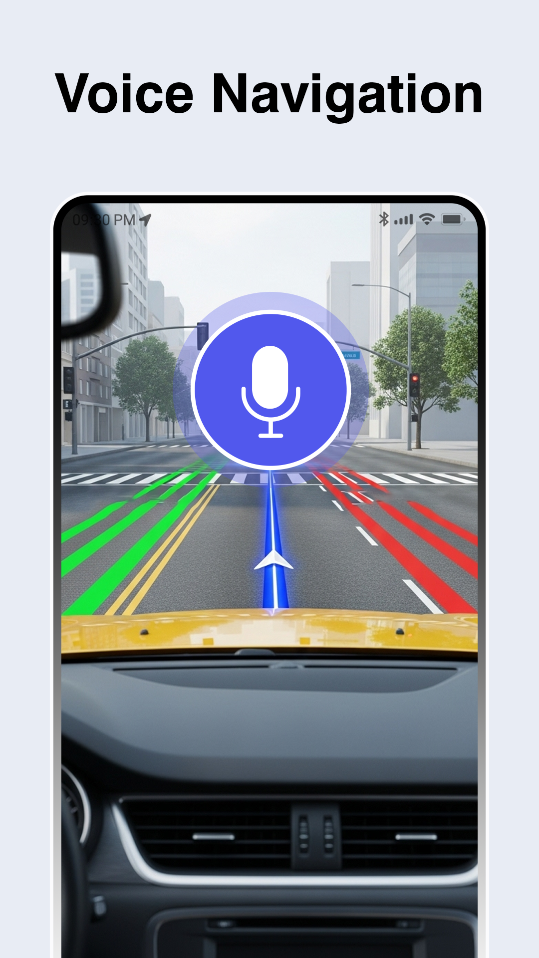
╰┈➤ GPS live satellite technology: Delivers real-time, precise route planning and directions, allowing you to save time. Effortlessly navigate live truck maps and estimated route timings with the voice-guided GPS navigation in no time at all. The satellite street view allows for zooming into specific locations with unmatched HD clarity.
🎞️ With live earth maps, you can virtually travel worldwide using a GPS emulator and witness live traffic at your favorite spots through a live satellite guide showcasing a clear HD earth map. Experience the real-time natural and space views with this live satellite map anytime.
Benefits
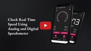
🕕Digital Speedometer and Vehicle Compatibility
The app's digital HUD speedometer is a standout feature. It displays readings for cars, bikes, and other vehicles, whether in miles per hour (MPH), kilometers per hour (KPH), or knots. The speed limit feature ensures you stay within safe driving boundaries, making it a reliable companion for all your journeys.
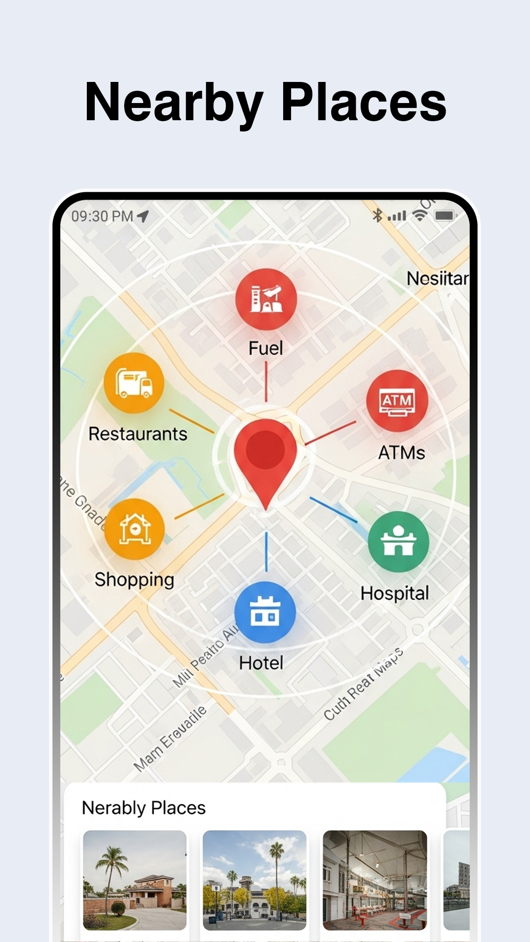
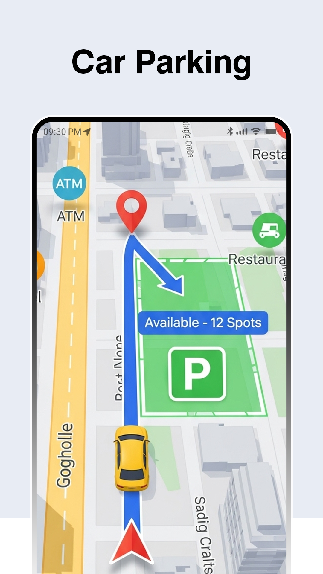
🚛 Route Finder and Traffic Updates
The route finder is a powerful tool that helps you plan your trips efficiently. It offers accurate directions and traffic routes, allowing you to avoid congestion and reach your destination faster. The live GPS updates keep you informed about traffic conditions, making it ideal for both urban driving and long road trips.
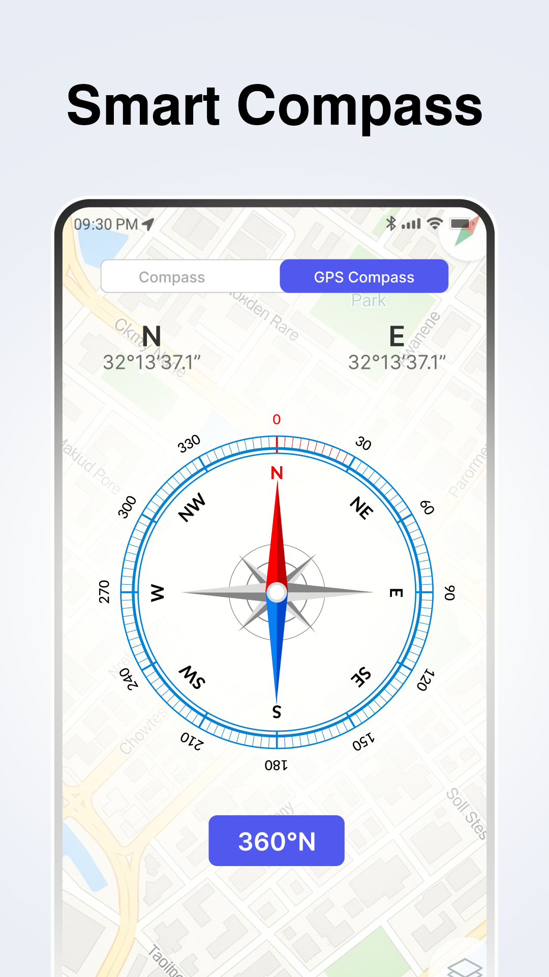
🚗 Digital Compass and Level Meter
The digital compass provides precise orientation, helping you find your way in any location. The level meter is also a useful feature, whether you're at home or on a construction site. It ensures horizontal alignment, adding an extra layer of functionality to the app.
🛰️Location Sharing and Tracking
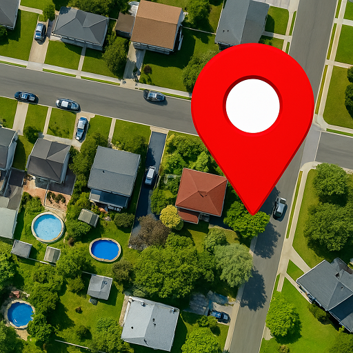
The "Find my location" feature allows you to easily locate yourself and share your current position with friends and family. This is especially useful for coordinating meetups or ensuring your safety while traveling. The live earth map and GPS map track your position accurately, giving you peace of mind wherever you are.
🌌 Benefit from GPS route finder live maps.
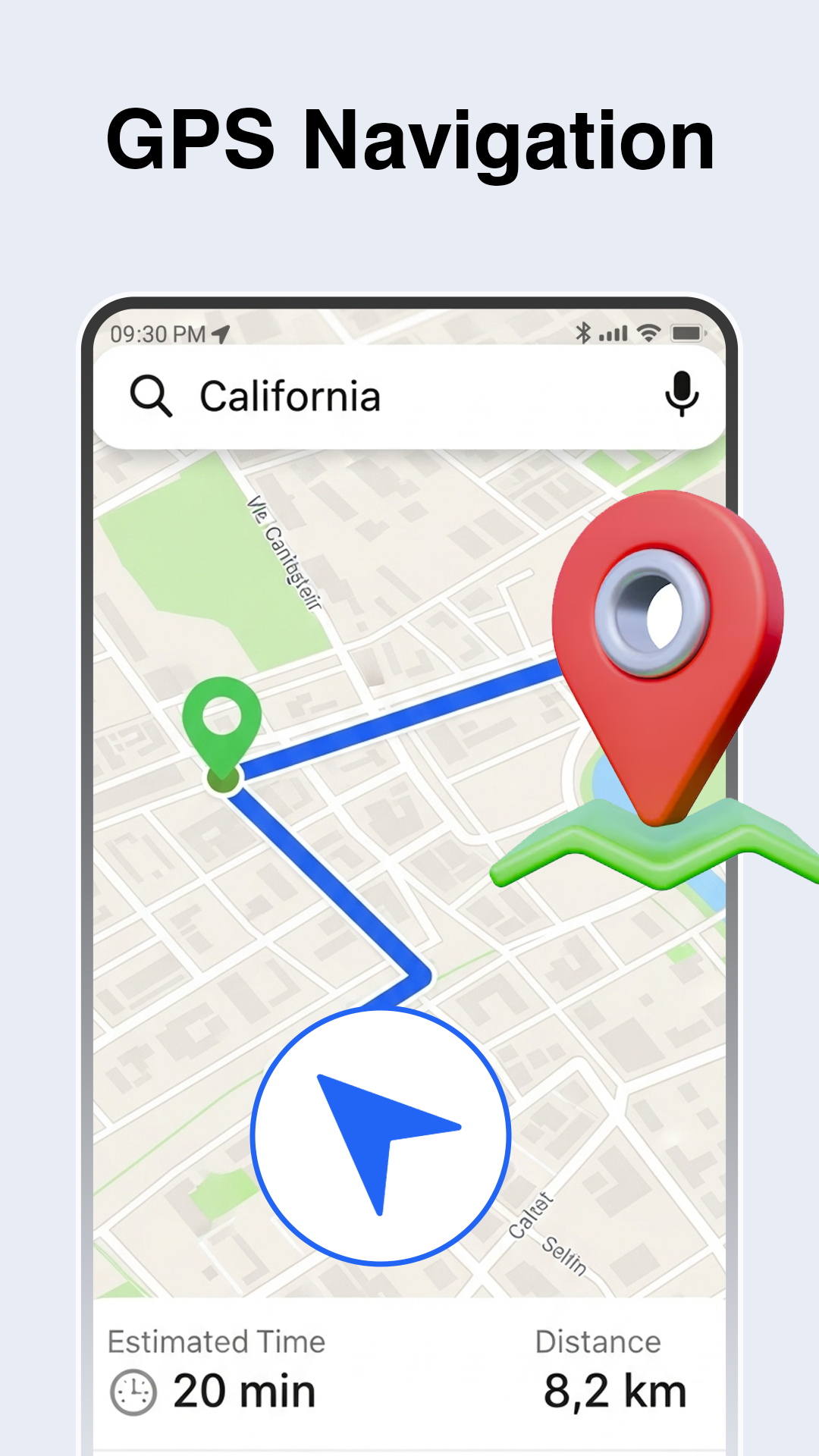
The free speedometer displays readings such as car speed in miles per hour using an MPH tracker. Easily navigate or quickly locate someone by fast navigation and high speeds in KPH. This GPS app helps you find your location globally through the live map satellite feature. View the street landscape of your hometown and see virtual locations like mountains, hills, and rivers with 3D imagery using this auto navigator.
You can view optimal driving directions while navigating to your destination with this GPS speedometer app. The speed radar calculates your car speed in MPH, KPH, and knots while monitoring speed limits, providing maximum or minimum readings on the HUD.
🛤️ Explore the street view.
Discover the live satellite street view across the globe and get accurate directions through this live Earth map, allowing you to zoom in and out of any location.
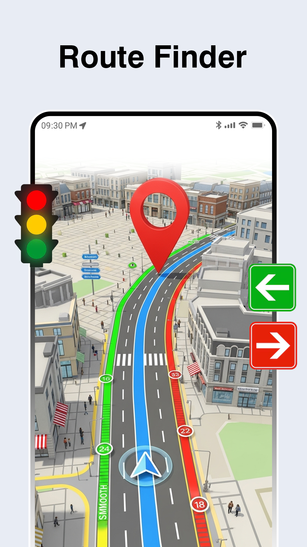
🌌 Utilize the route finder.
The GPS route finder caters to users seeking the shortest or most accurate routes via the auto navigator. It serves as a running route planner for hikers and is an excellent traffic route guide for newcomers to the city.
🗺️ Locate your desired spot.
Use the location detection and sharing app to achieve the best results based on your current or specified location. Navigate to your destination easily with voice-guided assistance regardless of the situation. The Live Earth Map and speedometer are designed to be user-friendly anywhere on the world map.
🧭 Use the compass to pinpoint your exact location and also find the Qibla and mosque through this handy feature.
Comments
Great app overall! Just one issue. When I open the app, my phone screen goes dark.
It's great, but it relies on an internet connection to function.
This app used to be amazing. It was simple and user-friendly. After the update, everything changed. Now it feels cluttered and complicated. Ads pop up everywhere, right from the start and every time I try to use any feature. It's frustrating. I can't deal with this anymore. Time to uninstall and search for a better, simpler option without all these annoying ads.
This app is fantastic! I use it while cycling to track my speed. It's really enjoyable and helpful for my rides.
The app feels really frustrating. Stopping for a light often means pulling over just to restart it. Ads pop up, and the app crashes again. Using it can become quite dangerous.
The app works well, but it keeps crashing! Every time I switch the screen from portrait to landscape, it crashes and needs a restart. I have a Samsung S23 Ultra. Even with the latest update on February 26, 2024, the problem persists in landscape mode. I really need a solution since I paid for this app!
Solid, useable data here. The app desperately needs to offer user customization. Starting with the mundane but vital Imperial/metric preference to dark mode, and including useful widgets like countdown timers, stopwatch, and the ability to write on the map and create zones and the like. Why not allow the cross referencing snd superimposition of other map data such as cell towers, stingrays, crime maps, and proximity notification and custom list integration too. I do like the app. Solid.*FALSE ADVERTISING!!! NOT LIVE SATELLITE IMAGERY!!! I specifically downloaded the app to view a piece of property that was clear-cut over 8 months ago. The imagery that is on the maps does not even show the trees that have been removed. It's still appears as though the trees are in place as they were for the last 10 years. Sad to see that the majority of this world is always looking for a way to take advantage of someone else no matter what the cost or what they must lie about! Junk Delly-JUNK!!
ARTICAL—— GPS live satellite technology
Space Segment
The GPS space segment consists of a constellation of satellites transmitting radio signals to users. The United States is committed to maintaining the availability of at least 24 operational GPS satellites, 95% of the time. To ensure this commitment, the U.S. Space Force has been flying 31 operational GPS satellites for well over a decade.
Constellation Arrangement
GPS satellites fly in medium Earth orbit (MEO) at an altitude of approximately 20,200 km (12,550 miles). Each satellite circles the Earth twice a day.
Expandable 24-Slot satellite constellation, as defined in the SPS Performance Standard. The satellites in the GPS constellation are arranged into six equally-spaced orbital planes surrounding the Earth. Each plane contains four "slots" occupied by baseline satellites. This 24-slot arrangement ensures users can view at least four satellites from virtually any point on the planet.
The Space Force normally flies more than 24 GPS satellites to maintain coverage whenever the baseline satellites are serviced or decommissioned. The extra satellites may increase GPS performance but are not considered part of the core constellation.
In June 2011, the Air Force successfully completed a GPS constellation expansion known as the "Expandable 24" configuration. Three of the 24 slots were expanded, and six satellites were repositioned, so that three of the extra satellites became part of the constellation baseline. As a result, GPS now effectively operates as a 27-slot constellation with improved coverage in most parts of the world.
GPS Applications
Like the Internet, GPS is an essential element of the global information infrastructure. The free, open, and dependable nature of GPS has led to the development of hundreds of applications affecting every aspect of modern life.
GPS technology is now in everything from cell phones and wristwatches to bulldozers, shipping containers, and ATM's. GPS boosts productivity across a wide swath of the economy, to include farming, construction, mining, surveying, package delivery, and logistical supply chain management.
Major communications networks, banking systems, financial markets, and power grids depend heavily on GPS for precise time synchronization. Some wireless services cannot operate without it.
GPS saves lives by preventing transportation accidents, aiding search and rescue efforts, and speeding the delivery of emergency services and disaster relief.
GPS is vital to the Next Generation Air Transportation System (NextGen) that will enhance flight safety while increasing airspace capacity.
GPS also advances scientific aims such as weather forecasting, earthquake monitoring, and environmental protection.
Finally, GPS remains critical to U.S. national security, and its applications are integrated into virtually every facet of U.S. military operations. Nearly all new military assets -- from vehicles to munitions -- come equipped with GPS.
This website describes just a tiny sample of existing GPS applications. New uses of GPS are invented every day and are limited only by the human imagination.
- Version2.9
- UpdateMay 24, 2025
- DeveloperMobile Notepad Apps
- CategoryMaps & Navigation
- Requires AndroidAndroid 5.0+
- Downloads1M+
- Package Namecom.mobilenotepadapps.speedometer.car.speedlimit.compass
- Signature330a9c3e00e281dbbdc4262f807168dd
- Available on
- ReportFlag as inappropriate
-
NameSizeDownload
-
11.19 MB
-
11.04 MB


Accurate speed readings
Use of speed camera integration
Compatible with multiple devices
Provides mileage tracking
Various display modes recommended
User-friendly for basic functionalities
Reassuring when compared to car speedometer
Excessive ads disrupting usage
Inaccurate speed readings reported
Frequent crashes in landscape mode
Confusing notifications without details
Difficulties using the app without restarting
Complicated interface after updates
Not compatible with all devices
Maximum speed limit too low for some users