GPS Field Area Measurement App - GPS area measurement & distance calculator
Easily measure land areas & distances using GPS technology. Perfect for contractors, travelers, & outdoor enthusiasts!
- 1.1.4 Version
- 1.1 Score
- 1M+ Downloads
- In-app purchases License
- 3+ Content Rating

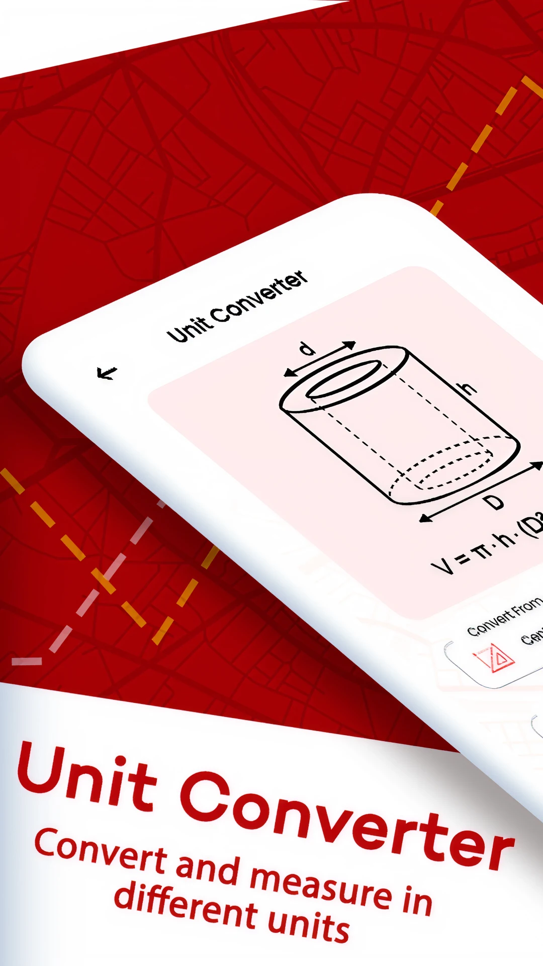
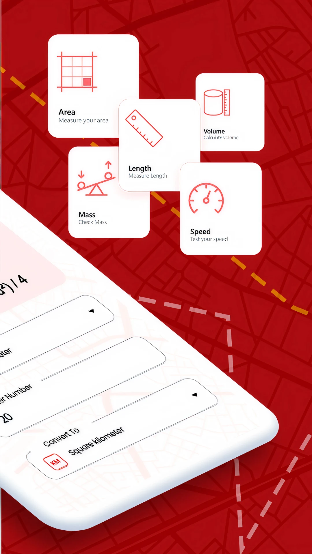
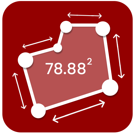
The GPS Field Area Measurement App is an excellent tool for accurately determining distances and areas. This application is beneficial for evaluating land sizes and can help estimate the acreage of land, the square footage of structures like roofs, or any other scenario requiring a reliable area estimation. Additionally, it provides the perimeter of the defined shape and allows measurements to be displayed in various units, including acres, square feet, meters, kilometers, and miles.
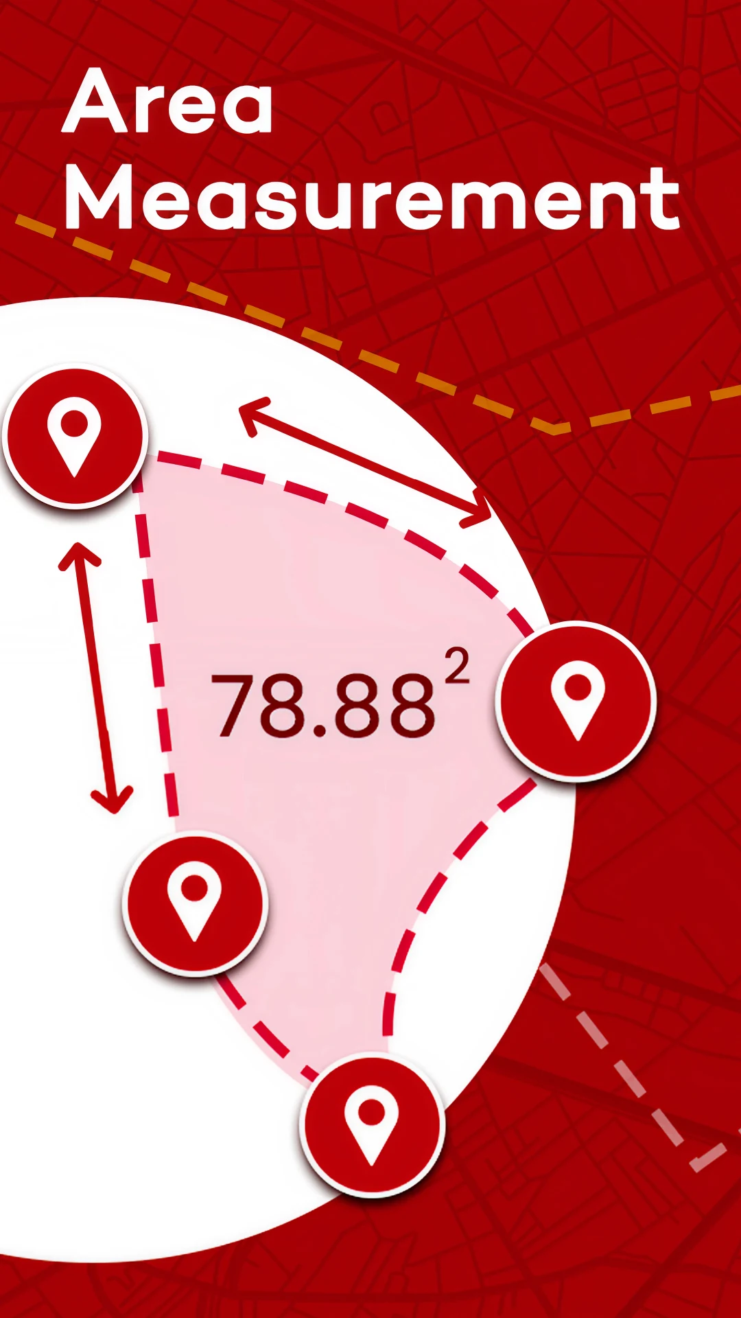
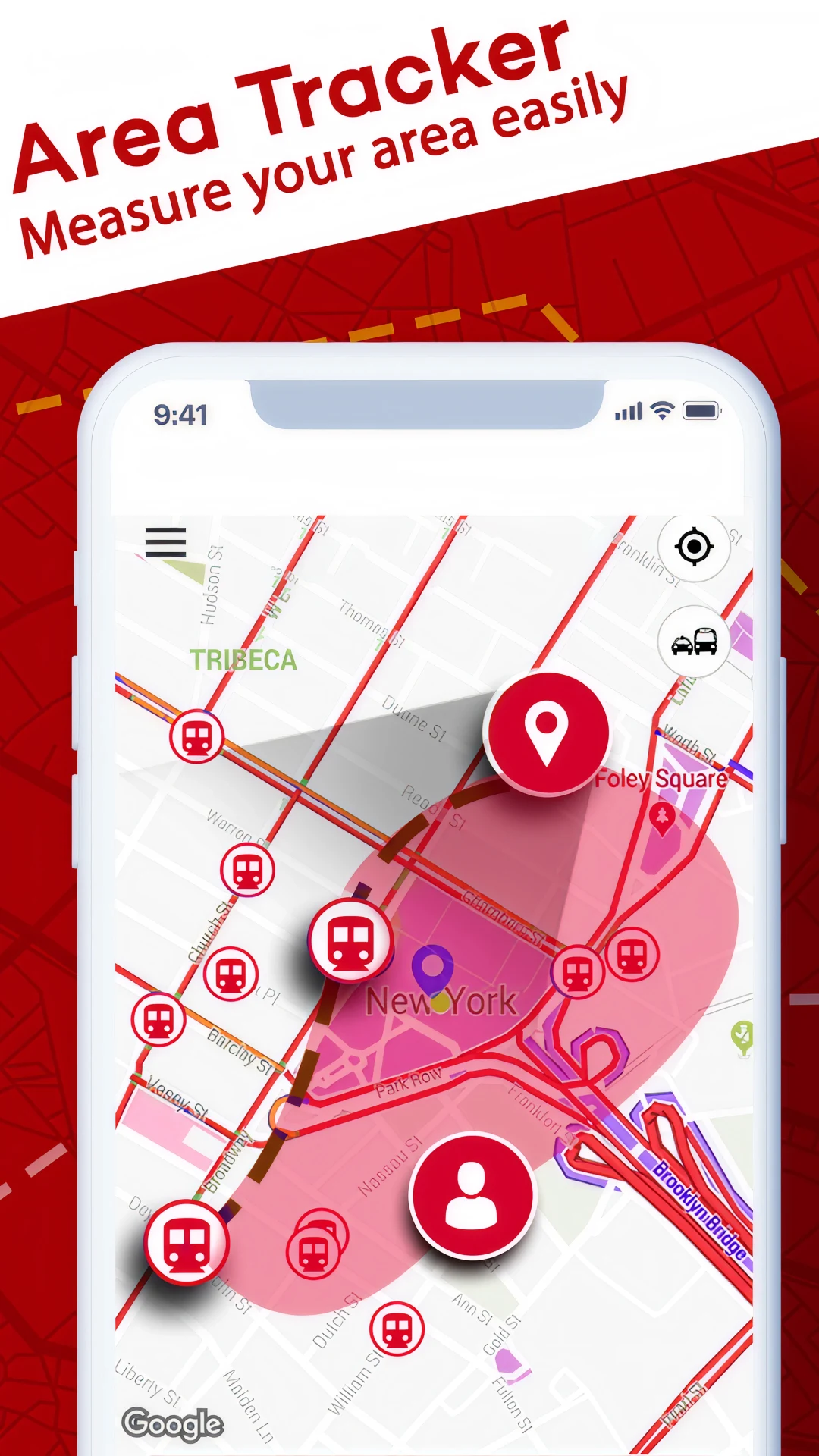
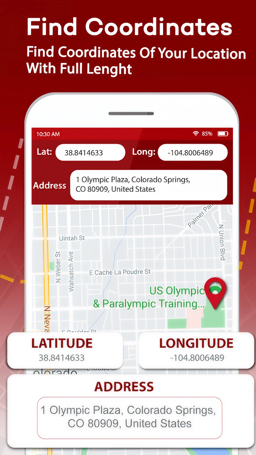
The GPS Field Area Measurement App serves as a free and user-friendly tool designed for both contractors and engineers. Travelers looking to gauge distance will find this area measuring app particularly useful. It can be used for assessing the field area of gardens and farms without needing to visit the location; simply input the address, and the app will pinpoint the precise spot using GPS technology. By placing points on the map, users can obtain area measurements. If you wish to measure distances, just drag the points on the map, and the distance calculator will present the results instantly. It also allows you to determine the distance between two cities with just one tap and check the distance from your current position to your desired destination. The app provides latitude and longitude coordinates on maps, making it easy to locate your current position and address.
The GPS Field Area Measurement App allows for land measurement with a single tap. This complimentary area measurement tool can be utilized for walking, land surveys, measuring rooms, objects, and more. Additionally, the app tracks running and walking distances. To find the acreage of a specific plot, users can enter the pertinent address. In rural settings where an address may not exist, cross streets or GPS coordinates can be used instead. Once the area is mapped out, the calculator will display the area measurements above the map. Users can measure distances between locations and along paths, as well as calculate the size of polygons using the GPS mapping feature.
This app offers distance and area measurements in kilometers and meters through GPS mapping.
Features:
Easy-to-use interface
Calculate areas of land and plots
Complimentary GPS field area measurement app
Measure distances in kilometers and meters
Determine field areas
Obtain area measurements on the map with a single tap
Distance measurement for running and walking in meters
Free measurements accompanied by a camera function
Identify current locations and addresses
Your Pocket-Sized Surveyor: GPS Field Area Measurement Delivers Precision Without the Price Tag
This app has fundamentally transformed how I approach on-the-ground measurements, proving itself as an indispensable and incredibly accurate tool for both professional tasks and everyday curiosity. The core promise of easy GPS-based area and distance calculation is delivered flawlessly through an intuitive, frustration-free interface – I consistently achieve professional-grade results without needing specialized training or equipment. Whether I'm roughly estimating the acreage of a remote field before a visit, calculating the precise square footage of an irregular garden plot, or even measuring walking or running routes with GPS path tracking, this app handles it all with surprising reliability. The single-tap area measurement on the map is remarkably efficient, instantly outlining polygons and providing clear readouts, while the drag-and-drop distance calculator makes verifying lengths between points or along complex paths incredibly straightforward. I especially appreciate the versatility in units (acres, sq ft, meters, kilometers, miles), allowing seamless switching depending on the project's requirements. The ability to locate and measure plots using just an address, cross streets, or even GPS coordinates is invaluable, particularly for rural locations lacking clear markers, and the app always provides precise latitude and longitude data for pinpointing my current position. Finding the distance between cities or destinations is accomplished with just a single tap, perfect for quick trip planning. While it's a completely free tool, the functionality rivals paid alternatives; the inclusion of features like camera integration for reference points and the ability to track exercise distances in meters adds significant practical value beyond pure land surveying. For contractors needing quick estimates, engineers verifying site plans, travelers mapping routes, or homeowners like myself managing property details, GPS Field Area Measurement delivers professional accuracy in a genuinely accessible and portable format. It turns my phone into a powerful surveying instrument that I now rely on constantly. This is one free app that consistently exceeds expectations.
- Version1.1.4
- UpdateJun 25, 2025
- DeveloperBizcraft Apps
- CategoryMaps & Navigation
- Requires AndroidAndroid 5.0+
- Downloads1M+
- Package Namecom.area.measure.distance.fieldsareameasure
- Signature5ff056ed189bcd3c5bb12e0173347f91
- Available on
- ReportFlag as inappropriate
-
NameSizeDownload
-
9.01 MB
-
8.92 MB


Convenient for quick quotes
User-friendly interface
Effective for basic location tracking
New layout is visually appealing
Helpful for initial distance assessment
Works well when phone location is enabled
Cannot save measurements for future reference
Inaccurate measurement capabilities
Frequent pop-up advertisements
Lacks area measurement options in acres or hectares
Poor user experience and functionality issues
Requires improved accuracy for specific metrics
No search function for locations during measurements
Night mode theme enhancement needed