FLY is FUN - Flight planning & navigation
Experience seamless flight prep & awareness with interactive maps, weather updates, and customizable logbooks for pilots.

- 35.22 Version
- 3.0 Score
- 122K+ Downloads
- In-app purchases License
- 3+ Content Rating

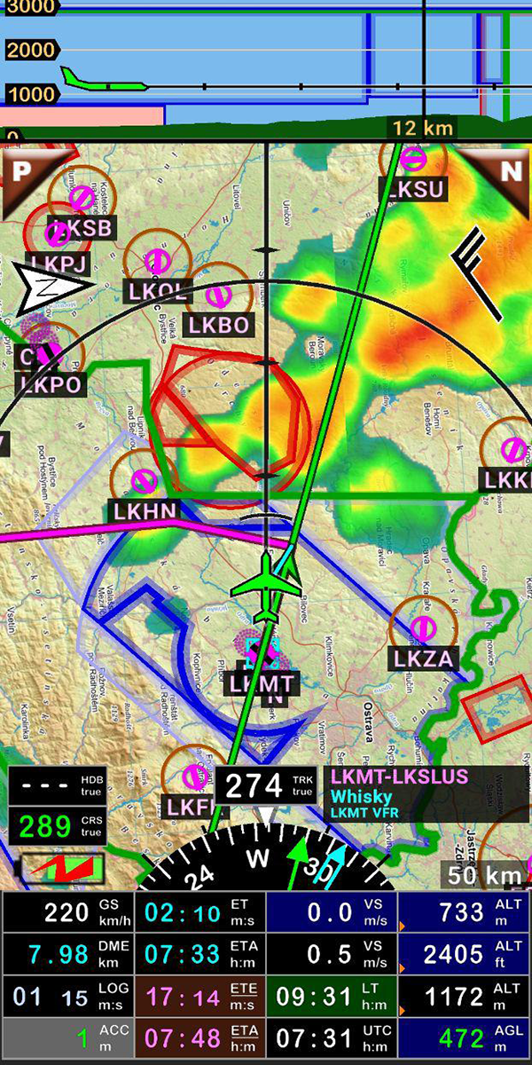


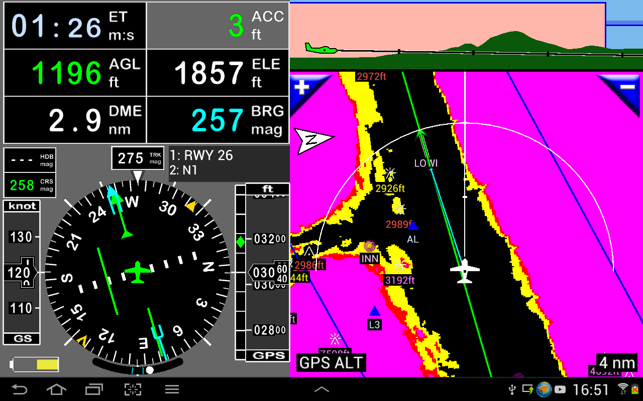
✈️FLY is FUN has been crafted by aviators for fellow aviators. This application streamlines the process of flight preparation and enhances situational awareness while flying, offering details on airspaces, reporting points, location on a moving map, elevation, frequencies, railways, weather information, and providing easy access to airfield-related PDF documents. It also showcases NOTAMs and data from rainfall radar.
✈️Moreover, it enables the simulation of ILS approaches, VOR, NDB, DME, marker beacons, RNAV navigation, and marker beacon alerts, all without the need for onboard ILS/VOR/NDB/RNAV equipment.
👉You can experience FLY is FUN for free for a limited number of days. At the conclusion of the trial period, users are invited to subscribe by paying an annual fee. This subscription grants them the right to use the application "as it is" and to aid in its ongoing development.
Main Features
- The ability to create and adjust routes using "drag and drop" and "rubber band" functionality
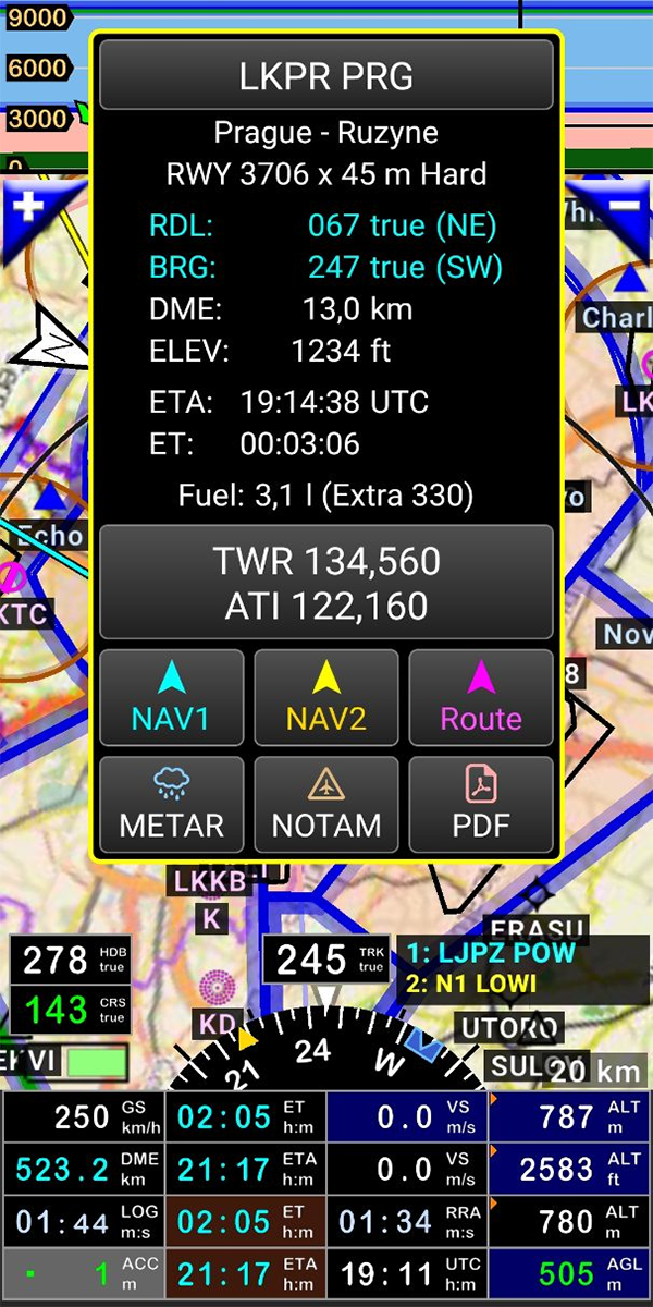
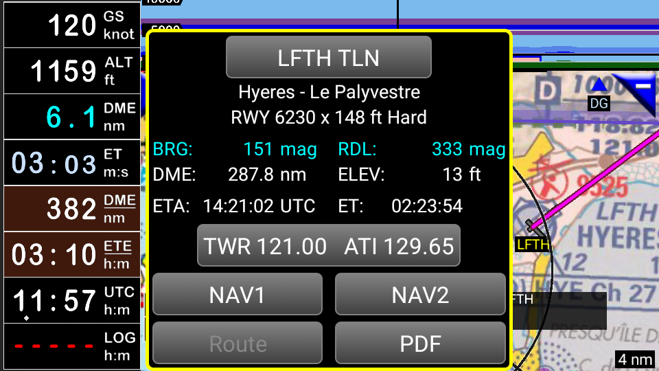
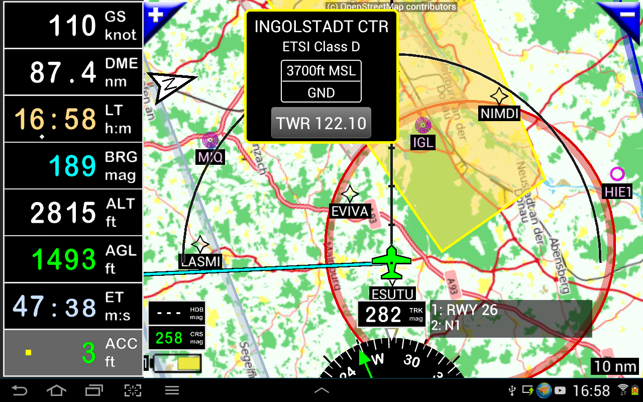
- Receiving alerts, warnings, and radio information prior to entering controlled or special-use airspaces and approaching specific points
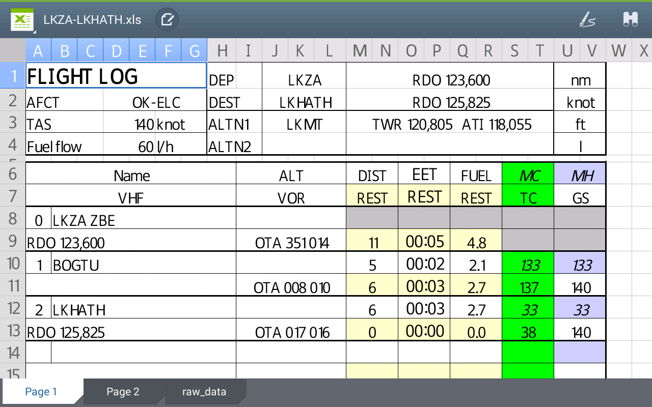
- Conducting route planning with evaluations of distance, time, and fuel consumption, based on wind conditions and aircraft specifications
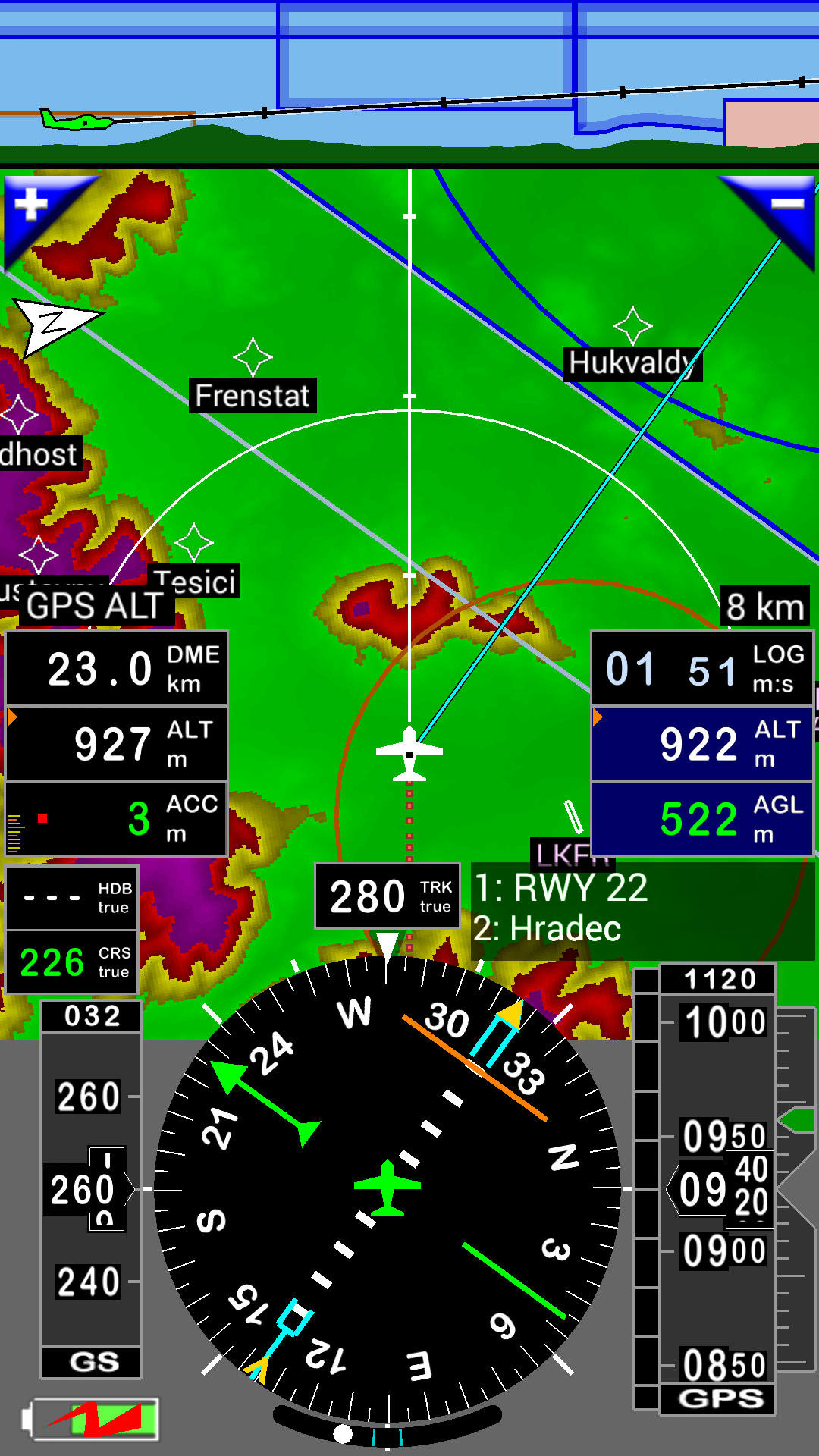
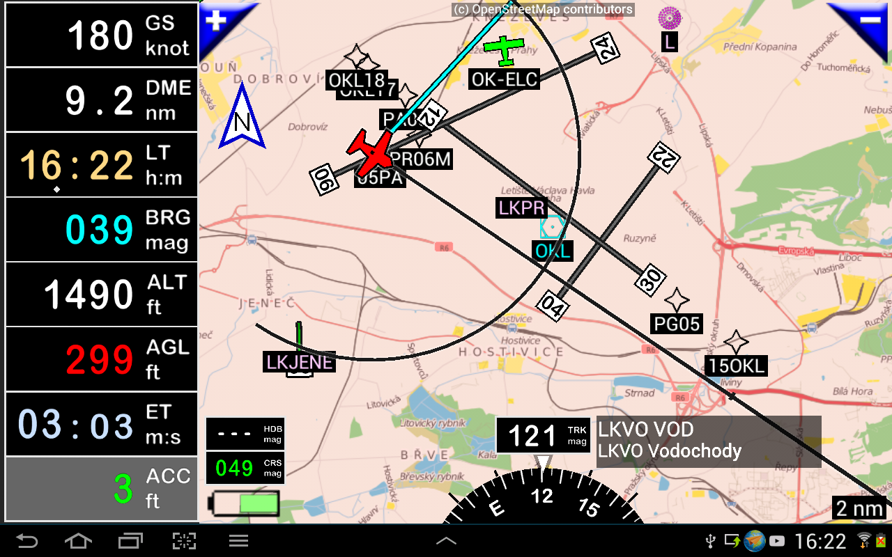
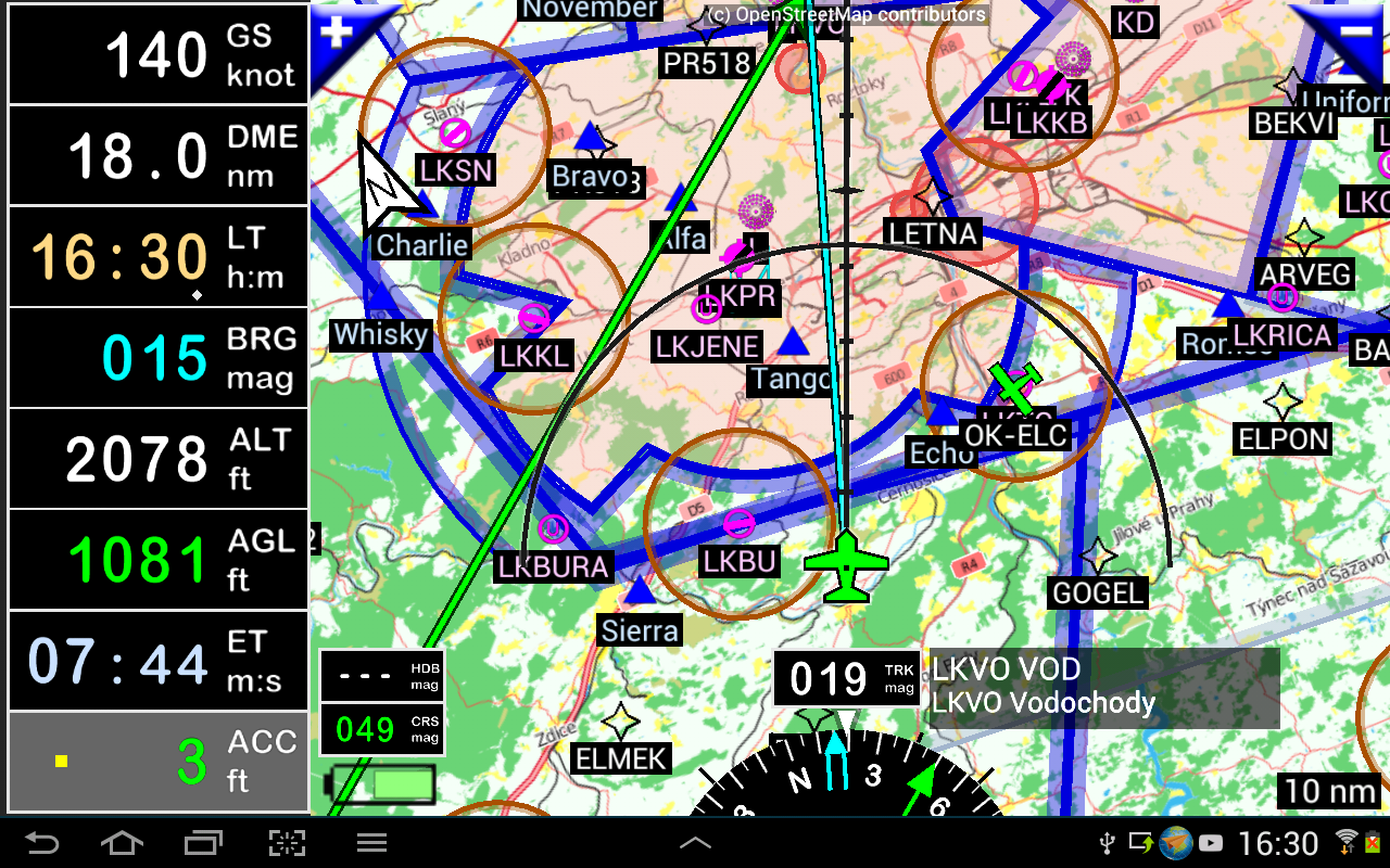
- Displaying routes, bearings, and traces on a moving map
- Visualizing airspace
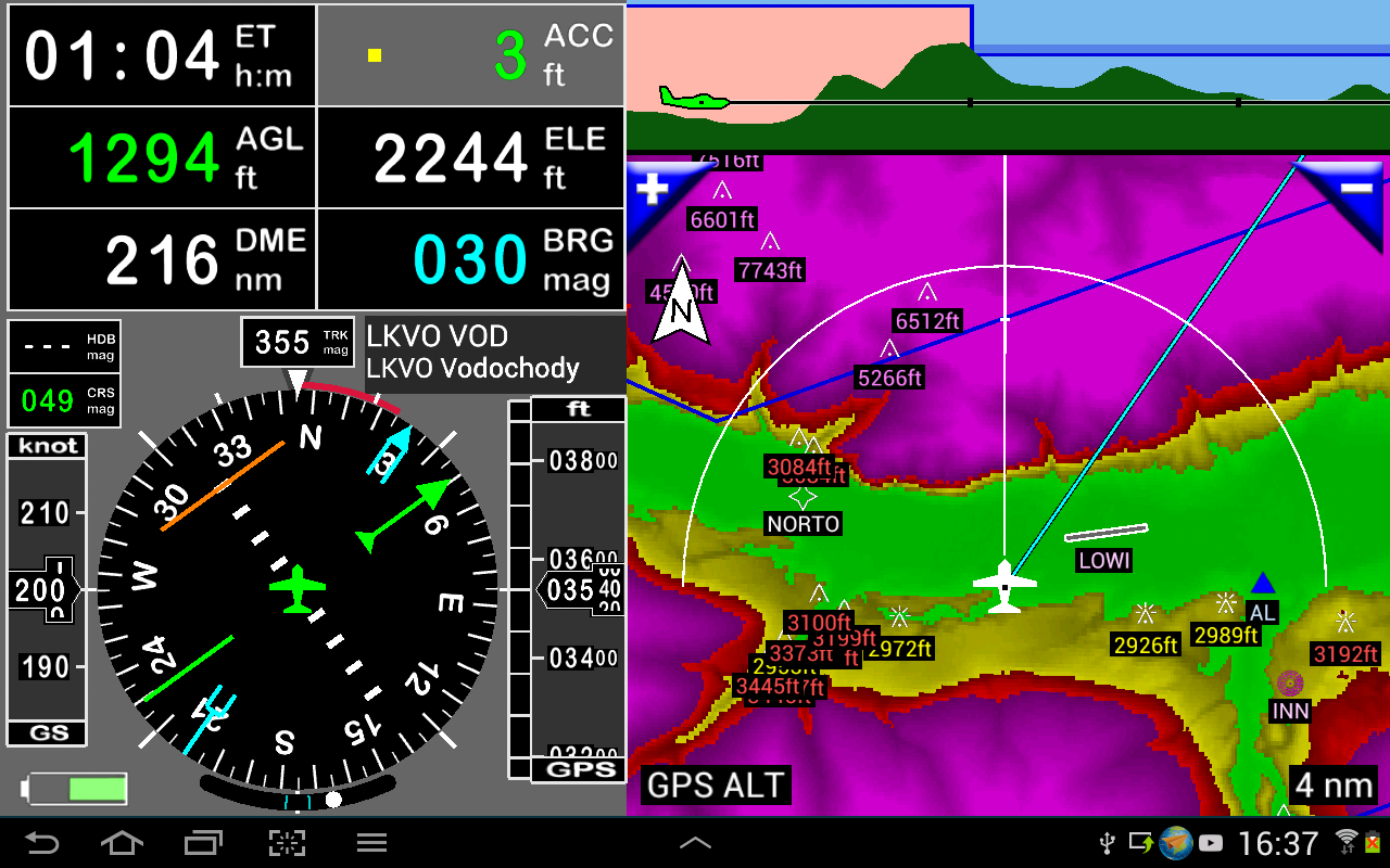
- Providing a dynamic terrain map, with color coding based on altitude above ground level
- Supporting STRATUX
- Creating and exporting flight plans
- Creating and exporting flight logs
- Importing and exporting routes, waypoints, runways, and airspaces in formats like Garmin .gpx, .kml, txt, OpenAir
- Recording flights and replaying them using Google Earth
- Showing sunrise and sunset times
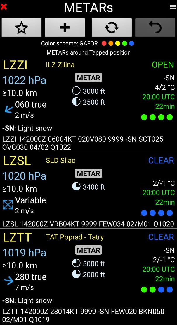
- Offering weather forecasts along the flight's path
- Providing rainfall radar data
- Displaying wind information
- Calculating distances between two points on the map
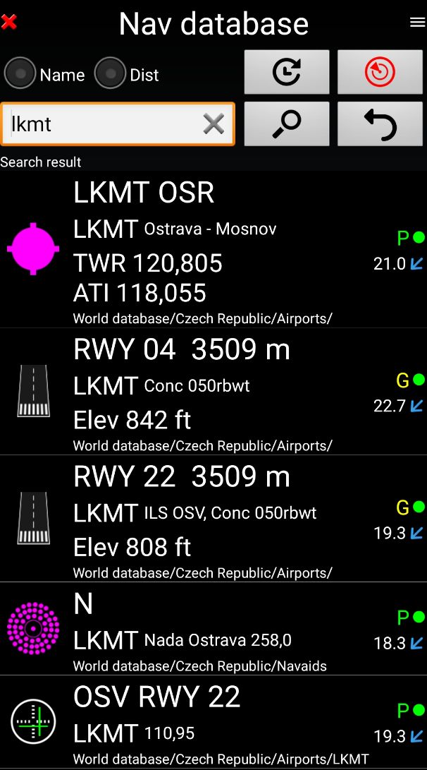
- Access to VACs
- A notepad feature
Additional Features
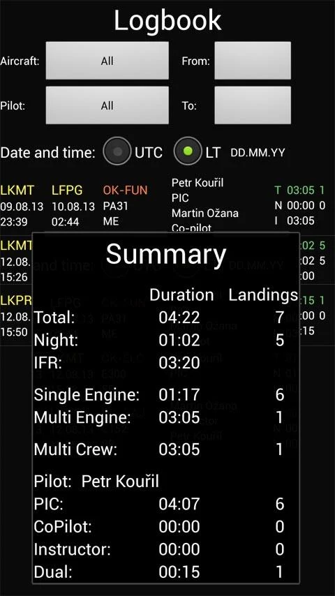
The built-in logbook facilitates recording:
- Duration since departure
- Departure and arrival timestamps
- Locations of departure and arrival airports
- Flight track (which can be exported as .kml or .gpx for playback)
- Aircraft used
- Pilot(s) and co-pilots responsible for the flight
- Distance traveled, average speed, and maximum speed
Charts and Elevation Data
Free charts and elevation data are available for most countries and can be imported directly through the application store.
Other charts can be created by pilots themselves or made available upon request through commercial services.
Pilots may choose from the most suitable charts, including both free open-source options and commercial offerings such as ICAO, Cartabossy, SkyVector, FAA sectional, and terminal charts.
VACs and PDF Files
VAC and AIP information covers over 50 countries
Users can conveniently attach their own PDF files.
The application supports the use of external GPS devices connected via Bluetooth.
To Display
All primary screens (five in portrait mode and five in landscape) can be easily customized. Pilots can select around 100 different values to display.
Examples include:
- GPS or barometric altitude
- Ground speed
- Bearing
- Vertical speed
- Distance measuring equipment (DME) to the next point or destination
- Estimated time to reach the next point or destination
- Time elapsed since departure
- Stopwatch feature
👉The displayed information can also be tailored to user preferences (VFR, IFR, or both) and the chosen zoom level. The more you zoom in, the greater the detail in terms of information, waypoints, and other relevant data.
Something More ...
User guide: If you have suggestions for enhancing this application or encounter any bugs, please visit [website link].
Disclaimer: This application is intended strictly for VFR flying. We do not accept any responsibility for its usage outside this context.
- Version35.22
- UpdateAug 25, 2025
- DeveloperPetr Kouril
- CategoryMaps & Navigation
- Requires AndroidAndroid 5.0+
- Downloads122K+
- Package Namegps.ils.vor.glasscockpit
- Signature8855a9d561693fa7cf1793eefe23ac1e
- Available on
- ReportFlag as inappropriate
-
NameSizeDownload
-
35.69 MB
-
35.69 MB
-
35.67 MB


User-friendly interface
Comprehensive features for navigation
Regular updates from the developer
Compatibility with various devices (including tablets and GPS)
Allows customization of maps and settings
Affordable compared to other aviation apps
Provides accurate situational awareness during flights
Supports a wide range of aviation tools and aids
Helpful for both VFR and IFR flying
Shift from lifetime license to subscription model
Loss of access to updates for existing license holders
Confusion over promo codes required for installation
Inconsistent pricing for subscriptions among users
Limited support for new airfields in certain regions
Issues with database compatibility after changing devices
Perceived abandonment of early supporters
Complicated user experience beyond initial setup
Concerns over reliability and accuracy in newer versions