Relief Maps - Mountain adventure navigation & planning
Navigate mountains easily with 3D maps, offline access, and route planning for hiking, skiing, and more!
- 2.0.6 Version
- 1.5 Score
- 250K+ Downloads
- In-app purchases License
- 12+ Content Rating

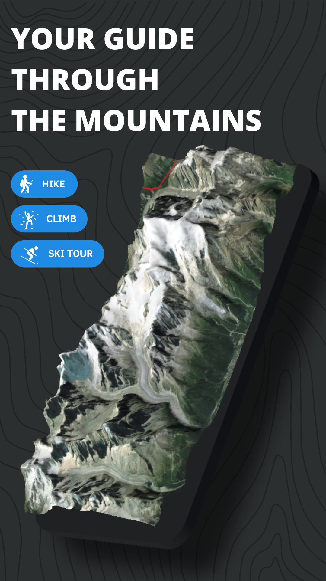
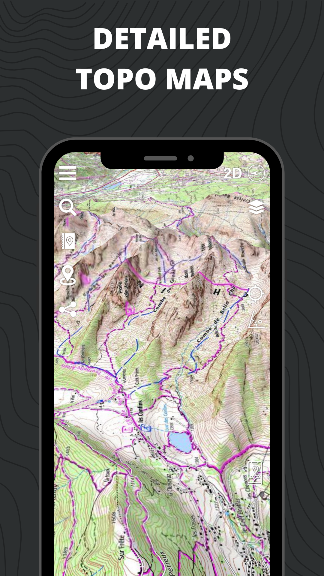
Relief Maps turns classic USGS, IGN, Swisstopo and OSM maps into living 3D terrain. One subscription-free app covers hiking, climbing, mountaineering, ski touring, paragliding and downhill skiing—and still works when you leave cell range.
CORE FEATURES
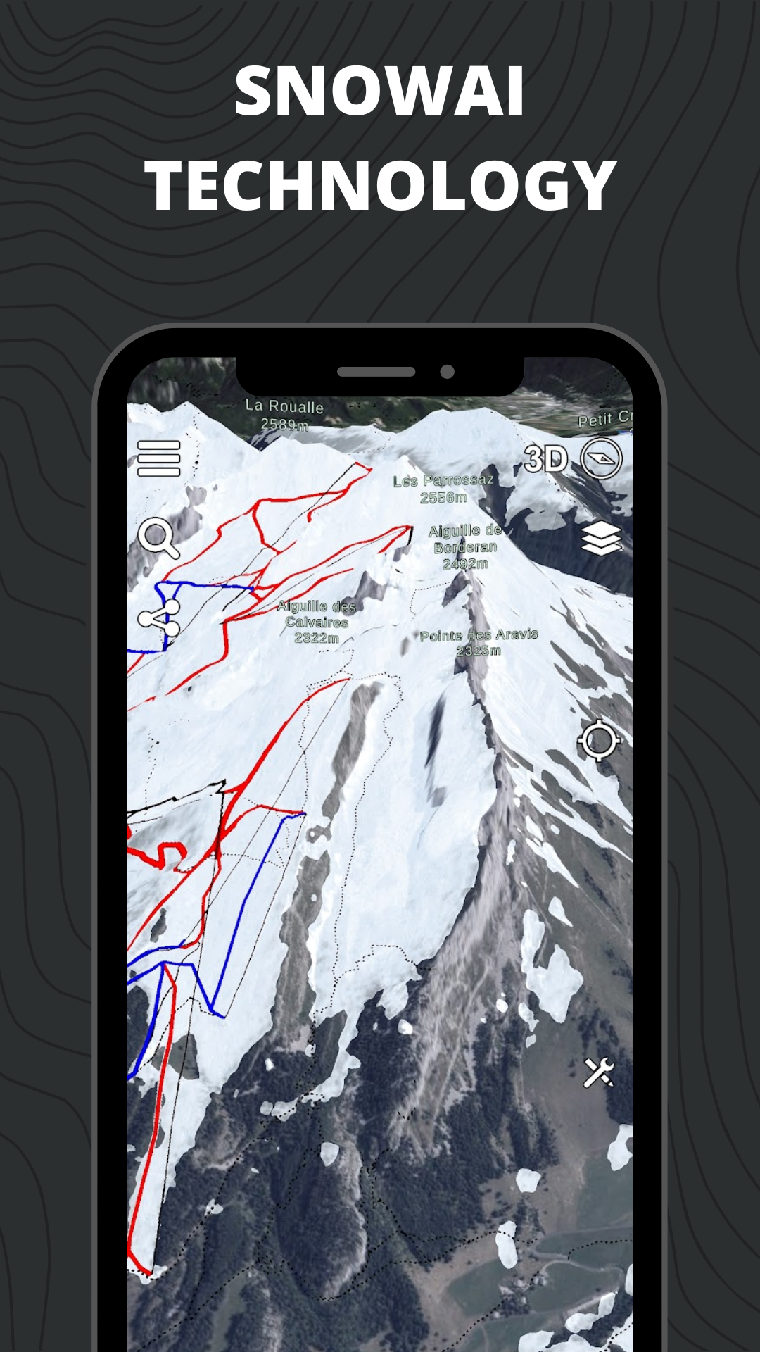
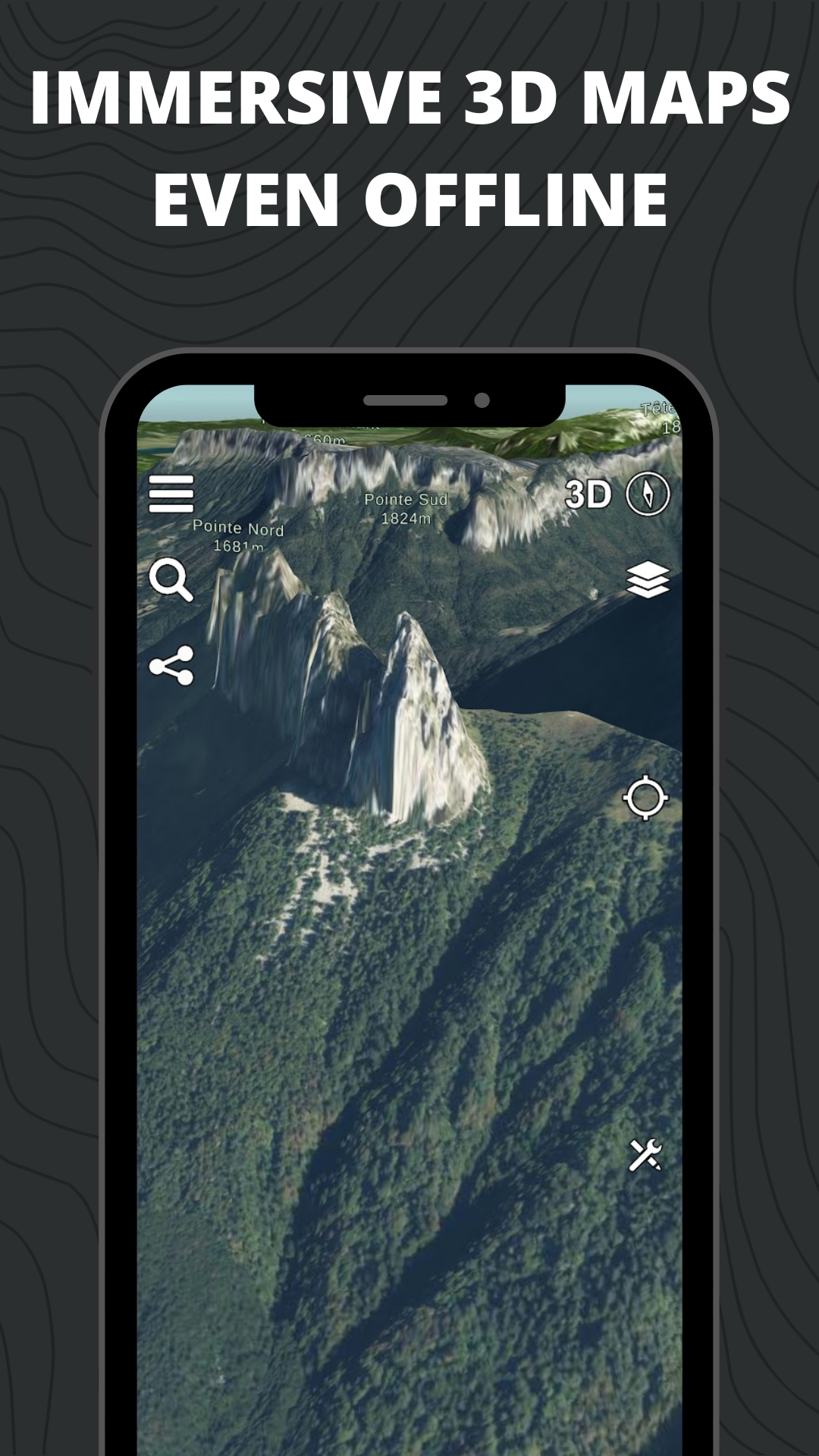
• Interactive 3D globe & augmented-reality view
• Real-time GPS tracking with live stats
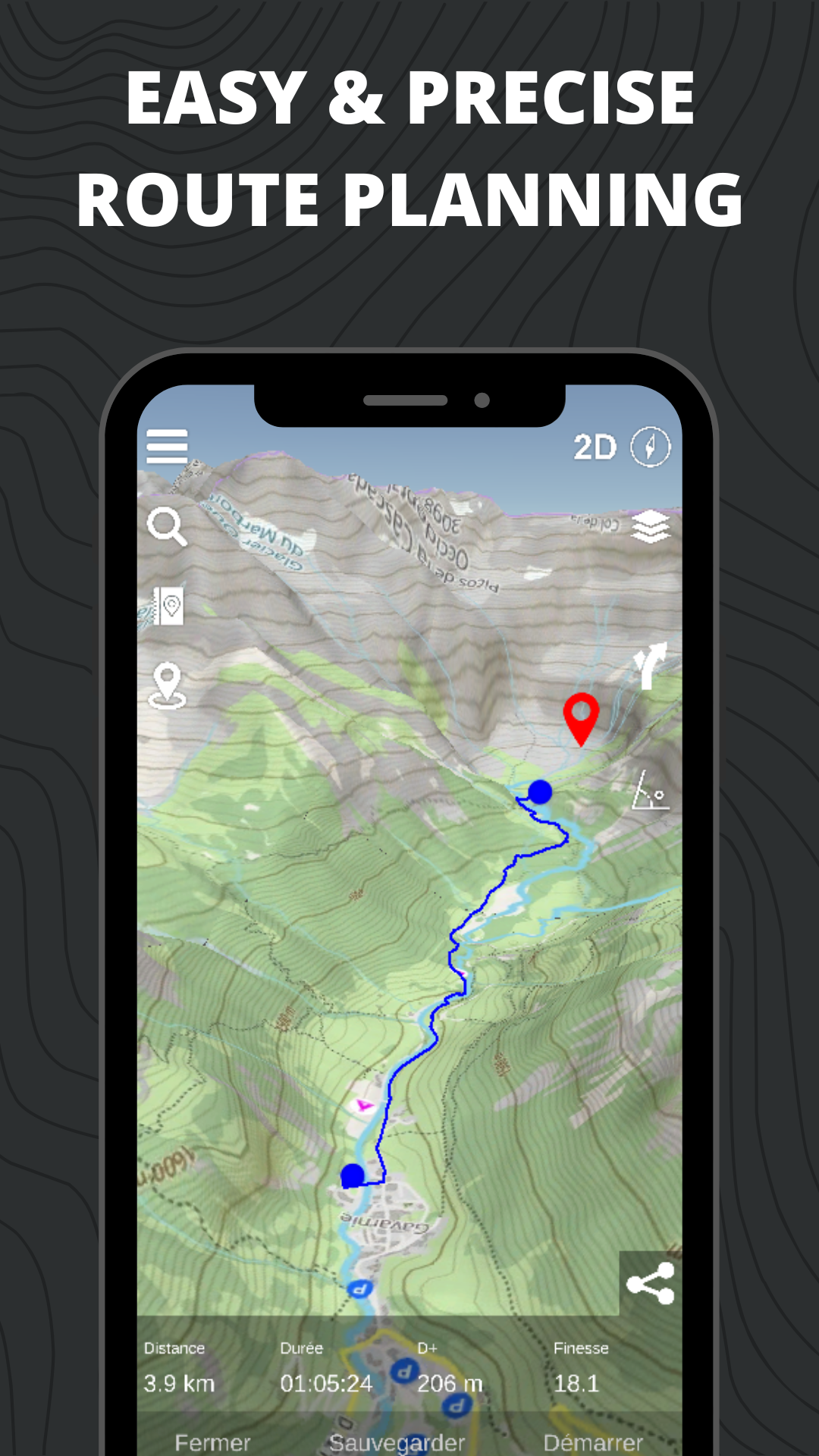
• Route planner: draw, save, export GPX
• Record, replay and sync tracks across devices
• Offline mode: pre-download any map layer
• Avalanche-risk slope maps & altitude-based weather
• Glide-ratio calculator for paragliders
• Resort piste maps (Park City, Breck, Jackson Hole, etc.)
• Points-of-Interest layer: shelters, bivouacs, water, parking, restrooms
ACTIVITY-SPECIFIC TOOLS
◉ Hiking
- Nearby trail catalog (easy to strenuous)
- Custom GPX export for watches & GPS units
◉ Mountaineering
- Camp-to-camp & ski-tour topographies
- GPS tracks for classic Alpine routes (Mont Blanc, Aiguille Verte, Whymper Couloir)
◉ Climbing
- One-tap GPX to every route start
◉ Trekking
- Multi-day itinerary builder for PCT, Appalachian Trail, GR routes
- Auto-calc distance, elevation gain, ETA
◉ Ski Touring
- 3D slope & AR inspection
- Snowfall and temperature layers by altitude
◉ Paragliding
- Wind, thermal and weather overlays
- Live tracking & replay (X-Alps athlete-approved)
◉ Downhill Skiing
- Full resort piste maps in 3D
MAP & DATA LAYERS
- USGS topo & satellite imagery
- IGN topo, scans & satellite (France)
- Swisstopo topo & satellite (Switzerland)
- OSM summer & winter maps
- Avalanche-risk slope shading (ski touring)
- Version2.0.6
- UpdateAug 29, 2025
- DeveloperRelief Maps
- CategoryTravel & Local
- Requires AndroidAndroid 7.0+
- Downloads250K+
- Package Namefr.reliefmaps.app
- Signaturedb4930ef97dd21c0083ec7c70cb082f3
- Available on
- ReportFlag as inappropriate
-
NameSizeDownload
-
101.79 MB
-
108.93 MB
-
201.47 MB


User-friendly 3D interface
Smooth navigation and fast rendering
Accurate peak names for specific regions
Useful for marking points of interest (POIs)
Great visualizations of terrain and mountain routes
Unique app with features not found in typical mapping tools
Ideal for exploring new areas and outdoor activities
Active community links for additional resources
Minimal intrusive ads in the free version
Slow performance can hinder user experience
Limited features in the free version, making it average without payment
High subscription costs may deter casual users
Occasional crashes and bugs affecting reliability
Lack of detailed information on activity sites
Static steepness that doesn’t reveal real terrain conditions
Inconsistent rendering of maps at different zoom levels
Complicated route planning process
Payment issues and poor developer support leading to frustration