Iphigénie - Hiking map app
Explore the great outdoors with detailed offline maps, GPS tracking, & real-time info for all your adventures!
- 11.6.3-2 Version
- 2.7 Score
- 622K+ Downloads
- In-app purchases License
- 3+ Content Rating

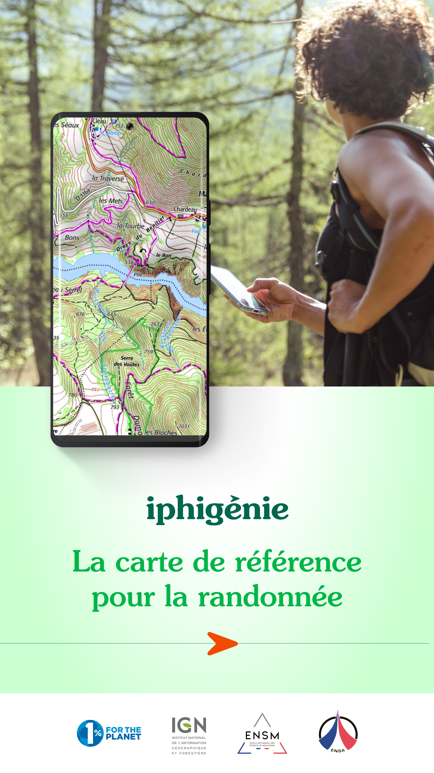
Iphigénie is an app designed for outdoor lovers looking for hiking maps in France and globally. It caters to both individuals, such as hikers, cyclists, and equestrians, as well as professionals like guides, emergency responders, surveyors, aviators, and mariners who depend on precise mapping.
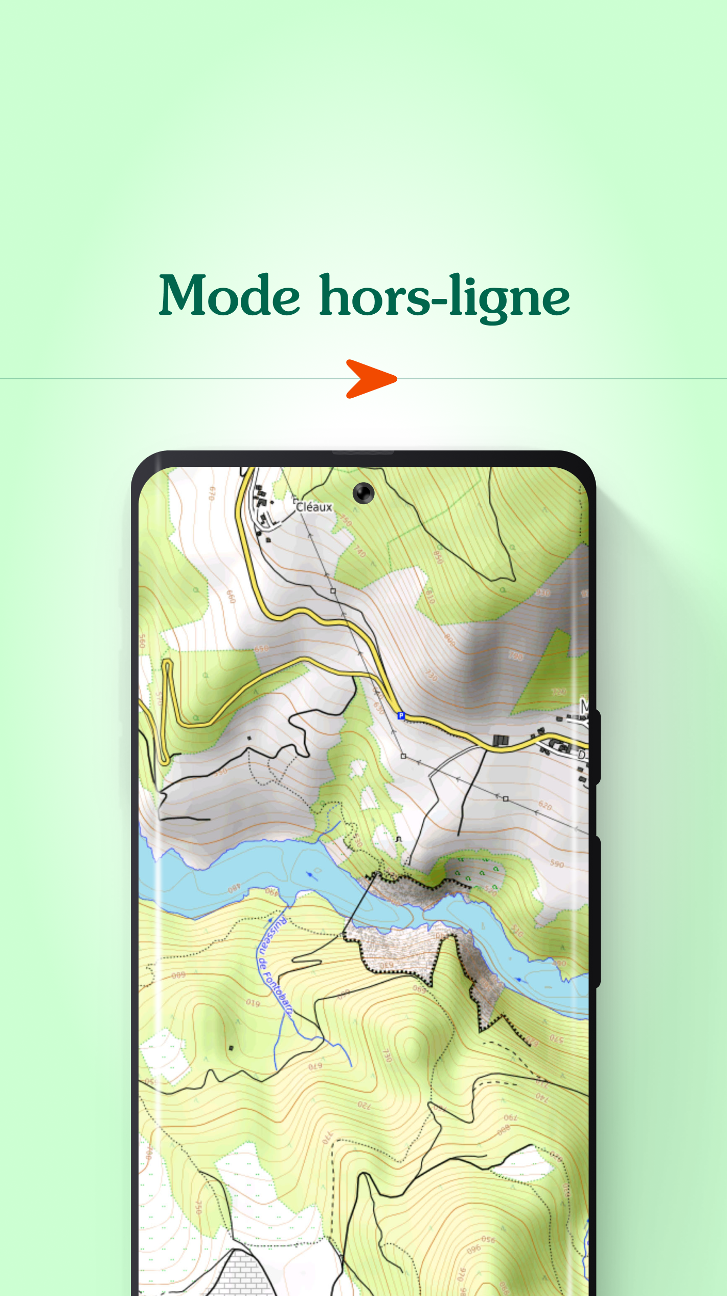
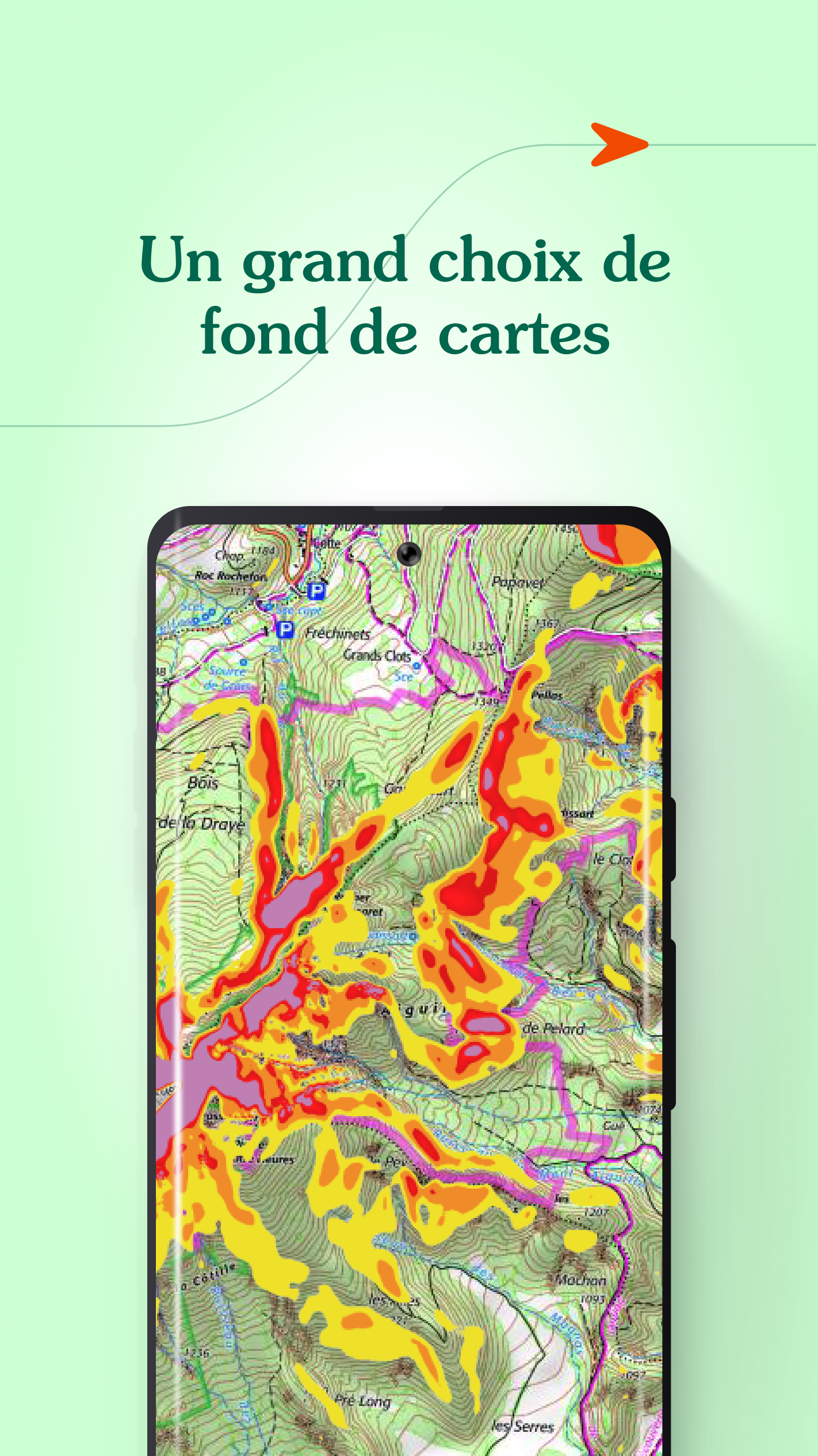
Access over 40 comprehensive topographic base maps (which include IGN maps, SwissTopo, IGN Spain, OpenTopo, OpenSnow, land registries, and slope inclinations), even without internet connectivity.
BEFORE YOUR OUTING
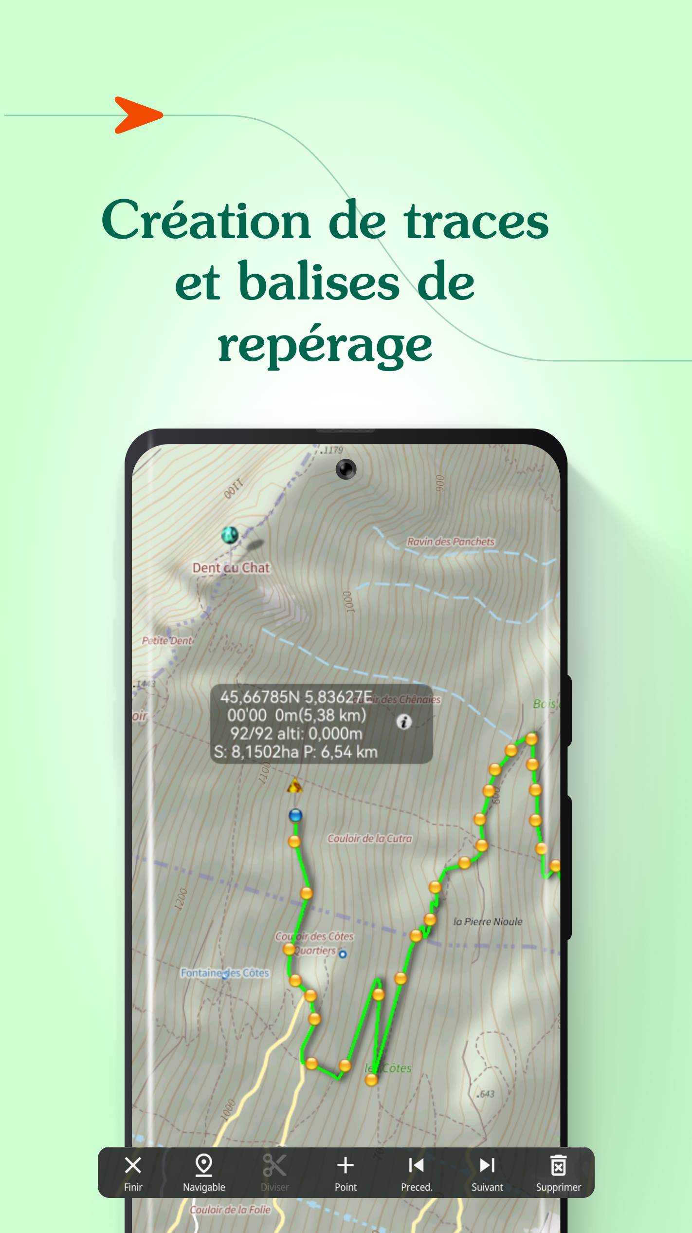
- Prepare by downloading maps to use offline.
- Create, modify, and import routes.
- Set and import markers (like mushroom picking spots or route starting points).
- Print map sections if necessary.
- Look up specific locations by name or GPS coordinates.
- Access trails or sites from IGNRando or Data-Avalanche.
- View in 3D and check slope angles.
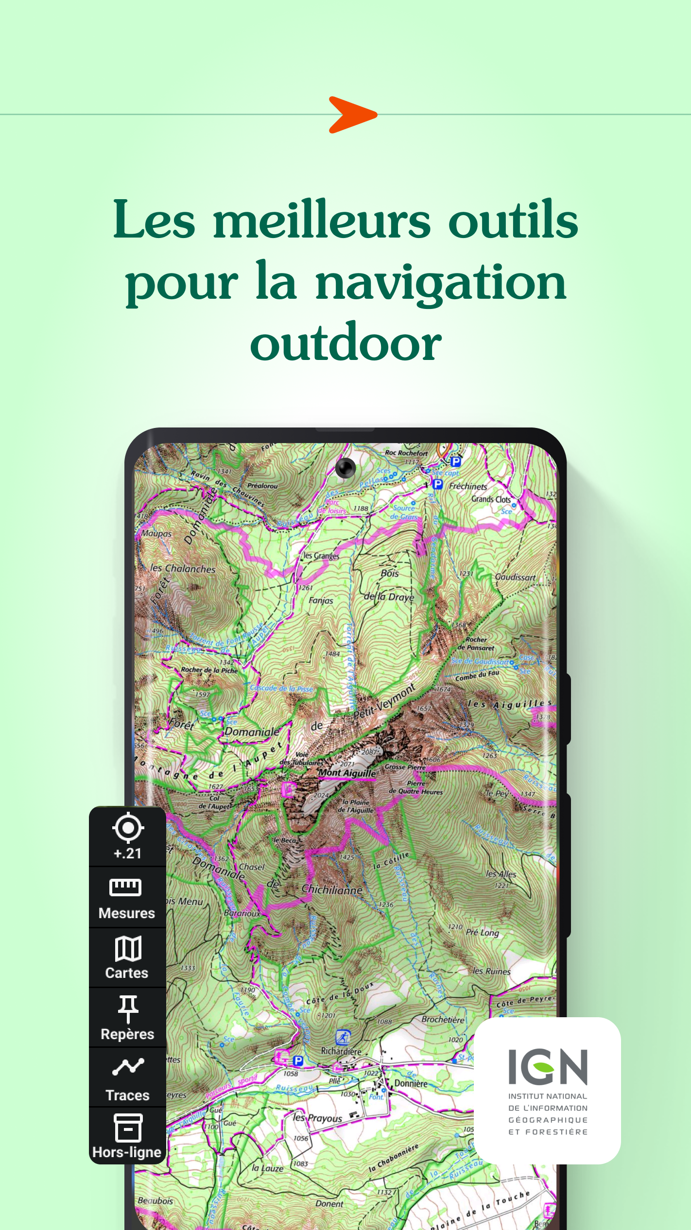
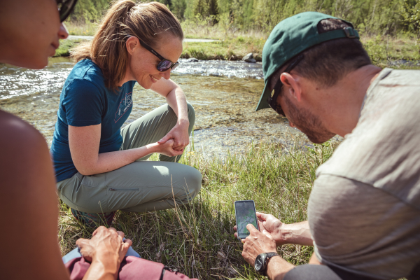
DURING YOUR OUTING
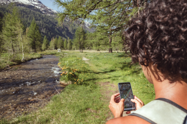
- Use geolocation on your preferred basemap.
- Navigate using GPS, regardless of network access.
- Track your journey.
- Monitor live data such as distance, elevation change, average speed, current speed, and estimated arrival time.
- Activate a beacon feature for loved ones to follow your real-time progress.
- Set up voice alerts tailored to keep you informed, even with your iPhone tucked away.
AFTER YOUR OUTING
- Organize groups of routes/markers.
- Safeguard all your information in the Cloud.
- Export your GPS routes and markers in GPX format.
- Share your experiences and waypoints with friends.
What our users say:
"With Iphigénie, I've found countless breathtaking new places. I take note of the slopes, peaks, and lakes... It saves me invaluable time, especially in isolated areas where signs are scarce!"
In the media:
20 minutes: "Outdoor activities, including hiking, have embraced digital innovation, as noted by Alice (25). "It’s incredibly convenient to access reliable IGN maps, especially when you lose connection in high-altitude regions."
Get the free basic app
Download the no-cost basic version on your smartphone. This tier permits geolocation on one of the 25 complimentary base maps like Open Topo Map, Open Cycle Map, or Open Snow Map. Adventure awaits!
You’ll also gain access to real-time data such as your location, direction, altitude, and speed.
Utilize the full app with the “Iphigénie Carto” subscription
The Iphigénie Carto subscription costs €24.99 per year, allowing access to 40 base maps, including those from IGN. These maps can be stored on your device (iPhone, iPad, iPod, Watch) for offline usage.
This subscription unlocks the complete functionality of Iphigénie, featuring all the tools previously described.
Note: You have a week to try out the advanced app at no charge.
Explore high-quality Italian maps with the ‘Maps of the Italian Alps’ subscription
You may purchase Fraternali's 1:25,000 Italian topographic maps for €24.99 annually. This subscription provides detailed digital maps that cover the western Italian Alps.
A list of available maps includes:
- IGN France
- SwissTopo
- Fraternali
- IGN Spain
- IGN Belgium
- BKG Germany
- Kartverket Norway
- Cartographic Institute of Catalunya
- OpenTopo
- OpenCycle
- OpenSnow
- ICAO
- ESRI
- Satellite view
- Cadastre
- Slope inclination
- Drone restricted areas
- Historical maps of France
- Geological and mining maps (France)
- National Forestry Office
Additionally, we contribute 1% of our revenue to 1% for the Planet to support environmental preservation.
MADE IN FRANCE
Iphigénie: Your 5 Most Frequently Asked Questions About Our Offers
Many of you use Iphigénie for your hikes, walks, or nature outings, and you often have questions about our offers, features, or available subscriptions. To help you better understand everything Iphigénie has to offer, we've compiled the 5 most frequently asked questions from our users, with clear and practical answers. Whether you're a beginner or an experienced hiker, this guide will help you get the most out of our app.
Ready to learn more? Let's go!
1. How do I renew my subscription?
The renewal of your Iphigénie subscription depends on your initial subscription method. Here are the different possible situations:
1. You subscribed via IGN Rando
The end of the IGN Rando service has put an end to the automatic renewal of your subscription.
→ To continue enjoying Iphigénie, you must manually renew your subscription:
Either from the Iphigénie website
Or directly from the mobile app (iOS or Android)
2. Automatic renewal via mobile (App Store or Google Play)
If you subscribed on an iPhone or Android device, your subscription automatically renews annually.
📍 You can check or manage your subscription:
On iOS: Settings > App Store > Subscriptions
On Android: Play Store > Account > Payments & Subscriptions
3. Automatic renewal via the website
Subscriptions purchased on the official Iphigénie website are also automatically renewed, without any action required on your part. You will receive a confirmation email before each renewal.

4. You were subscribed to Iphigénie J or X
Since the services are no longer supported by our teams, you will not be able to renew your Iphigénie J or X subscription.
Can I cancel my Iphigénie subscription?
Yes, you can cancel your subscription at any time, directly from the platform used for the purchase (website, App Store, or Google Play Store).
📧 If you have any questions, our customer support team is here to help.
questions-iphigenie
2. Why can't I keep my €14.99 subscription?
The price of the €14.99 Iphigénie subscription is gradually increasing to €19.99 at your next renewal. This price update applies to existing subscribers and is part of a price harmonization process.
This rate remains attractive: it is still lower than the standard price of €24.99 that has been applied to new subscribers for the past two years. This gradual upgrade allows the standard rate to be reached the following year, with a new revision.
This increase directly contributes to the development of Iphigénie: improved usability, the addition of new topographic maps, and a general enrichment of the user experience.
👉 Good to know:
You can cancel or change your subscription at any time via your phone's settings.
The preferential rate is reserved for automatic renewals. If you cancel or subscribe via IGN Rando, the €19.99 rate will not be maintained.
iphigenie-termination
- Version11.6.3-2
- UpdateJun 26, 2025
- DeveloperIphigénie
- CategoryBooks & Reference
- Requires AndroidAndroid 7.1+
- Downloads622K+
- Package Namecom.iphigenie
- Signature5629fbfdff4c21612bad5be6f2a33de9
- Available on
- ReportFlag as inappropriate
-
NameSizeDownload
-
30.69 MB
-
30.58 MB
-
24.91 MB


Reliable offline functionality
Effective caching of maps for no signal areas
Clear and detailed topographical maps
Yearly subscription provides ongoing access to maps
Efficient customer support when issues arise
Cost-effective compared to purchasing paper maps
Useful for various outdoor activities
Multiple features available for different needs
Not very intuitive or user-friendly
Frequent glitches and crashes during use
Issues with map zooming and loading layers
Unclear subscription status despite payment
Requires GPS activation to function properly
Difficult navigation within the app interface
Additional costs for certain features (e.g., GPX file access)
Problems transferring the app between devices