GPS Test - GPS signal & sensor display
Explore GPS data, update AGPS, check altitude & time with customizable themes for a personalized navigation experience

- 1.6.5 Version
- 4.7 Score
- 10M+ Downloads
- In-app purchases License
- 3+ Content Rating

This application allows you to assess the GPS signal quality in your vicinity and refresh AGPS data for quicker positioning, while also providing access to various GPS and sensor information. It serves as a comprehensive platform for displaying: altitude, precise UTC plus local time, compass direction, lunar phase, and daylight duration. The app is compatible with a range of satellite systems including GPS, GLONASS, GALILEO, SBAS, BEIDOU, and QZSS. Users can select from multiple color themes according to their preferences, including a night mode, which can be coordinated with other tools used alongside the app.
GPS Test features six distinct screens:
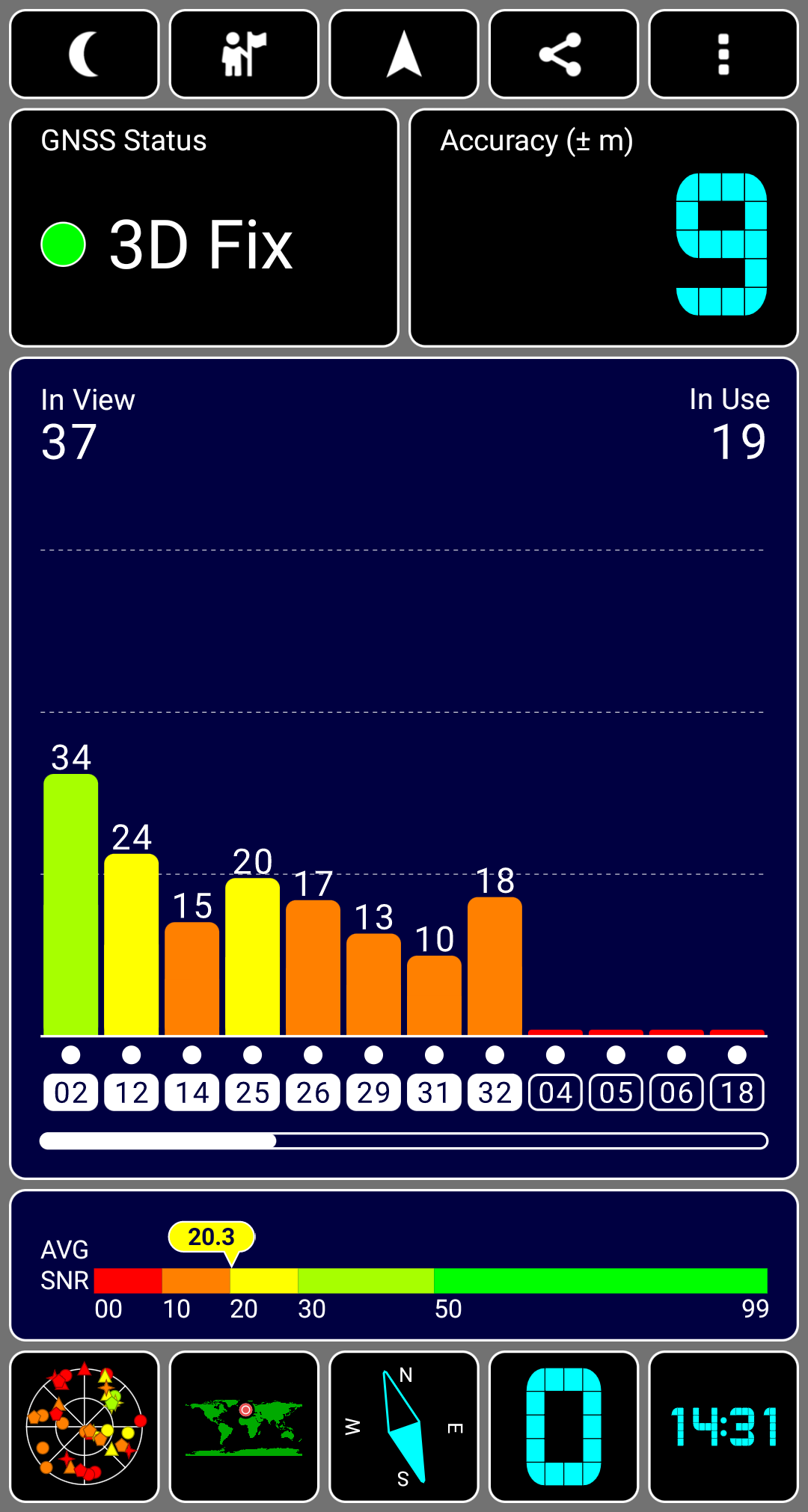
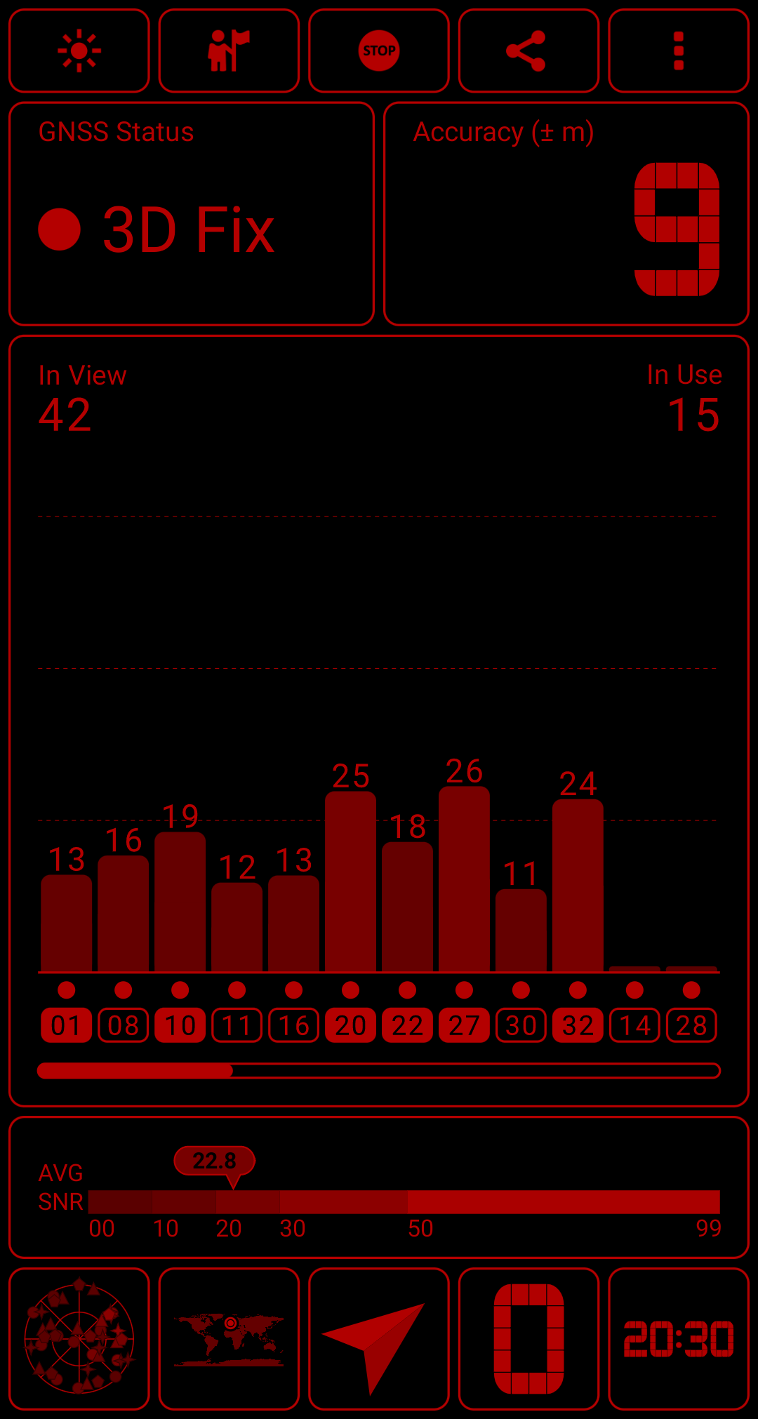
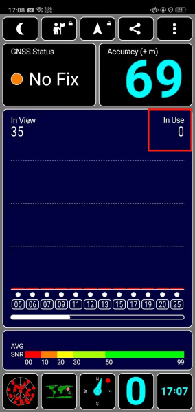
• A bar chart displaying GPS signal (SNR), indicating the strength of signals from each satellite, along with the accuracy and status of the GNSS network.
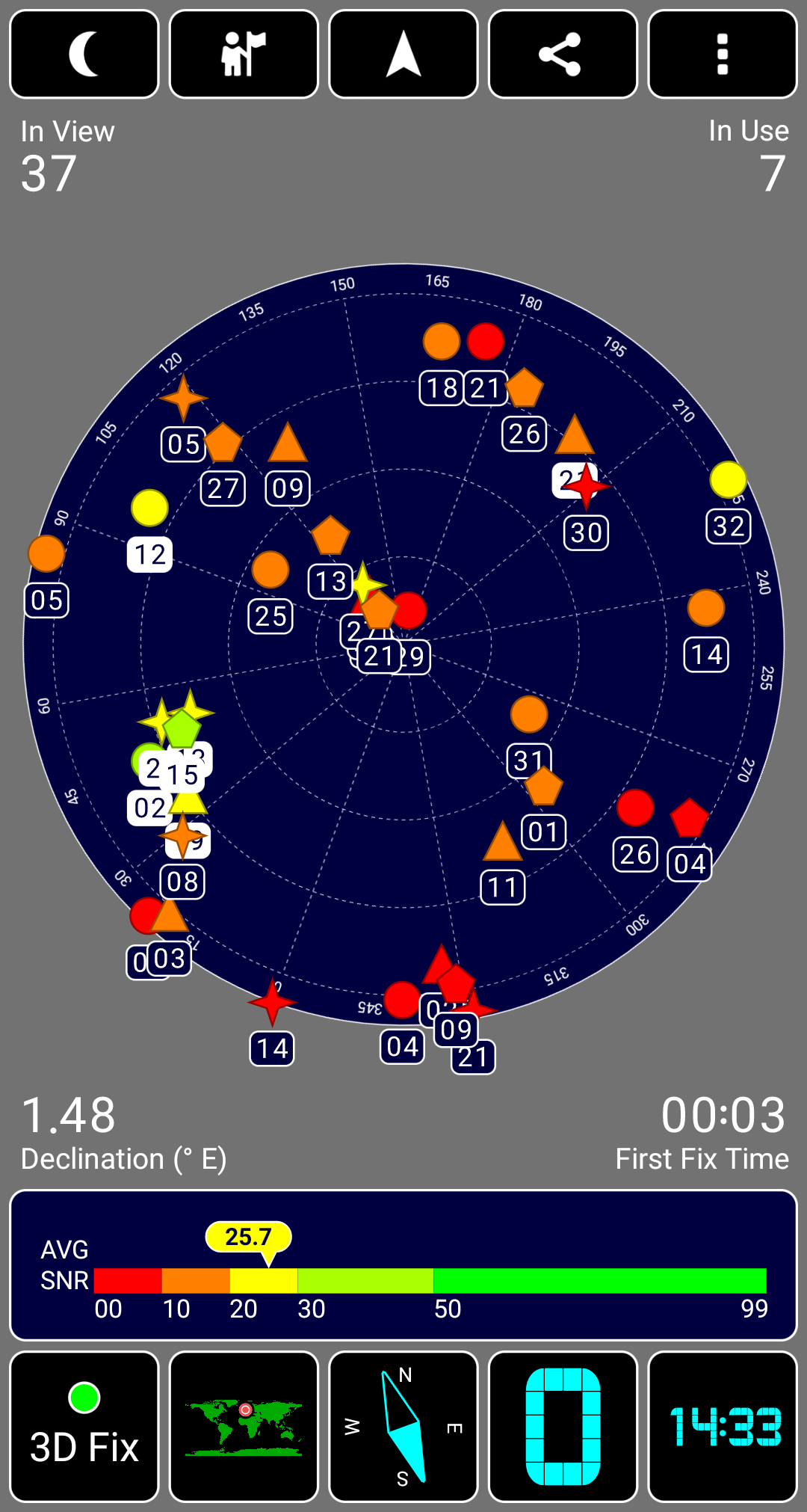
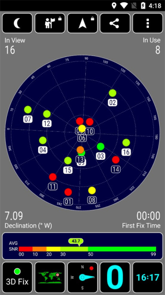
• A rotating compass that illustrates satellite locations in the sky (sky view).
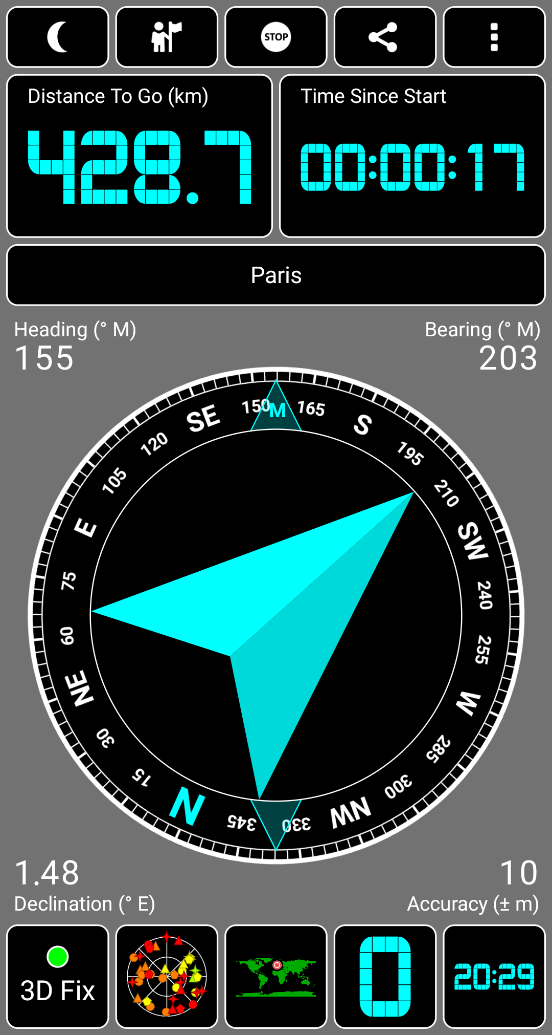
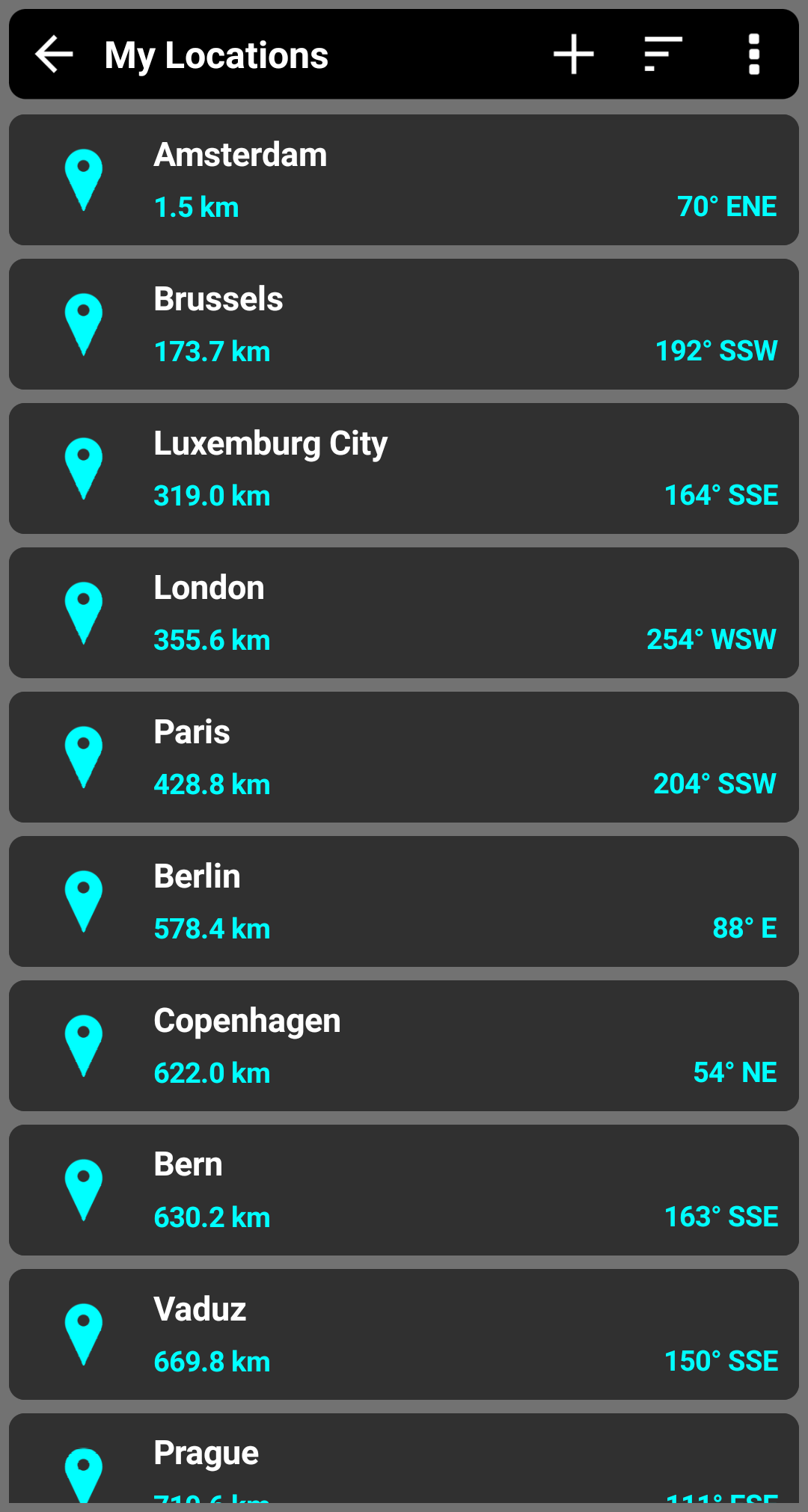
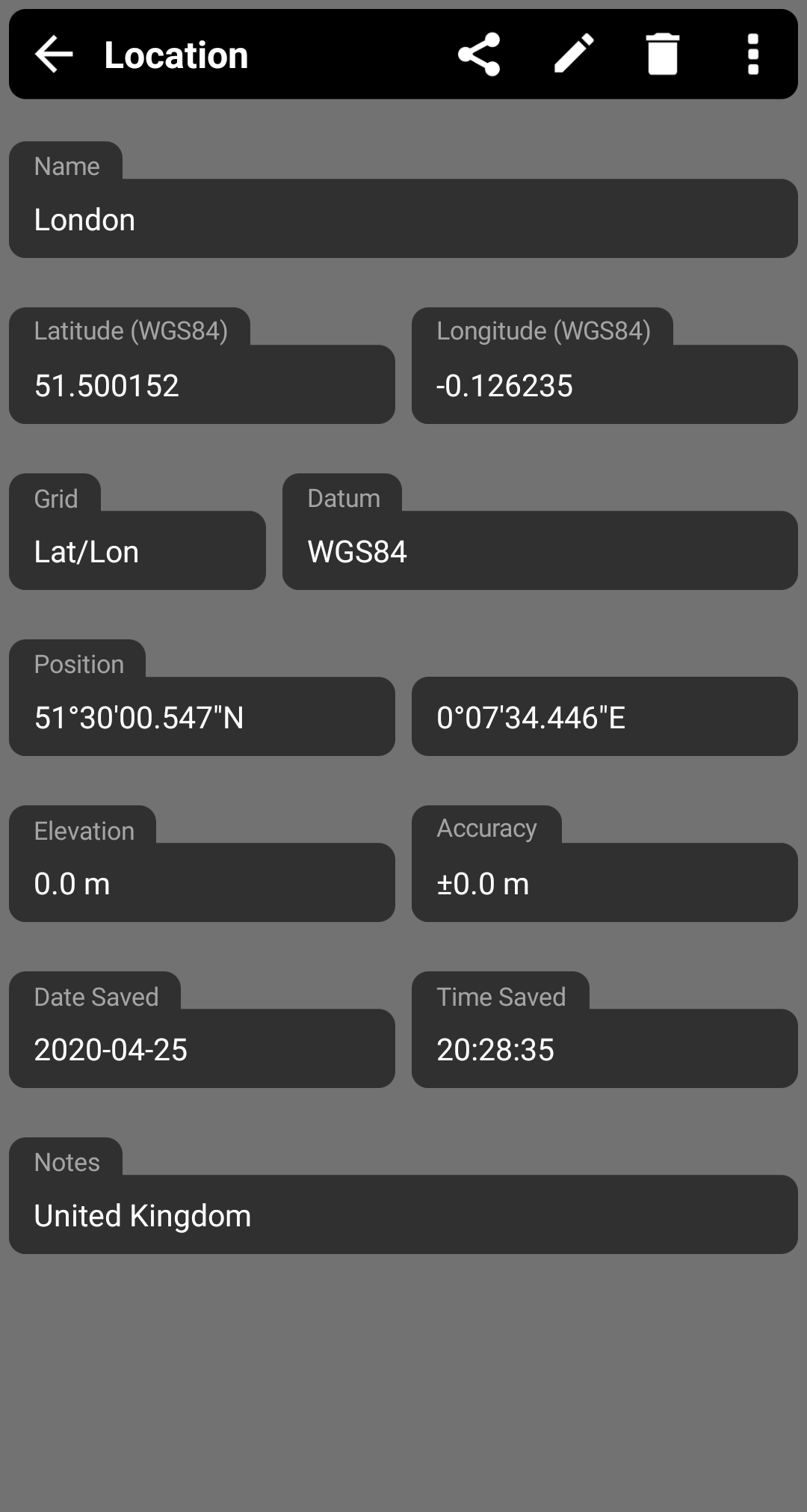
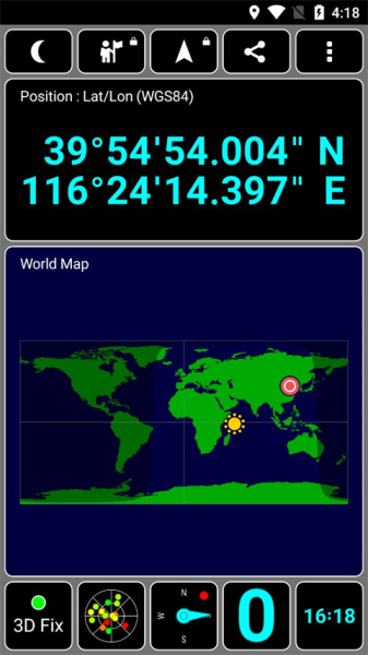
• Your current geographical location presented in text format and on a world map, including the sun's position and the day/night transition curve.
• A compass feature.
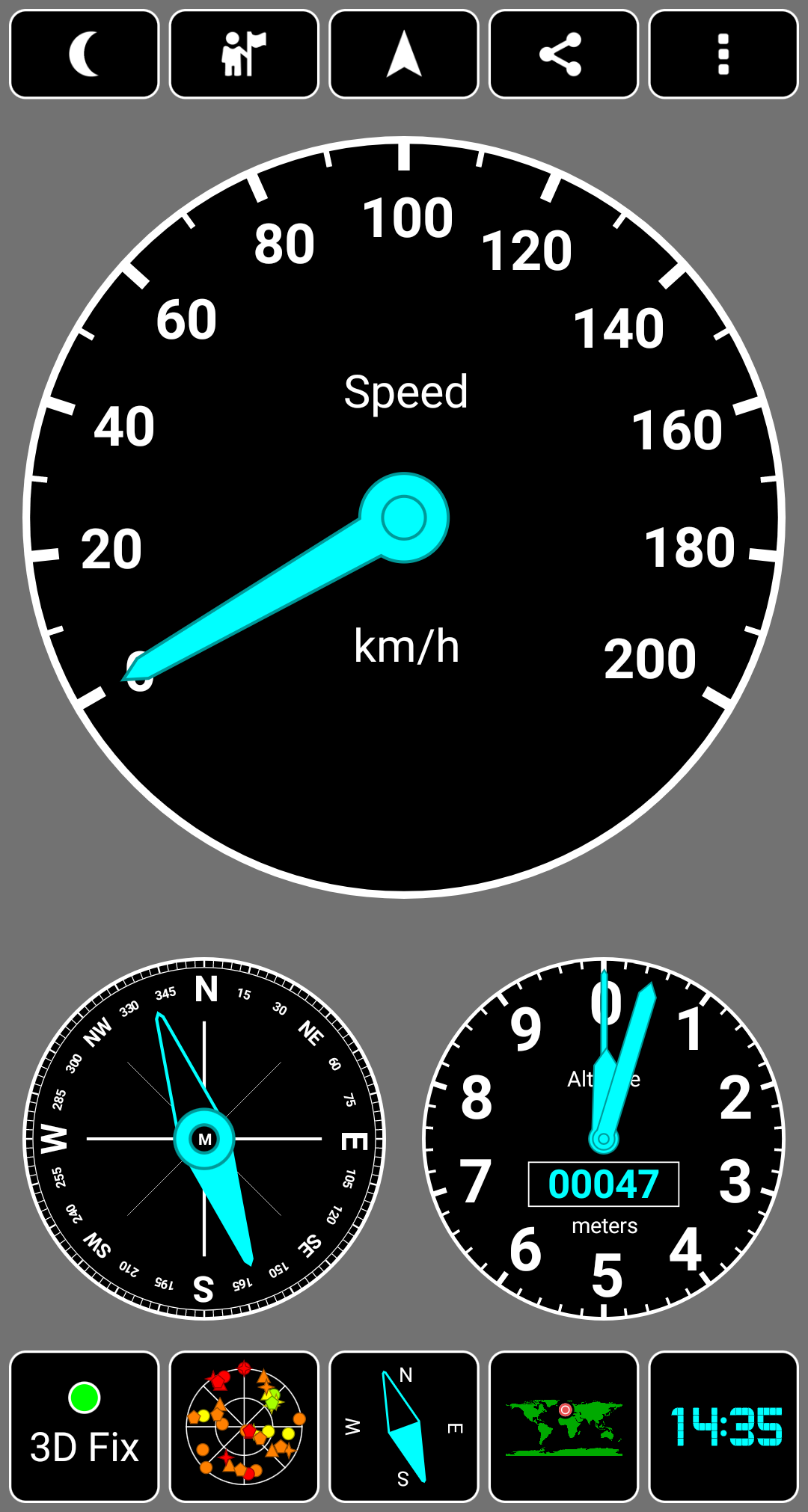
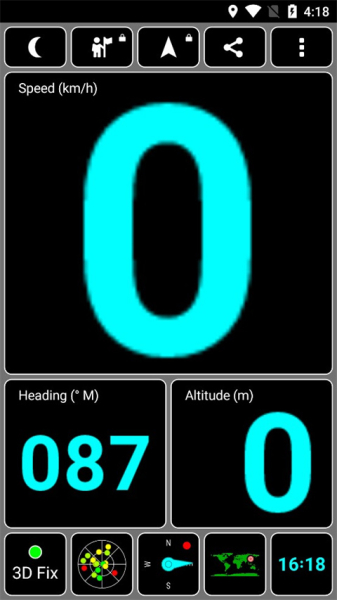
• Text display of your current speed, heading, and altitude.
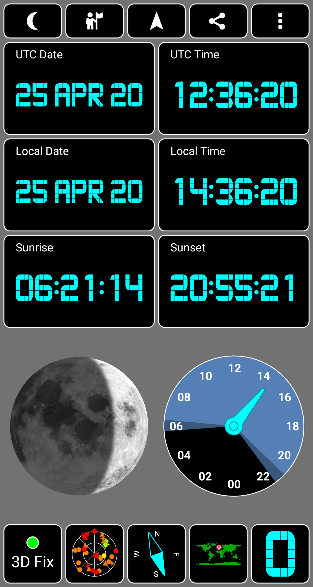
• The time derived from the GPS system, along with the local time for your timezone, plus sunrise and sunset times specific to your location.
Coordinate systems supported by GPS Test include:
OSGB, UTM, MGRS, USNG, CH1903, Maidenhead.
Datums recognized by GPS Test are:
WGS84, NAD83, NAD27, ED50, AGD66, AGD84, SAD69, among others.
The app is designed to work seamlessly on all screen sizes, from smartphones to large tablets.
What’s new
Fixed font issues.
Updated copyright year.
Fixed disclaimer text.
Fixed setting update issues.
Update to support the latest Billing library.
Removed test display font.
Fixed the fuzzy font problem, on some phones.
Fixed show on map bug.
If you find this app useful, consider exploring GPS Test Plus, which offers enhanced capabilities such as:
* Easy Navigation.
* Location Sharing options.
* Instrument displays (Altimeter, Speedometer, and Compass).
* 7-segment LED styling.
* Dot Matrix display option.
* HUD functionality.
Additionally, this free app has in-app purchases available to enhance its existing features if you desire more functionality.
* Internet access is needed solely for analytics and advertising purposes; the app functions without a Wi-Fi or data connection.
How to use
1. Click to enter the GPS Test page, you can see that you are required to turn on GPS first, turn on the GPS function in the phone settings;
2. Then you can enter the GPS test page; the red box in the figure below shows the number of satellites in use. When the number of satellites is not less than 3, your terminal device (here refers to your mobile phone) can complete positioning. Generally, the number of satellites in use is not less than 10.
3. At the same time, you can also use the circular coordinate chart to display the detailed positioning information; as well as the searched satellite distribution information;
4. Click the position on the world map to switch to the specific location of the positioning information on the world map;
5. Click the longitude and latitude information to see the longitude and latitude information of the positioning location;
6. Click the time to see the time of the positioning location, UTC time, and sunrise and sunset time;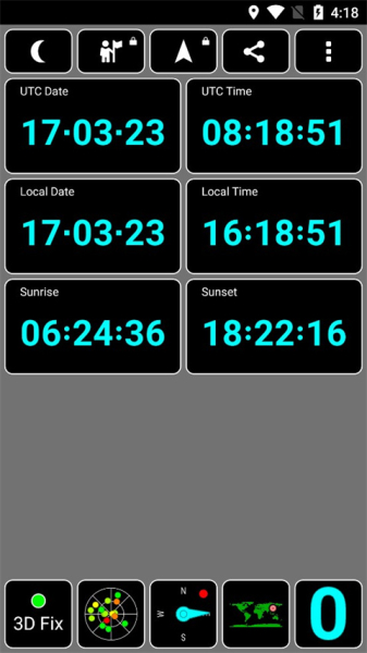
7. At the same time, these positioning information can also be shared to various social networking sites through the sharing function;
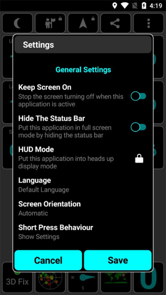
8. Click the setting option to set the general properties of GPS Test;
- Version1.6.5
- UpdateMar 31, 2025
- DeveloperChartcross Limited
- CategoryTools
- Requires AndroidAndroid 5.0+
- Downloads10M+
- Package Namecom.chartcross.gpstest
- Signaturef893b6047c1b50a732dc7dc78b79df77
- Available on
- ReportFlag as inappropriate
-
NameSizeDownload
-
2.95 MB
-
1.10 MB
-
250.30 KB


Accurate nautical measurements using arc seconds
Compatibility with various measurement systems (miles, kilometers)
User-friendly interface and easy navigation
Lightweight app without unnecessary bloat
Offline functionality for GPS testing
Flexible feature set catering to different user needs
Regular updates and bug fixes from the developer
Customizable display options for individual preferences
Efficient battery usage when app is active
Inaccurate sunset and sunrise time reporting
Issues with user interface overlapping system navigation
Compass calibration problems reported by users
Premium features locked after purchase for some users
Some accuracy issues with altitude readings
Dependency on external GNSS signals for optimal performance
Poor customer support response to inquiries
Ad cycle issues disrupting user experience
Changes in functionality after app updates causing frustration