
Durunubi - Korea Dulle Trail guide
Explore Korea’s beautiful Dulle Trail with essential info, route tracking, & memorable experiences all in one app!

- 3.19.0 Version
- 2.0 Score
- 324K+ Downloads
- Free License
- 3+ Content Rating


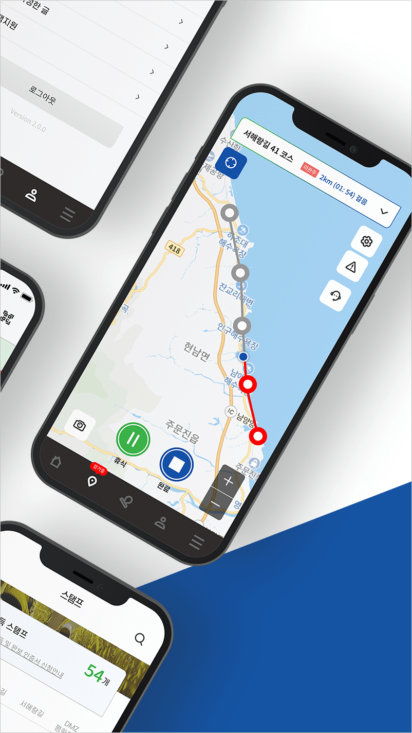

Durunubi serves as your resource for experiencing the Korea Dulle Trail.
It offers insights to enhance your journey, making it more enjoyable and easy.
The Korea Dulle Trail is a service that delivers extensive tourist details including transportation, lodging, dining, and cultural attractions focused around the Korea Dulle Trail routes.
Durunubi is accessible through both a website and a mobile application.

Key Sections and Functions
*Core Navigation
- Basic Information: Hiking Information, Travel Stories, Resource Library, Customer Support, Events, and Safe Hiking.
- Route Search: Provides a map search function, allowing users to click on specific routes by region.
* Route Categories and Recommendations
- Recommendations: Includes 45 must-see recommended routes, highly rated routes, professionally recommended international routes, and most completed routes.
- Specific Routes: Categorized by region and characteristics, with each route indicated by duration, distance, and difficulty.
* Special Services and Experiences
- Hiking Packages: Offers packaged hiking tours covering themes such as healing, experiential, scenic, and scavenging hikes.
- Supporting Resources: Each route includes associated rest stops, recommended attractions, and special activities, including night hikes.
User Support and Data Services
* Safety and Guides
- Safety Regulations: Provides hiking safety guidelines and emphasizes essential pre-trip knowledge.
- Verification Services: Supports route verification.
- Feedback Channels: Information correction requests, FAQs, and partnership inquiries.
[Services offered by Durunubi]
1) Access to 284 courses of the Korea Dulle Trail (Haeparang Trail / Namparang Trail / Seohaerang Trail / DMZ Peace Trail) along with various related tourist information services.
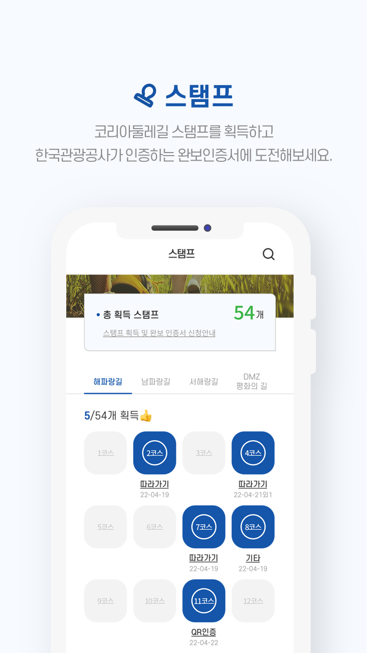
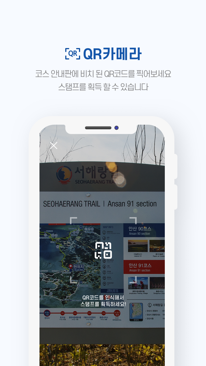
2) Functionality for acquiring Korea Dulle Trail stamps using QR codes.
3) Stamp tour features that allow users to obtain a completion certificate for the Korea Dulle Trail.
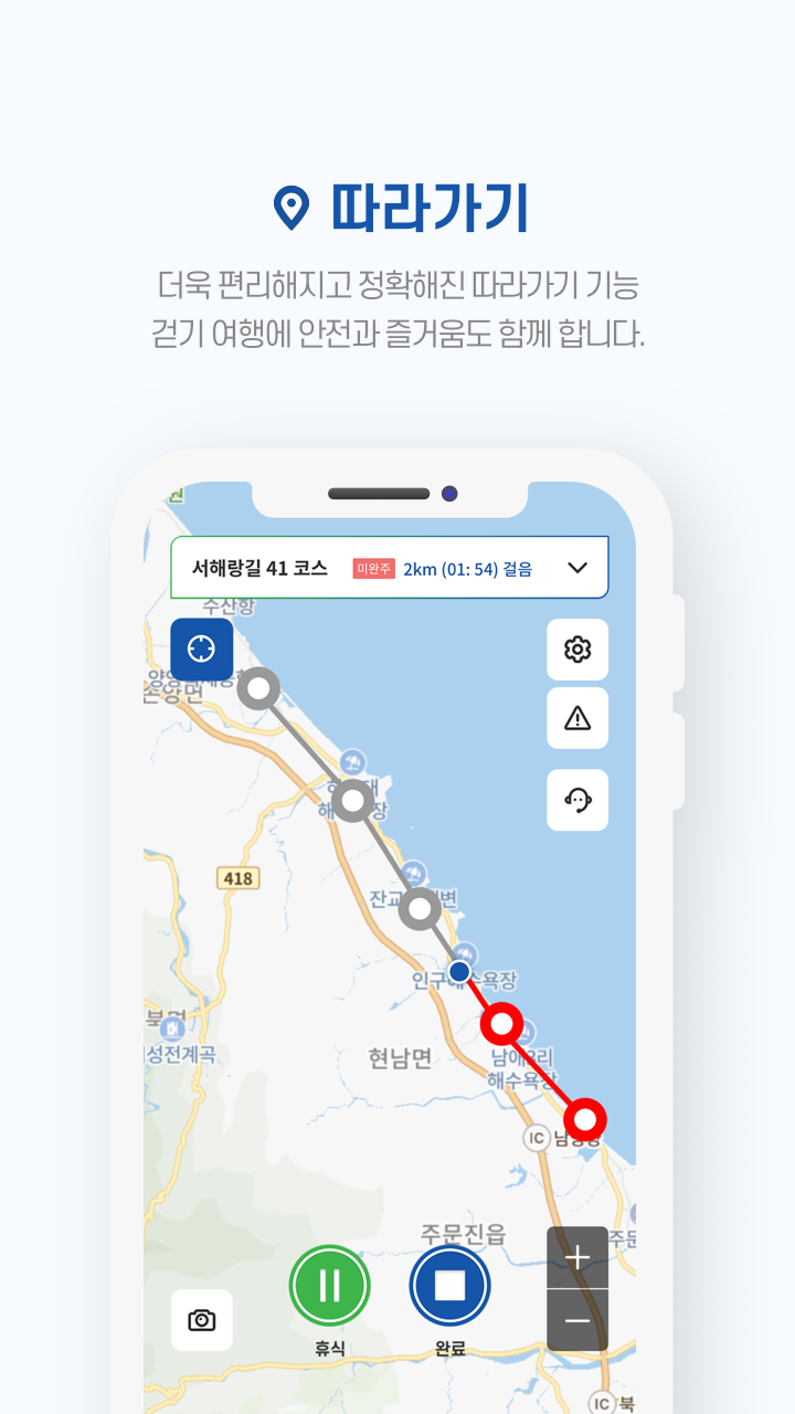
4) Capability to track and record the course route shown on GPS maps.
5) Maps that display nearby travel information such as attractions, dining, accommodations, and cultural facilities by each course.
6) A service enabling users to find desired tour courses based on region, difficulty level, and time needed.
7) Curated travel content recommending courses of Korea's circumambulatory trail categorized by skill level, events, seasons, and themes.
8) Safety guides for walking trails ensuring secure hiking experiences.
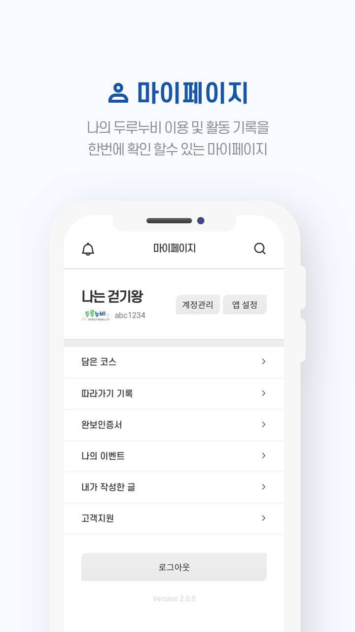
9) A personal page feature allowing users to review their participation in activities.
[Notice]
* Information about destinations featured in the app may vary based on local circumstances.
* The application is provided free of charge. While data usage may be complimentary in Wi-Fi zones, charges could apply depending on your mobile plan.
[Target Audience]
Suitable for hiking enthusiasts and outdoor travelers who are planning or currently hiking the Korean Ring Road, as well as tourists who want to experience the Korean Coast/DMZ Peace Trail. Suitable for both beginners and experienced hikers.

FAQs
1. What is the Korea Loop Trail (코리아둘레길)?
The Korea Loop Trail is a long-distance hiking route connecting South Korea's east, west, and south coasts, as well as the DMZ border area. It covers a total of approximately 4,500 kilometers and offers hiking enthusiasts an outdoor adventure around the country.
2. What are the different types of routes on the Korea Loop Trail?
They are mainly categorized as the "해파랑길" on the east coast, the "남파랑길" on the south coast, the "서해랑길" on the west coast, and the "DMZ 평화의 길" (DMZ Peace Road). Each route is detailed by difficulty, distance, and duration.
3. How can I find specific hiking routes?
You can use the platform's "Map Search" function to view route details by clicking on a specific area. You can also filter by recommended criteria (such as must-see routes and highly rated routes).
4. What special hiking services does the platform offer?
We offer packaged hiking tours (covering themes like healing and scavenging hikes), information on rest stops, recommended attractions, and special activities like night hikes and spiritual healing.
5. Can I get certification after completing a route?
Yes, the platform offers "Route Completion Certification." As of September 5, 2025, 22,936 people have completed at least one route.
6. Are there any safety guidelines?
Yes, the platform clearly lists "Hiking Safety Guidelines," which you should read before setting off to ensure safety.
7. How can I contact customer service for inquiries?
For inquiries regarding the "두루누비" platform, please contact: 070-4920-8773 (weekdays 9:30 AM - 5:30 PM, lunch break 12:00 PM - 1:00 PM). For inquiries regarding the Korea Ring Road, please contact: 1588-7417 (weekdays 9:00 AM - 6:00 PM, operating on weekends and holidays during certain seasons).
- Version3.19.0
- UpdateOct 08, 2026
- Developer한국관광공사
- CategoryTravel & Local
- Requires AndroidAndroid 6+
- Downloads324K+
- Package Namekr.durunubi
- Signaturee671ed97f9213c3384e6fd699192896c
- Available on
- ReportFlag as inappropriate
-
NameSizeDownload
-
222.09 MB
-
224.97 MB
-
183.37 MB













Wide-ranging routes offer a wide variety of options.
Detailed information makes planning easy.
Specialized themed hikes and certification services are available to enhance the experience.
Customer service is not available 24 hours a day and may not respond promptly on weekends or holidays.
Relying on online information may result in delays in on-site route signs or real-time traffic updates.