Yango Maps - GPS navigation & live maps
Explore Dubai effortlessly with accurate directions, real-time updates, offline access, & stunning 3D landmarks at your fingertips.

- 16.8.0 Version
- 1.4 Score
- 716K+ Downloads
- Free License
- 3+ Content Rating

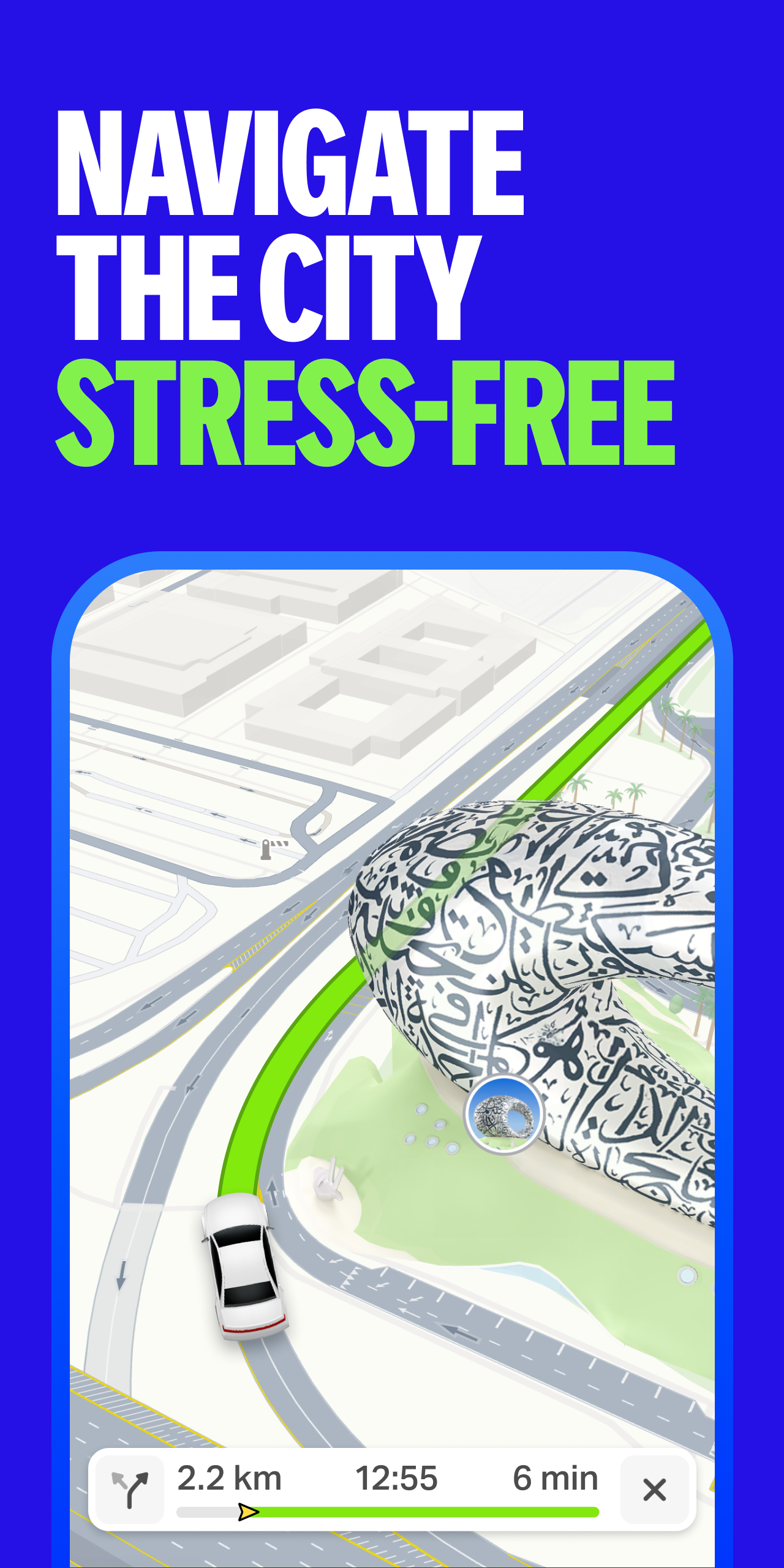
Yango Maps is a top-notch GPS navigation service that offers a highly detailed live map and precise, convenient routes for various modes of transportation, including driving, walking, and public transport. Whether you're in Dubai or other supported regions, this app is designed to make your navigation experience seamless and stress-free.
FEATURES
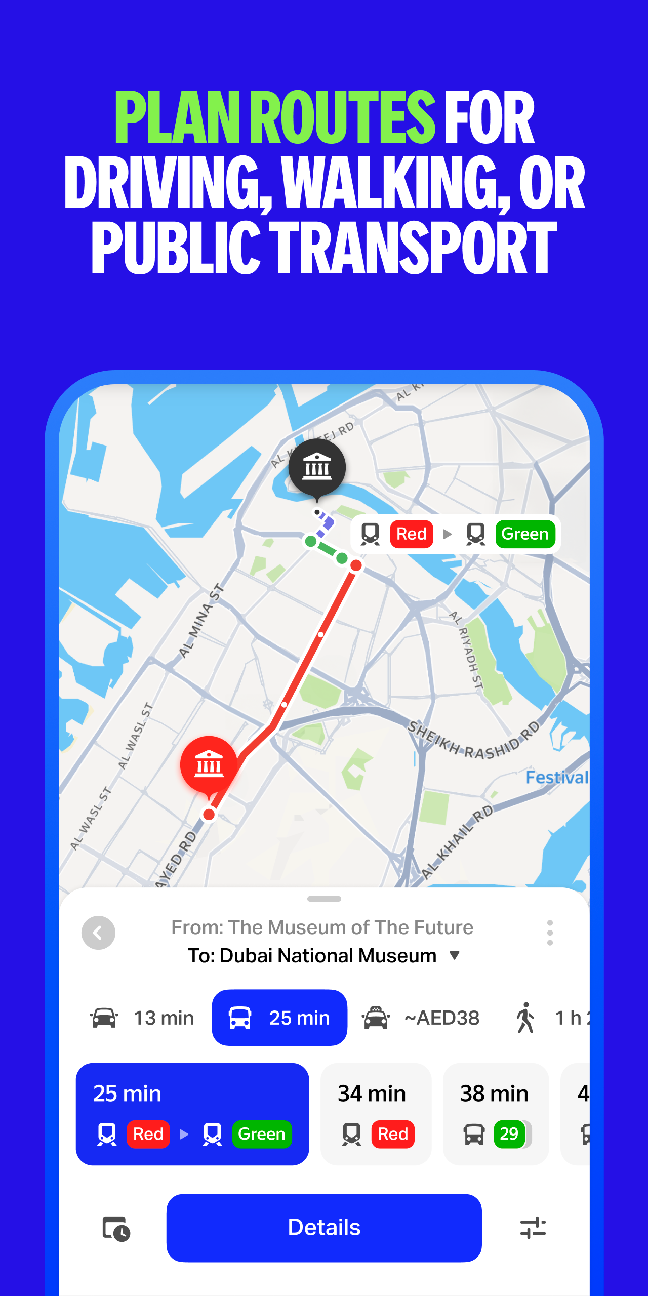
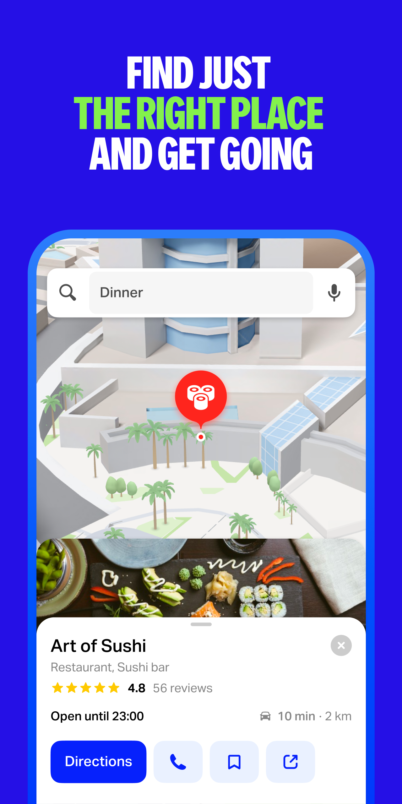
Accurate Location and Route Planning
With our GPS-enabled platform, you can pinpoint your exact location on the live map and plan direct routes to your destination in Dubai. The app provides directions that circumvent traffic, offers current bus schedules, and highlights quick walking paths to help you navigate around obstacles. The interface and voice guidance are available in multiple languages, including Arabic and English.
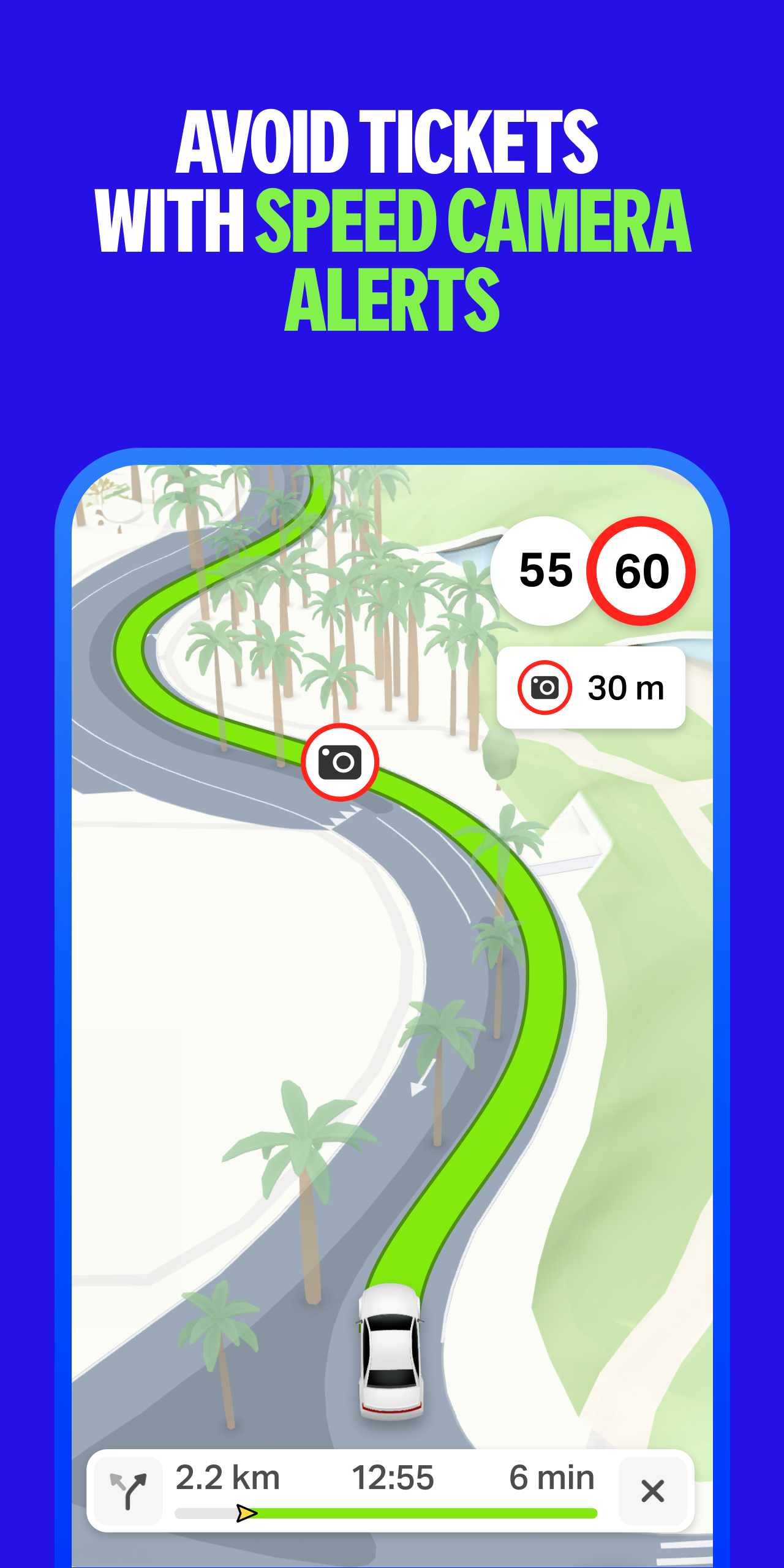
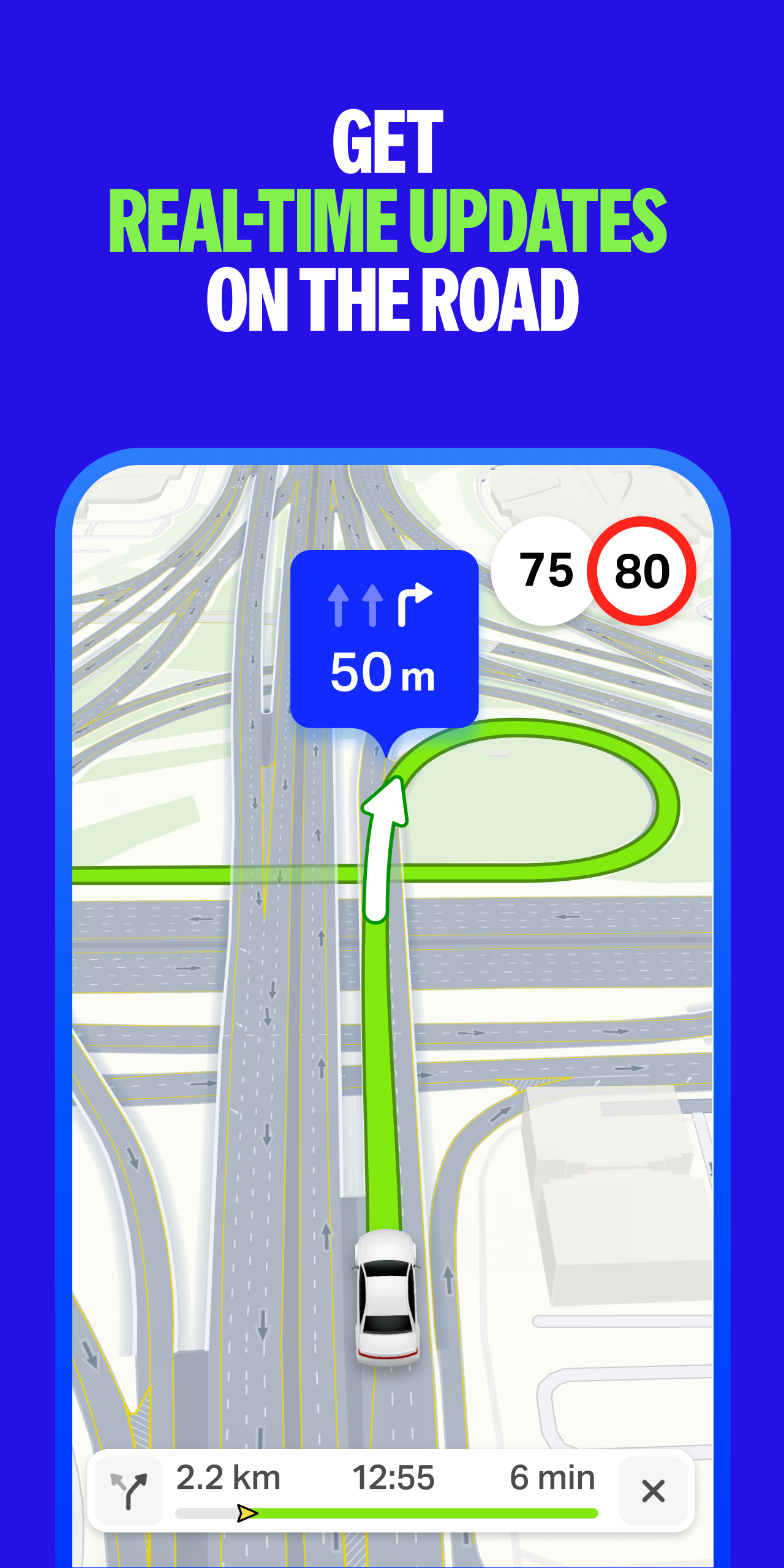
Stress-Free Driving Experience
For drivers, Yango Maps offers a smooth and hassle-free journey. It provides real-time updates on the road conditions, including alerts about upcoming traffic jams, road closures, and speed limits. The detailed Dubai map showcases roads with all markings, multi-level interchanges, tunnels, traffic lights, parking lots, and more, ensuring you have a clear understanding of your surroundings. Clear instructions on navigating complex intersections help you reach your destination on time. Additionally, the app guides you to convenient parking and drop-off locations near your destination, eliminating any unnecessary detours.
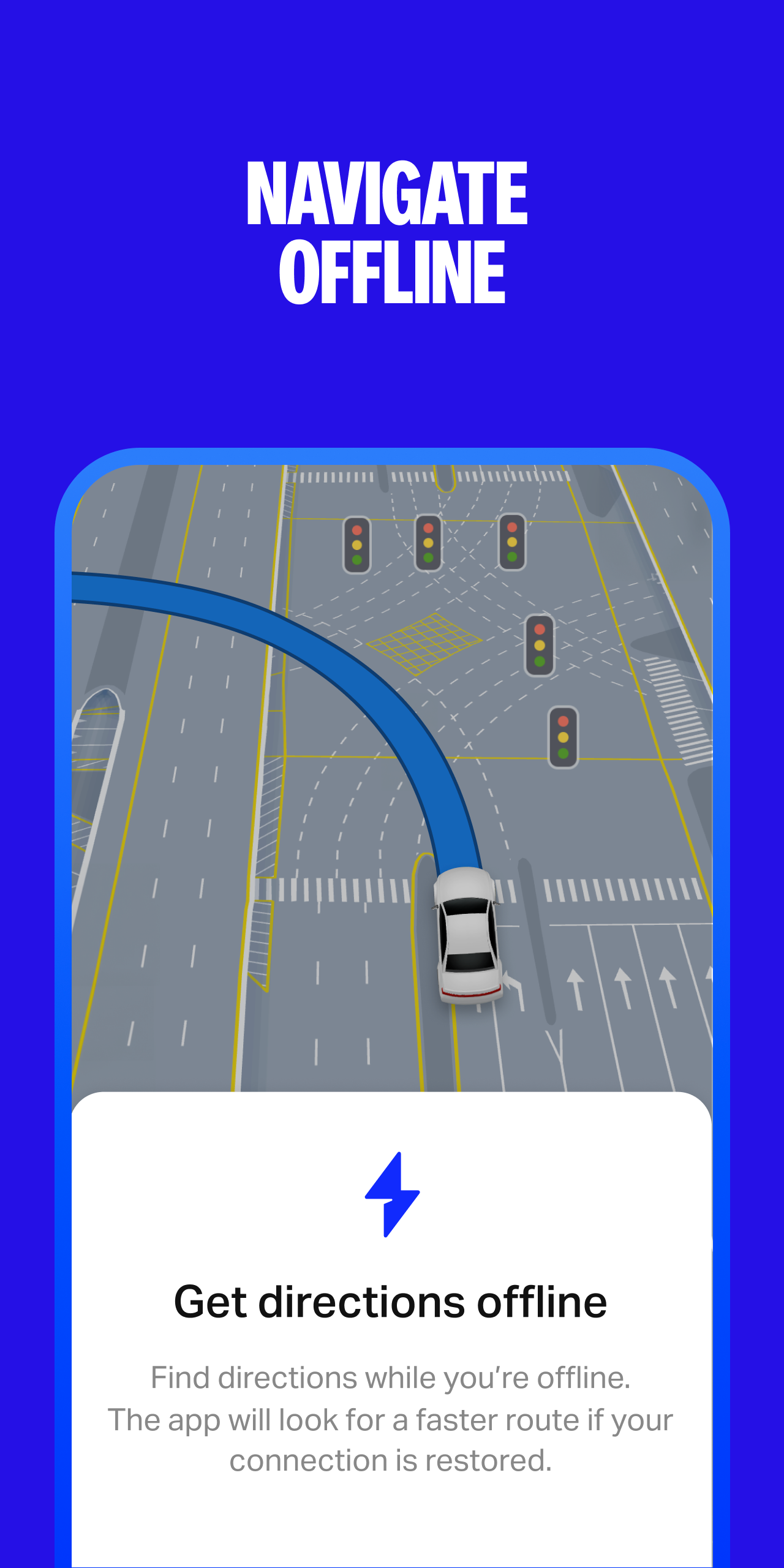
Offline Navigation Capability
One of the great features of Yango Maps is its ability to function without an internet connection. Simply download an offline map for your city or region, and you can build routes and navigate to your desired location without worrying about getting lost. This offline mode provides you with the flexibility to explore even in areas with poor or no network coverage.
Additional Convenient Features
If you're not driving, Yango Maps has you covered. You can book a ride through the built-in Yango ride-hailing service, check the scheduled arrival times of buses, and get a streamlined walking route to reach your destination effortlessly. The app also enhances your navigation experience by displaying iconic Dubai landmarks in full-color 3D, such as the Burj Khalifa, Dubai Frame, the Museum of The Future, and the Jumeirah Mosque. When you switch to dark mode, lifelike lighting effects are triggered on the 3D models, replicating the city's evening atmosphere realistically.
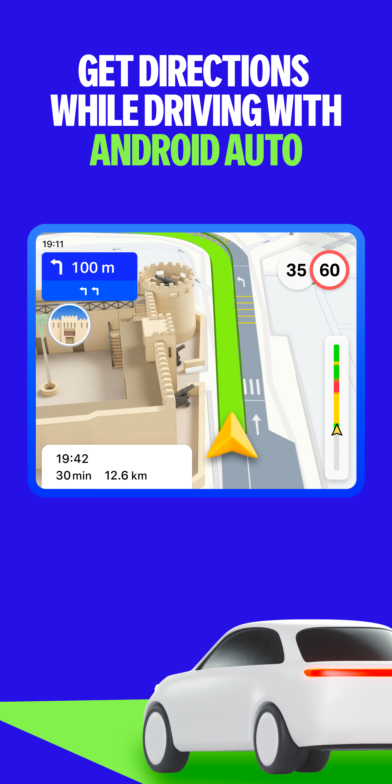
Compatibility and Expansion
Yango Maps is compatible with Android Auto, allowing you to view your route directly in front of you while driving. Currently, this feature is available in the UAE and Azerbaijan, and the app developers plan to add support for more locations in future updates, expanding its usability for more users.
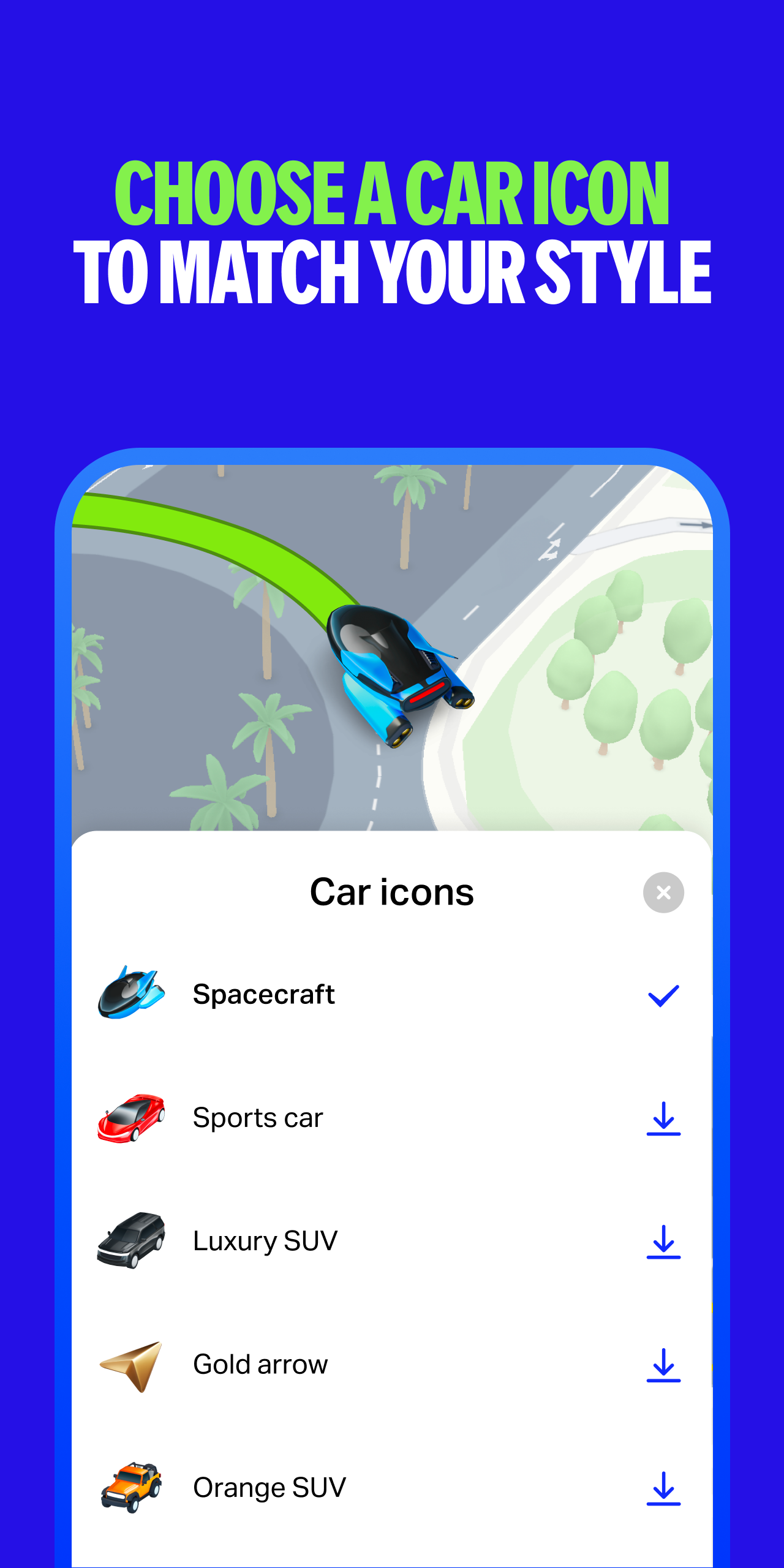
Unique Customization
To add a touch of personalization to your driving experience, Yango Maps has introduced custom car icons. You can choose from a variety of options, some of which reflect Dubai's culture and essence, such as gold and silver arrows, a sports car, a motorcycle, and a specially designed naturally-animated white horse exclusive to Dubai users. You can find these icons in the Settings → Navigation → Car icon section.
Final Note
It's important to note that Yango Maps is a navigation app and does not offer any healthcare or medical functions. If you're looking for a reliable and feature-rich navigation app to explore the city, whether you're driving, walking, or using public transport, download Yango Maps and enjoy the freedom to explore with confidence.
Configuring the Map
Move the Map
By default, the service displays the map of your city or region.
To view a different area, left-click and drag the map in the appropriate direction.
Change the Map Type
In the top-right corner of the page, click and select one of the Yango Maps display modes:
-
Map to see roads, buildings, and other map items.
-
Satellite to see photographs of an area taken from space.
-
Hybrid to see satellite images with additional details from the map (street names, addresses, and other related information).
Display mode doesn't affect other map functions, such as the search, route planning, or map dragging.
Enable the Day and Night Map
In the top-right corner of the page, click and select Day and night map.
In this mode, the map shows five layers:
-
Day
-
Civil twilight
-
Nautical twilight
-
Astronomical twilight
-
Night
The position of layers on the map is updated in real time.
You can view the position of layers on any date and at any time by moving the sliders at the bottom of the page.
To return to the real-time update mode, click Reset.
Rotate or Tilt the Map
You can rotate and tilt the map only in Map mode.
Alert: This feature is not supported on outdated and low-power devices.
To control the tilt and rotation of the map, you can use:
1. The compass button
-
To tilt the map, click 3D. To reset the map tilt, click 2D.
-
To rotate the map, hold down the left mouse button and turn the outer ring of the compass.
-
The red arrow on the compass points north.
2. Mouse and keyboard
-
Click and hold Ctrl and the left mouse button. Move the mouse to rotate or tilt the map.
-
To return the map to its original position, click the outer compass ring once.
-
At small scale, the tilt resets automatically.
Change the Map Scale
To change the map scale, you can use:
-
The buttons+and-.
-
The mouse wheel: Scroll backward to zoom out and forward to zoom in.
-
Mouse buttons:
-
Zoom in with a double left-click on the map.
-
Zoom out with a double right-click.
-
-
The right mouse button:
-
Click the map.
-
Without releasing the button, move the mouse in the appropriate direction.
-
By moving the mouse, you will highlight an area on the map.
-
Release the button.
-
The highlighted area will shift to the center of the map, and the map will zoom in.
-
Measure Distance
You can measure the distance on the map along straight and curved lines (for example, to trace a street).
To do this, follow these steps:
-
In the top-right corner of the page, click. Make sure that Ruler is selected in the selector that appears on the left.
-
To disable this feature, click this button again.
-
Select the starting point for the measurement.
-
Select the next points. The length of the entire line will display next to the last point.
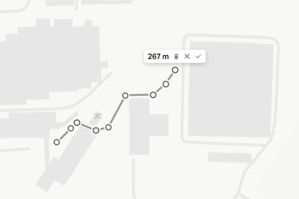
You can adjust the resulting line:
-
Click any point and drag it to another place.
-
If you click the line anywhere, a new point appears. You can also drag it around the map.
-
Click any point. You'll see the distance from the starting point to the selected point displayed next to it.
-
To delete a point, double-click it.
-
To delete the entire line, click X next to the end point.
-
To disable the ruler and delete the entire line, click X next to the end point.
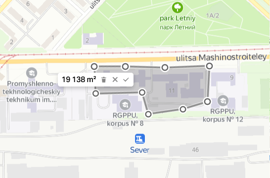
Measure the Area
You can measure the area of an arbitrary polygon.
To do this, follow these steps:
-
In the top-right corner of the page, click. Select Planimeter in the selector that appears on the left.
-
Select the starting point for the measurement on the map.
-
Select the next points to form a polygon.
You can adjust the resulting polygon:
-
Click any point and drag it to another place.
-
If you click the line anywhere, a new point appears. You can also drag it around the map.
-
To delete a point, double-click it.
-
You can drag the polygon to another place on the map.
-
To delete the entire polygon, click X next to the end point.
-
To delete the polygon and disable the planimeter, click X next to the end point.
Print a Map
-
Click and select Print. A preview window opens.
-
Zoom in and out on the map and drag it around if you need to.
Select:
Page format:
-
A3 (420 × 297 mm)
-
A4 (210 × 297 mm)
-
B4 (250 × 353 mm)
-
B5 (176 × 250 mm)
-
Letter (216 × 279 mm)
-
Legal (216 × 356 mm)
Page orientation:
-
Portrait: The vertical side of the sheet is longer.
-
Landscape: The horizontal side of the sheet is longer.
Write a comment if you need to. This text is printed below the map.
-
Click Print.
-
Select the printer and printing options.
-
Click Print again.
Get Directions
On Yango Maps, you can build and configure optimal routes and select your preferred mode of transportation.
Setting a Route
-
Click on the map or Route in the place card.
-
In the side menu, enter your start (From) and end (To) points.
You can:
-
Enter the address manually.
-
Select points on the map.
-
Specify coordinates.
-
Use the location data. To do this, click From → Use my location.
-
Use your home or work address from My places. To do this, click From or To and select an address.
-
If you need, you can change the route points. To do this, click the address and edit it.
-
You'll see the route options in the side menu and on the map.
The first option in the list is the best route according to the current Yango Maps data.
On the map, the route is shown as:
-
For cars, taxis, and ground public transport: A line in a color reflecting traffic conditions on the route.
-
For the metro: A line in the color of the metro line.
-
For walking routes: A purple dotted line.
-
For a bicycle route: A green line or blue if riding on a motor road.
-
Choose the route type:
Driving, walking, cycling, scooter, public transport, or taxi.
To do this, click the appropriate icon.
The route creator works with all types of public transport that operate within city limits and additionally with commuter buses and trains in some cities, for example, Belgrade, Ulaanbaatar, Bishkek.
-
Select a route option.
To do this, click the route in the list or the route line on the map. -
To see the details of a driving route or a public transport route, click Details in the side menu.
Changing the Route
To swap the start and end points of the route, click ↔ between the points.
Add Points to the Route
You can add up to eight points to your route.
To do this, follow these steps:
-
In the side menu, click Add a waypoint.
-
Set a new point.
-
To swap route points, click and drag the address where it needs to be.
The route will be reset automatically. -
To delete a point, hover the cursor over the point you want to delete. Click ✖, and the route will be reset.
Optimize the Route
You can automatically optimize a route if:
-
It is a pedestrian, driving, or public transport route.
-
It consists of 4 or more points.
To do this, click Optimize in the side menu.
Your route points will remain the same, but their order may change.
Adjust a Driving Route
You can change your driving route. Choose your preferred driving option:
-
Select a point along the route that you want to move and click it.
-
Hold the left mouse button and drag the point where it needs to go. The route will be reset automatically.
-
To delete an additional point, double-click it.
- Version16.8.0
- UpdateMay 26, 2025
- DeveloperDirect Cursus Computer Systems Trading LLC
- CategoryMaps & Navigation
- Requires AndroidAndroid 5.0+
- Downloads716K+
- Package Namecom.yango.maps.android
- Signaturedd87f1144151b06b25e120aab7d68eda
- Available on
- ReportFlag as inappropriate


Clear directions and instructions
Real-time traffic updates
Lane guidance assistance
Speed limit and camera alerts
User-friendly interface
Offline map functionality
Detailed road markings
Accurate navigation in certain areas
Incomplete location database
Slow response time
Buggy offline mode
Issues with Android Auto compatibility
Lack of alternate route suggestions
Poor search functionality
Unreliable real-time traffic data
Limited voice guidance quality