WHIO Weather - Live Weather Tracking & Alerts
Stay informed with real-time weather updates, interactive radar, & precise alerts tailored just for you.

- 5.17.705 Version
- 3.2 Score
- 184K+ Downloads
- Free License
- 3+ Content Rating

Stay updated on the weather conditions in your area in real-time. For years, you have enjoyed comprehensive weather reports for Dayton, Springfield, and all across Ohio on your computer and TV. Now you can access this information LIVE on your Android device!
Features Overview:
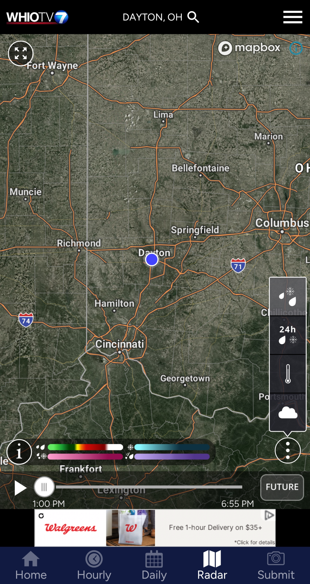
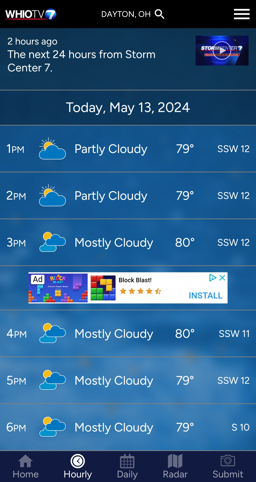
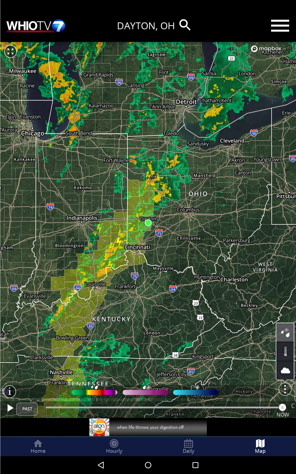
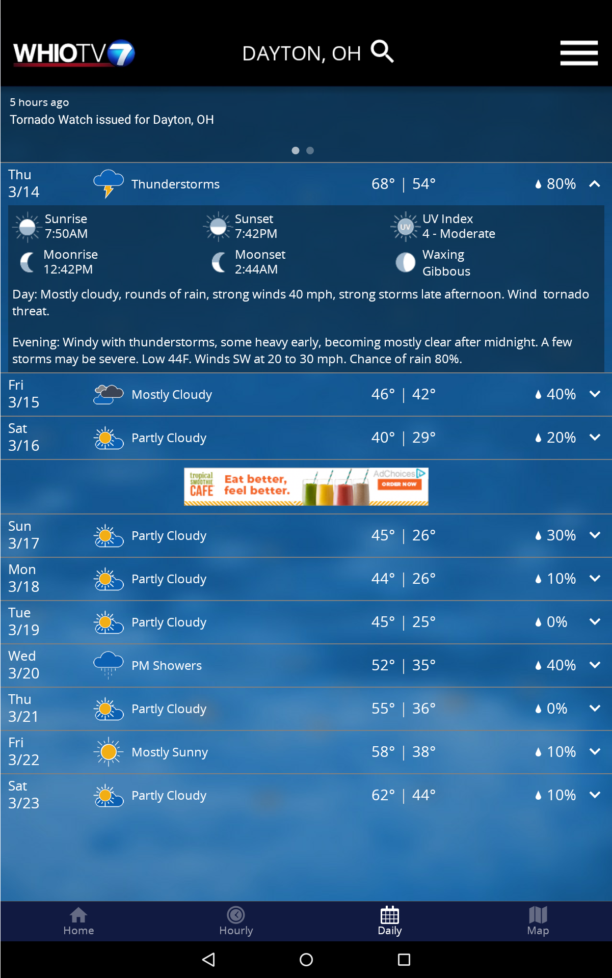
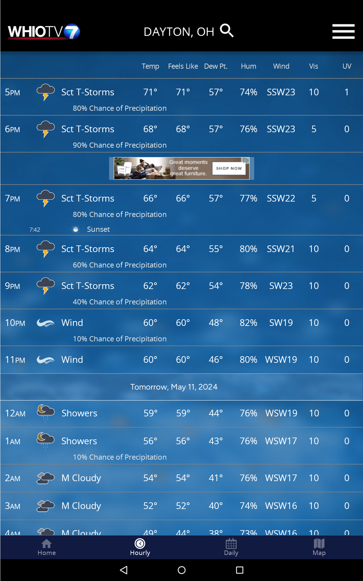
- The weather app includes a new radar system that mirrors the radar available on other digital platforms while offering future radar features to indicate potential storm paths and forecasts. This radar provides a 250-meter resolution, the highest option available.
- New tracking options - Earthquakes and storm tracks have been incorporated as layers in the radar. You can now monitor earthquake location and magnitude alongside storm speed, direction, and type. Tap the “storm symbols” icon on the radar to view the list.
- FREE push alerts available for over 25 types of alerts covering everything from tornado warnings to winter storm notifications and tropical storm alerts.
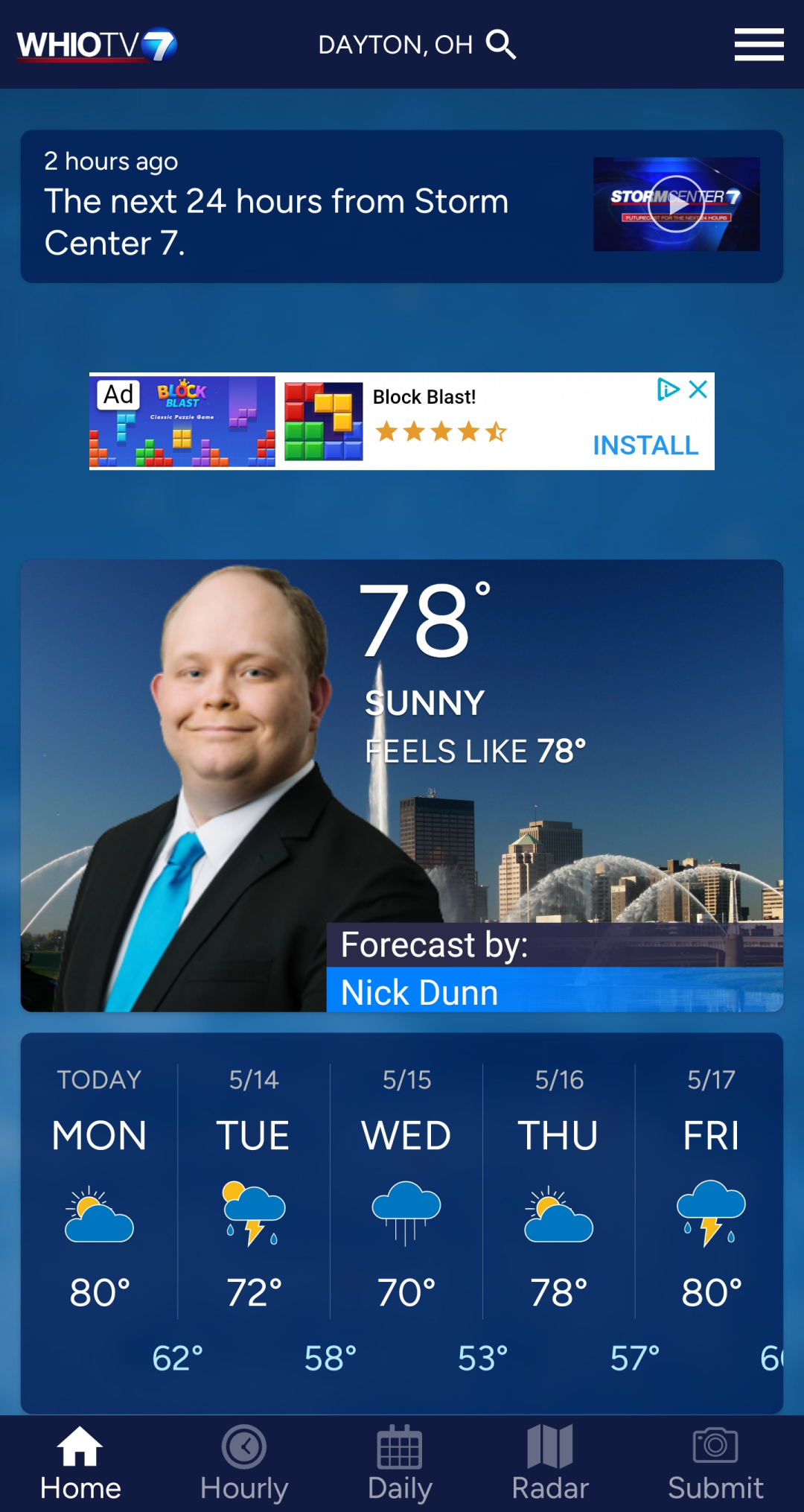
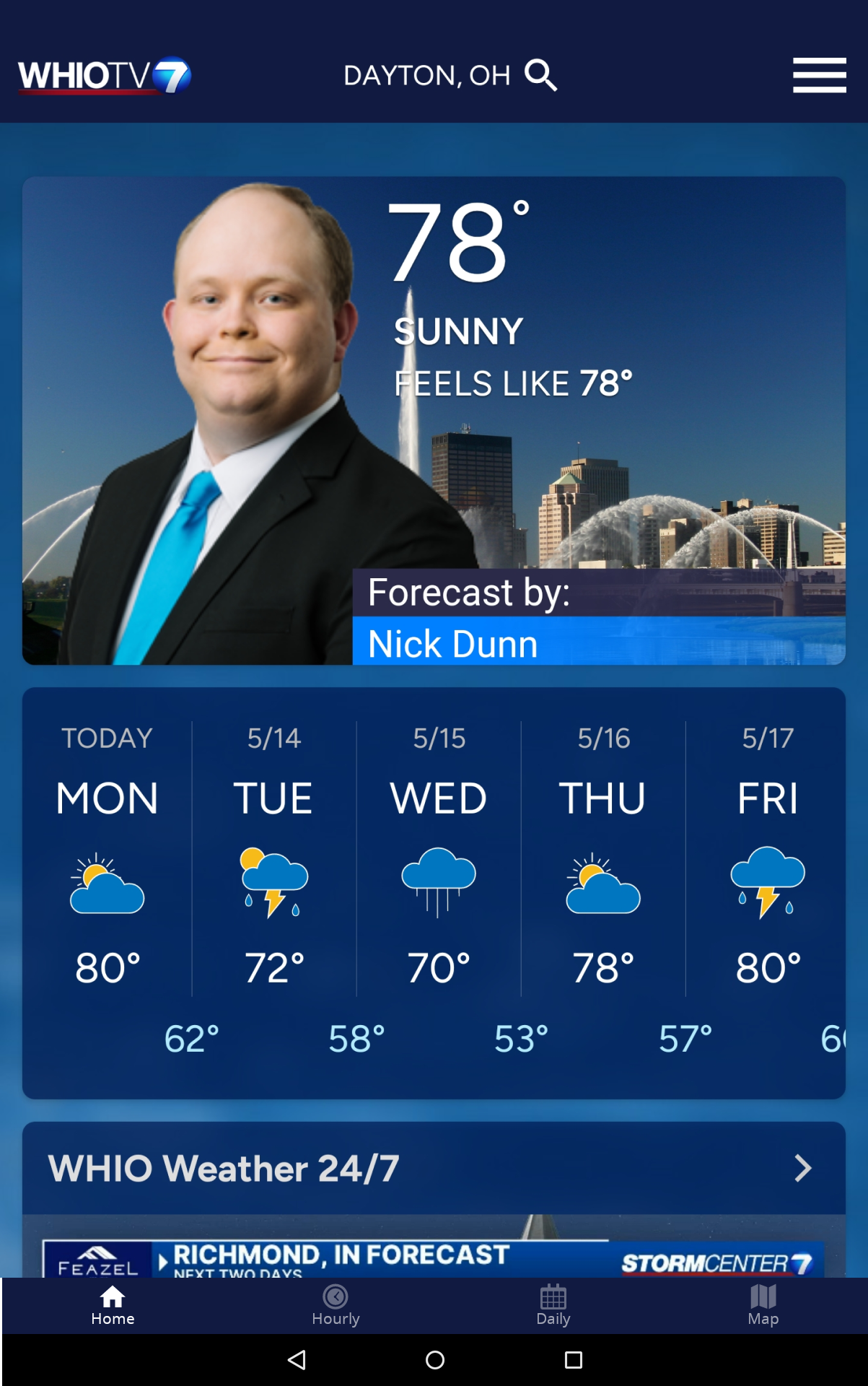
- You can now scroll through the home screen to find most of what you need or want conveniently located on one tab.
- Precisely place a location pin at any address or spot on the map. When you save a location, you have the freedom to name it as you prefer.
- The app offers consistent features on both tablet and mobile devices.
- Seasonal updates will provide additional items.
The weather application also offers these essential benefits and features:
- Zoom into your neighborhood with the radar or zoom out to assess conditions across the entire country.
- Location-Based alerts are available. Unlike many other applications that issue alerts by county, this app delivers a more specific type of alert tailored to the most significant weather threats. Enhanced precision ensures you receive relevant alerts, minimizing false alarms.
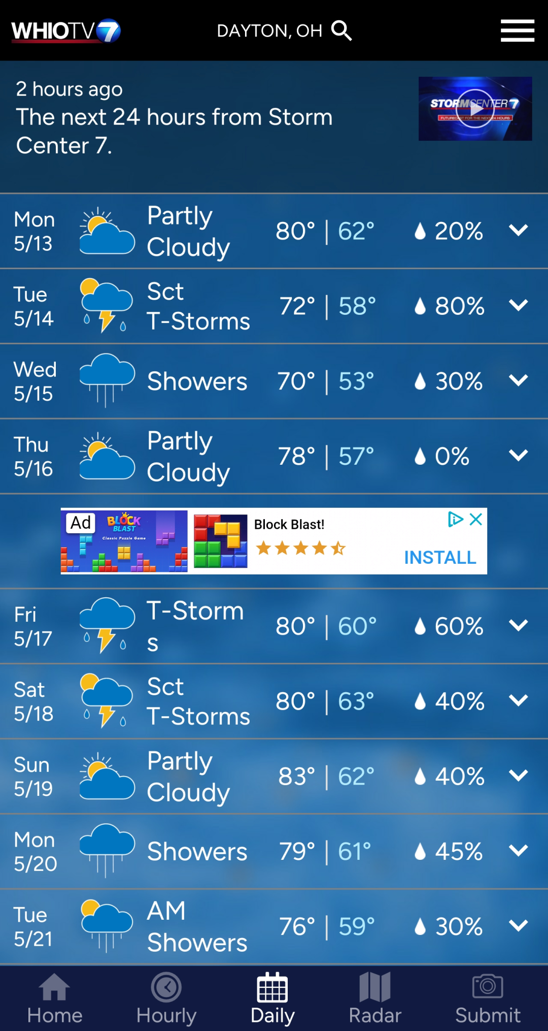
- Get current weather conditions, as well as hourly and daily forecasts for any location you input.
- High-resolution satellite cloud imagery is provided.
- Capability to add and save different locations.
- Fully integrated GPS for real-time location awareness.
- Seasonal additions will be made throughout the year.
*Data and alerts pertain exclusively to the United States.
Title: An Indispensable Tool for Precision Weather Tracking and Safety
My experience with this weather application has been transformative, setting a new standard for how I monitor and prepare for weather conditions. The high-resolution radar is its standout feature, offering an unparalleled level of detail that allows me to pinpoint storm activity right down to my neighborhood streets.
The ability to overlay real-time storm tracks and even earthquake data provides a comprehensive situational awareness that feels both advanced and incredibly practical. What truly sets this app apart, however, is its sophisticated alert system; receiving hyper-specific warnings for immediate threats like tornadoes, rather than broad county-wide alerts, minimizes anxiety and maximizes preparedness.
The interface is remarkably intuitive, consolidating current conditions, hourly forecasts, and radar into a seamless, scrollable view that makes finding critical information effortless. It has become an essential daily tool, providing not just forecasts but genuine peace of mind through its precise, reliable, and actionable data.
FAQ Section:
• How accurate and timely are the push alerts?
The alerts are exceptionally precise and rapid. Because they are based on specific threat polygons from the National Weather Service rather than entire counties, you receive warnings that are highly relevant to your exact location, often with crucial lead time.
• Does the app heavily drain battery life?
With typical use for checking forecasts and radar, the battery impact is minimal. Continuous use of the GPS for real-time location tracking or leaving the radar active for extended periods will consume more power, as is expected with any location-aware app.
• Can I use the app when traveling outside of Ohio?
Yes, the app covers the entire United States. You can add and save any location within the U.S. to get detailed forecasts and radar imagery for that area.
• Is an internet connection required for the radar to function?
Yes, a data connection is necessary to download the live radar imagery, forecast data, and alert information. Previously viewed areas are often cached, but real-time functionality requires connectivity.
- Version5.17.705
- UpdateOct 16, 2025
- DeveloperCox Media Group Inc.
- CategoryWeather
- Requires AndroidAndroid 9+
- Downloads184K+
- Package Namecom.cmgdigital.android.whioweather
- Signaturef4cb862e28974f03e501572c4e9c91c2
- Available on
- ReportFlag as inappropriate
-
NameSizeDownload
-
99.93 MB
-
108.11 MB
-
108.11 MB


Accurate weather forecasts
User-friendly interface
Quick access to radar and temperature maps
Reliable severe weather alerts
Trusted local news source
Useful for planning outdoor activities
Responsive meteorology team
Provides hourly and daily predictions
Frequent crashes when opened
Notifications often lead to blank screens
Slow or inaccurate radar updates
Overly crowded with advertisements
Uninstalling and reinstalling does not resolve issues
Inconsistent temperature readings
Lack of detailed weather information
Problems with notification settings