Earth Viewer - Live weather visualization
Explore animated Earth, view live weather & forecast data, and observe climate changes through stunning visualizations.
- 2.2 Version
- 3.0 Score
- 148K+ Downloads
- Free License
- 3+ Content Rating

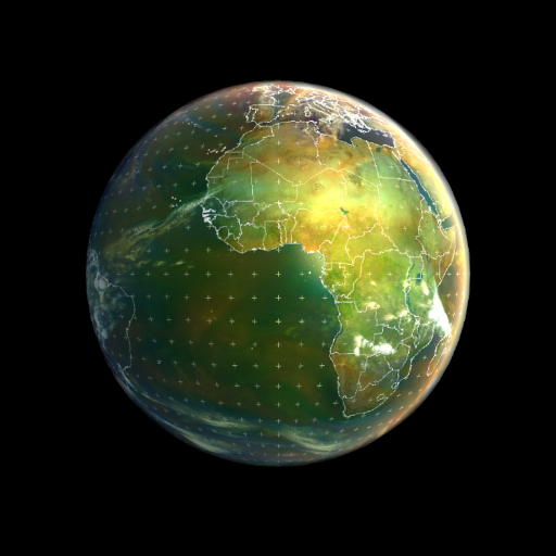
Earth Viewer
This application provides an animated representation of our planet, showcasing real-time weather conditions, satellite imagery, global forecasts, and historical data. It also visualizes datasets that are valuable for monitoring global warming.
To utilize the app, tap the three dots located in the upper right corner (settings) and choose a satellite view. The app will then initiate a download which may take a moment (internet access required—please be patient). Afterward, press play/pause to observe the weather dynamics.
Imagery included:
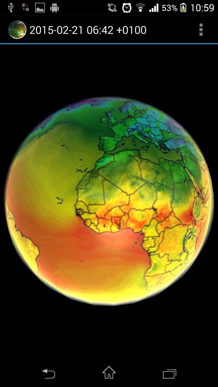
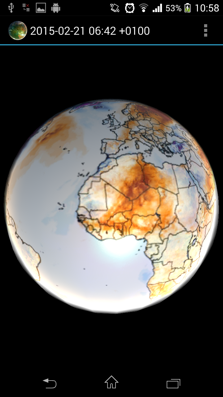
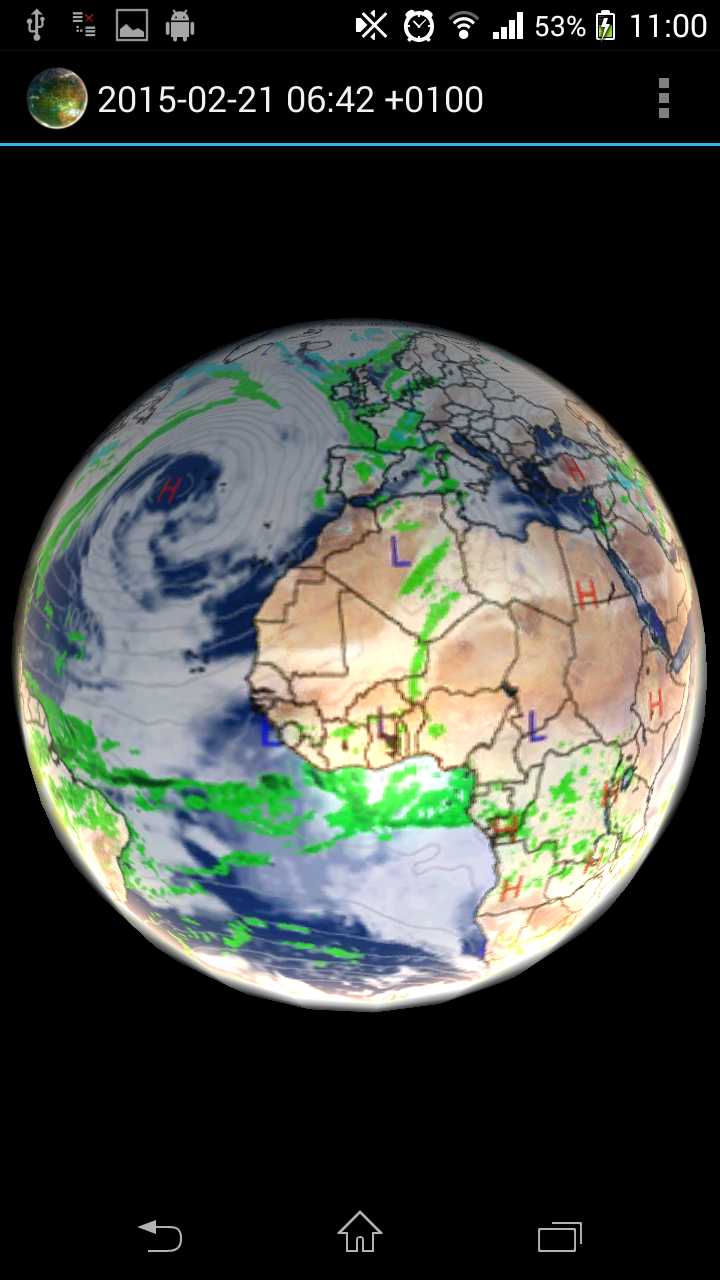
Climate Reanalyzer weather forecast
- Global GFS Precipitation and Clouds (+7d)
- Global GFS Air Temperature (+7d)
- Global GFS Air Temperature Anomaly (+7d)
- Global GFS Precipitable Water (+7d)
- Global GFS Surface Wind Speed (+7d)
- Global GFS Jetstream Wind Speed (+7d)
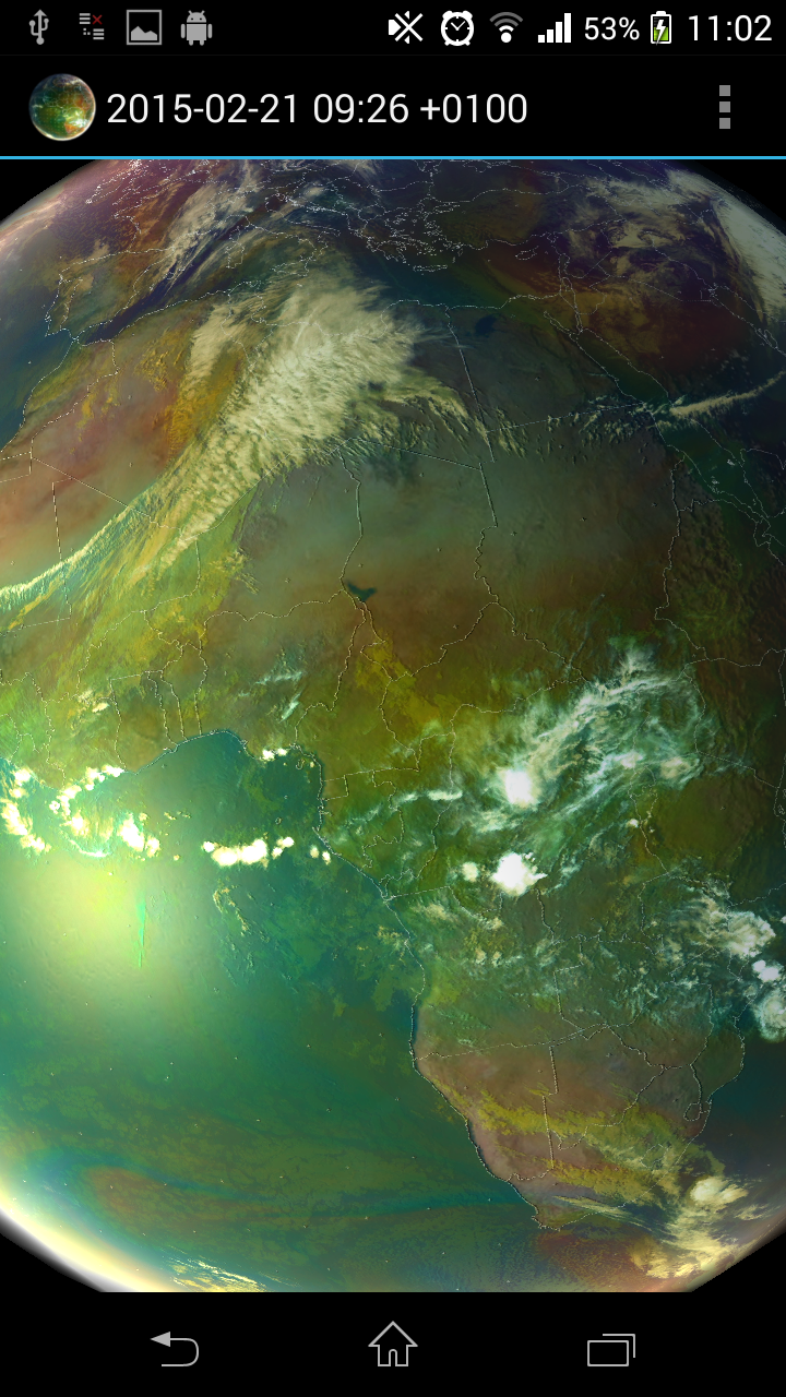
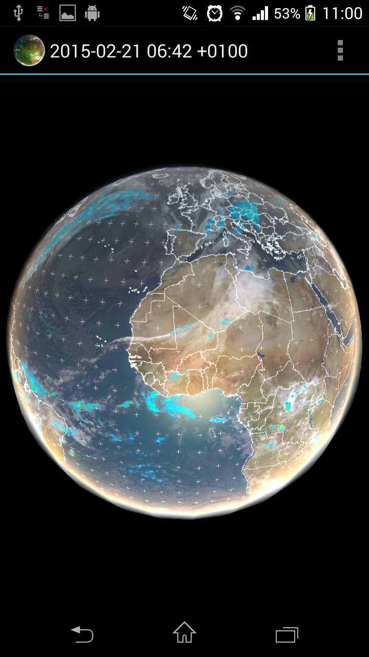
METEOSAT 0-degree satellite
- Airmass real-time imagery (-24h, generated every hour)
- High-resolution airmass imagery (-6h, generated every hour)
- Infrared 10.8 (-24h, generated every hour)
METEOSAT IODC satellite
- Infrared 10.8 (-24h, generated every three hours)
SSEC
- Low-resolution infrared global composite (-1 week, generated every three hours)
- Low-resolution water vapor global composite (-1 week, generated every three hours)
NOAA
- Northern Hemisphere Aurora 30-Minute Forecast (-24h)
- Southern Hemisphere Aurora 30-Minute Forecast (-24h)
Application features:
- Interpolation between images
- Image selection from a menu
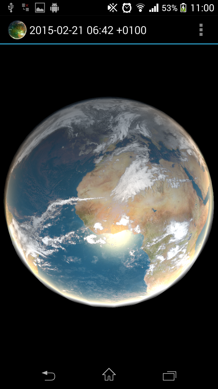
- Real-time sunlight effects
- Bump mapping technology
- Offline data caching
- Double-tap functionality to start/stop animation
Limitations
Some devices may experience issues launching the application, resulting in crashes. This is often due to insufficient graphics card capabilities or limited memory on the device. The application utilizes OpenGL ES 2.0 and employs advanced pixel shaders with multitexturing.
The application operates as a local image viewer that accesses publicly available content from the internet on the user’s behalf. Data is internally cached, and only changes are downloaded. There are no guarantees regarding the availability of downloaded data; however, the app can function without internet connectivity.
The program is shared with the hope that it will be beneficial, but it comes WITHOUT ANY WARRANTY.
Title: A Humbling and Mesmerizing Window onto Our Living Planet
My experience with Earth Viewer has been nothing short of transformative, offering a perspective on our world that is both profoundly educational and deeply moving. This application is far more than a simple weather tool; it is a dynamic, interactive globe that makes the invisible forces shaping our climate tangibly visible. I have spent countless hours mesmerized by the graceful, swirling dance of global cloud patterns, watching real-time weather systems march across continents.
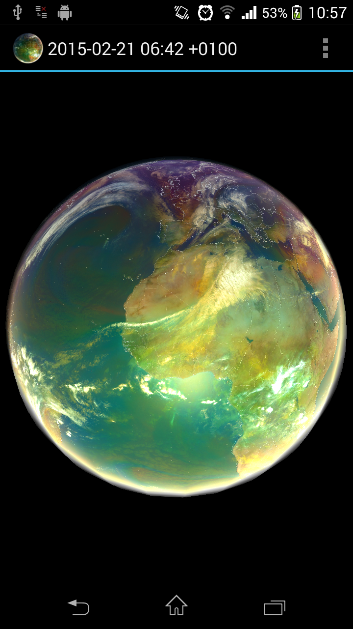
The ability to overlay different datasets, such as switching from a standard infrared view to the stark visualizations of temperature anomalies, provides an immediate and intuitive understanding of complex climatic events. I was particularly captivated by the aurora forecasts, which added an element of celestial wonder to the experience. The bump mapping and real-time sunlight effects create a stunningly realistic, three-dimensional sphere that feels like you are holding the planet in your hands. It’s this powerful combination of scientific rigor and breathtaking visual artistry that makes Earth Viewer an essential app for anyone curious about meteorology, climate science, or simply the majestic beauty of our home planet.
FAQ:
• Q: My app crashes on startup. What can I do?
◦ A: This is typically due to the device's graphics capabilities. The app uses advanced OpenGL ES 2.0 rendering. Ensure your device is not overly outdated and that you have sufficient free memory. Closing other running applications before launching may help free up necessary resources.
• Q: Can I use the app to see past weather data?
◦ A: Yes, to an extent. While the primary focus is on real-time and forecast data, many of the satellite imagery layers offer archives ranging from 6 hours to a full week in the past, allowing you to review recent weather events.
• Q: Does the app require a constant internet connection?
◦ A: An internet connection is required to download new imagery and data. However, once data is downloaded, it is cached locally, so you can still view and animate the cached datasets without an active connection, making it useful for later reference.
- Version2.2
- UpdateOct 24, 2025
- DeveloperH21 lab
- CategoryWeather
- Requires AndroidAndroid 3.0+
- Downloads148K+
- Package Namemobile.application.forfree.earth
- Signature8bff0a0c0e59f1fff1da1cfeff831551
- Available on
- ReportFlag as inappropriate
-
NameSizeDownload
-
3.51 MB
-
3.50 MB
-
4.33 MB


True global cloud map available
New features enhance user experience
No advertisements for uninterrupted use
Beautiful and informative display of data
Useful for understanding weather patterns
Future potential in weather forecasting
Ability to check current weather and cloud cover
Option for infrared viewing
Saves time with worldwide coverage
Lack of introductory guide for new users
Buttons are not clearly labeled or distinguishable
Missing geographical labels for cities and countries
Zoom feature lags and does not function smoothly
Real-time updates on clouds can be slow or inconsistent
Occasional freezing or black screens during use
Outdated satellite images in some cases
Insufficient detail when zooming in on specific areas
Missing color-key for data interpretation