UDOT Traffic - Traffic info & alerts
Stay updated on Utah's traffic conditions, accidents, and weather with real-time maps & alerts for safer travels.
- 4.6 Version
- 2.7 Score
- 249K+ Downloads
- Free License
- 3+ Content Rating

The UDOT Traffic app offers commuters and travelers mobile access to information regarding Utah's roadways, sourced from the Intelligent Transportation System (ITS) managed by the Utah Department of Transportation.
The information accessible through the app includes:
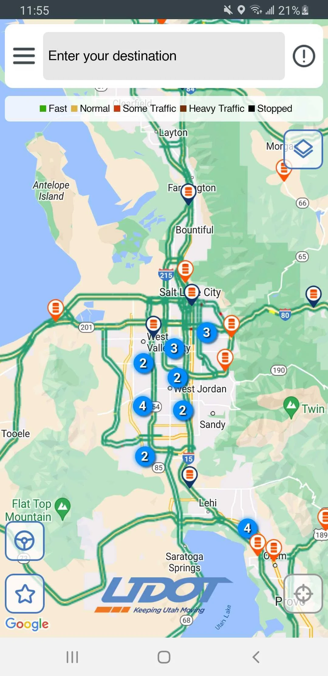
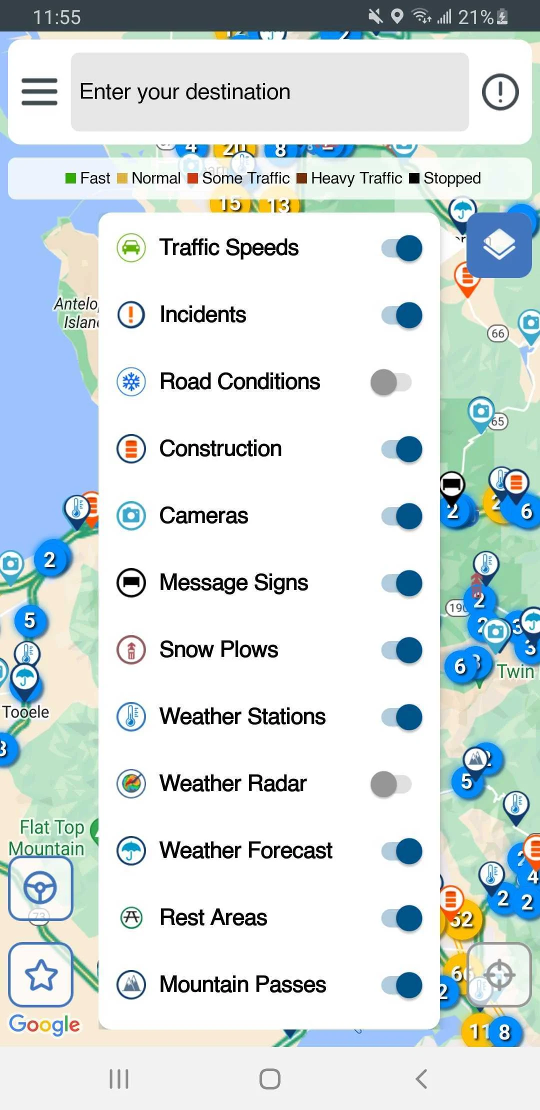
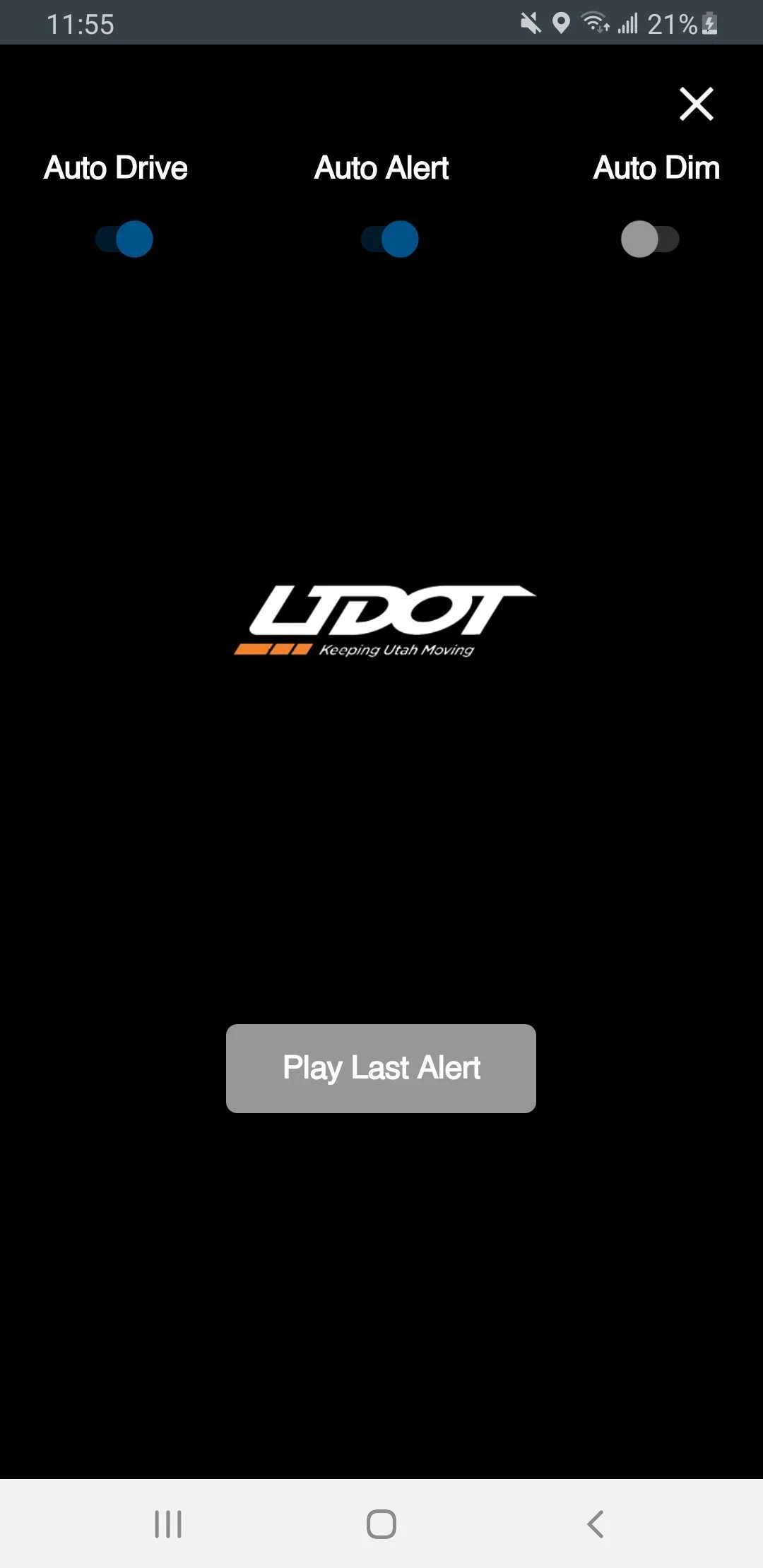
1) An interactive map that is zoomable and scrollable
2) Real-time traffic conditions on major highways and main surface streets in Utah
3) Reports on accidents, construction activities, and other roadway hazards
4) Information on special events impacting traffic, such as sports events
5) Current weather conditions for roads along with forecasts
6) Status updates on seasonal road closures
7) Images from closed-circuit television (CCTV) traffic cameras
8) Messages displayed on electronic roadway signs
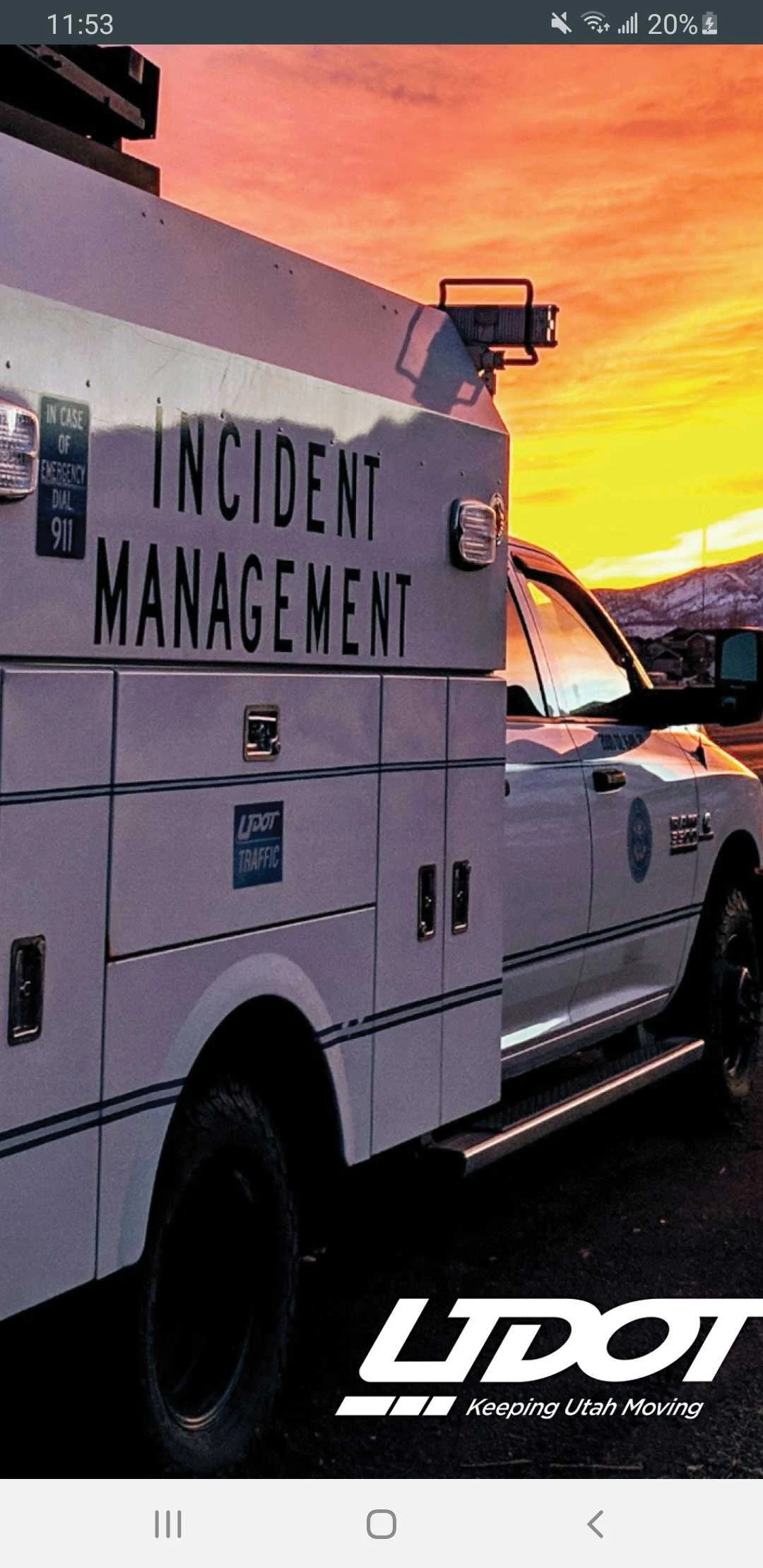
UDOT's Intelligent Transportation System (ITS) employs technology aimed at enhancing safety, efficiency, and cost-effectiveness.
This system is automated and works to oversee and regulate traffic flow on freeways and significant surface streets. Its components comprise CCTV cameras, electronic message boards, sensors for traffic speed and volume, pavement sensors, and sensors for weather conditions.
UDOT Traffic: The Road Whisperer That Saved Me From I-15 Hell
As a Salt Lake City newbie navigating monsoon season, I expected white-knuckle commutes—not this app transforming my dashboard into a crystal ball. The moment flashing red “ACCIDENT” tags pulsed on I-15 while Google Maps showed clear sailing, UDOT Traffic became my co-pilot. Watching live CCTV feeds revealed a jackknifed semi miles ahead; one tap rerouted me through surface streets before gridlock swallowed me whole. But its genius unfolded during a blizzard: pavement sensors flagged black ice near Parley’s Canyon while electronic sign warnings (“CHAINS REQUIRED”) flashed on my screen—all as weather forecasts updated minute-by-minute.
Now I plan drives like a tactician: checking construction zones before heading to Provo, timing Jazz game exits using event alerts, even spotting rogue cows on rural Route 6 via camera scrolls. It’s not just data—it’s roadway telepathy, turning anxiety into empowered precision. That snowy night it guided me home through spinning tires and zero visibility? I owe it my deductible.
Frequently Asked Questions:
Q: How real-time are camera feeds/incident alerts?
A: Cameras refresh every 20-60 sec. Accident/closure alerts post within 90 sec of UDOT verification—often faster than police scanners.
Q: Does it cover ALL Utah roads or just interstates?
A: Comprehensive! Includes state highways (SR-201, US-89) + major surface streets in 15 counties. Rural routes have sparser cameras but full hazard reporting.
Q: Battery drain during long drives?
A: Moderate (≈10%/hour). Enable “Driving Mode” to reduce background refresh when parked.
Q: Can I report hazards through the app?
A: No—but integrates with 511 Utah for call/text reporting. App displays verified incidents only to prevent misinformation.
Q: How accurate are road weather forecasts?
A: Hyperlocal! Pavement sensors provide temp/ice risk within 1-mile segments. Alerts trigger when frost forms on your route.
Q: Event traffic predictions for concerts/games?
A: Yes! Aggregates historic data + real-time flow to estimate delays (e.g., “Expect 45-min exit delay post-Utes game”).
Q: Offline functionality?
A: Limited. Saves bookmarked cameras/routes, but real-time features require cellular/Wi-Fi.
Q: Difference vs. Google Maps/Waze?
A: UDOT uses official sensors/signs—no crowd-sourcing. More reliable for closures/ice, less for police traps.
Q: Free forever? Any ads?
A: 100% free, ad-free, no subscriptions—funded by Utah taxpayers.
Q: Camera privacy concerns?
A: All feeds are public domain per Utah law. No recording/storage—streaming-only.
- Version4.6
- UpdateAug 30, 2025
- DeveloperUDOT
- CategoryTravel & Local
- Requires AndroidAndroid 8.0+
- Downloads249K+
- Package Namecom.transcore.android.commuterLink
- Signaturec74255b9105c4cb75da28318f9876bc6
- Available on
- ReportFlag as inappropriate
-
NameSizeDownload
-
123.13 MB
-
121.00 MB
-
57.61 MB


Real-time traffic reports are helpful.
Cameras provide views along commuting routes.
Enhanced visibility of snow plow activity.
Updated map functionality has removed zoom issues.
Allows viewing of webcams for weather and road conditions.
Useful for planning driving routes in adverse weather.
Accurate information on construction and accidents.
Can check multiple locations efficiently when set up correctly.
Frequent crashes and loading failures on multiple devices.
New design complicates user experience with overloaded visuals.
Required permissions invasion raises privacy concerns.
Map tends to revert to the user's GPS location, limiting exploration.
Many cameras non-functional or out of service.
Lack of clarity on alerts and notifications overload.
Difficult navigation between functions due to poor UI.
Older features that worked well have been removed or altered.