MapCam - Geo Camera & Collages - Photo location & sharing
Capture, organize & share stunning geo-tagged photos effortlessly with creative captions and seamless storage options.
- 5.1.2 Version
- 3.2 Score
- 259K+ Downloads
- In-app purchases License
- 3+ Content Rating

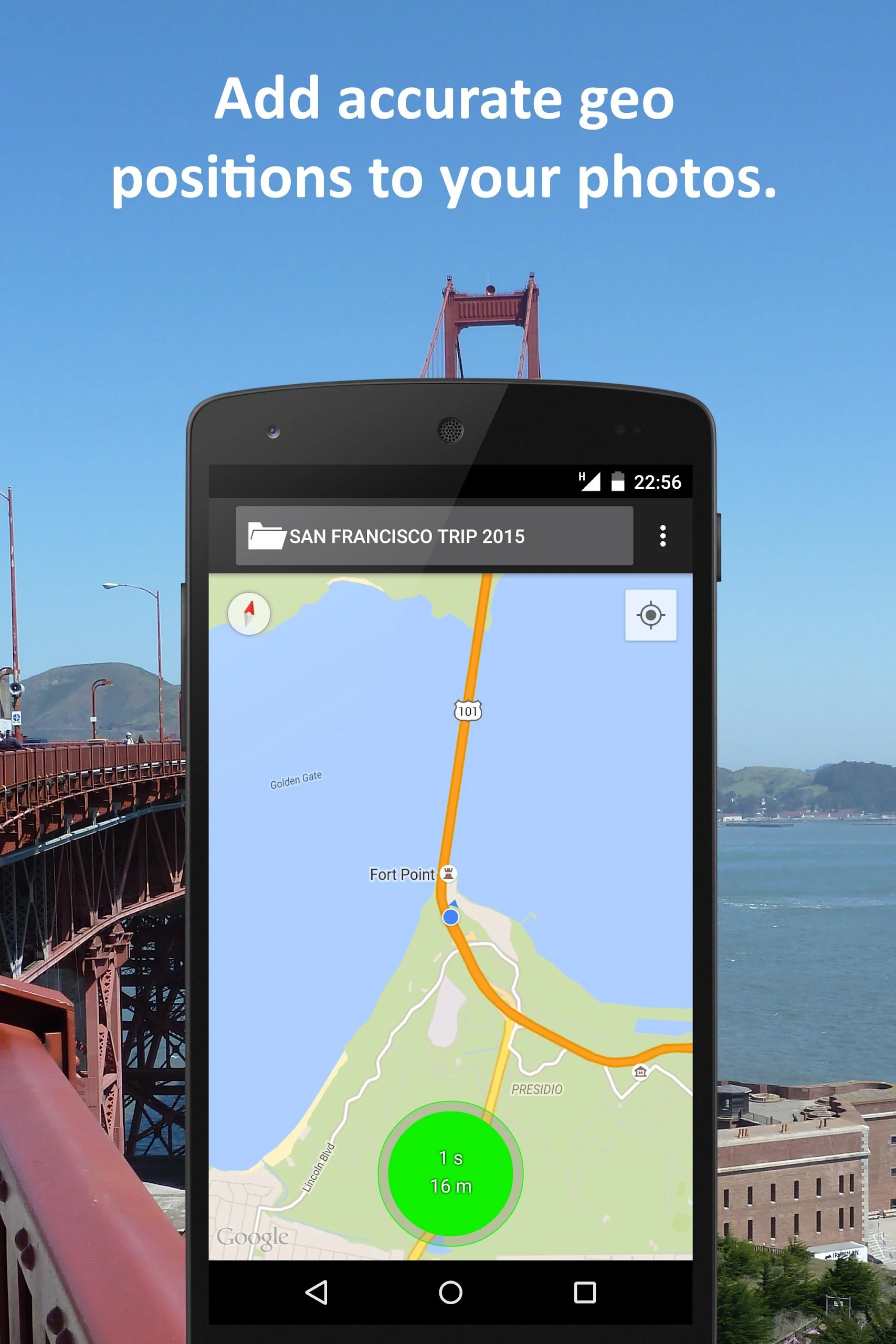
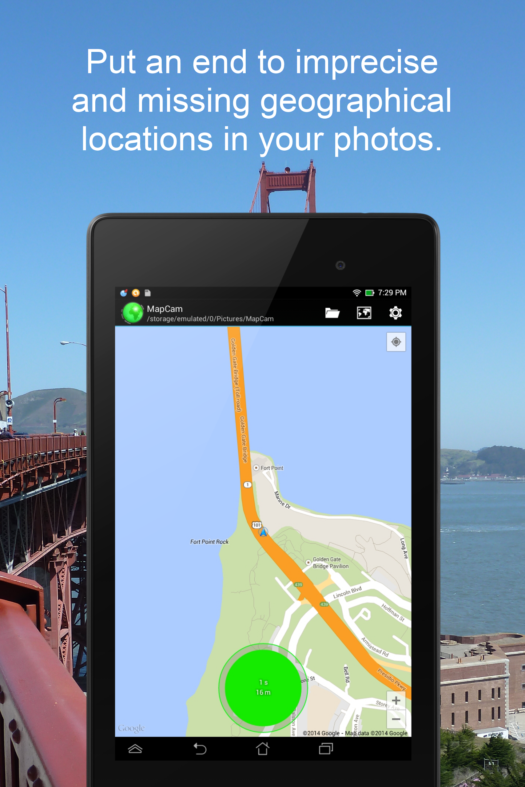
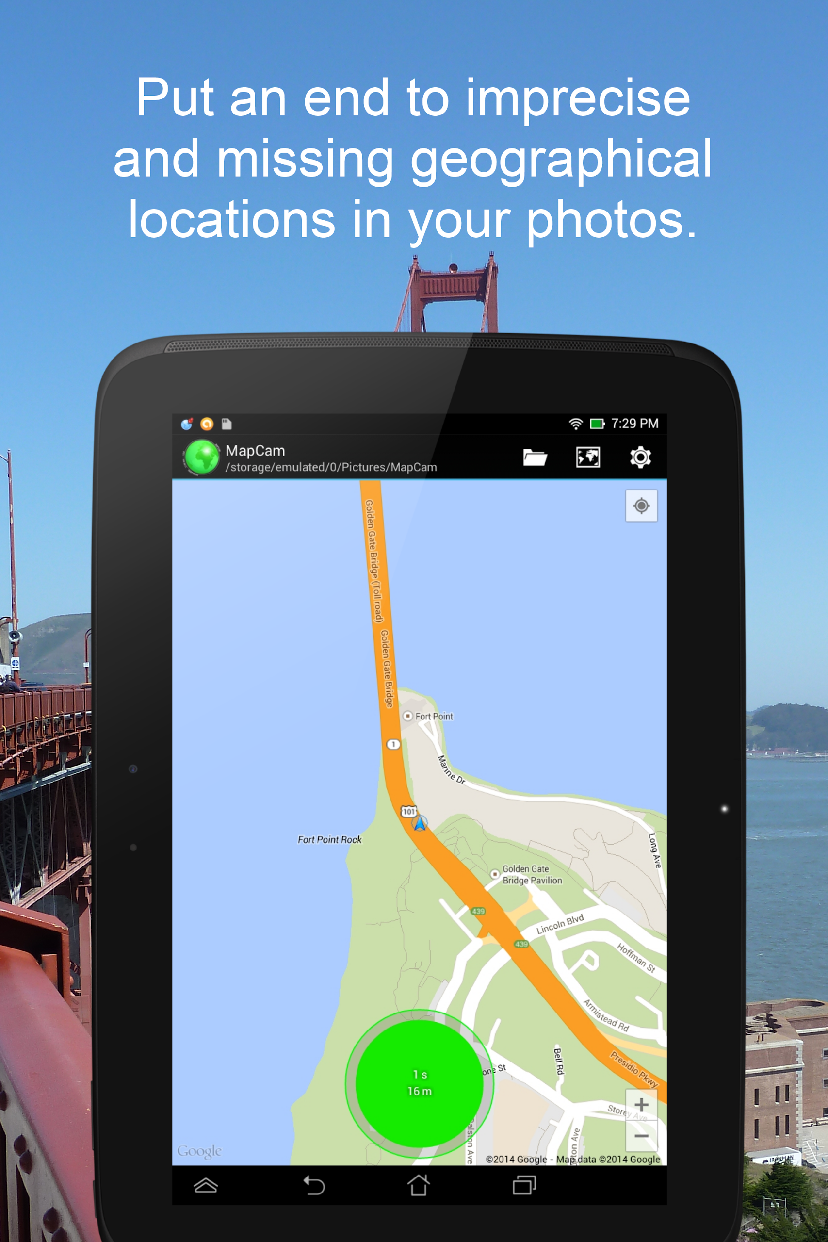
Eliminate inaccuracies and omissions in the geographical location data (GPS coordinates) of your images. Prior to capturing your photos, arrange them by easily selecting a specific storage folder. Enhance your images by adding captions. Observe your photos along with their geographical positions on a global map. Create stunning geo photo collages and share them with your friends.
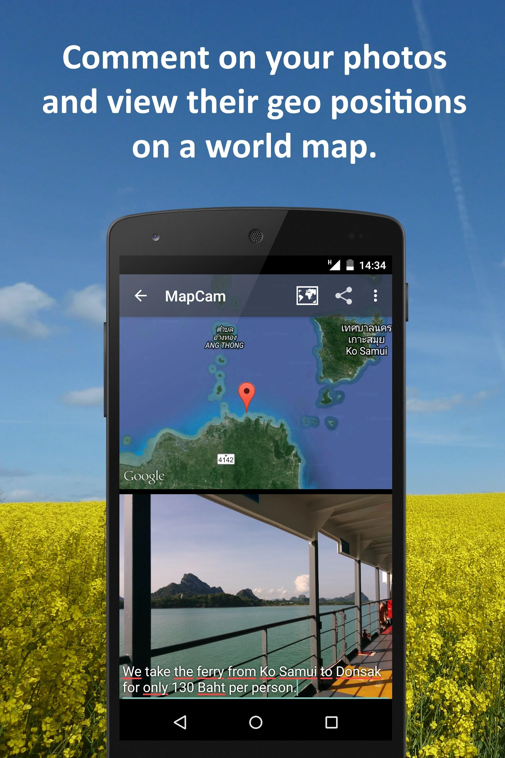
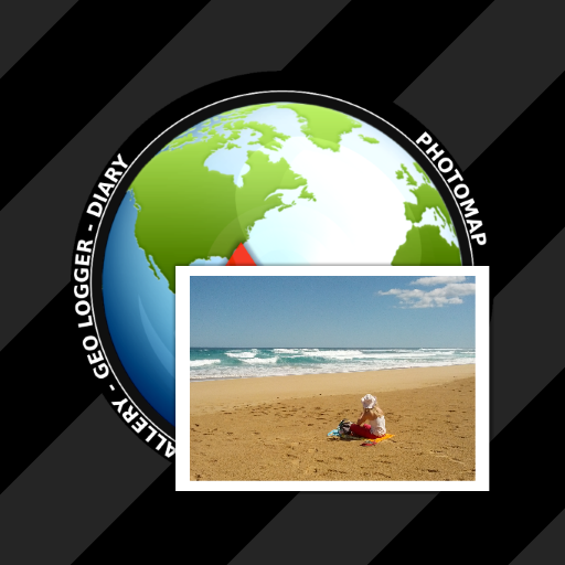
MapCam collaborates seamlessly with your preferred camera application, storing extra metadata within your photo files. This allows you, for instance, to see your pictures and their associated captions displayed on a world map at the locations where they were taken (refer to my applications EagleEye and PhotoMap). This functionality allows you to relive your journeys by virtually hopping from one site to another.
MapCam provides a range of features:
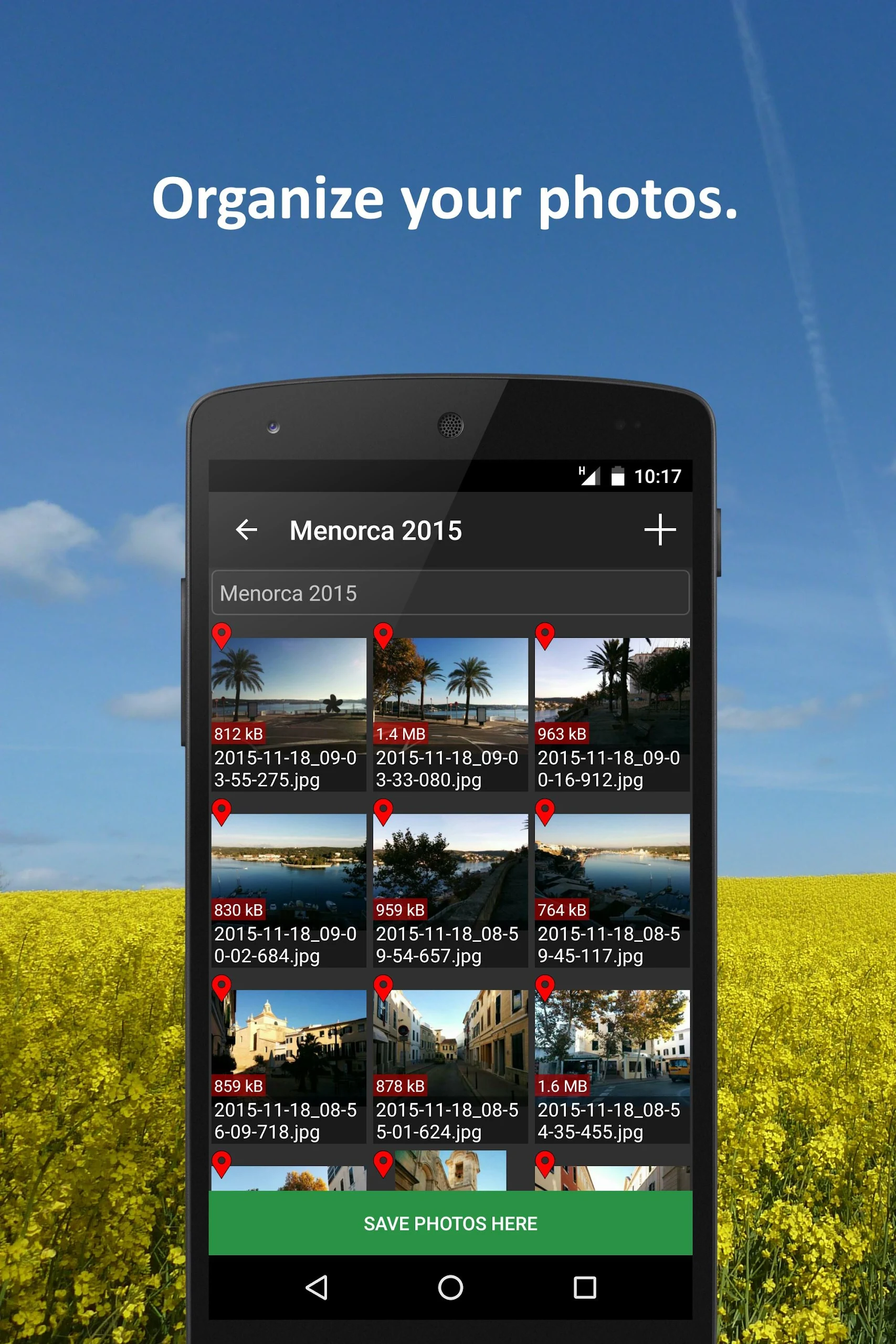
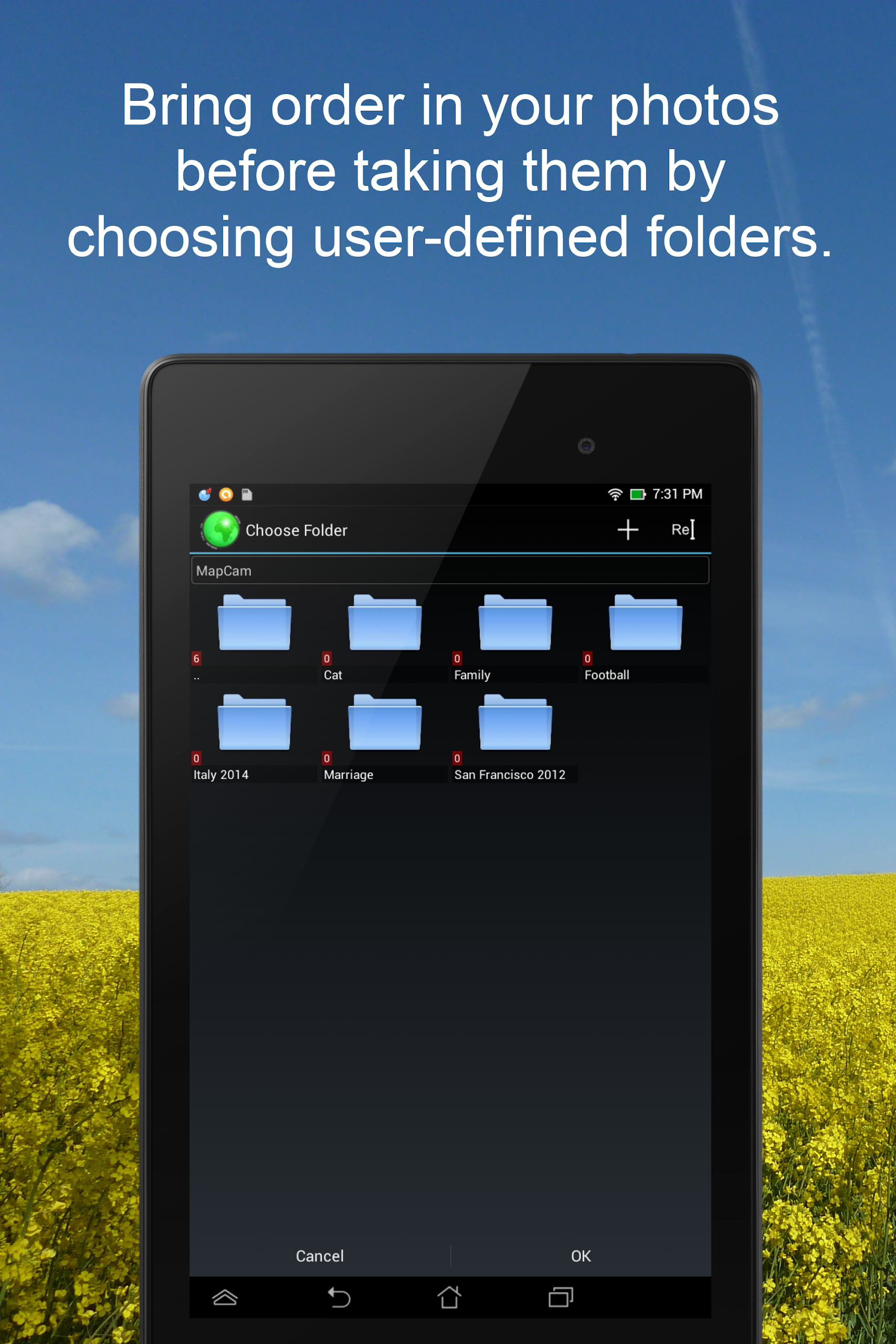
✔ Effortlessly create and choose storage folders for your images before capturing them.
✔ Automatically save the most accurate latitude/longitude and elevation (in meters above sea level) within the Exif data of your photo files.
✔ Add informative text or captions to your images. This information is stored in the IPTC metadata of your photo file without altering the actual image. Picasa can read and display these captions on your computer.
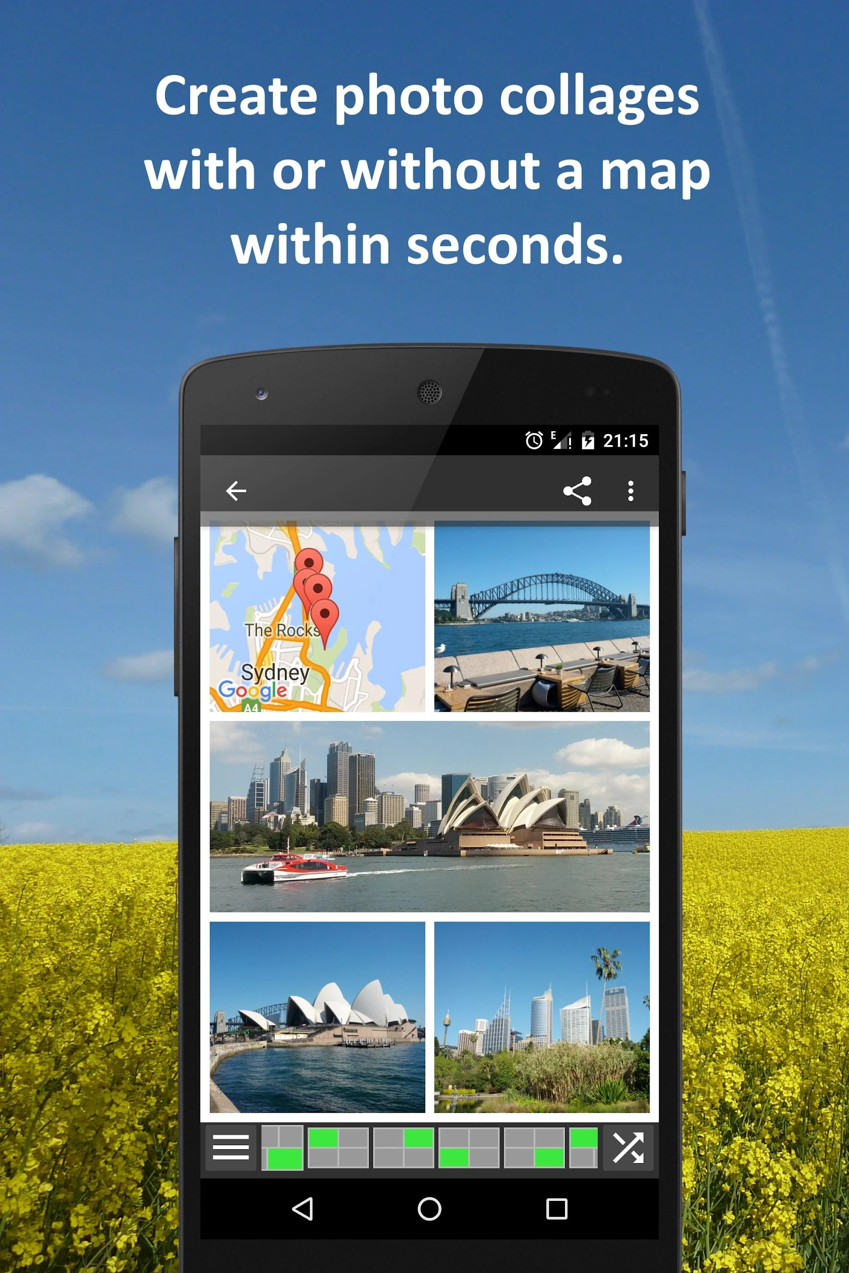
✔ Generate geo photo collages that combine maps and images.
✔ Share your photos immediately after taking them through various platforms.
✔ Utilize existing camera applications. Numerous apps are compatible, including many preinstalled ones like Camera MX, Cymera, LINE camera, pudding camera, Camera FV-5 Lite, Camera360 Ultimate, etc.
Using MapCam is straightforward:
1.Press the round button once you are satisfied with the detected location. The button will appear large and light green when the position is accurate; it will turn small and red if the location is inaccurate.
2.Capture your image:MapCam activates your default or chosen camera app and logs the most precise location into your photo file's Exif data。
3.Optionally, include a descriptive caption and share your photo.
Consider using MapCam if the location and details of your photos matter to you. Here are some scenarios where it can be utilized:
★ While traveling, during vacations, business trips, camping, at the beach, airports, train stations, museums, etc.
★ To document places such as properties, residences, vehicles, hotels, hostels, restaurants, workplaces, schools, parking facilities, etc.
★ In sports activities like cycling, rowing, running, jogging, skiing, snowboarding, hiking, exercising, playing soccer, etc.
★ When attending special events such as concerts, festivals, soccer games, tennis matches, etc.
★ As a visitor at parks, flea markets, zoos, amusement parks, Christmas markets, etc.
★ During weekend family outings, parties, celebrations, at bars/nightclubs, clubs, for capturing nightlife, etc.
★ When gathering with friends at malls, playgrounds, shopping, in restaurants, etc.
★ On special occasions like birthdays, weddings, celebrations, parades, etc.
★ In case of disasters such as earthquakes, storm surges, floods, tsunamis, storms, hurricanes, forest fires, etc.
MapCam is particularly beneficial for professionals in various fields, including real estate agents, traders, craftsmen, firefighters, police officers, construction workers, drivers (including truck and taxi drivers), event organizers, foresters, gardeners, custodians, pilots, military personnel, and more.
Title: MapCam: The Indispensable Tool for the Discerning Photographer and Traveler
My experience with MapCam has fundamentally transformed how I document and relive my journeys, elevating it from a simple utility to an essential part of my photography workflow. What truly sets this application apart is its unwavering commitment to data integrity; the precision with which it logs and, when necessary, corrects GPS coordinates directly into the EXIF data is remarkable, ensuring that every photo becomes a pin on a map with unerring accuracy.
I've found immense value in the ability to add descriptive captions directly to the image's metadata before even leaving the scene—this has turned my photo library from a chaotic collection into a meticulously organized visual diary. The feature to then view these geotagged images on a global map is not just a novelty; it's a powerful storytelling tool that allows me to trace the exact path of a hiking trip or revisit a city tour with perfect contextual memory. The geo photo collages are a delightful way to create and share summaries of an entire vacation in a single, impactful image. For anyone who cherishes their memories and believes in the power of location to give them context, MapCam is an invaluable, professionally-minded application that delivers on its promises with impressive reliability.
FAQ:
• Q: Does using MapCam require me to abandon my favorite camera app?
A: Not at all. MapCam is designed to work seamlessly alongside your preferred camera application. It triggers your chosen camera to take the photo and then automatically writes the enhanced location data and captions into the image file afterward.
• Q: How does the app handle location accuracy, especially indoors?
A: The app provides clear visual feedback. A large, light green button indicates a highly accurate GPS lock, while a small, red button signals poor accuracy, allowing you to wait for a better signal or manually correct the location before capturing.
• Q: Is the caption data stored in a way that other software can read it?
A: Yes, captions are written into the standardized IPTC metadata within the image file itself. This means they are portable and can be viewed by many popular photo management applications on your computer, such as Adobe Lightroom or Picasa.
- Version5.1.2
- UpdateOct 22, 2025
- DeveloperDr. Ludger Bischofs
- CategoryPhotography
- Requires AndroidAndroid 4.4+
- Downloads259K+
- Package Nameeu.bischofs.mapcam
- Signature244d8bfbd4e79569a95420efe8657a8b
- Available on
- ReportFlag as inappropriate
-
NameSizeDownload
-
2.22 MB
-
2.17 MB
-
2.16 MB


Fast and simple app for organizing photos
Encoded GPS data displayed quickly on map
Facilitates accurate documentation with geotagging
Useful for inspection documentation and fields notes integration
Allows users to remember locations of pictures easily
Impressive settings available for personalization
Easy cataloging without retracing steps
Works well on various devices like Galaxy S3
Location map occasionally fails to appear
Issues when used with certain camera apps
Continually runs in the background, draining battery
Lack of instructions makes app usage challenging
Can't save satellite images as expected
Confusion over duplicate image files created
Only available in metric units
Limited functionality without internet connection
Frequent permission requests even when not actively used