Landreport.in - Private land mapping tool
Discover property boundaries & dimensions with ease for informed real estate decisions using our innovative mapping app.

- 2025030501 Version
- 1.4 Score
- 1M+ Downloads
- Free License
- 3+ Content Rating


⚠️ Important Notice:
This application has no connection with the Government of Maharashtra or any official land revenue agency. It functions as an independent service that offers mapping tools utilizing information accessible to the public. Users are encouraged to confirm official land records via the Maharashtra Bhulekh website or through appropriate government offices.
Landreport is a private tool for land mapping, aimed at aiding landowners, property buyers, and real estate professionals in viewing property boundaries, measuring land areas, and identifying survey numbers on a digital platform. The app plays a crucial role in estimating property dimensions and understanding land divisions prior to making decisions in real estate.
📌 Key Features:
✔ View Land Boundaries – Access estimated property limits on a digital map (Applicable only in Maharashtra).
✔ Survey Number Lookup – Locate approximate land survey numbers using coordinates from the map.
✔ Measure Land Area – Use a digital tool to calculate the size of plots.
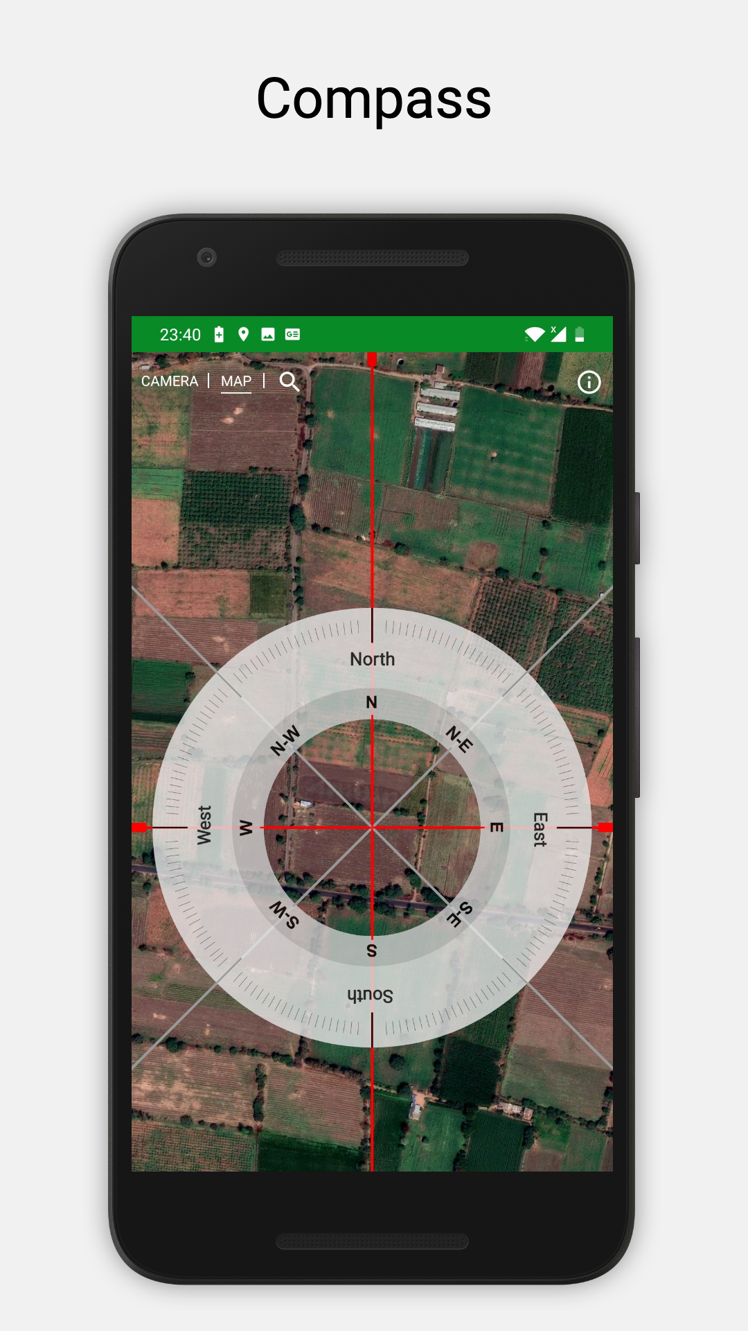
✔ Advanced Compass – Acquire accurate directions for civil work and land marking.
✔ Unit Converter – Easily switch between Acre, Guntha, Square meter, and Square foot.
✔ Avoid Fraud – Aids in verifying land details prior to purchase decisions.
✔ Instant Land Reports – Obtain an estimated mapping of land based on existing survey data.
More details
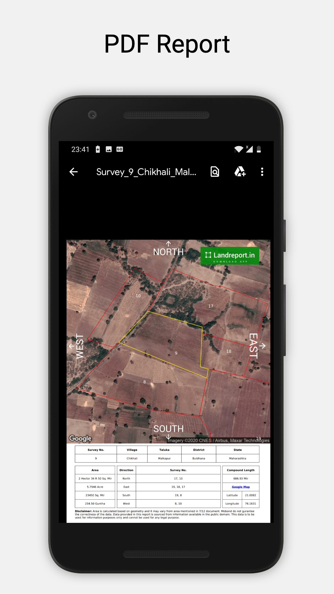
Instant 7/12 Survey map / Gav Nakasha
While buying the land quick verification of the land is necessary. It is very essential that land being shown to you and its 7/12 document & Gav Nakasha are matching.
Knowing boundaries of the land is very important. Landreport.in helps you to locate the land boundaries on map from its 7/12 number instantly for lands located in Maharashtra.
It also works in reverse manner, you can find the 7/12 survey number of the land from its location.
Land report costs you very little but it saves future encumbrances.
Using 7/12 number find land map
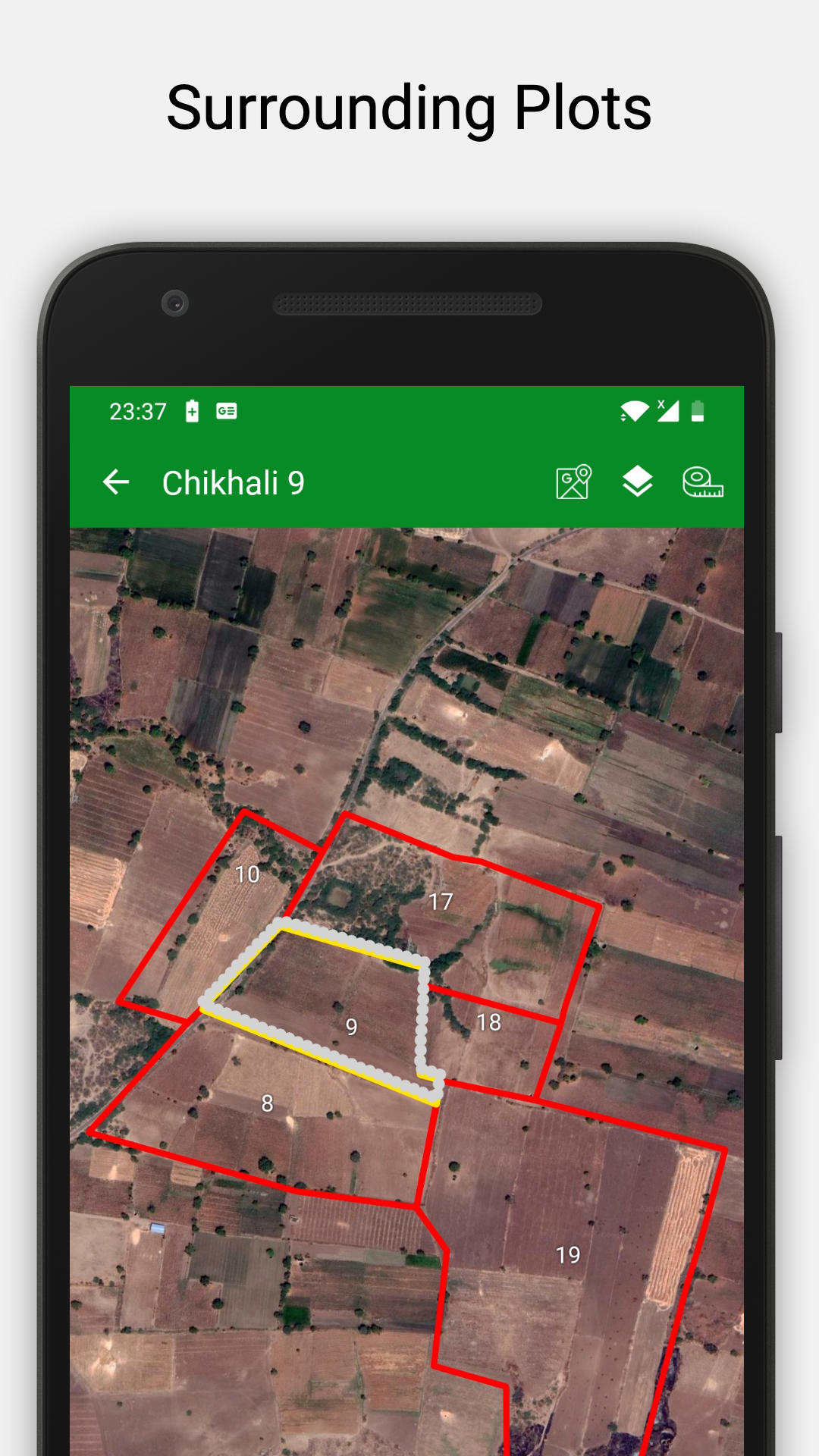
Select your District, Taluka, Village & Survey Number and get the map of the land on Map.
You will get the boundry of that land and surrounding lands. You can adjust the boudry to match with physical features.
You will also get the tabular information of plots surrounding your plot which is very crucial information to be put in a sale deed.
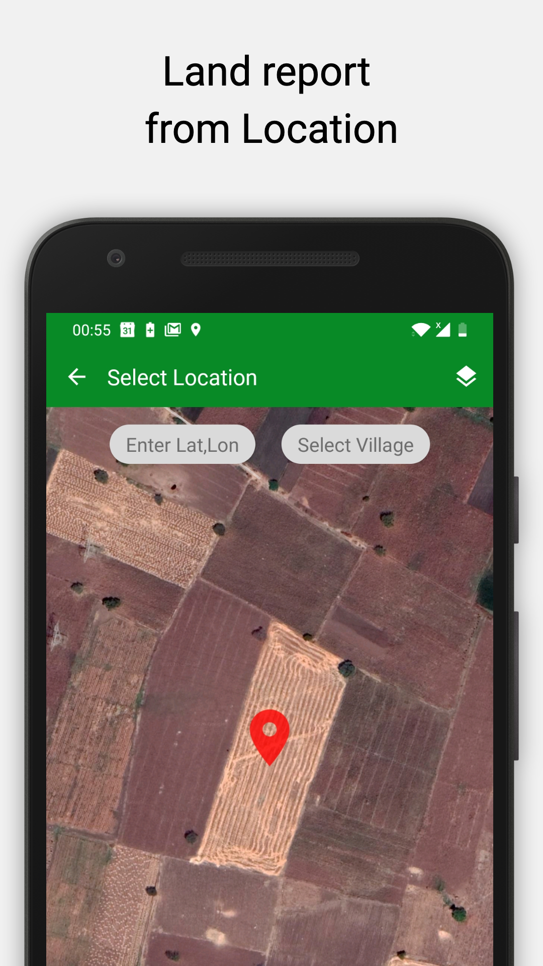
Using location (Lat,Lon) find 7/12 Survey number of the land
Many times it happens that we do not know the land survey no. of the particular location.
Using Landreport.in app you can get the 7/12 survey number of the land from Location.
This will be very helpful in getting ancesterial property documents.
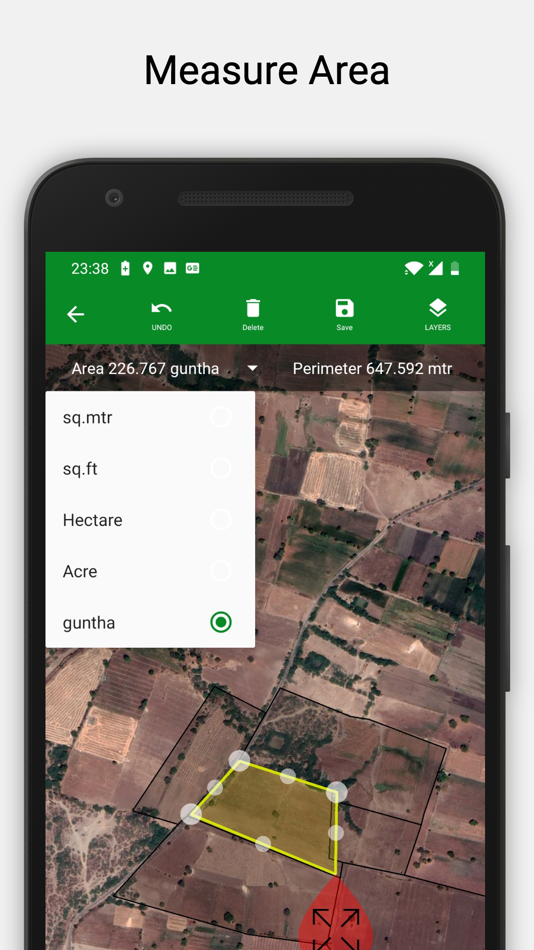
Measure area of plot & calulate distance between two points
Select the plot location on the map. You can measure area of the plot and distance between two points. Measured area is available in different units such as Hectare, Acre, Gutha, Sq. meter & Sq. Foot.
You can save this measured area & length for future use. This is very useful in measuring actual area of the land and comparing it with the area mentioned in 7/12 document.
This is very useful to estimating the pole requirement in fencing. Estimating electrical wire length between two points & material estimation for construction of the road.
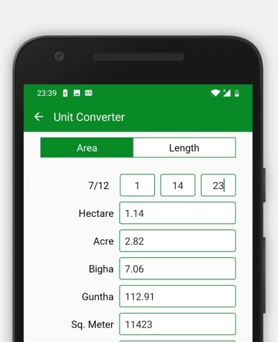
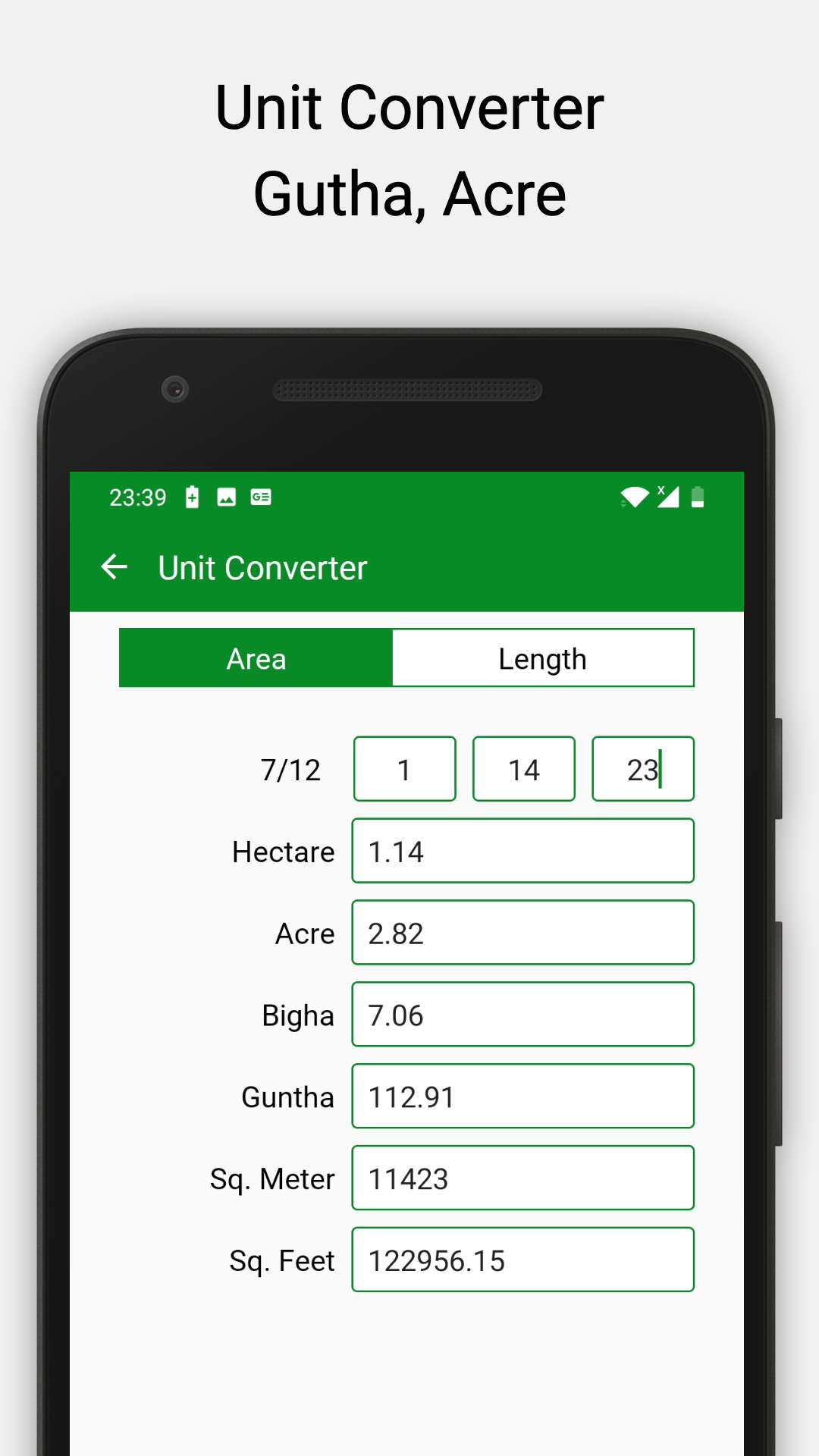
Unit Coverter Hectare, Acre, Guntha, Sq. meter
Many times different regions have different popular land area measurement units. In Konkan region Guntha is very much popular. This creates confusion among land buyers.
Landreport.in app has a free tool named 'Unit Converter'. Using this tool you can easily convert the area into a desired unit instantly.
Using this tool you can also convert length units among Meter, Foot, Inch & Centimeter easily.
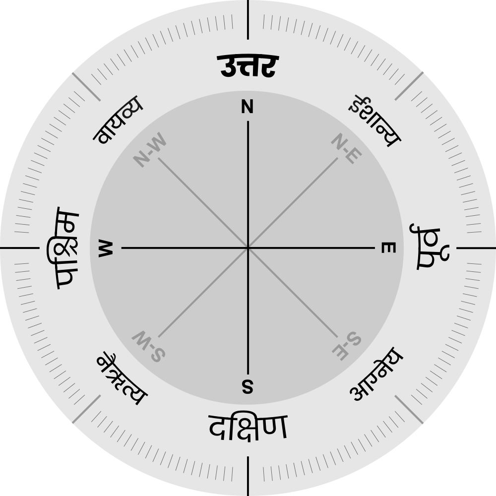
Civil Compass
You can use this tool to check the direction of the plot. For building the house or for the plantation we need this special type of compass. Using this compass you can plot markings on the ground.
📍 How It Helps:
Facilitates verification of land boundaries.
Assists land buyers by providing reference maps for informed decision-making.
Aids surveyors and real estate professionals in evaluating land.
💡 Note: This application is not intended for legal use. It serves as a private reference tool for land mapping utilizing available data. For official land records, please approach your local revenue office.
What's new
Updated landreport.in
- Version2025030501
- UpdateMay 08, 2025
- DeveloperLandreport.in
- CategoryProductivity
- Requires AndroidAndroid 5.0+
- Downloads1M+
- Package Namein.landreport
- Signaturec12fa753d550a844808a957218030106
- ReportFlag as inappropriate
-
NameSizeDownload
-
4.84 MB
-
4.84 MB
-
4.84 MB


High-quality area measurement
Convenient pivot point adjustments
Ability to save measurements with custom names
Crisp satellite images
Time-saving compared to government offices
Potential for improvements in user experience
Helpful customer support in some cases
Expensive charges for maps and reports
Inaccurate data leading to confusion
Lack of responsiveness from customer support
Misleading claims about free features
Limited availability of updated land records
Issues with app functionality after updates
Incomplete or outdated surveys and details
Possible misuse of personal information