IGNrando' - Outdoor routes & POIs
Discover thousands of outdoor routes & points of interest to enhance your adventure and explore France's beautiful landscapes.

- 1.97.14 Version
- 1.1 Score
- 478K+ Downloads
- In-app purchases License
- 3+ Content Rating


IGNrando’ serves as a collaborative platform for sharing routes and points of interest (POIs) associated with outdoor activities across France.
EXTENSIVE DATA AVAILABILITY
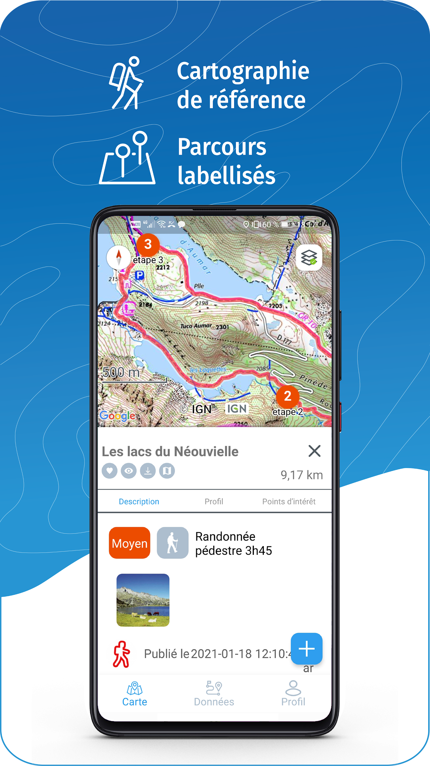
• Access to tens of thousands of routes and POIs throughout both Metropolitan and Overseas France
• Select by activity type, difficulty, and route length to discover options nearby or in any desired location
• Download or save favorite routes and POIs
FREE ACCESS MAPS & LAYERS (requiring internet connection)
• Plan IGN: the most up-to-date map suitable for various activities
• IGN aerial imagery
• OpenStreetMap Outdoors: a global map featuring hiking routes and contour lines
• OpenCycleMap: a global cycling map with routes and elevation details
• IGN map of Spain
• Swisstopo mapping
• Mobile network coverage map for emergency calls (112) in France
• OpenSnowMap
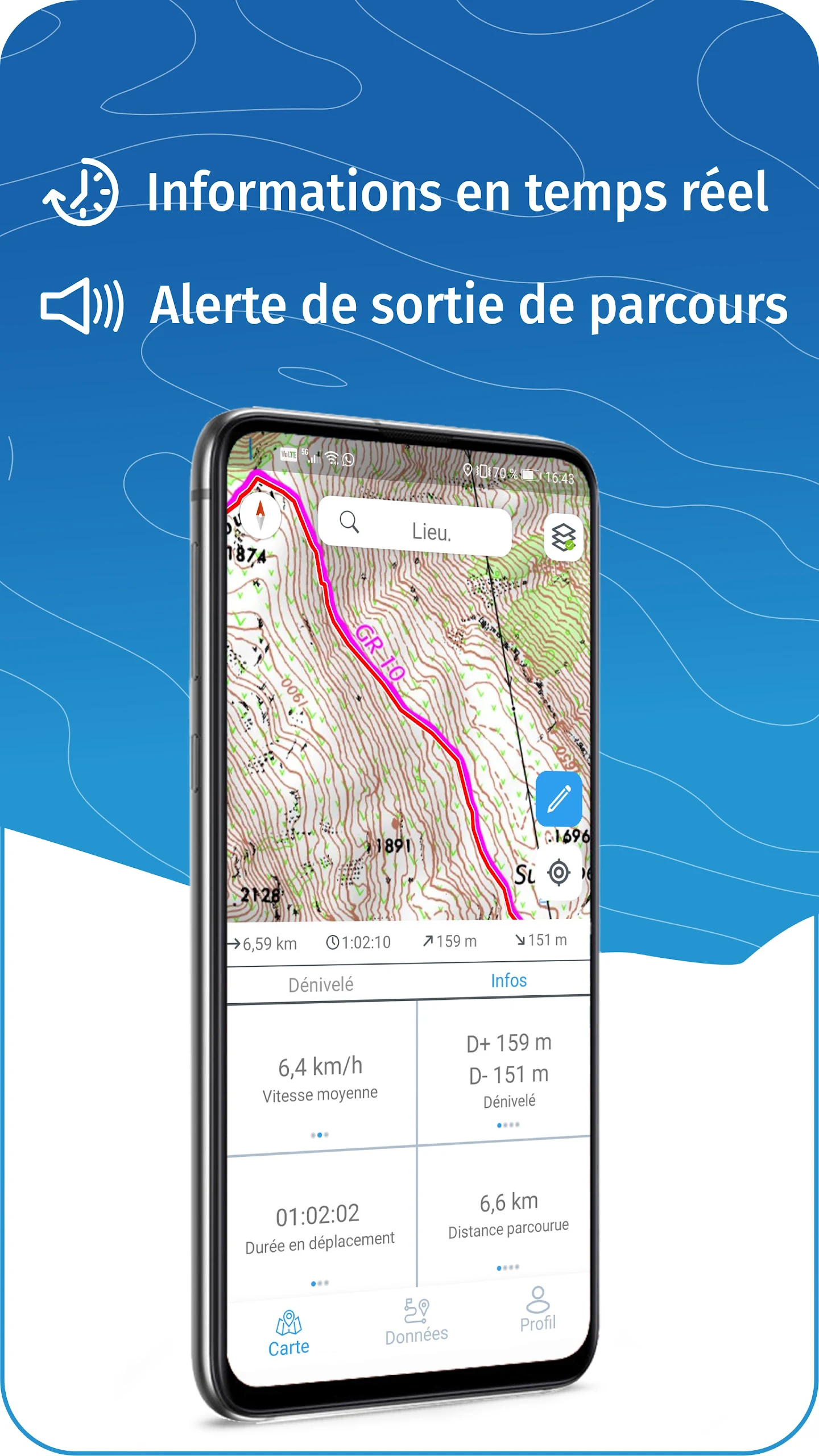
GPS NAVIGATION ALONG ROUTES
• Monitor your progress using the altitude graph
• Receive alerts if you deviate from your route
• Notifications on upcoming POIs or information points (coming soon)
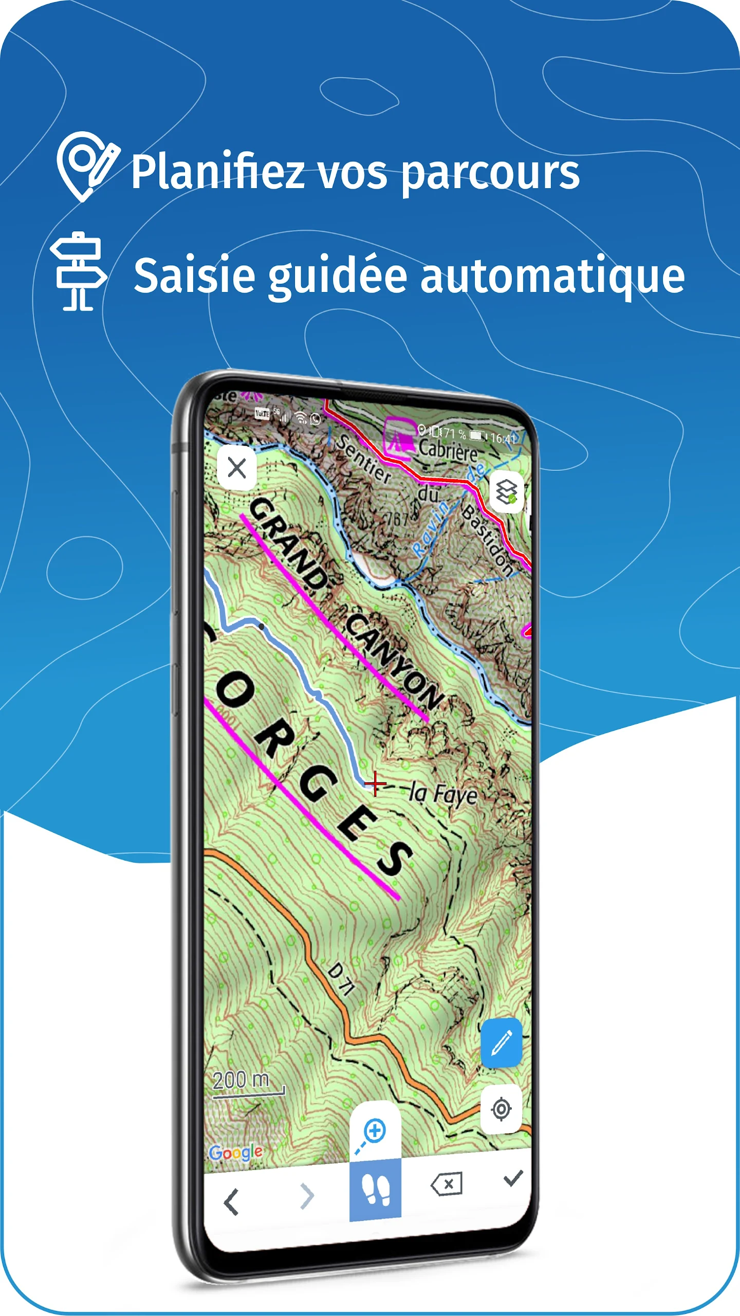
GPS TRACKING AND DATA CREATION
• Log your routes using GPS tracking
• Quickly generate routes directly on-device with an automatic routing feature that adheres to roads and pathways (available online only, with subscription)
• Create Points of Interest
• Upload your routes to ignrando.fr for backup or publication purposes
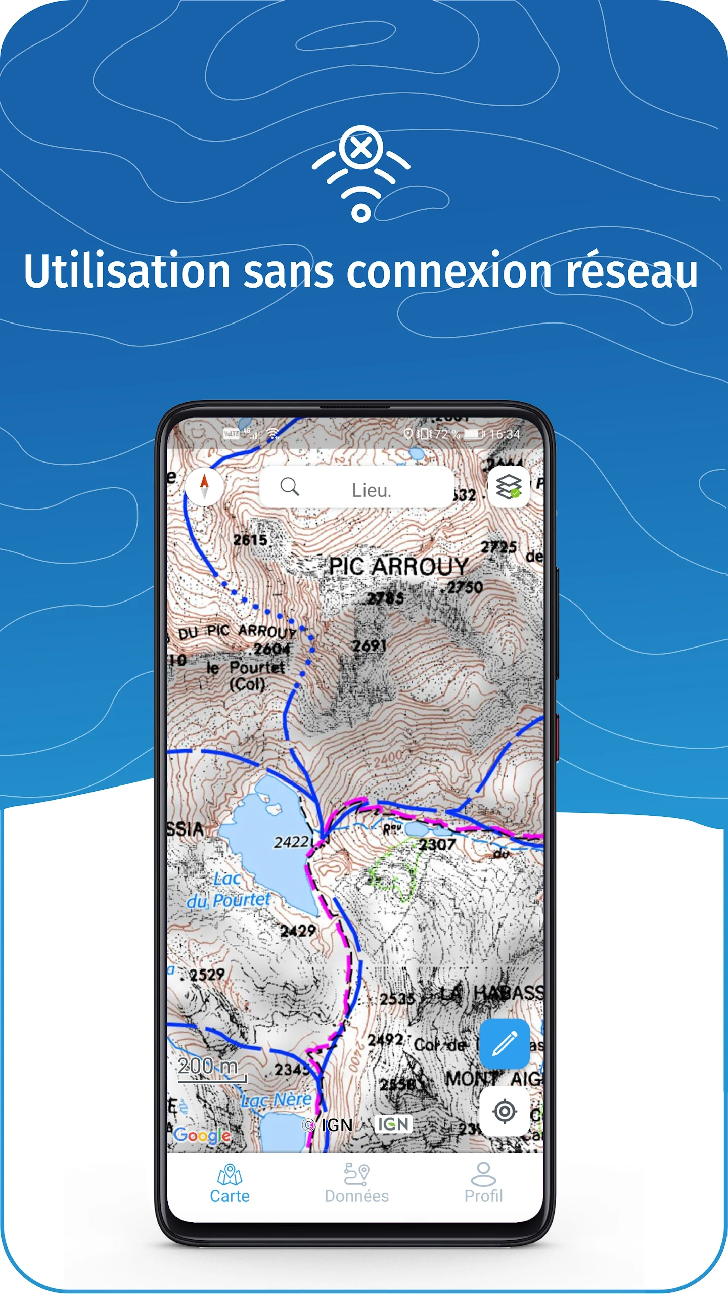
OFFLINE FUNCTIONALITY
• GPS functionality remains available without internet access: view your location on maps, use GPS navigation, and record routes
• Access descriptions, photos, and guidance for downloaded routes
• Downloaded maps are accessible (with subscription)
Tip: Activating Airplane Mode or disabling Mobile Data can help conserve battery life while maintaining Location Services (GPS)
SUBSCRIPTION FOR IGN MAPS
• Generate routes using both pedestrian and vehicle routing
• View and download the following maps and layers:
• All maps available in the free version
• IGN maps across various scales
• IGN 1:25k topographic maps (Top 25): renowned French topographic maps at all zoom levels
• Historical IGN maps from 1950
• Military maps from the years 1820-1866
• ICAO aeronautical charts
• Coverage maps of mobile network operators in France
• Areas with slopes exceeding 30° (important for winter activities)
• Cadastral parcels layer
• DFCI grid (forest fire protection grid)
• Drone flight restriction zones
• Roads & paths layer (exclusively available with aerial images)
Subscription via Play Store
• Connected to Google account
• Automatically renews unless canceled at least 24 hours prior to the current period's conclusion
• Auto-renewal option can be disabled post-purchase
IGNrando' store subscription
• Linked to IGNrando' account
• No automatic renewal feature
• Can be utilized on up to three devices simultaneously
Consider using an SD card for data storage
Free up space on your device.
——————————————————————
The application utilizes your network connection to stream or download maps and content, which may incur carrier charges.
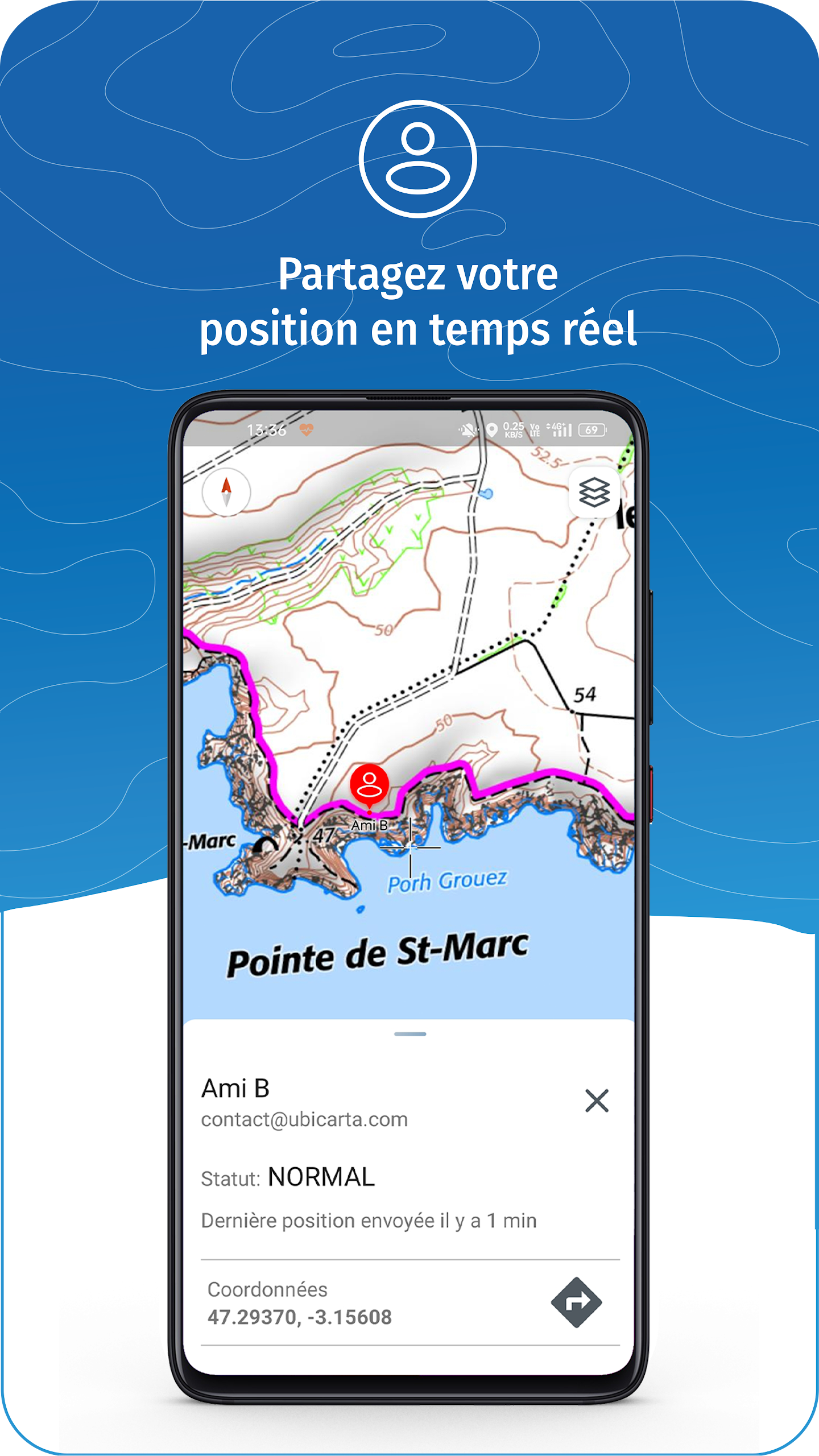
Your device's location is used to display it on the map, track your movements, and enable sharing with friends through a location-sharing function.
If you have suggestions for enhancing the IGNrando' app, feel free to reach out.
- Version1.97.14
- UpdateJul 26, 2025
- DeveloperUbicarta
- CategoryTravel & Local
- Requires AndroidAndroid 6+
- Downloads478K+
- Package Nameubicarta.ignrando
- Signature5dbbb8690b0a967f5e63ef7ab9ea7559
- Available on
- ReportFlag as inappropriate
-
NameSizeDownload
-
78.58 MB
-
51.10 MB
-
51.10 MB


Access to offline maps
Richer and detailed map content
Effective for planning outdoor activities
Good support and assistance from the help desk
Compatible with various GPS devices
Precise IGN maps
Flexibility in map usage compared to paper
Unreliable map downloads
Poor offline functionality
Slow download speeds
Difficulties with app registration
Outdated user interface
Inability to save maps to SD cards
Bugs leading to app crashes
Navigation issues without route guidance toggle
Subscription management problems