
Geovelo - Bike GPS & Stats - Bike routing & tracking
Unleash your bike's potential with tailored routes, automatic journey recording, and community challenges for every cyclist!
- 16.0.0 Version
- 1.5 Score
- 777K+ Downloads
- Free License
- 3+ Content Rating

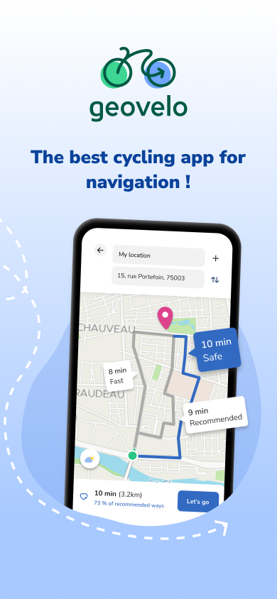
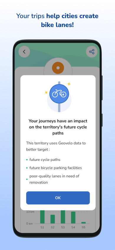
Experience Geovelo, the free app without advertisements designed for all your cycling needs.
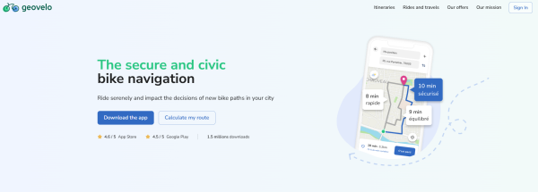
Geovelo operates as a B Corporation, joining a worldwide network of businesses committed to high social and environmental standards.
Features
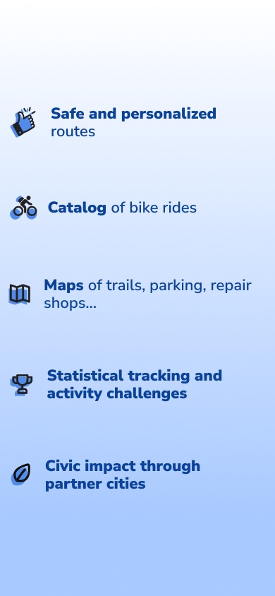
- Safe routes generated by an advanced route calculator.
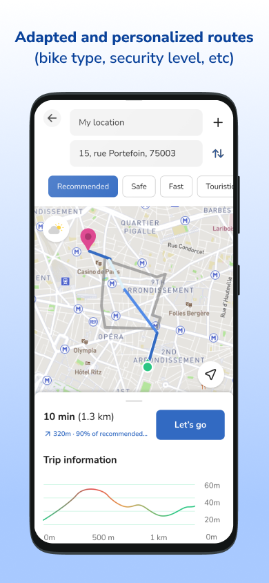
- Tailored routes considering your bike type (standard, electric, shared, etc.) and preferred route style (quickest or safest).
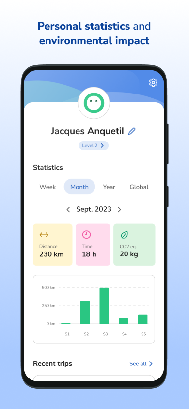
- Individual statistics regarding your activities and their effects.
- Automatic identification and documentation of your biking trips.
- Community-focused framework that supports municipalities in enhancing their cycling infrastructure.
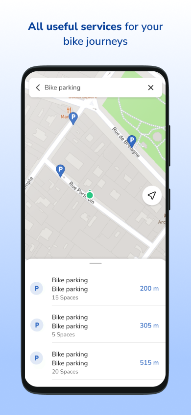
- Identification of bike parking spots and bike lanes.
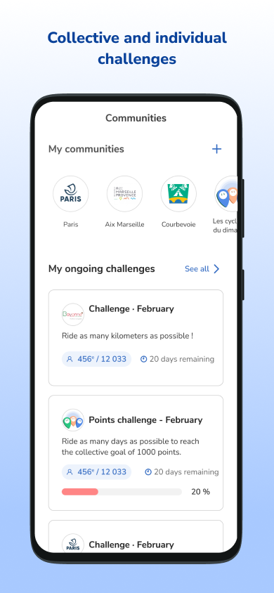
- Challenges for individuals and groups.
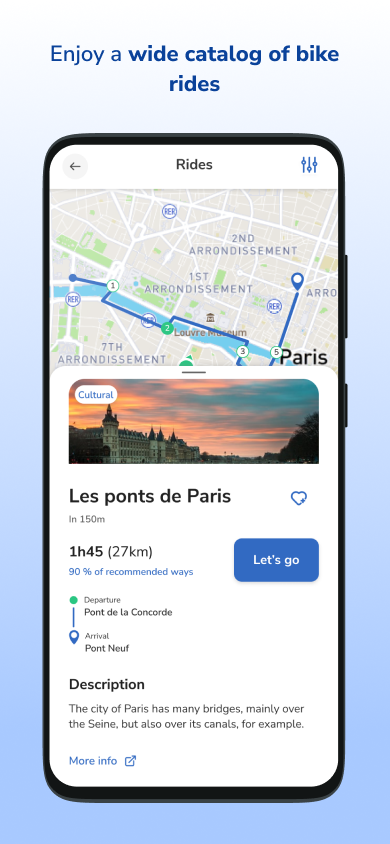
- A library of cycling paths and excursions.
- Weather notifications.
- A specific app for Wear OS to facilitate easy tracking of your rides.
How to Use:
1. **Download and Install**: Search "Geovelo" in the App Store to download and install. Open the app and follow the prompts to grant location permissions (including background tracking for trip recording).
2. **Set Preferences**: In Settings, select the bike type (e.g., electric, shared) and route preference (fastest/safest).
3. **Plan Route**: Enter your starting and ending points to generate a route that includes bike lanes and low-traffic roads. View details.
4. **Start Ride**: Tap Navigation to get real-time maps, voice prompts, and other directions. The app will automatically record your ride.
5. **Other Features**: Find parking spots, participate in community challenges, view recommended routes, receive weather alerts, and check the real-time availability of shared bikes. You can also report route issues to help improve the map.
6. **View Stats**: View distance, speed, and other stats in the app after your ride.
In Detail:
• CUSTOMIZED ROUTES & GPS
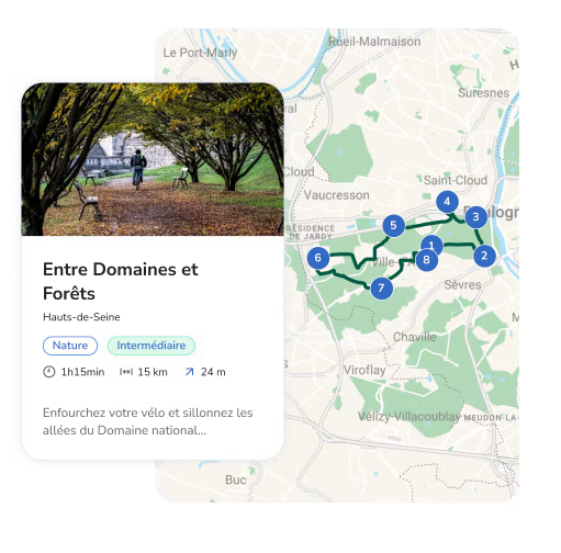
The application adjusts to your bicycle type, speed, and desired route preferences. Geovelo emphasizes bike lanes, cycling paths, and roads with lower traffic to enhance your comfort, safety, and tranquility. The app provides real-time navigation with map views, full-screen displays, compass guidance, and voice prompts with notifications.
• STATISTICS & AUTOMATIC RECORDING
Just ride while having the Geovelo app active—your journeys will automatically be identified and documented. You can review your trips within the application. Please be aware that location access must be granted when the app is closed or running in the background for this feature to function.
• AN ENGAGED COMMUNITY APP
The data produced from trips logged via the Geovelo app is anonymized and exclusively used to assess and enhance bike-friendliness in partnered locations.
• BIKE INFRASTRUCTURE AND PARKING
Through comprehensive mapping, Geovelo allows you to quickly locate nearby cycling facilities, parking lots, and bike racks.
• COMMUNITIES & CHALLENGES
Engage with fellow cyclists in your local area or workplace and join ongoing activity challenges. Cycle daily or cover the longest distances to secure a spot at the top of your community leaderboard.
• CYCLING ROUTES & EXCURSIONS
The app presents various cycling routes, including La Vélodyssée, Via Rhôna, La Loire à Vélo, La Scandibérique, La Flow Vélo, Le Canal des deux Mers à Vélo, La Vélo Francette, La Véloscénie, L'Avenue Verte London-Paris, and many others. It also includes numerous rides to discover cultural heritage and local attractions.
• CONTRIBUTIONS & REPORTING
Enhance the mapping of parking facilities and infrastructure through our partnership with OpenStreetMap, a community-driven mapping initiative, and assist other cyclists by reporting any issues or unsafe routes.
• USEFUL TOOLS
Receive weather alerts for your favorite routes (to help determine departure times based on forecast conditions), simplified address searches, among other features.
• SHARED BIKES
Geovelo shows real-time availability for various shared bikes, including those from multiple well-known services.
• Permissions
Location: Essential for displaying your GPS position and ensuring accurate navigation.
Background Location: To track your bike trip details, speeds, and statistics, access to your location when the app is not actively displayed is required for activity detection and manual logging functionalities.
• Continuous updates
Aimed at further enhancing Geovelo and integrating new features.
• Engage with us on social platforms
If you enjoy using Geovelo, we encourage you to provide a rating and share your experience!
The reasons for working with Geovelo
We adapt to the size and specific needs of each territory

We defend the development of active mobility to accelerate the ecological transition.

Our application is free and ad-free, to make cycling easier and safer for everyone.
Your data is only used to help develop the practice of cycling (cycle paths, bicycle parking lots, etc.)
FAQs
1. **Why isn't my Geovelo accurately acquiring location information? **
Make sure you've granted the app "Always" location permissions. Selecting "Allow while using the app" may result in inaccurate or delayed location acquisition. Some phone system settings also require enabling background activity permissions for the app to ensure Geovelo continues to track your location even when running in the background, allowing it to accurately record your rides.
2. **What should I do if the generated route doesn't meet my expectations? **
Check that you've correctly selected your bike type and route preferences in your settings. Choosing the "safest" route when trying to reach your destination quickly may result in a longer route. Re-entering your start and end points or fine-tuning your destination may sometimes generate a more suitable route. If multiple attempts still don't work, provide feedback to the app developer to help improve the routing algorithm.
3. **What can I do if the app crashes while running? **
First, try closing the app, clearing background apps on your phone, freeing up memory, and then reopening Geovelo. If the problem persists, check your phone's operating system for available updates. Some older operating system versions may have compatibility issues with the app, and updating the system may resolve the issue. If crashes persist, contact the app's support team and provide detailed information about the crash scenario and phone model to assist with troubleshooting and remediation.
4. **Why are my ride statistics inaccurate?**
Make sure Geovelo is always running in the background and not cleared by the system while riding; otherwise, data recording may be interrupted. Additionally, GPS signal interference in poor signal conditions or in unusual environments like tunnels can affect data accuracy. If you notice significant discrepancies, retest your ride in an open area with good signal and compare the differences. If inaccuracies persist, check the data recording settings in the app settings.
5. **How can I participate in community challenges and view my rankings?**
Find the "Community" or "Challenges" entry on the app's home screen. Click to browse the various ongoing challenges. Select a challenge of interest and click "Join" to join. During the challenge, complete the required ride tasks, and the app will automatically record the relevant data. To view your ranking, find the corresponding leaderboard on the challenge page to see how you rank against other participants. Strive to achieve higher rankings by continuously improving your riding performance.
- Version16.0.0
- UpdateOct 15, 2026
- DeveloperGeovelo
- CategoryMaps & Navigation
- Requires AndroidAndroid 8.0+
- Downloads777K+
- Package Namefr.geovelo
- Signaturefd5c754c3668b54eb5348708128f07e8
- Available on
- ReportFlag as inappropriate








Provides efficient biking routes
Identifies bike paths better than Google Maps
Features auto-detection for cycling
Offers statistics tracking for rides
No advertisements in the paid version
Simple and user-friendly interface
Allows for route planning and GPX download
Good support from app developers post-update improvements
High battery consumption reported by users
Bugs leading to incorrect GPS tracking
Lack of offline map downloading option
Compulsory account creation hindering user experience
Annoying background operation after exiting the app
Difficulties with navigation voice language settings
Slow refresh rate for location tracking
User complaints about not saving trips correctly
Limited customization options for routes and displayed statistics