Geoportal Mobile - Geoportal Mobile: Map & Emergency Tools
Explore maps, locate parcels & send emergency alerts—all in one intuitive app designed for seamless navigation.

- 3.6.13 Version
- 2.6 Score
- 620K+ Downloads
- Free License
- 3+ Content Rating

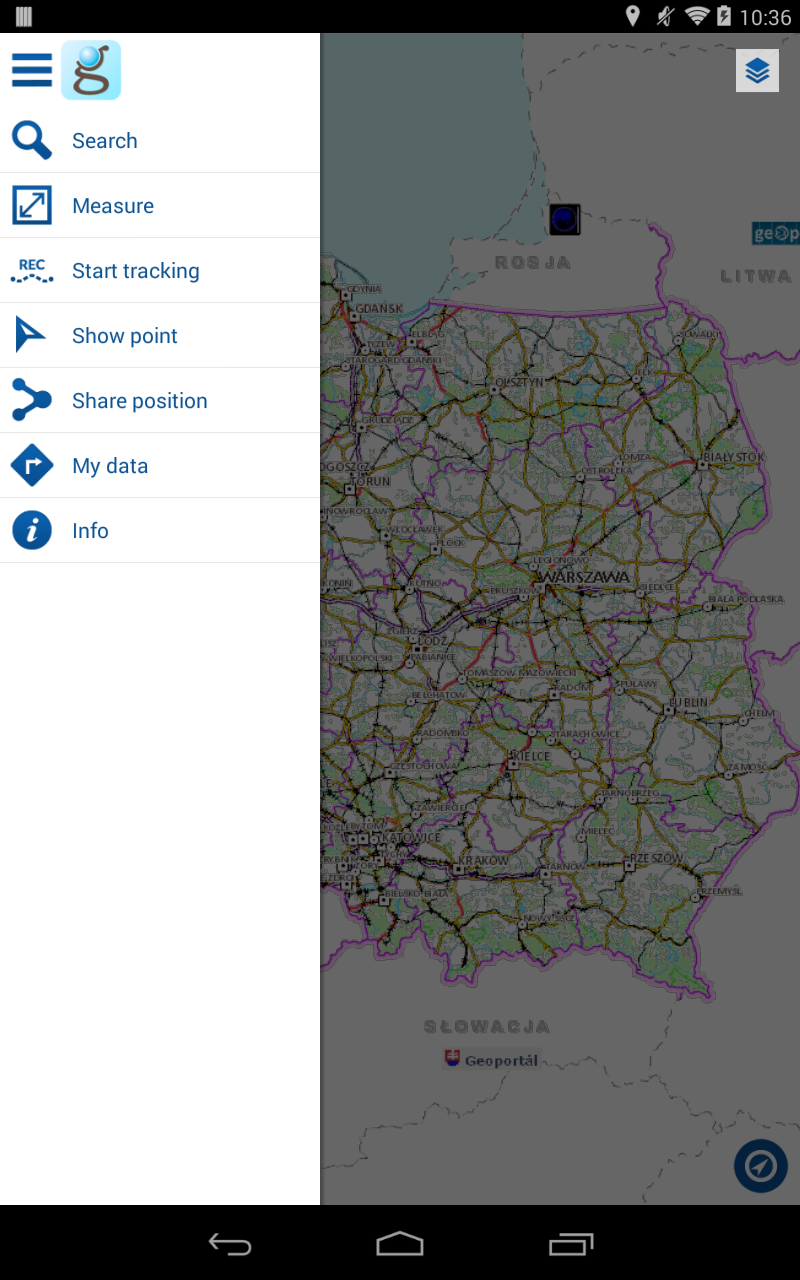
Geoportal Mobile offers:
• Access to spatial data services
• The ability to browse and find cadaster parcels
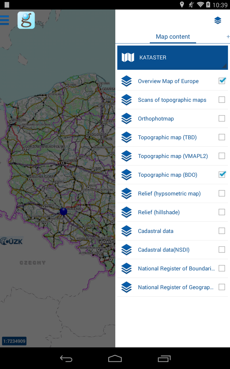
• Options for adding services and choosing from various maps
• A feature to search for geographical entities including address points.
This application allows users to view maps and includes the following functionalities:
• Emergency Contact (ICE) – permits the user to send an SMS alerting a designated individual about an emergency situation
• Navigation of map window – adjusts the view of the map according to user movements (panning, zooming in, zooming out)
• Visualization of tiled services – shows maps alongside their content as tiled services
• Integration of external WMS services – this functionality enables users to enrich map content by incorporating WMS services.
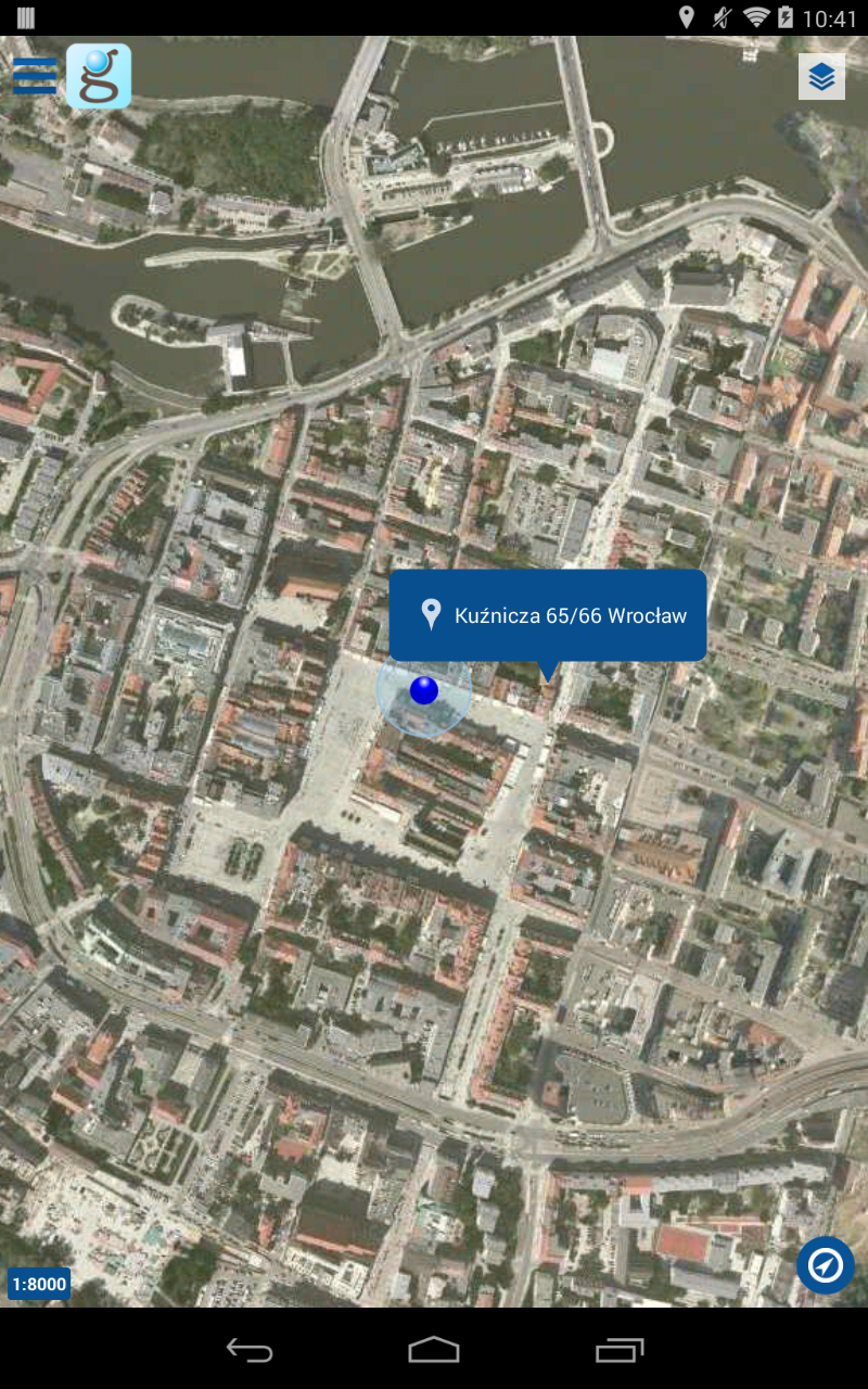
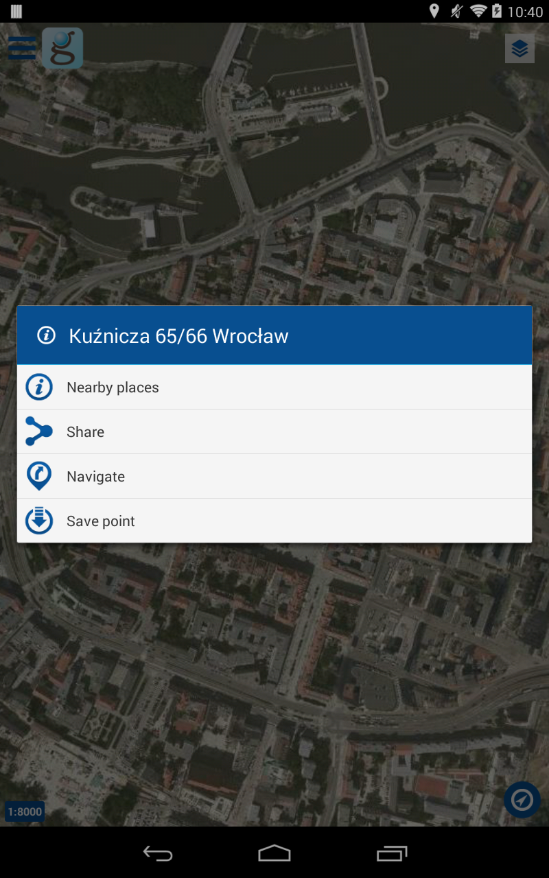
• Address, parcel, and geodesic point searching – selected addresses or parcels will appear on the map display.
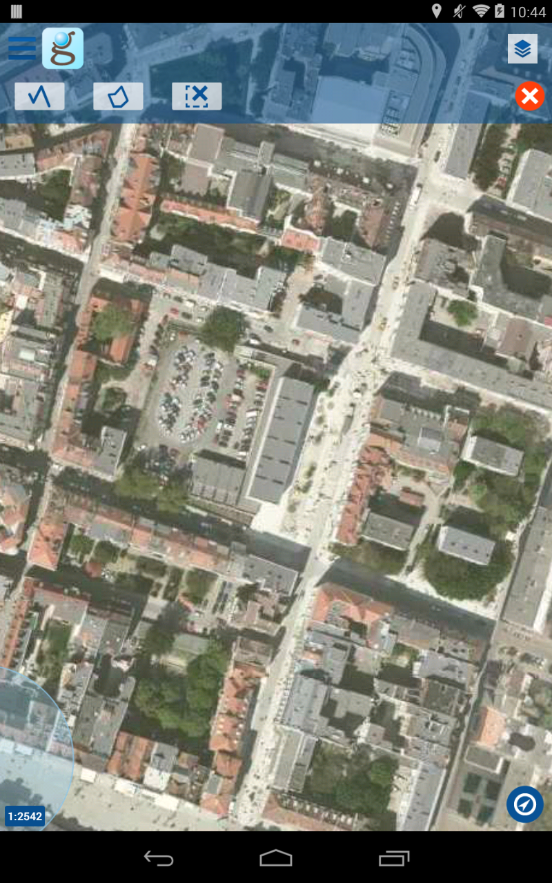
• Length measurement – calculates the distance of a line drawn on the map
• Area measurement – allows for measuring the area or outline of a polygon drawn on the map
• Current location sharing – permits the user to share their current whereabouts or a chosen location as a link to the app that displays coordinates on the map
• Track registration and saving – users can register and monitor their path on a map based on GPS signals.
• Route recording and saving – users can document and track their own routes on the map using GPS signals, save those routes, display them in the application, and export as KML files
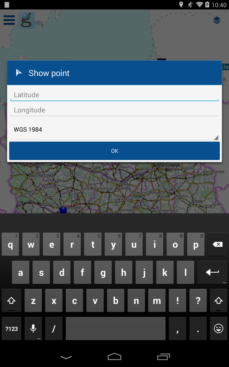
• Highlighting points on the map – indicates locations based on coordinates in the selected mapping interface
• Address, locality, and parcel identification – by performing a Long Press gesture on the map, users can retrieve information about objects at specified points.
Key Features
Access to Spatial Data
Geoportal offers unparalleled access to a vast array of spatial data services and GeoServices REST, encompassing comprehensive national registers. Whether you're a professional urban planner analyzing land use trends, a researcher studying geographical patterns, or simply an enthusiast exploring the intricacies of your region, this access provides you with detailed and accurate data. You can retrieve information about terrain, infrastructure, demographics, and more, all at your fingertips. This wealth of data serves as a solid foundation for a wide range of applications, from environmental studies to real - estate development projects.
Mapping and Navigation
With Geoportal, seamless mapping and navigation experiences are at your disposal. Effortlessly browse through high - resolution maps that cover local neighborhoods to expansive regions. The intuitive location search functionality allows you to quickly find specific addresses, parcels, landmarks, or points of interest. Once you've identified your destination, rely on the precise GPS - enabled navigation system. Whether you're driving through unfamiliar streets, hiking in the wilderness, or cycling around the city, Geoportal will guide you every step of the way, providing turn - by - turn directions and real - time location updates to ensure you reach your destination efficiently.
Data Management
Take full control of your viewing experience with Geoportal's robust data management capabilities. Users have the flexibility to manage multiple layers of viewing services with ease. Adjust the transparency of different data layers to blend them seamlessly and gain a more comprehensive perspective. For example, you can overlay population density data on top of a street map to understand how demographics interact with urban infrastructure. Additionally, the viewing legend feature offers clear and concise explanations of the symbols and colors used in the maps, ensuring that you can interpret the data accurately and make informed decisions based on what you see.
Route Planning and Tracking
Geoportal empowers you to plan your journeys with precision. Whether you're mapping out a road trip across the country, planning a delivery route for your business, or plotting a scenic bike ride, the route - planning tool considers various factors such as traffic conditions, road types, and distance to suggest the most optimal routes. While on the move, the real - time location tracking feature keeps you updated on your progress. You can record your entire journey, save these routes for future reference, and even share them with friends, colleagues, or clients. This functionality is invaluable for logistics management, fitness tracking, and adventure planning, allowing you to document and analyze your travels over time.
Sharing and Reporting
Stay connected and contribute to the continuous improvement of Geoportal through its sharing and reporting features. Easily share your current location or any interesting points of interest with others, whether it's to invite friends to a new discovery or to collaborate on a project. The bug - reporting and improvement - suggestion functions give you a voice in enhancing the application. If you encounter any glitches, inaccuracies, or have ideas for new features, your feedback helps the development team refine and optimize Geoportal, ensuring that it remains a reliable and user - friendly tool for everyone.
Offline Functionality
Certain versions of Geoportal, such as the one available on Géoportail, offer the convenience of offline access. This is a game - changer when you're in areas with limited or no internet connectivity, like remote mountain regions, underground parking lots, or during travel in areas with poor network coverage. Before you head out, simply download the maps and relevant data you need. You can then continue to view maps, search for locations, and even plan routes offline, ensuring that you're never left without navigation or geographical information when you need it most.
Emergency Features
Your safety is a top priority, and some Geoportal versions come equipped with essential emergency features. In case of an unexpected emergency, such as an accident, medical issue, or getting lost in an unfamiliar place, you can quickly send an SMS message that automatically includes your precise location information to a pre - designated contact. This immediate communication can be a lifesaver, allowing emergency responders or loved ones to locate you promptly and provide the necessary assistance, giving you peace of mind during any unforeseen circumstances.
- Version3.6.13
- UpdateJul 05, 2025
- DeveloperGłówny Urząd Geodezji i Kartografii
- CategoryTravel & Local
- Requires AndroidAndroid 6+
- Downloads620K+
- Package Namepl.gispartner.imapmobile
- Signature8e9a2f5c6f66d3d5e7d844f1264a0cc0
- Available on
- ReportFlag as inappropriate
-
NameSizeDownload
-
55.39 MB
-
55.39 MB
-
55.39 MB