Garmin Pilot - Aviation planning & navigation
Experience seamless flight planning, navigation, & logging with advanced weather tools designed for pilots’ needs.

- 8.1.6 Version
- 2.3 Score
- 265K+ Downloads
- In-app purchases License
- 3+ Content Rating

** Experience a 30 Day Free Trial! **
Garmin Pilot is an all-inclusive aviation app that facilitates flight planning, filing, flying, and logging effortlessly.
This application offers an extensive range of tools tailored for general aviation and corporate pilots on Android. It encompasses flight planning, filing, charts, interactive maps, weather briefing resources, and navigation features; everything you need is included. The user-friendly interface reflects the latest Garmin touchscreen avionics, allowing for a smooth transition from preflight to in-flight tasks. Utilize Garmin Pilot to plan, file, and execute flights seamlessly.
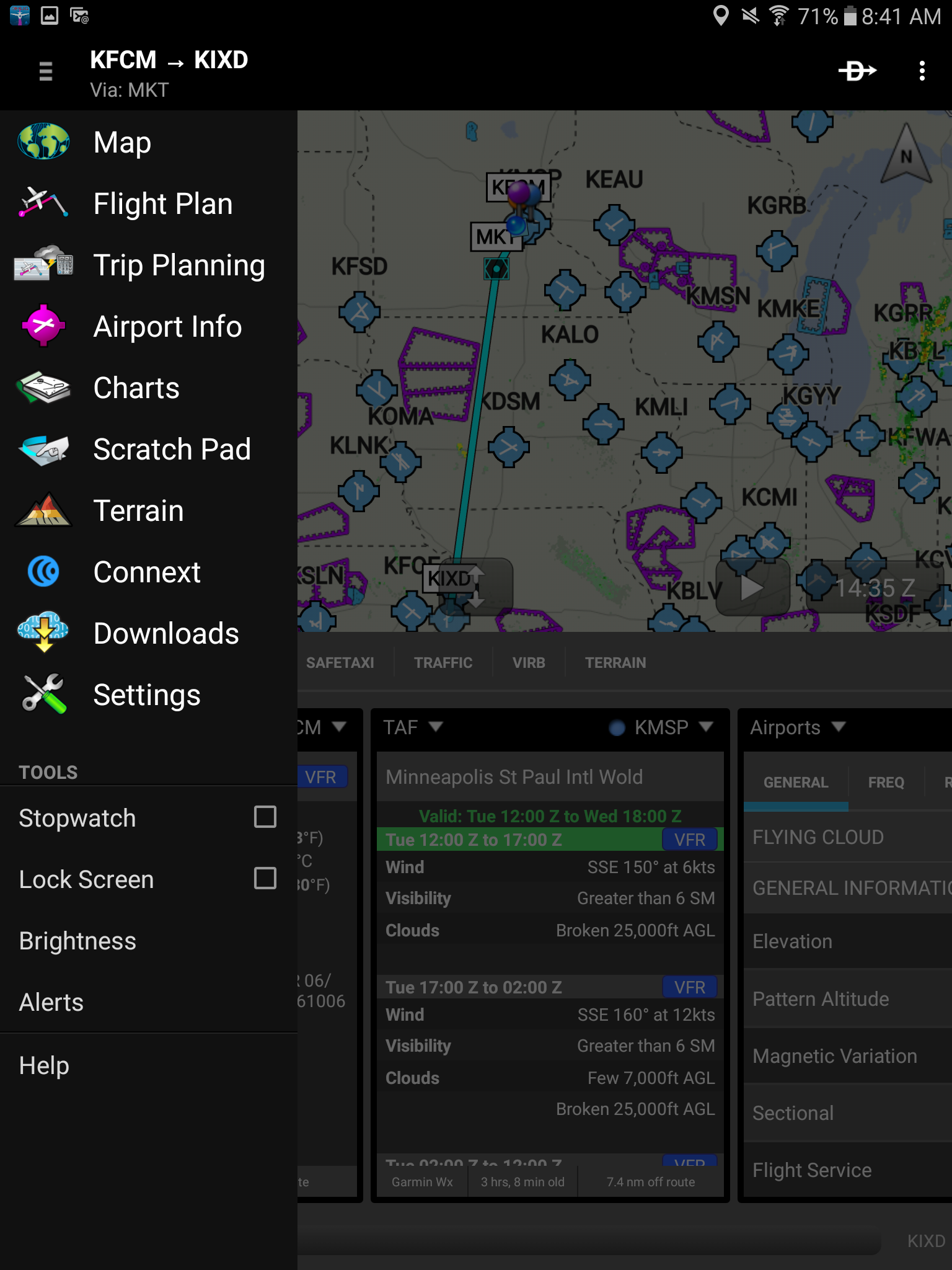
Planning
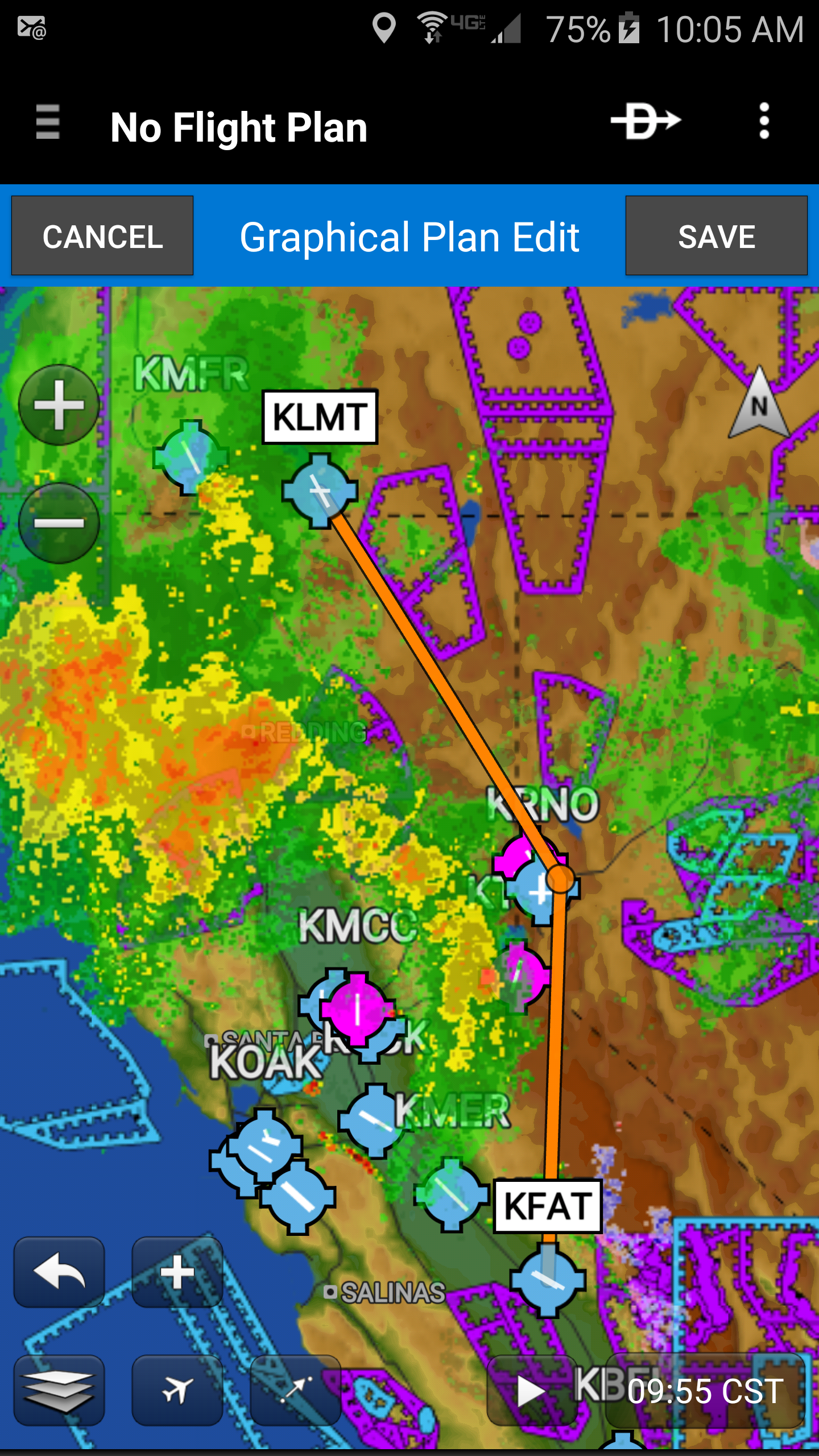
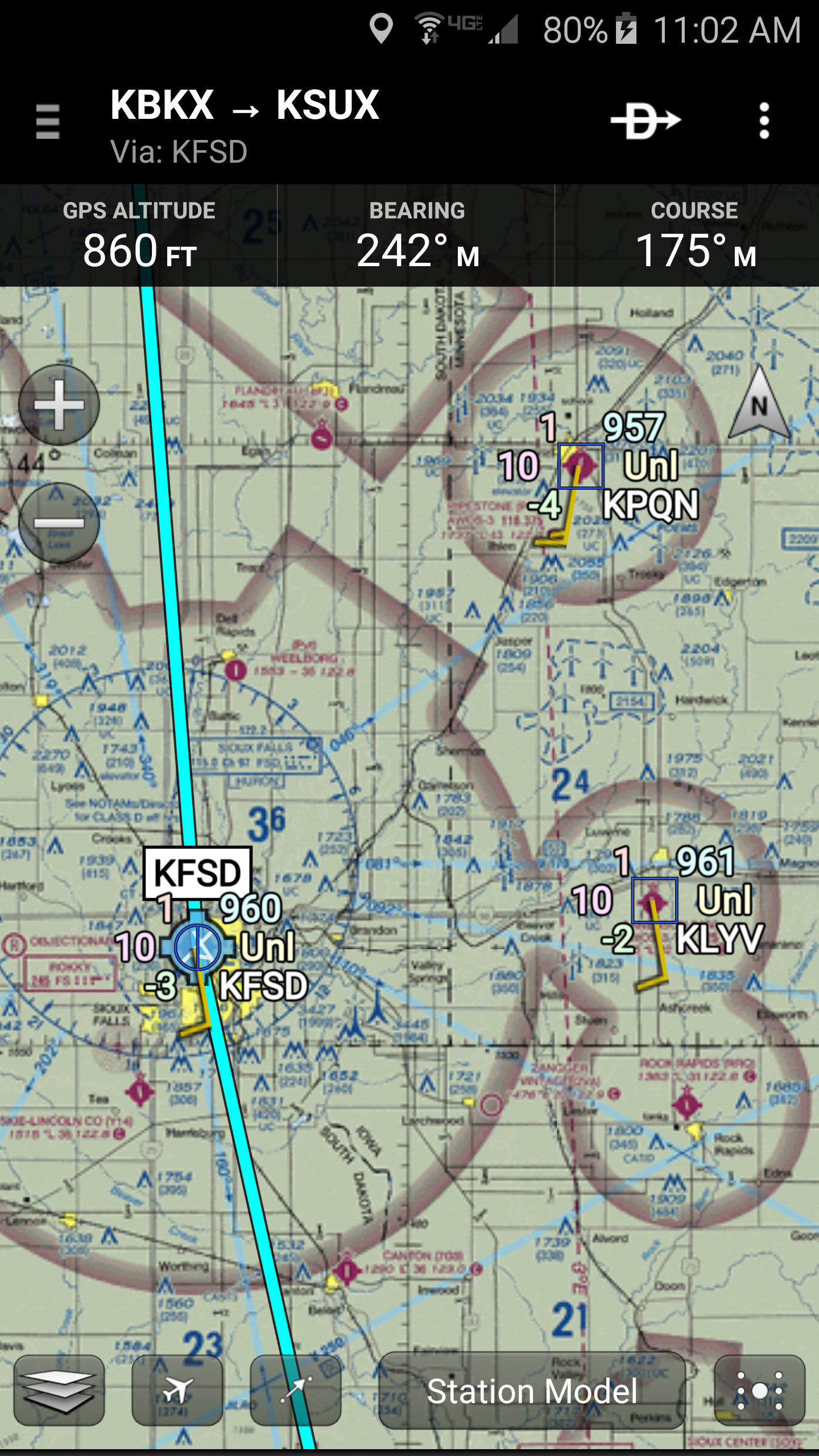
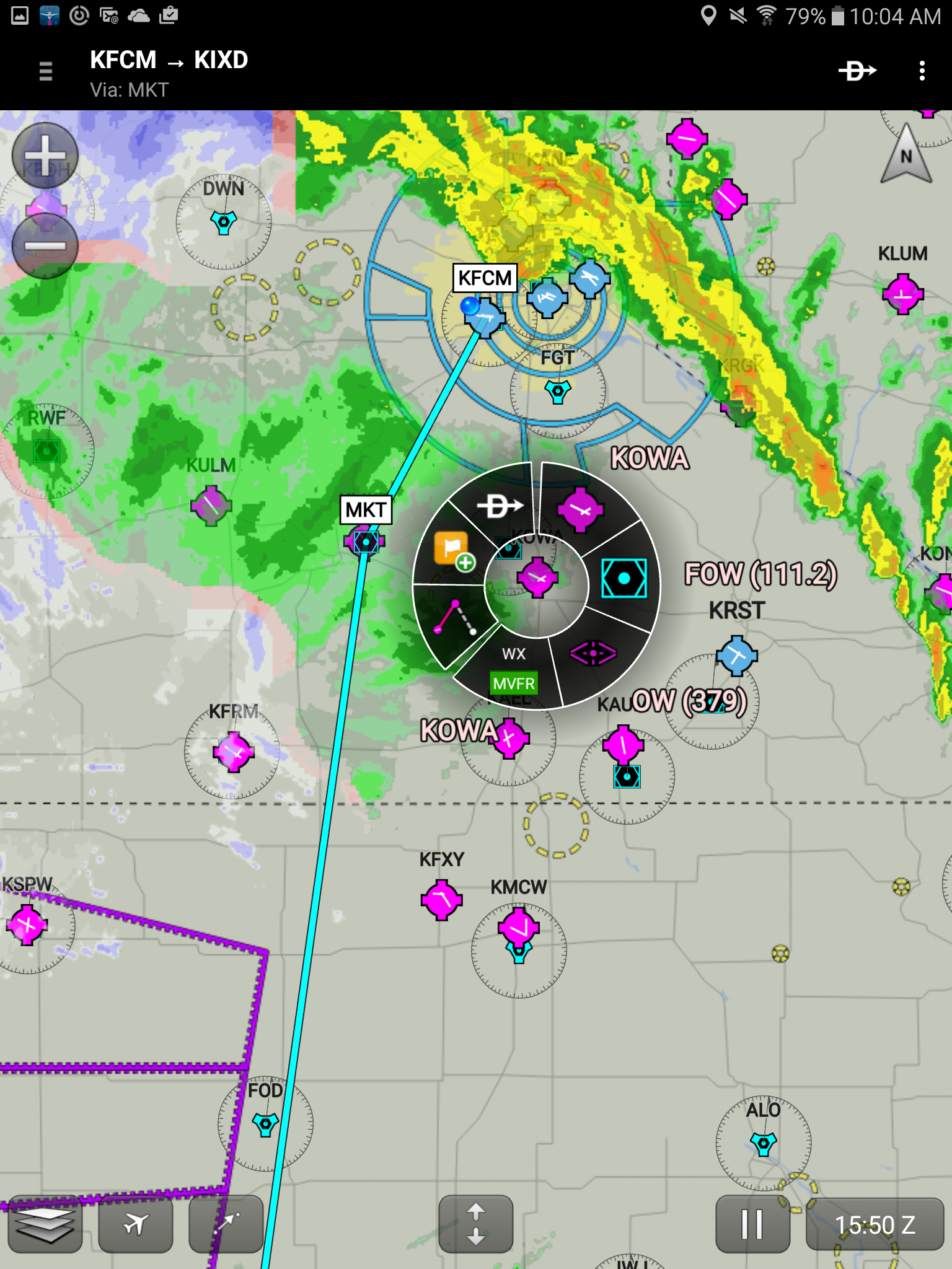
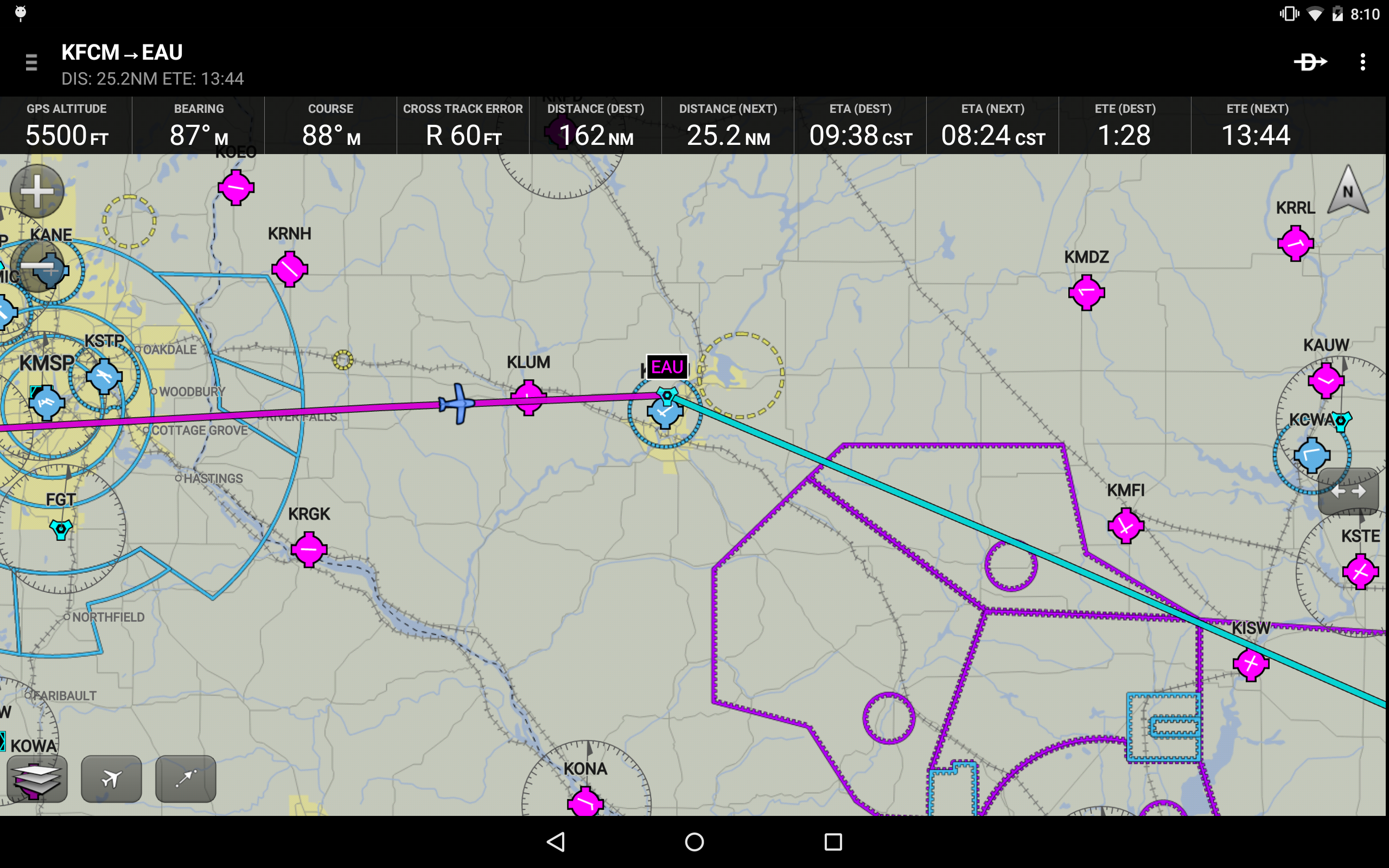
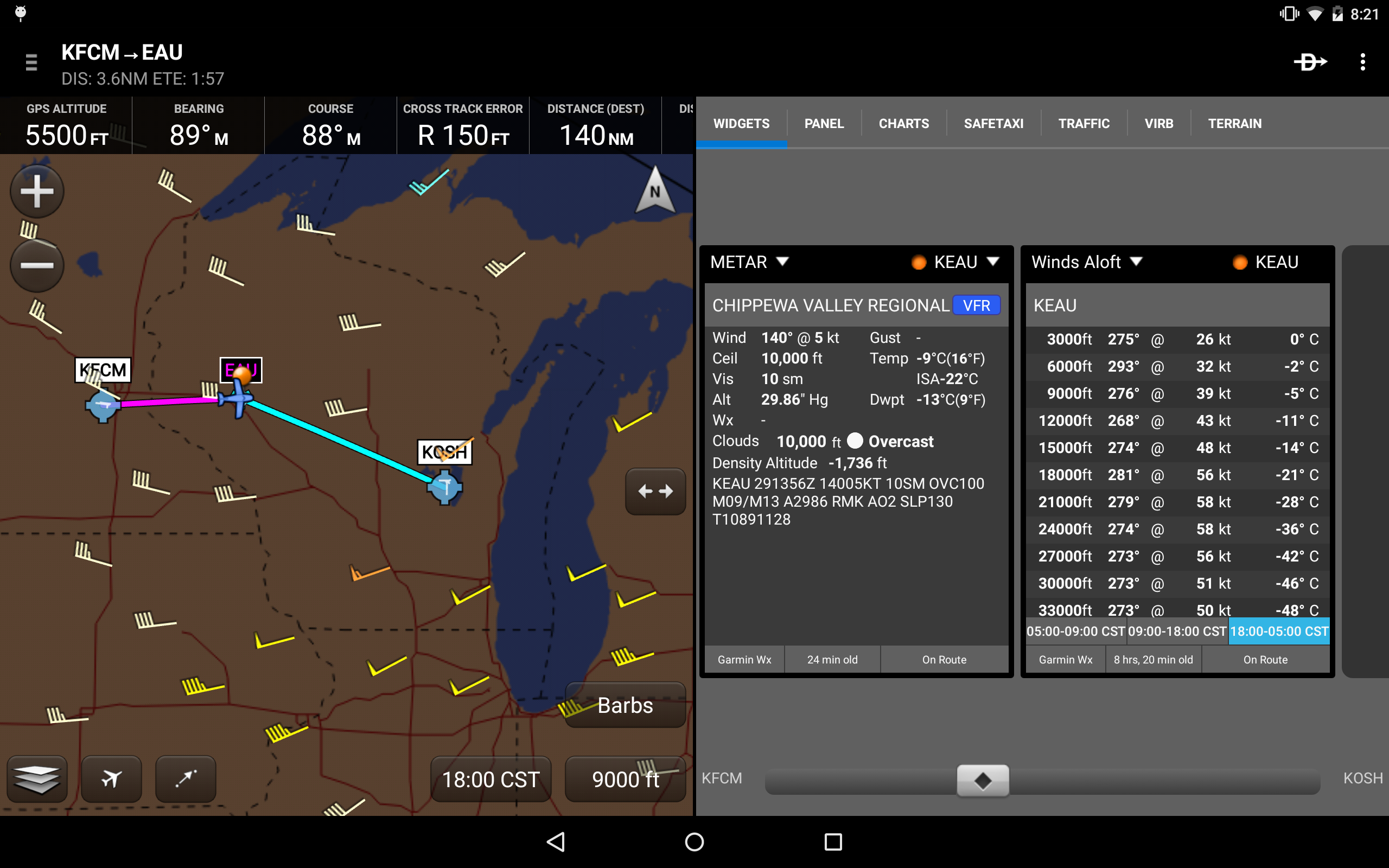
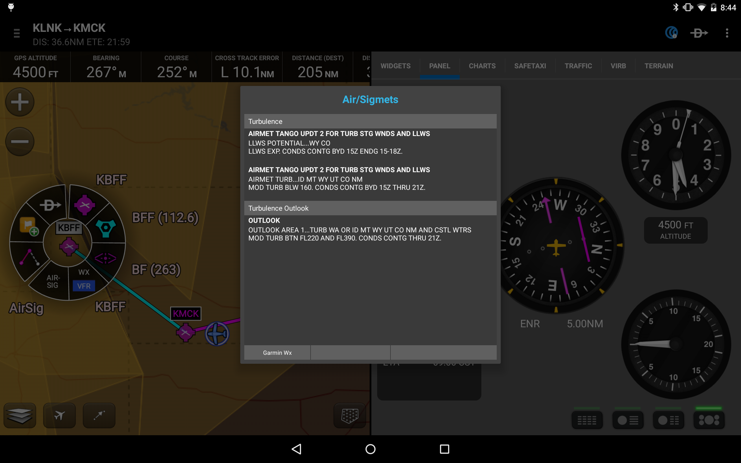
Garmin Pilot enhances your pre-flight preparation by supplying the most comprehensive aviator weather data, enabling pilots to make well-informed decisions about their flights. Users can access NEXRAD radar, cloud imagery (visible and infrared), METARs, TAFs, AIRMETs, SIGMETs, PIREPs, NOTAMs, winds, temperatures aloft, TFRs, and lightning information. Within Garmin Pilot, this information can be overlaid on VFR sectional or IFR low/high en-route charts, giving pilots a clear view of the weather affecting their planned route. Enrich your experience with text-based weather widgets and leverage the unique NavTrack feature to monitor weather throughout your journey.
Filing
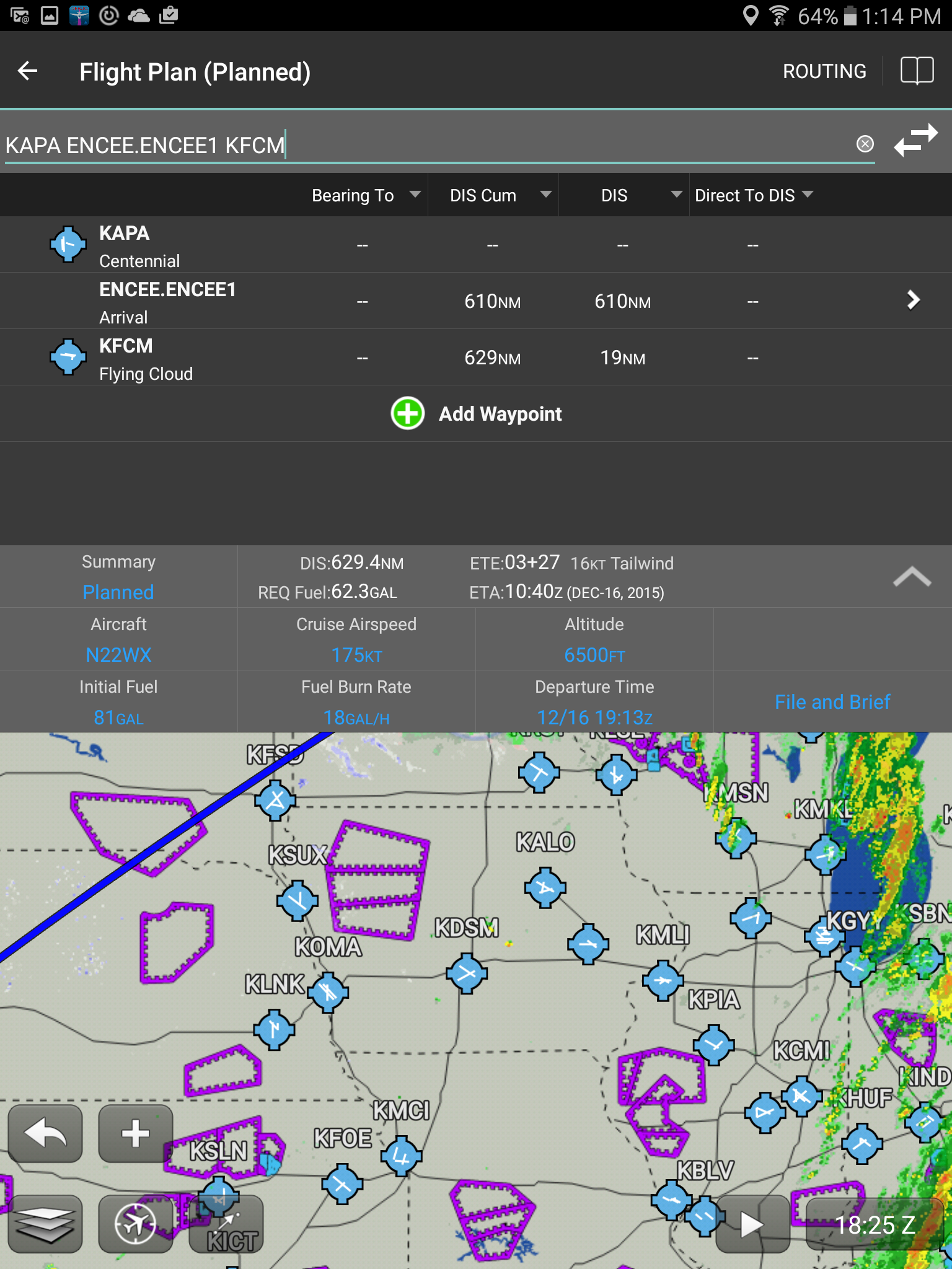
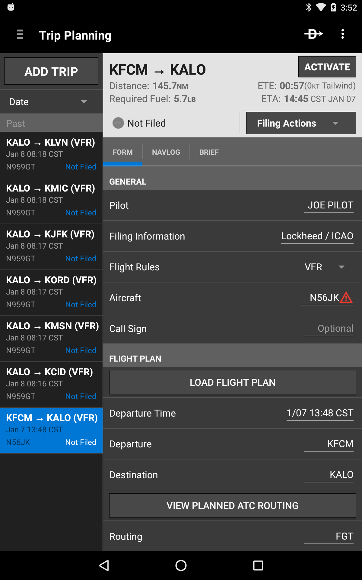
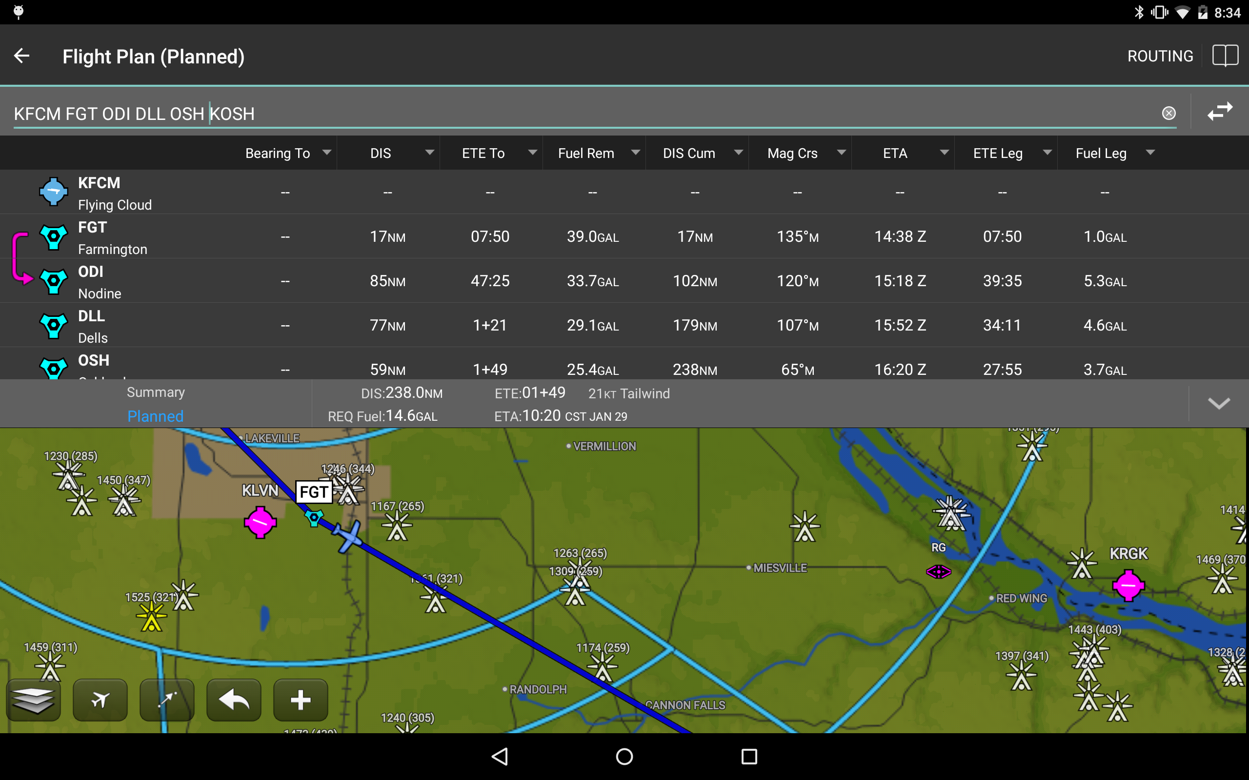
Users can conveniently input their flight plans using Garmin Pilot's intuitive system. Pre-filled forms expedite the process of saving and reusing details for frequently traveled routes. Once the flight plan is finalized, Garmin Pilot allows for straightforward filing, canceling, or closing of the plans.
Flying
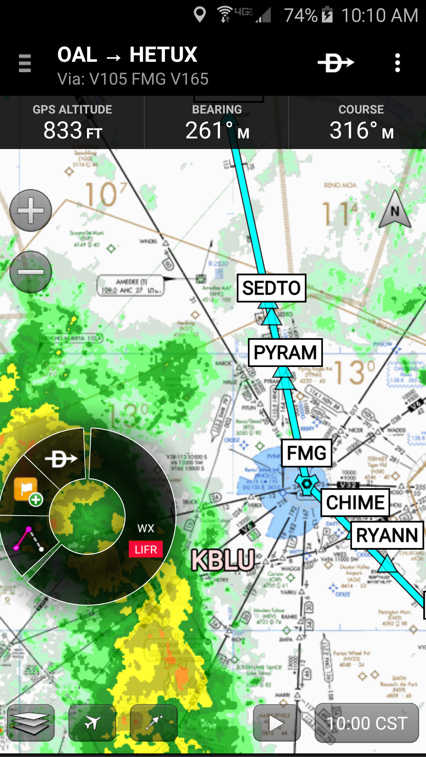
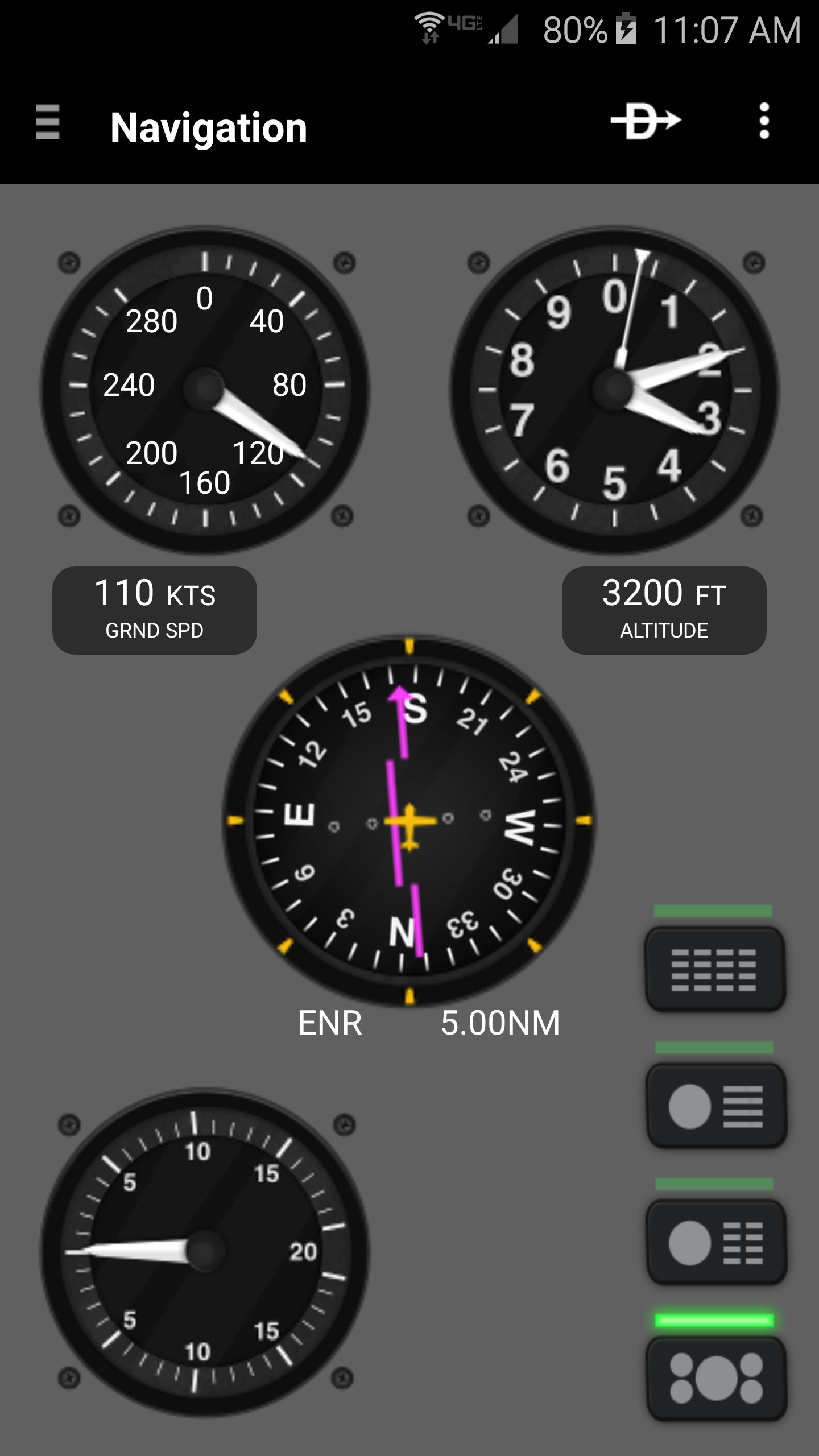
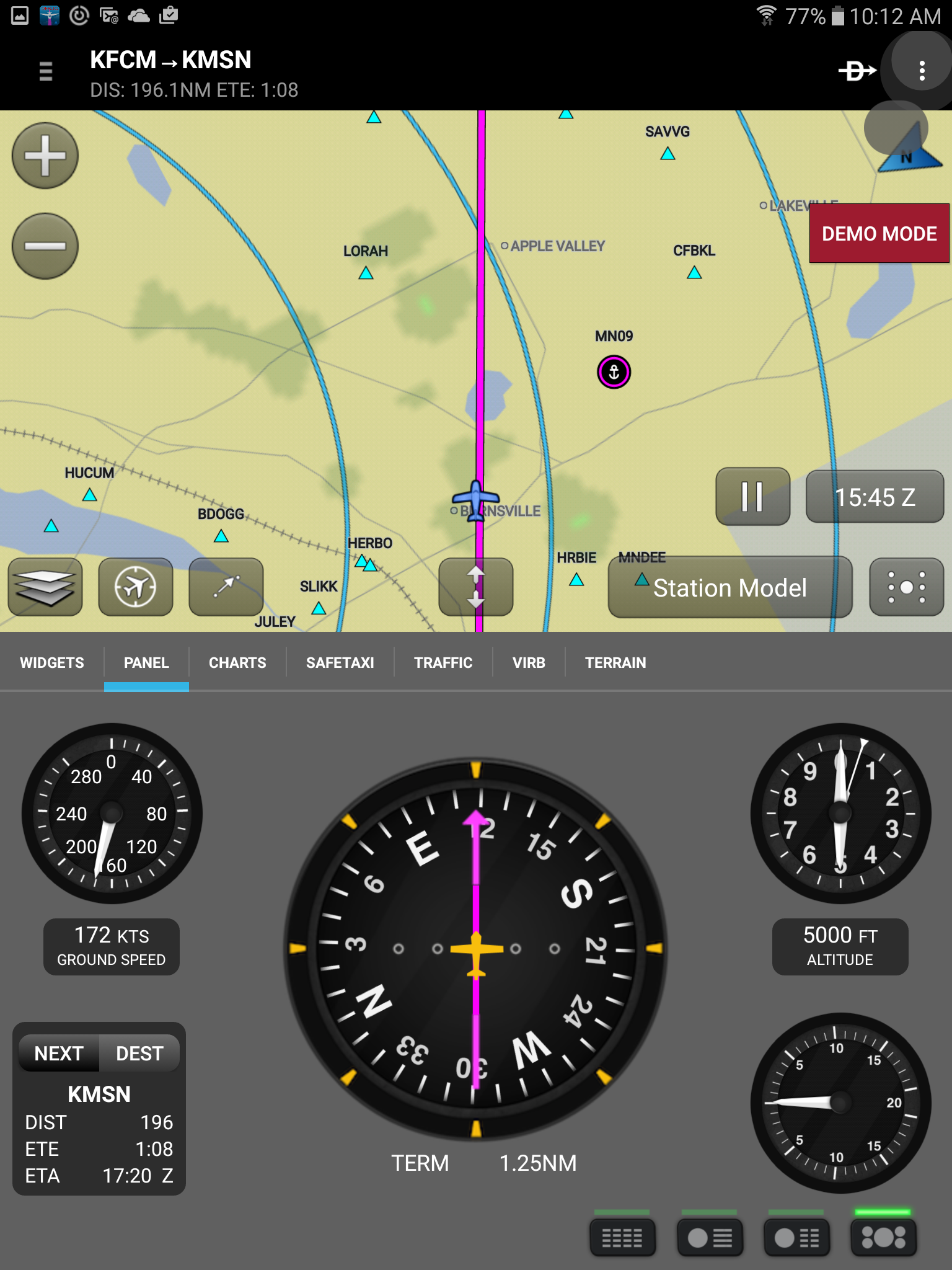
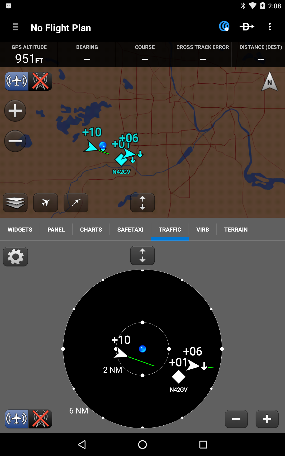
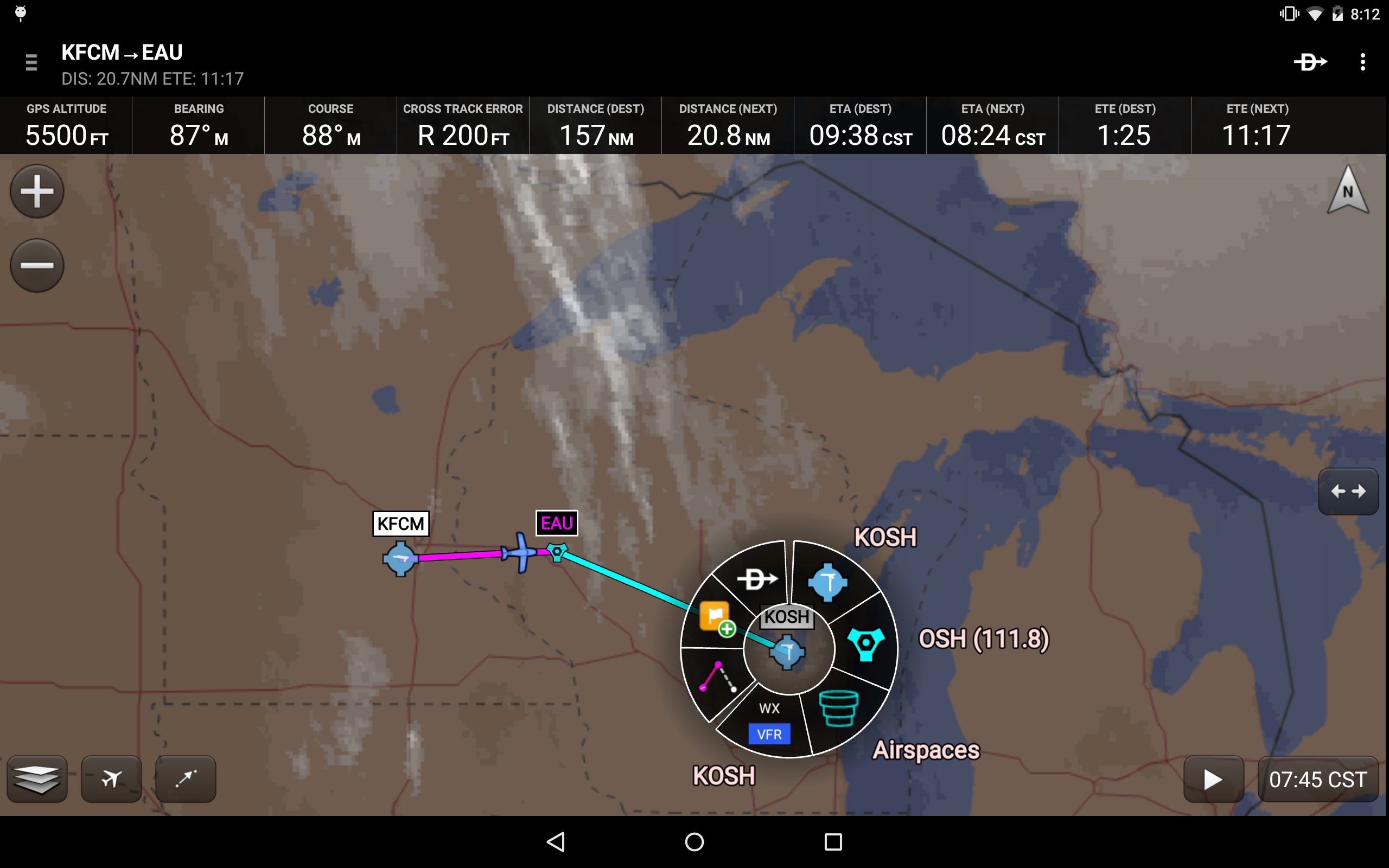
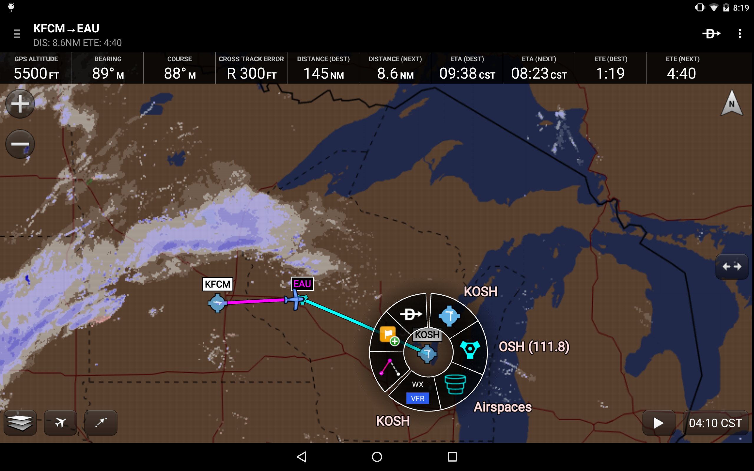
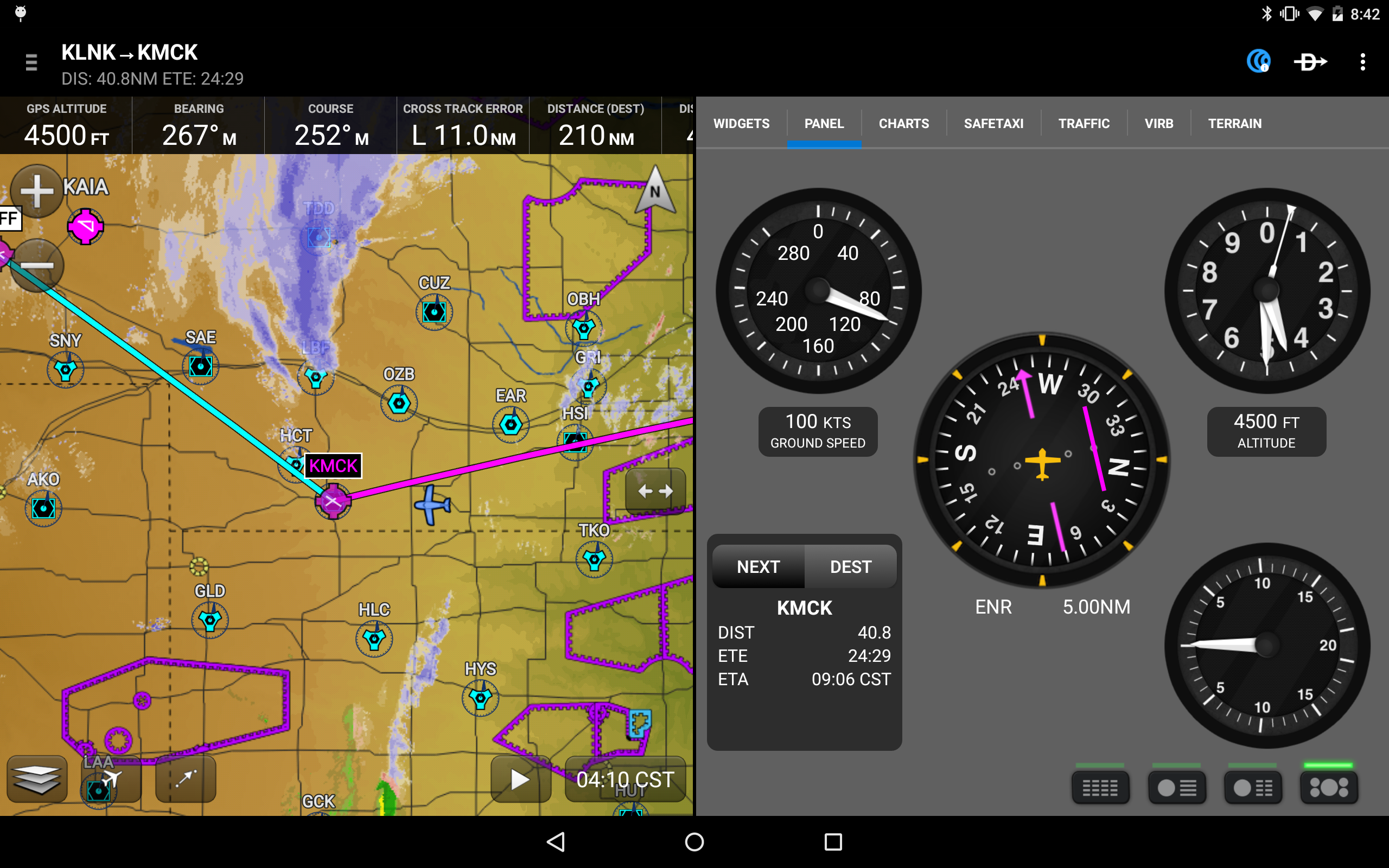
Garmin Pilot offers complete en-route navigation capabilities through its dynamic moving map, presenting important information such as estimated time en route (ETE), estimated time of arrival (ETA), cross track error, distance to the next waypoint, and current position.
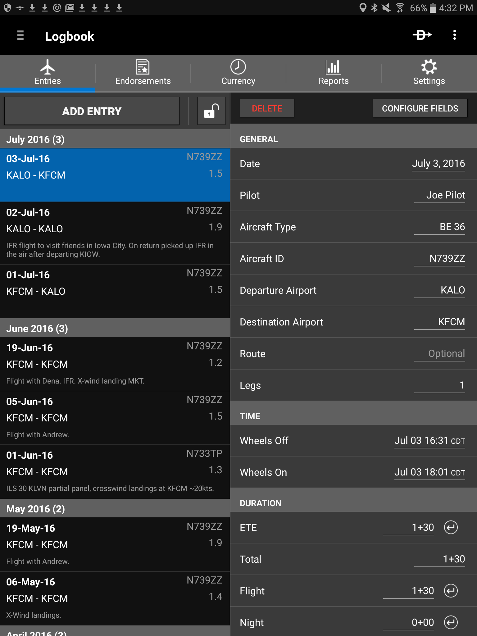
Logging
The app features a detailed electronic logbook that integrates with flyGarmin, automatically generating entries based on GPS data gathered during flights, tracking currency, accommodating manual inputs, endorsements, and producing reports.
Garmin Pilot is the innovative app that pilots have eagerly anticipated.
Notable features include:
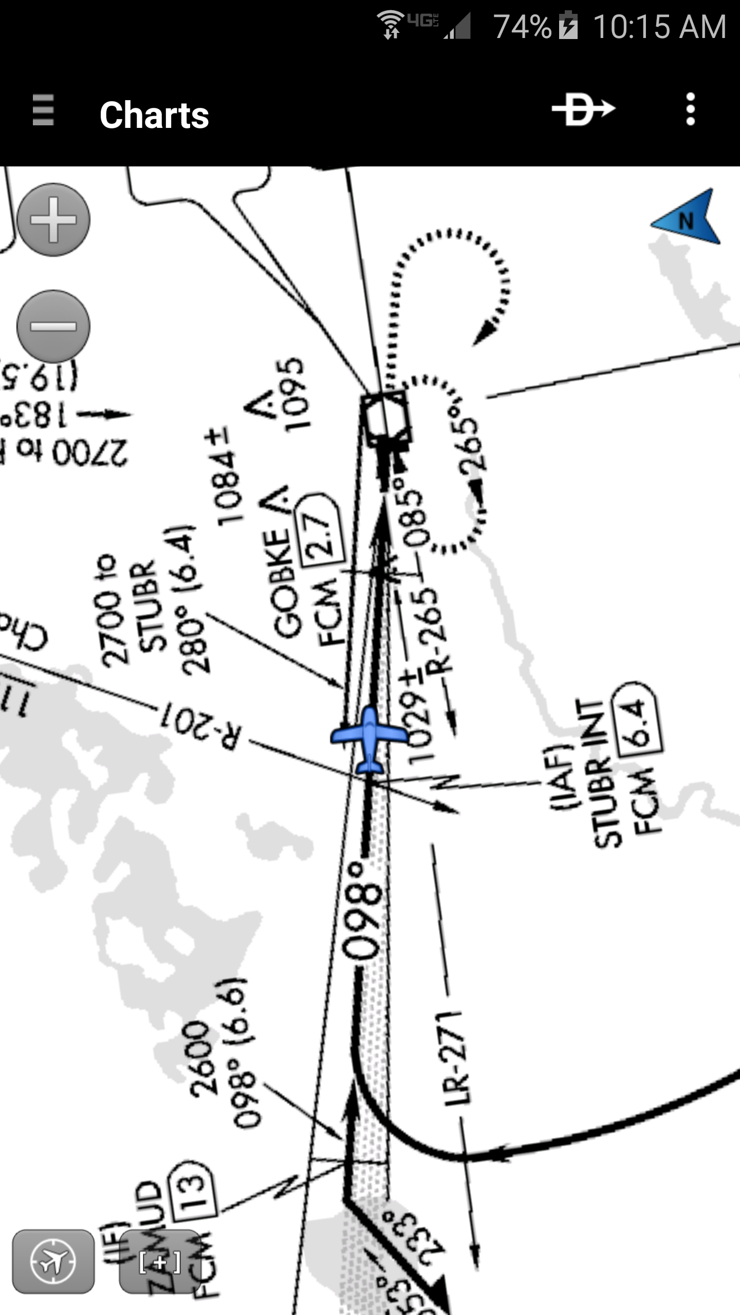
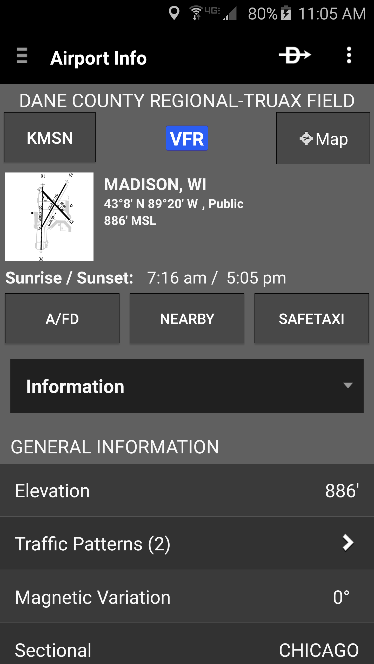
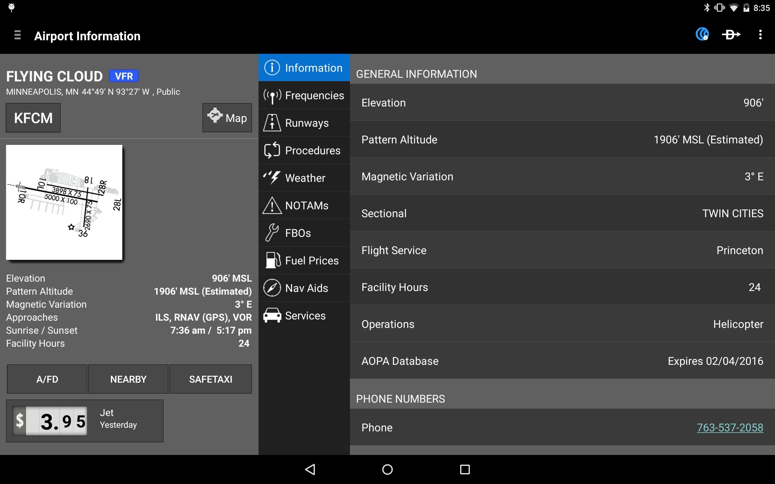
- Charts: VFR Sectionals, low and high IFR en-route charts, airport diagrams, and approach procedures
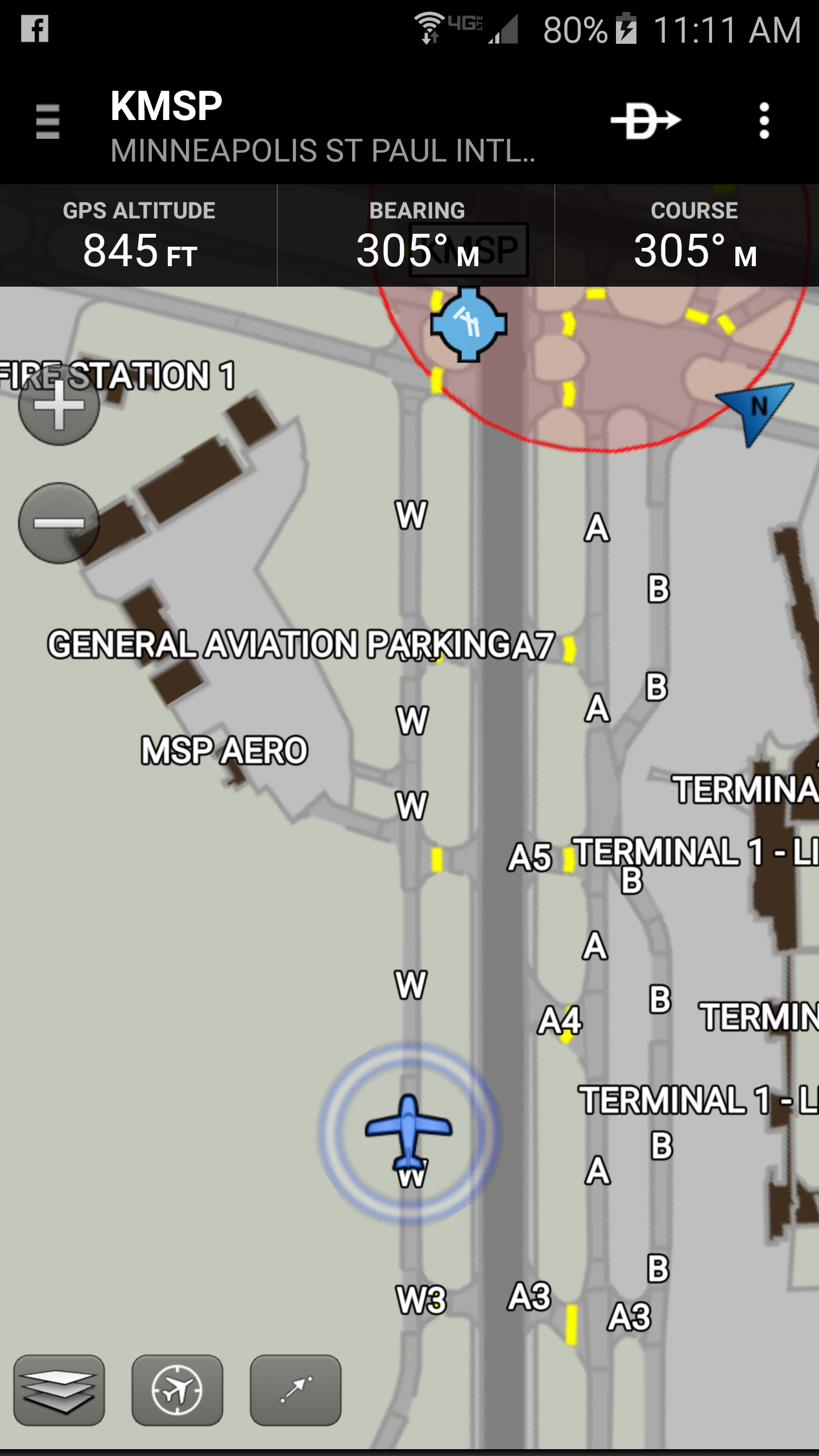
- Optional geo-referenced Garmin FliteCharts® and Garmin SafeTaxi® displaying aircraft position on approach charts and taxiways
- Weather Maps: Animated radar, AIRMETs/SIGMETs, lightning data, PIREPs, METARs/TAFs, winds aloft, TFRs, and infrared and visible satellite images
- A wealth of text products: METARs, TAFs, winds aloft, PIREPs, AIRMETs, SIGMETs, area forecasts, and NOTAMs
- Dynamic overlays of weather data combined with your plotted route on the map
- AOPA Airport Directory
- Capability to file flight plans via Lockheed Martin and DUATS
- Comprehensive weather information sourced directly from the National Weather Service and Environment Canada
From Pre-Flight Jitters to Pure Confidence: How Garmin Pilot Became My Essential Copilot
That 30-day trial felt like unlocking a new level of aviation, transforming my tablet into the most valuable piece of gear in my flight bag. While the list of features like charts and weather overlays sounds comprehensive on paper, the real magic of Garmin Pilot lies in how seamlessly and reliably it integrates the entire flight lifecycle, drastically reducing cockpit workload. Pre-flight planning became a revelation. The ability to dynamically overlay detailed Nexrad radar, METARs, SIGMETs, and TFRs directly onto my precise VFR sectional route wasn't just convenient; it was life-savingly intuitive. Instead of mentally cross-referencing multiple sources, I saw exactly where a growing storm cell intersected my planned path near the Appalachians last week, allowing me to confidently file an altered route before engine start. The user interface truly mirrors Garmin avionics – transitioning from tapping through weather briefings to in-flight navigation felt completely natural, like using an extension of my panel.
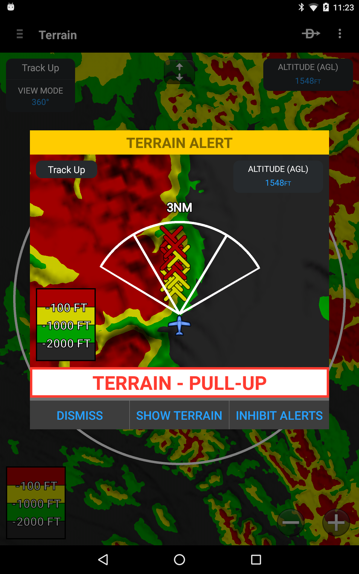
The geo-referenced approach charts with aircraft position during a moonless night IMC approach provided an incredible layer of situational awareness I didn't know I was missing. But it's the little things: pre-filing my most common cross-countries in seconds, the NavTrack silently monitoring weather enroute while I focused on airwork, or the sheer relief of opening the app post-flight to find my logbook meticulously auto-filled with GPS-accurate times and legs. It reduces mental clutter so effectively, letting me fly more and manage less. Security updates and bug fixes aside, this update solidified it: Garmin Pilot isn't just software; it’s the indispensable digital copilot that makes every flight safer, smoother, and far more enjoyable. Goodbye, frantic binders of paper charts and disjointed web tools.
FAQs Tackled by Hands-On Use:
Q: How does the weather overlay actually help compared to just checking METARs?
A: Seeing the animated radar loop directly over your planned route line on the sectional instantly visualizes threats. It’s the difference between knowing there’s rain near an airport and seeing if that rain movement crosses your path at your estimated time – critical for go/no-go and routing decisions.
Q: Is the auto-logging via GPS truly accurate and useful?
A: Surprisingly flawless. It captures exact takeoff/landing times, routes flown (even deviations!), and duration automatically. It saves significant post-flight admin time and provides an accurate, defensible digital record, automatically tracking currency requirements.
Q: Does the Garmin touchscreen familiarity translate well to the app?
A: Absolutely. If you've flown with modern Garmin panels (like a GTN series), the layout and interaction logic (panning, zooming, selecting options) is immediately recognizable. This drastically reduces the learning curve and minimizes head-down time in the air.
Q: How reliable is the filing & closing via Lockheed Martin/DUATS?
A: Rock solid in my experience. Inputting the plan is straightforward, and the "File," "Activate," and "Close" functions work reliably every time, eliminating the need for separate filing websites or FSS calls. It integrates perfectly into the pre/post-flight workflow.
- Version8.1.6
- UpdateAug 05, 2025
- DeveloperGarmin
- CategoryWeather
- Requires AndroidAndroid 5.0+
- Downloads265K+
- Package Namecom.digcy.pilot
- Signature3ec0b937563d96021cd88f5201b5901d
- Available on
- ReportFlag as inappropriate
-
NameSizeDownload
-
87.57 MB
-
64.51 MB
-
56.90 MB


Reduced app crashes after updates
Integration with Garmin panel devices
Intuitive user interface and design
Strong customer support experience
Features beneficial for flight planning (e.g., weighted balance calculations)
Consistent improvements over time
Compatibility with various Garmin products
Good navigation aid and situational awareness tool
Easy synchronization with other Garmin devices
Frequent crashes and bugs in Android version
Lacking features compared to iOS version
Poor performance affecting usability
Slow loading times for downloaded content
Issues with subscription management and syncing data
Inconsistent weather update functionality
Limited ADS-B hardware support
User interface could be more intuitive
Major reliance on internet connection for access to features