Add Date and Time on Photo - Geotag photos easily & efficiently
Capture moments with location details, timestamps, weather info & notes to treasure memories uniquely and conveniently.

- 18 Version
- 1.5 Score
- 317K+ Downloads
- Free License
- 3+ Content Rating

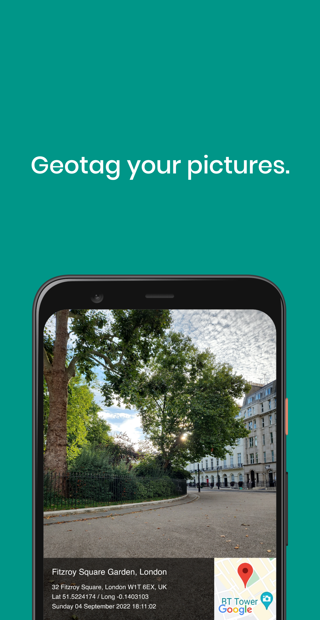
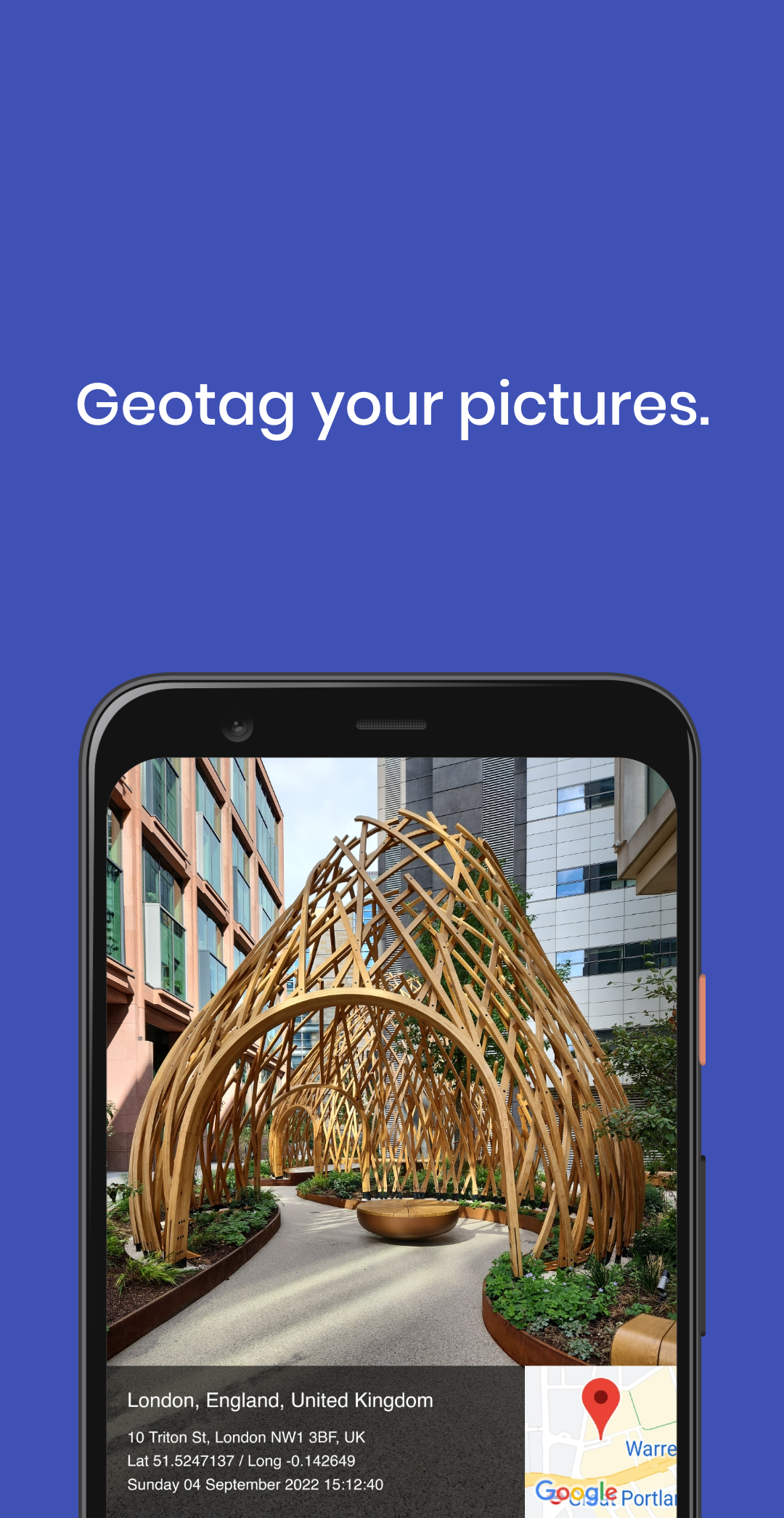
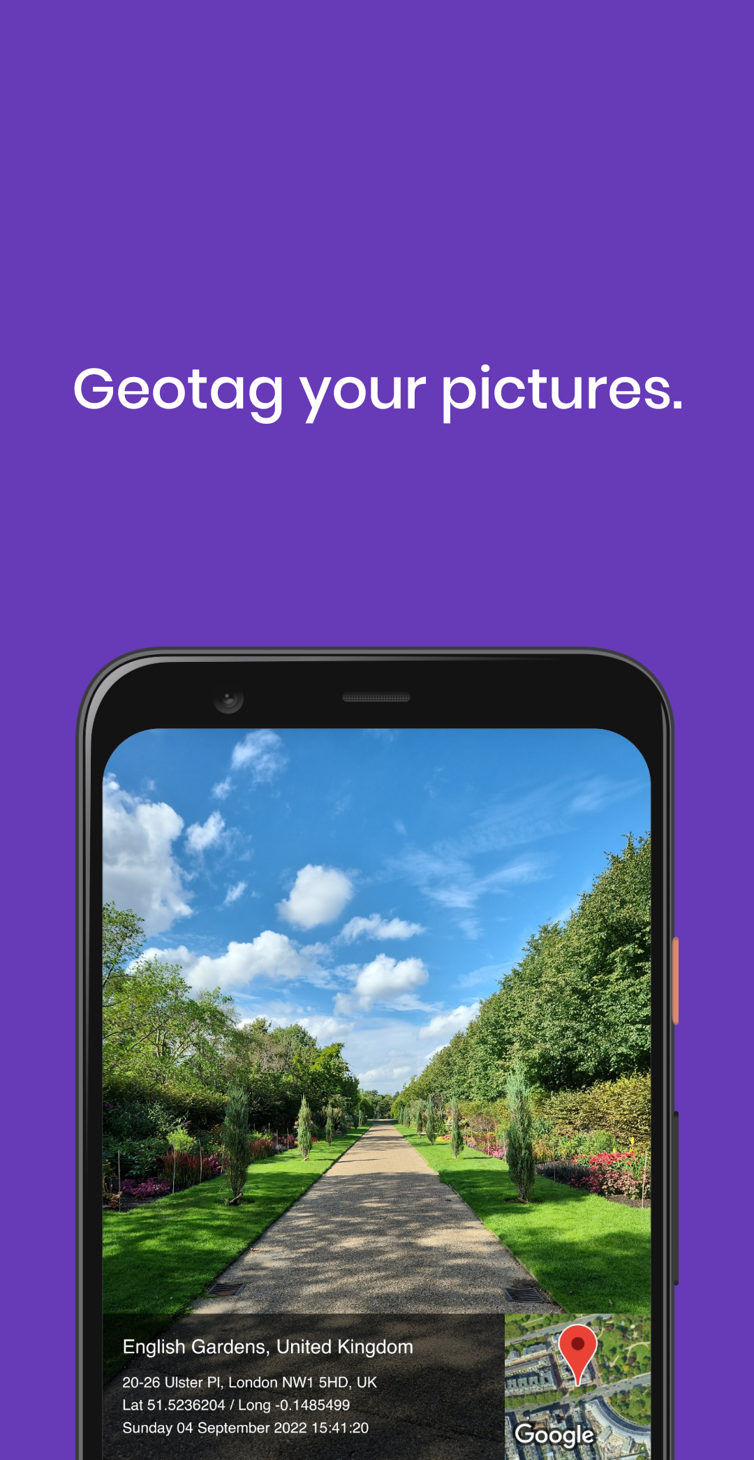
GeoSnap Tag is the pocket-sized geotagging studio that turns every photo into a fully-documented memory. Instead of wondering “Where was this shot?” or “What was the weather like that day?”, your images are automatically embedded with precise GPS coordinates, an interactive map thumbnail, exact date & time stamps, real-time weather data and your own personal notes. Whether you’re a globe-trotting photographer, a field researcher, a real-estate agent, or simply someone who loves organised memories, GeoSnap Tag makes your pictures tell the whole story—retroactively or on the spot.
KEY FEATURES
• Uses GPS, GLONASS & Galileo for sub-second location lock.
• Works with JPG, HEIC, PNG, TIFF and RAW (DNG, NEF, CR3).
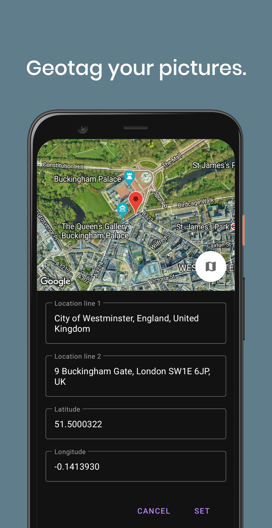
• Built-in mini-map with pin, satellite or hybrid view.
• Drag the pin to correct a location manually—great for indoor re-tagging.
• Add text captions, hashtags or record a 30-second voice memo that stays inside the EXIF.
• Strip or mask location before sharing to social media.
• Export “safe” copies with coordinates removed.
• Save originals to iCloud, Google Drive, Dropbox or OneDrive with tags intact.
POWER-USER TIPS
• Trip Mode: activate “Track Log” to record a continuous GPX file while you drive; later auto-match photos to the track.
• Keyboard Shortcuts (iPad): press “M” for map, “N” for notes while reviewing.
• Voice Commands: “Hey GeoSnap, add note ‘Golden hour at Uluru’.”
• Keep a star-rating system in notes (#★★★★) to sort your best shots later.
- Version18
- UpdateAug 26, 2025
- DeveloperHope Factory Apps
- CategoryPhotography
- Requires AndroidAndroid 10+
- Downloads317K+
- Package Namecom.hopefactory2021.gpscamera
- Signaturedb23c01fe94ebc8efc4977d877193659
- Available on
- ReportFlag as inappropriate
-
NameSizeDownload
-
6.00 MB
-
6.01 MB
-
4.57 MB


Simple and fast operation
Ad-free experience
Ability to change address and coordinates
Easy to adjust picture size (4:3/16:9)
Editing features for location names and notes
Almost zero latency, quick loading of coordinates
Option to upload live weather forecasts
Compact app with low storage usage
No option to deactivate latitude and longitude
Lack of map-only or location tag-only modes
App occasionally lags during use
Issues with saving locations without internet access
Glitches such as incomplete frame captures
GPS tag misalignment in landscape mode
Limited map style options
Information display remains in portrait format regardless of camera orientation