Watch Duty (Wildfire) - Wildfire alerts & mapping
Stay safe with real-time wildfire tracking & alerts from professionals monitoring conditions around the clock for you.

- 2024.6.25 Version
- 3.2 Score
- 829K+ Downloads
- Free License
- 3+ Content Rating

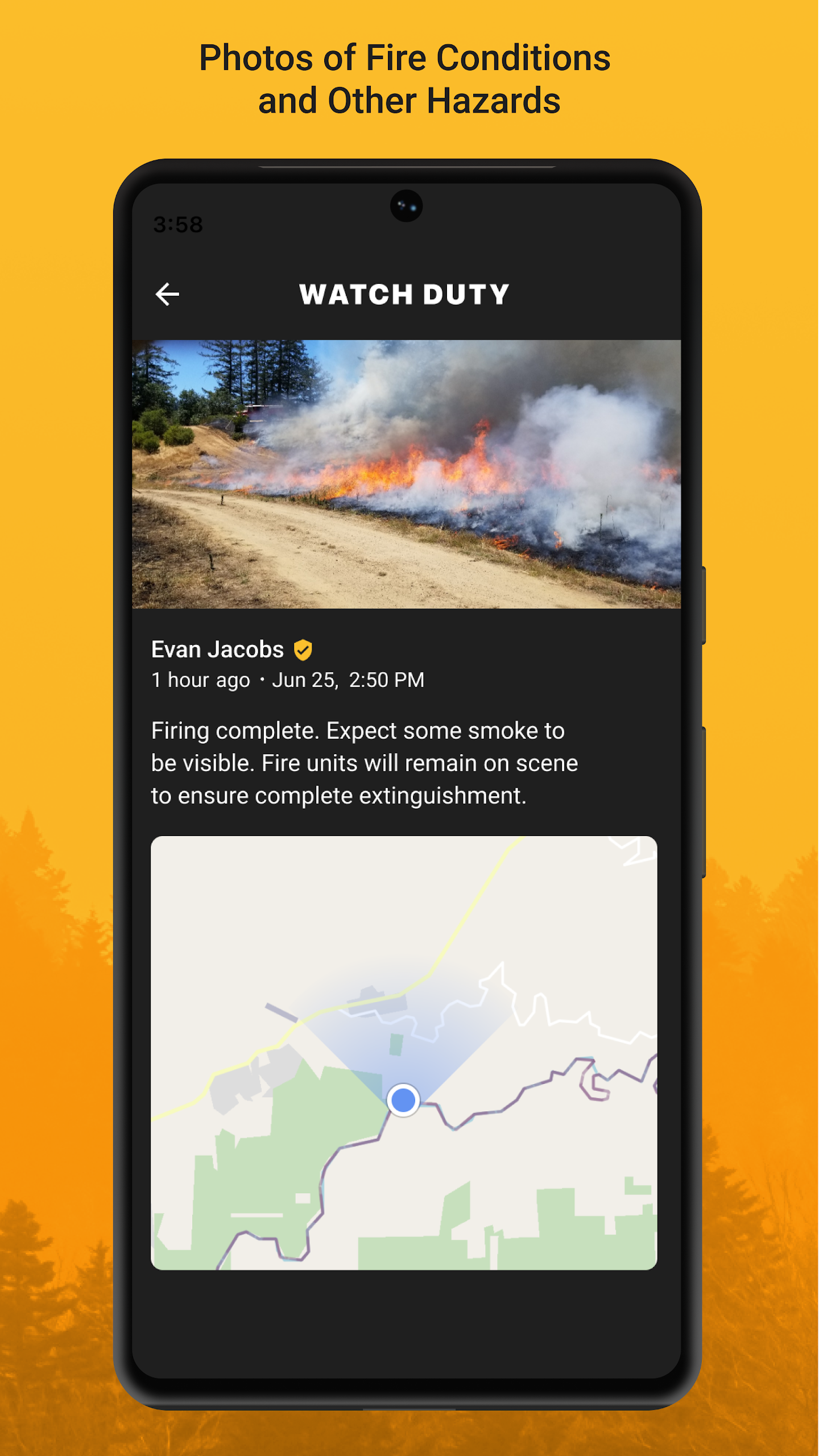
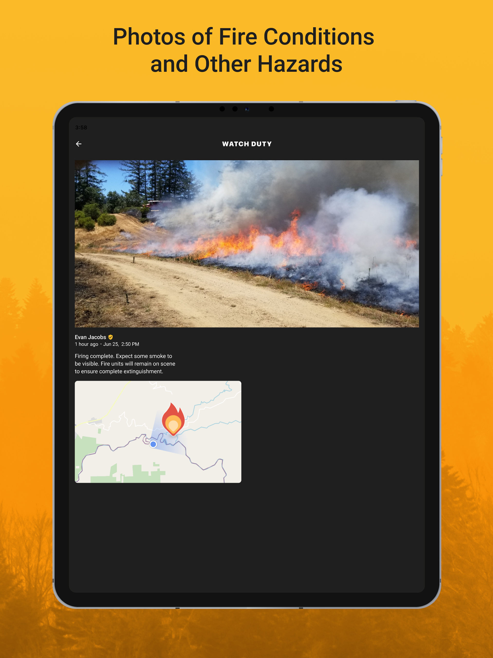
Watch Duty is a unique application designed for wildfire mapping and alerts, powered by real human contributions that provide you with real-time information verified by trained experts rather than machines. Unlike many apps that depend solely on delayed governmental notifications, Watch Duty delivers immediate, life-saving updates through a dedicated team of active and retired firefighters, dispatchers, first responders, and reporters who continuously monitor radio communications. Our objective is to keep you updated and safe with timely alerts and information.
Wildfire Tracking Features:
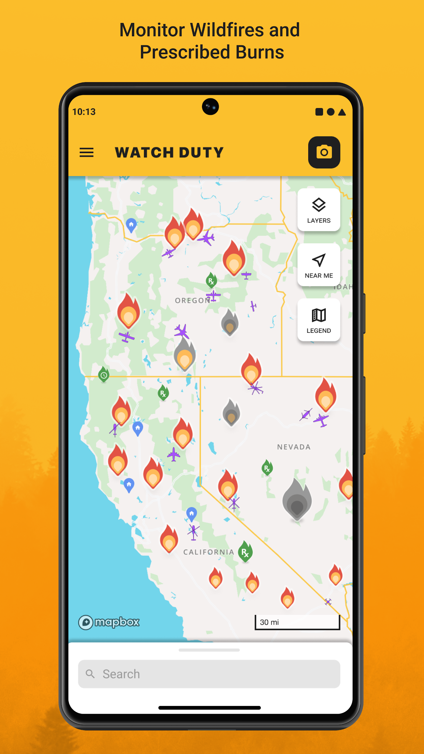
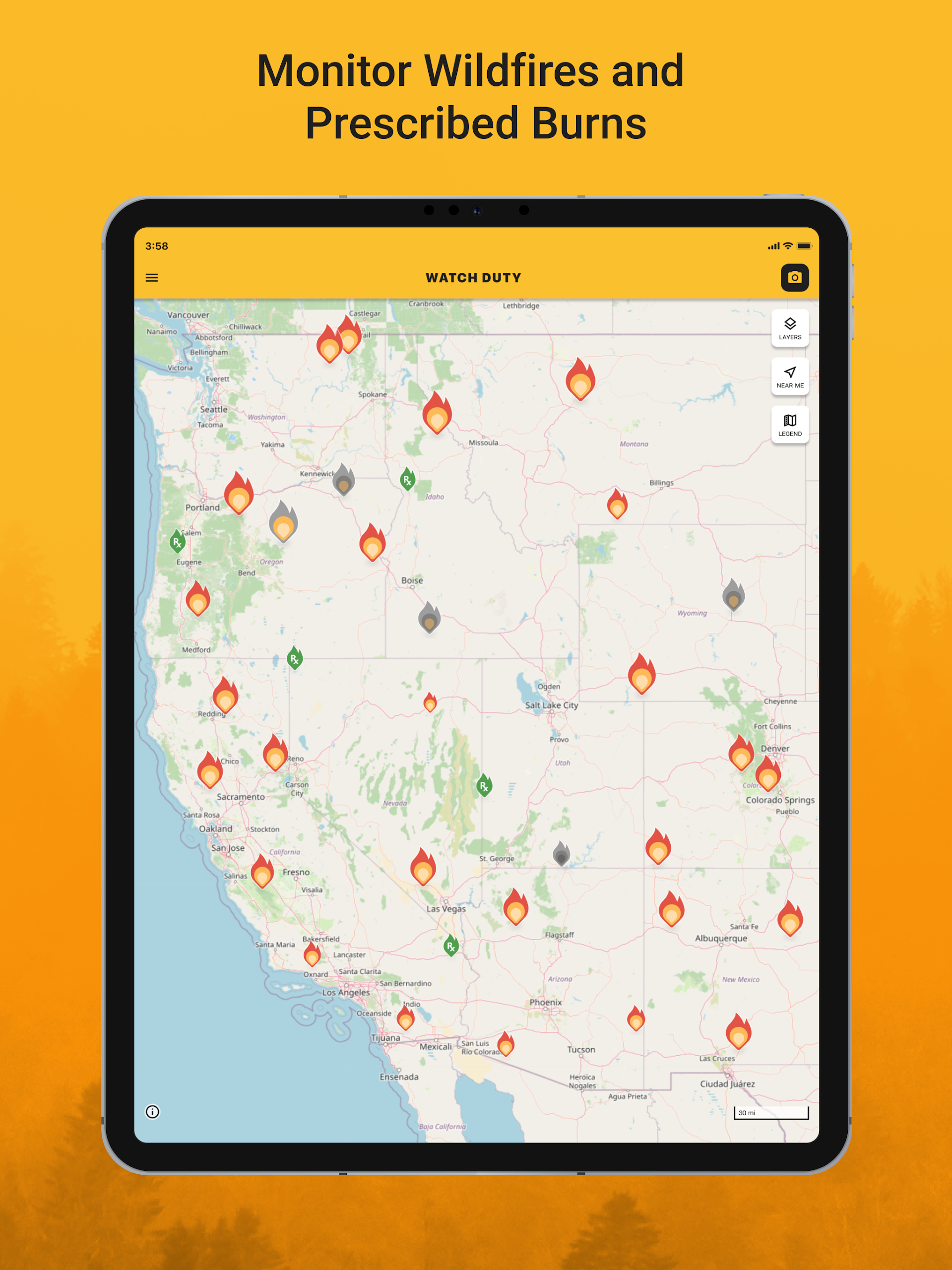
- Notifications about wildfires close to your location and ongoing firefighting initiatives
- Live updates reflecting changing conditions
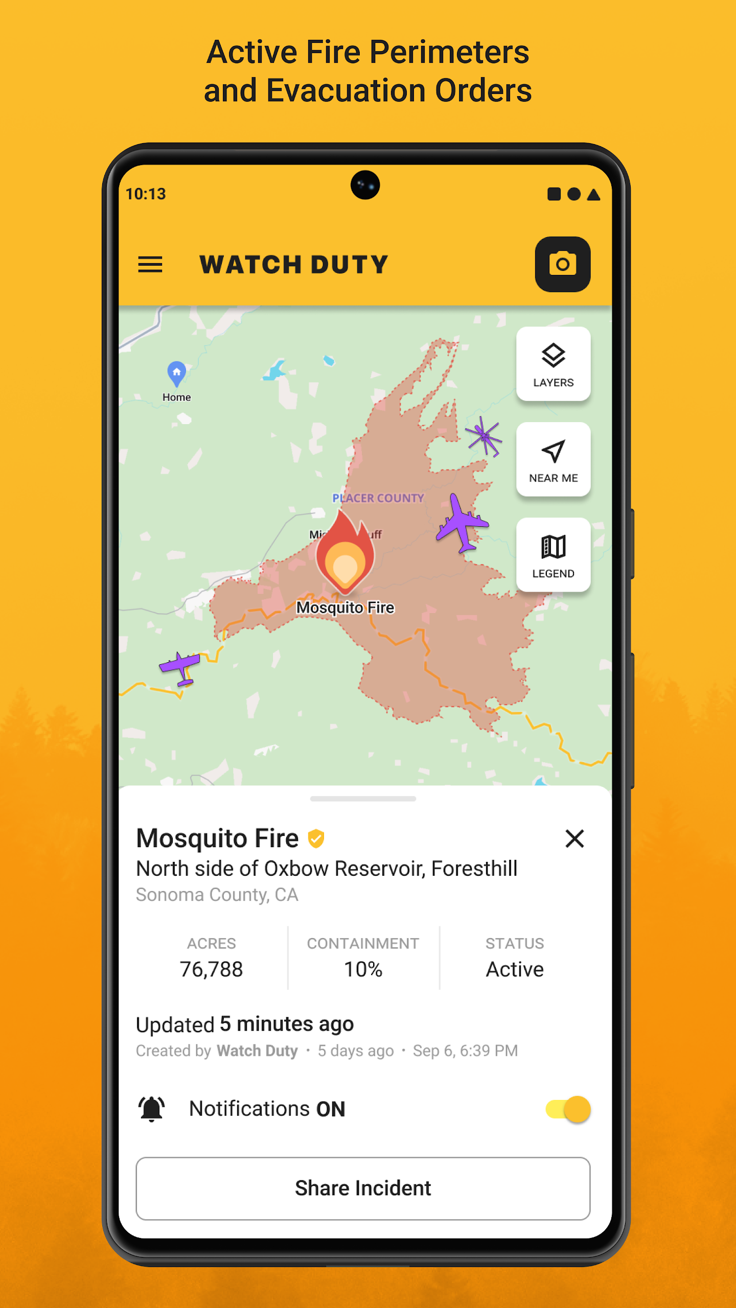
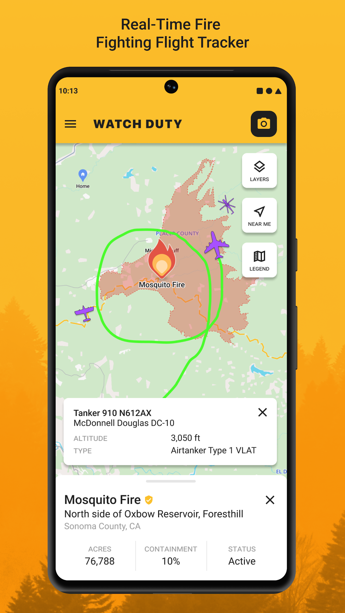
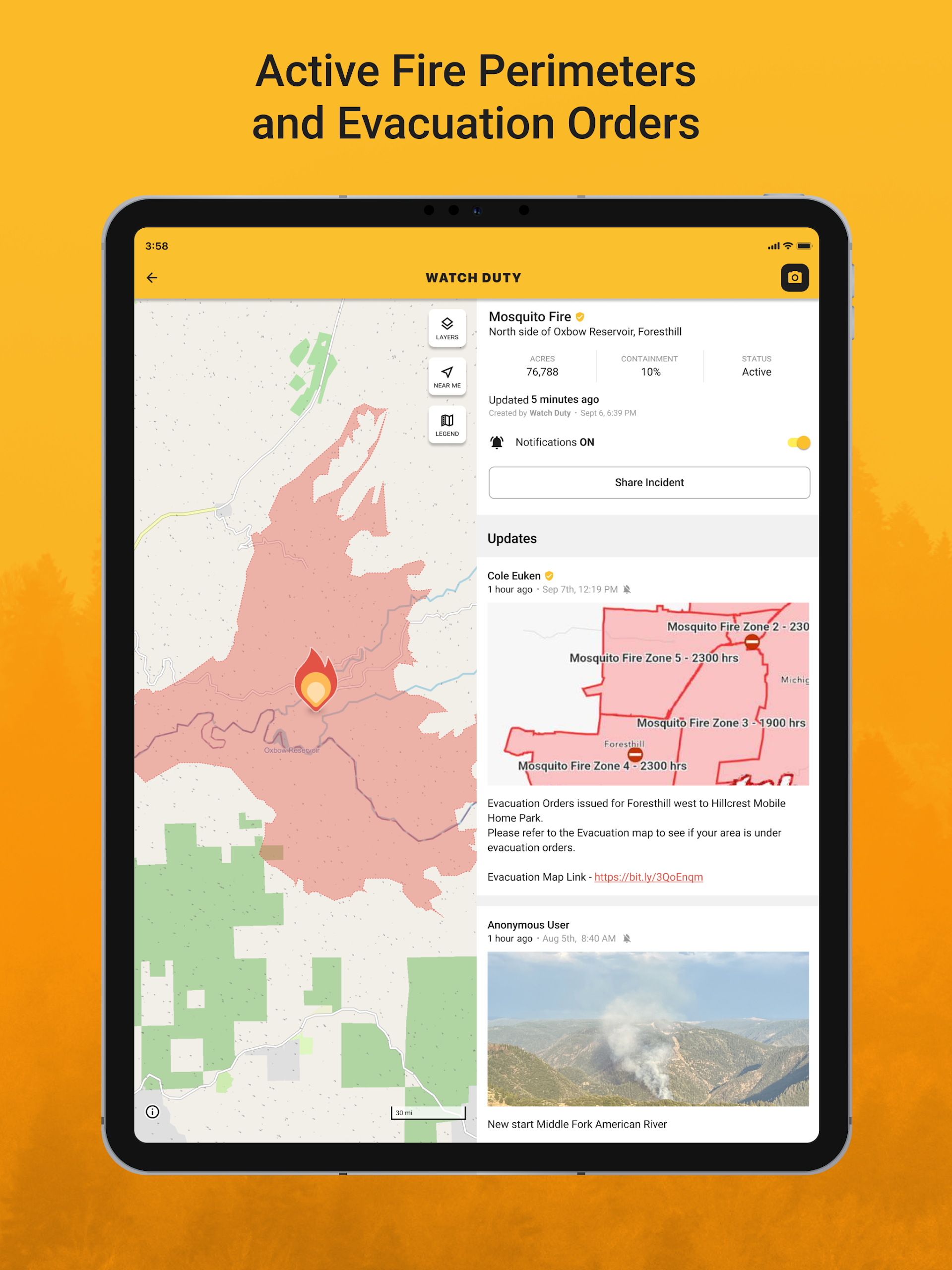
- Current fire boundaries and their development
- Infrared satellite hotspots from VIIRS and MODIS
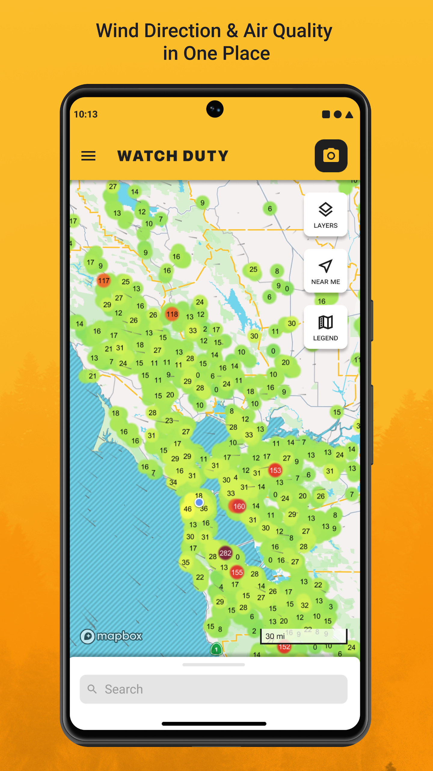
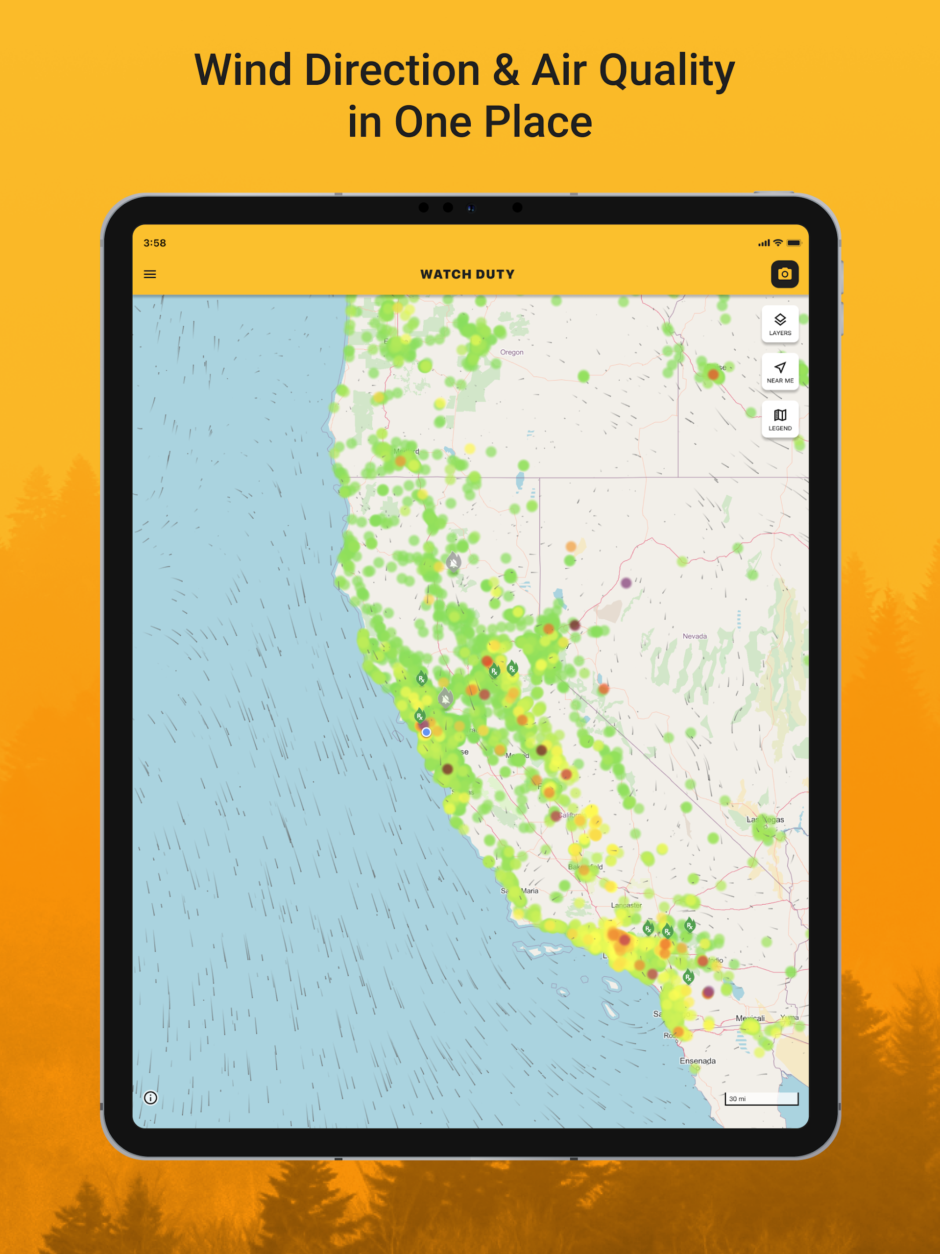
- Wind speed and direction indicators
- Information regarding evacuation orders and shelters
- Historical data on wildfire boundaries
- Access to street and satellite mapping
- Tracker for aerial firefighting operations
- Ability to save locations for easy map access
Watch Duty operates as a 501(c)(3) non-profit entity. Our services will always be offered free of charge, without any advertisements or sponsorships. Support for our mission can be provided through a $25 yearly membership, which gives access to exclusive features as a gesture of appreciation.
Disclaimer: Watch Duty does not have any affiliation with government bodies. The information shared within this application comes from publicly accessible and reliable sources, including but not limited to government entities, radio communications, and satellite information. Specific governmental resources include various agencies that assist in monitoring and managing wildfires.
FAQ
Where can I find my evacuation zone?
If you live in a county that uses Genasys Protect, you can find your evacuation zone by searching for your address here: https://protect.genasys.com/search
Note: Genasys is not used in all counties, and zones may change if they get split during a fire.
If your county doesn't use Genasys Protect, please consult your county's website.
What states and counties do you cover?
Since our launch in 2021 where we monitored 3 counties in northern California, to now cover 22 states, Watch Duty will continue to our expand our coverage area. As of Dec 21, 2024, we report on the following 22 states.
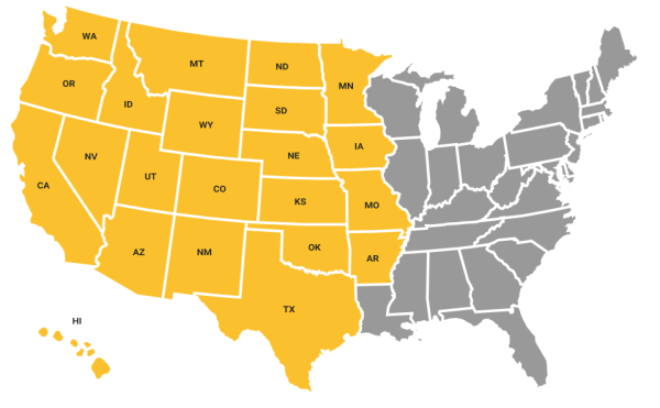
Arizona
California
Colorado
Idaho
Oklahoma
Oregon
Montana
Nevada
New Mexico
Texas
Utah
Washington
Wyoming
Hawai’i
North Dakota
South Dakota
Nebraska
Kansas
Minnesota
Iowa
Missouri
Arkansas
How many devices can I use Watch Duty on?
You can use your membership on all of your personal devices.
Please note that while your saved places are synced across devices, notifications—for example, counties you are subscribed to—are not. In other words, make sure you are subscribed to counties you’d like notifications for on every device you’re using.
How do I become a member of Watch Duty?
Becoming a member of our 501(c)(3) non-profit is easy! In the left hand menu of Watch Duty is a link to 'Become a Member'. There you can pay with Credit Card, Apple Pay, or PayPal. Once you become a member you will get access to our special members only features as a thank you for supporting us.
- Version2024.6.25
- UpdateOct 11, 2025
- DeveloperWatch Duty
- CategoryCommunication
- Requires AndroidAndroid 5.1+
- Downloads829K+
- Package Nameorg.watchduty.app
- Signature3d21cf7480f099ea13b0af706a86d66f
- Available on
- ReportFlag as inappropriate
-
NameSizeDownload
-
23.61 MB
-
18.28 MB
-
23.19 MB


Excellent real-time notifications for wildfires
Comprehensive coverage across multiple counties
User-friendly interface with up-to-date data
Free version available to access essential information
Ability to track fire progression and containment levels
Detailed maps showing evacuation zones and fire perimeters
Community-driven updates increasing reliability
Features like wind direction and live camera views
Supports users in remote areas or during travel
Limited availability for states outside the primary regions
Frequent crashes reported by users on certain devices
Excessive notifications for large counties causing annoyance
Technical issues with updates leading to app malfunction
Inconsistent notification accuracy across different counties
Restrictions on the number of counties users can monitor
Problems with GPS location tracking for alerts
App performance can slow down with updates
Some features require a paid membership for full access