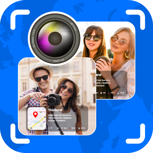
GPS Camera Map Geotag Location - Photograph & map integration
Capture photos with embedded GPS location data for easy organization.
- 2.0.5 Version
- 1.5 Score
- 1M+ Downloads
- In-app purchases License
- 3+ Content Rating

GPS Camera Map Geotag Location is a clever tool to add geotag locations to your photos. Easily track and save your GPS location, and effortlessly share it with others using this application focusing on GPS camera location and geotagging capabilities.
GPS Map Camera: Capturing Photos with GPS Location & Map
Install GPS Map Camera & Geotag on Photos with Add GPS Location App on your Android device to record your locations on camera-captured photos through GPS coordinates. Enhance your photos with Geotag Photos & Add GPS Location features provided by this app.
GPS Photo With Location - Camera GPS Photo Location:
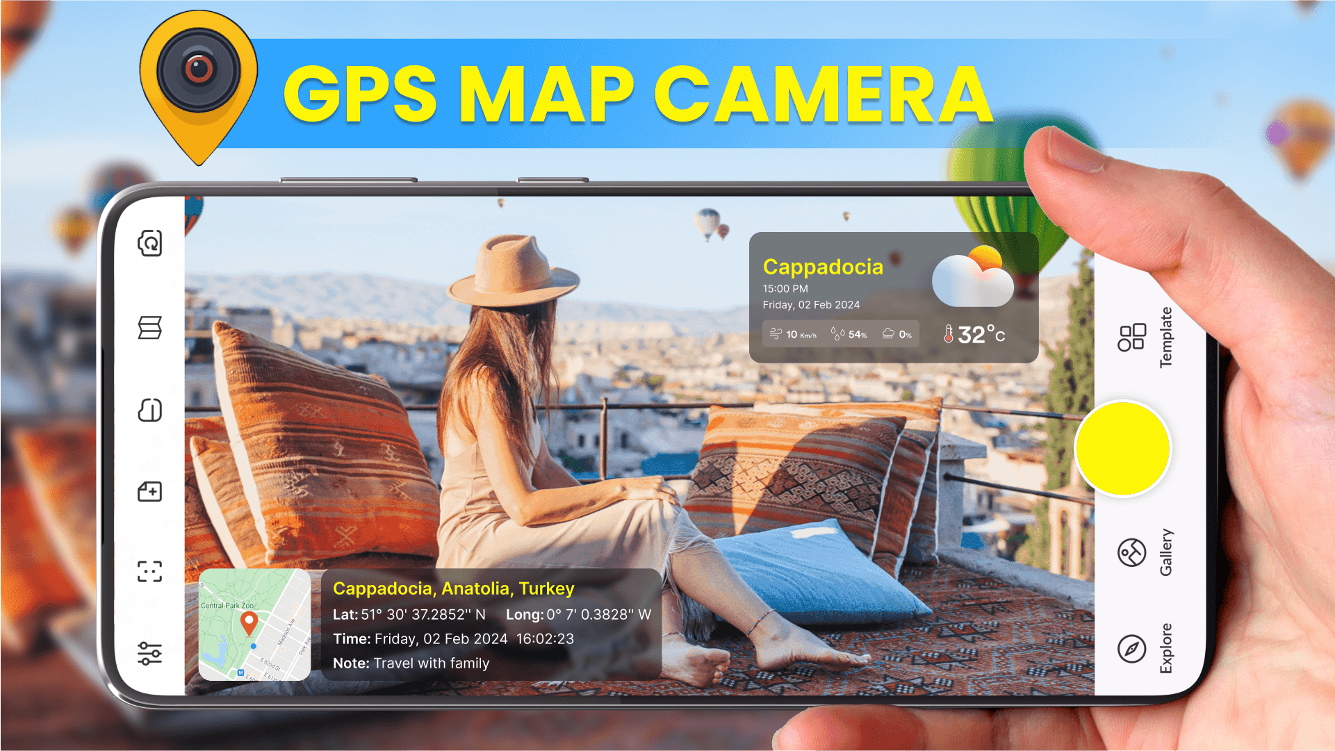
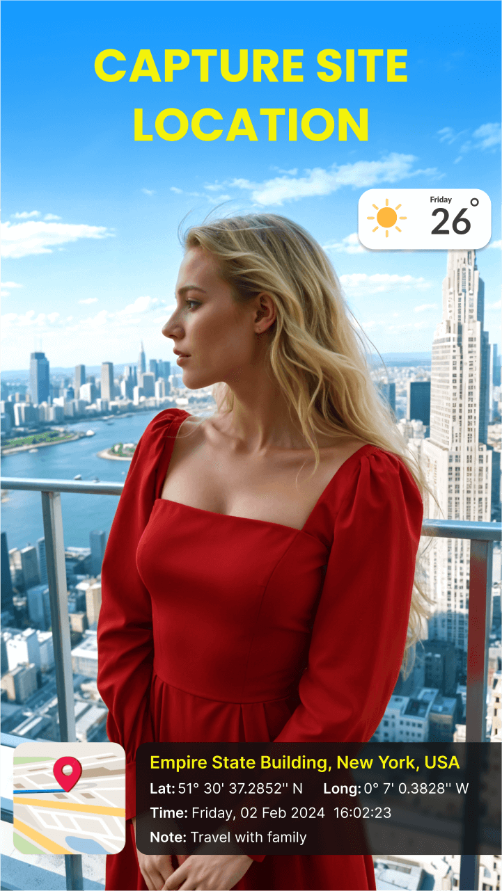
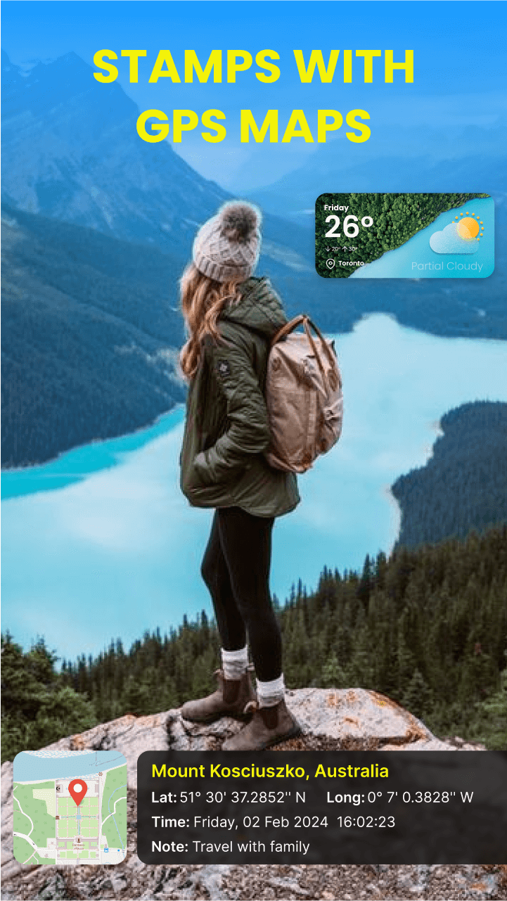
Keep tabs on your current location and weather conditions when snapping photos with the GPS camera feature that includes latitude and longitude data for geotagging photos and adding GPS locations.
Geo Camera App - GPS Camera with Longitude and Latitude
Download the location-adding app and share geolocation details of places or streets via photos with loved ones to reminisce about travel memories. Incorporate the GPS camera feature within this app for easy geotagging.
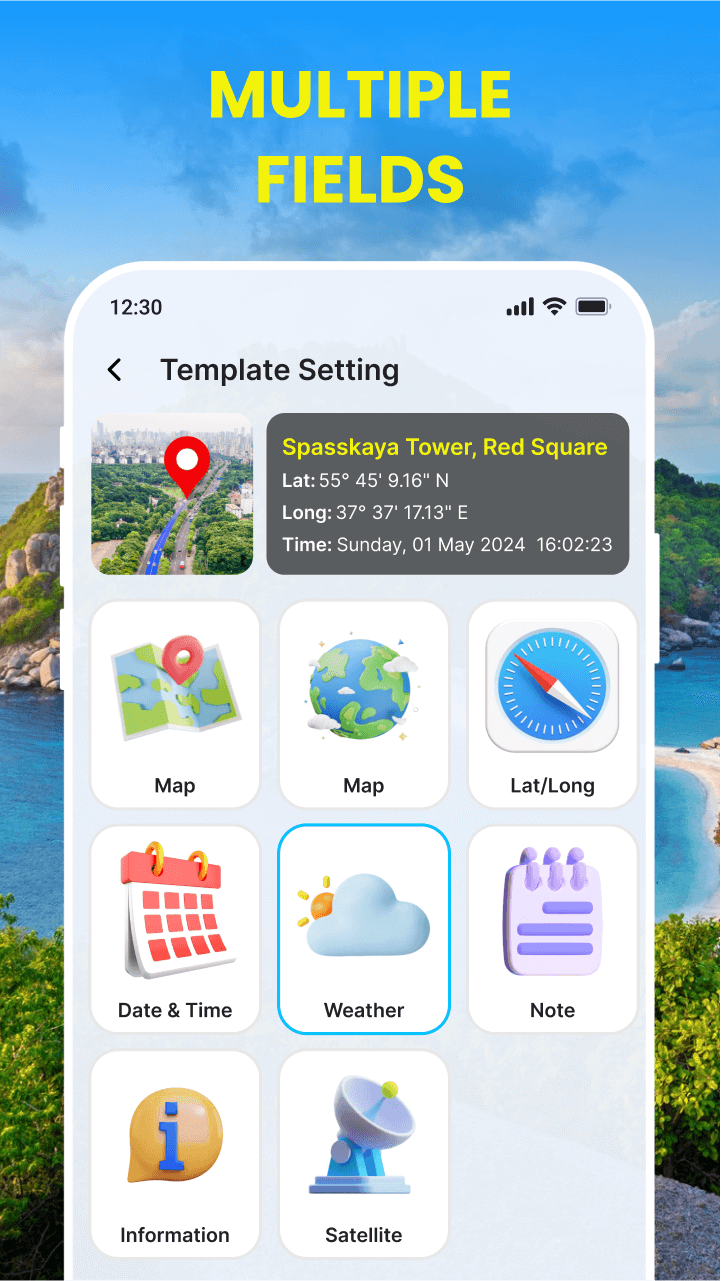
Key Features of GPS Camera Location with Latitude and Longitude - Camera GPS:
Camera App - Adding GPS Locations:
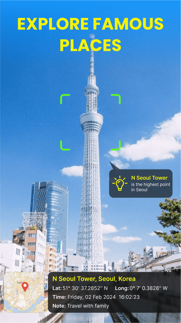
📸 Retrieve GPS Coordinates of your current location using the GPS camera function along with the GPS map cam.
Time Stamp Camera - Swift Image Capture:
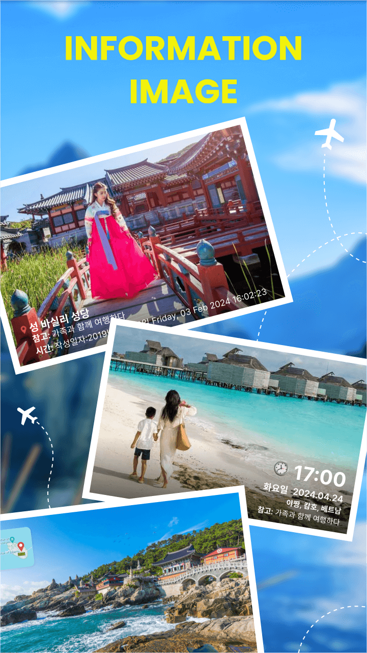
🗺️ Share GPS location photos easily in the GPS Status camera and geotag photo app. Add geotags to your photos with the GPS camera feature.
Photo Settings - Self-timer Camera:
⏲️ Include GPS coordinates in your Gallery and Camera settings for geotagged photos akin to geostamping images.
Long Exposure Camera - GPS Camera Map:
🌡️ Seamlessly share photos embedded with your GPS status using the GPS Photo Viewer app for a comprehensive mapping experience.
GPS Map Camera - Stamp Camera:
☀️ Automatically attach notes to your photos using the GPS Camera equipped with an Automatic Note feature for seamless geotagging.
GPS Location, GPS Map Camera:
⛱️ Save your position swiftly and accurately utilizing the integrated camera with GPS location, aptly named the GPS map camera.
Map Camera Date and Exact Time: GPS Map Camera Location
☁️ Opt for Photo GPS Location & Date Photo GPS for optimal results when using the camera feature with GPS for precise location tracking. Download GPS camera with location functionality for enhanced experiences.
How many times have you found yourself in a situation where you want to take a picture of a certain place but don’t know the exact location? Or maybe you want to share the exact location of a certain place with your friends but don’t want to spend the time and effort to do so? Well, you don’t need to worry about any of those problems anymore because GPS Map Camera & Geotag Location has come to the rescue! With this app, you can add the location of a certain place to your photos and post them on social media without having to worry about the quality of the picture.
It’s a very simple app, and you can use it with your phone or tablet. Just install it on your device and start using it. It’s easy to use and very user-friendly.
- Version2.0.5
- UpdateAug 10, 2024
- DeveloperImagination.AI
- CategoryTravel & Local
- Requires AndroidAndroid 7.0+
- Downloads1M+
- Package Namecom.app.tools.town.gps.camera.live.map
- Signature936b9b5cd2bdb31ad9e2fe9a3ad094a2
- Available on
- ReportFlag as inappropriate
-
NameSizeDownload
-
39.16 MB
-
40.08 MB
-
15.46 MB


brilliant app to get around the places
Good quality camera with all features like weather, time, humidity, and latitude longitude
our photos and our location are all analyzed
Stuck on Advertising Page
Free trial option is deceptive