WiGLE WiFi Wardriving - Network mapping & observation
Discover hidden networks, track findings, & compete globally with real-time mapping and community engagement through GPS tracking.

- 2.94 Version
- 4.6 Score
- 576K+ Downloads
- Free License
- 3+ Content Rating

About the app
This is an open-source tool for observing, positioning, and displaying wireless networks derived from the largest accessible database globally. It can assist in site surveys, security evaluations, and friendly competitions with others. Users can gather networks for personal study or submit their findings to a dedicated platform. Since its inception in 2001, this repository has accumulated and mapped over 350 million networks. It's important to note that this service does *not* provide a list of usable networks.
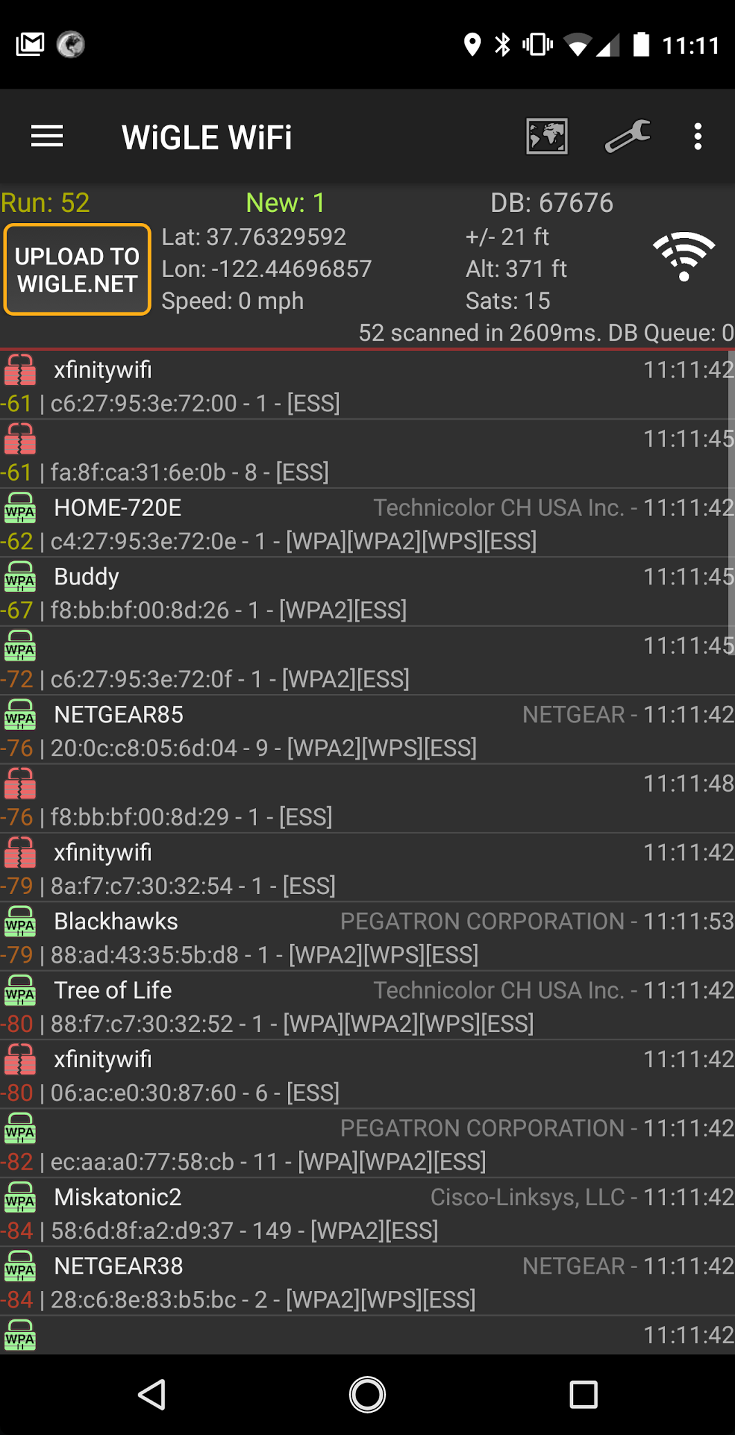
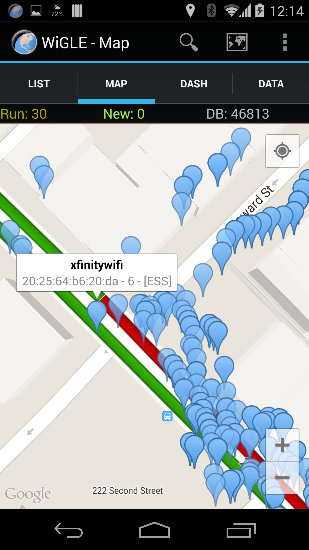
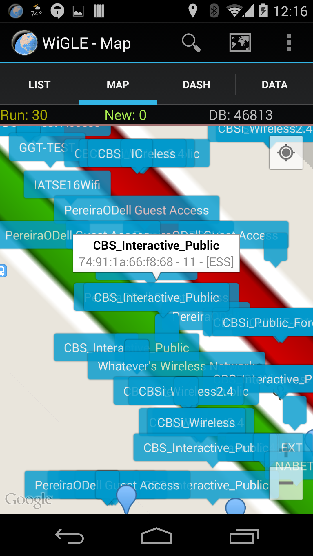
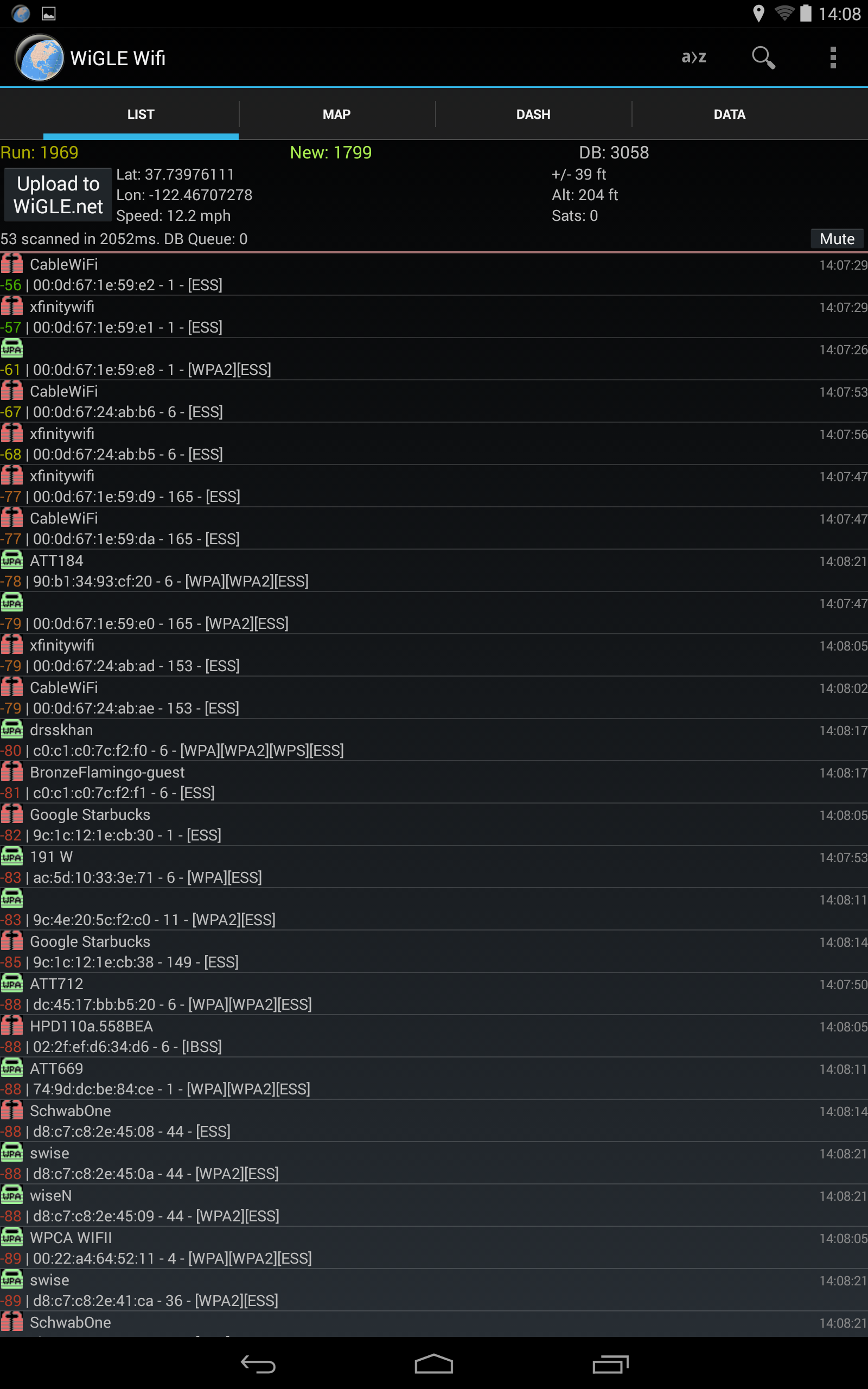
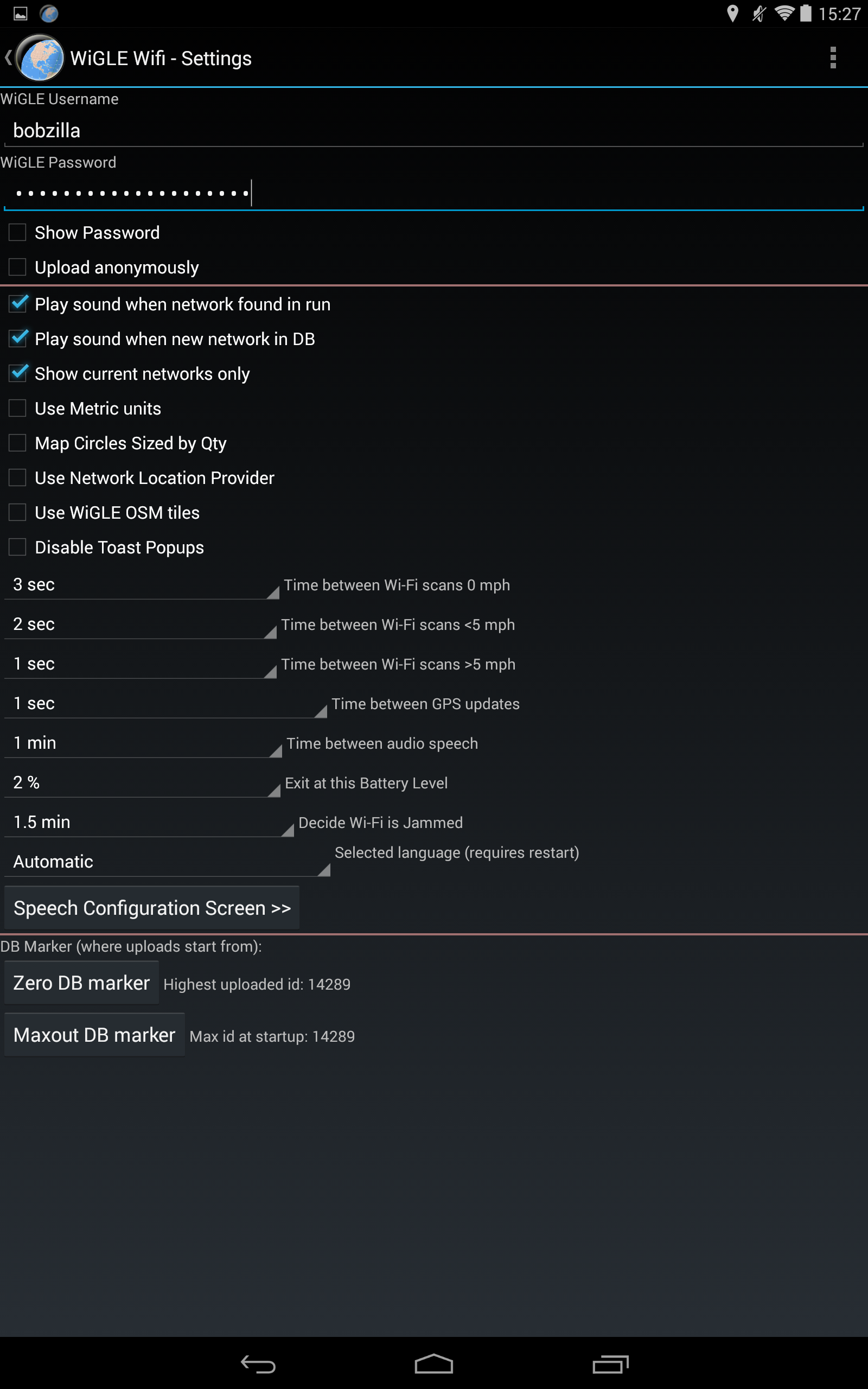
* Leverages GPS technology to approximate the locations of detected networks
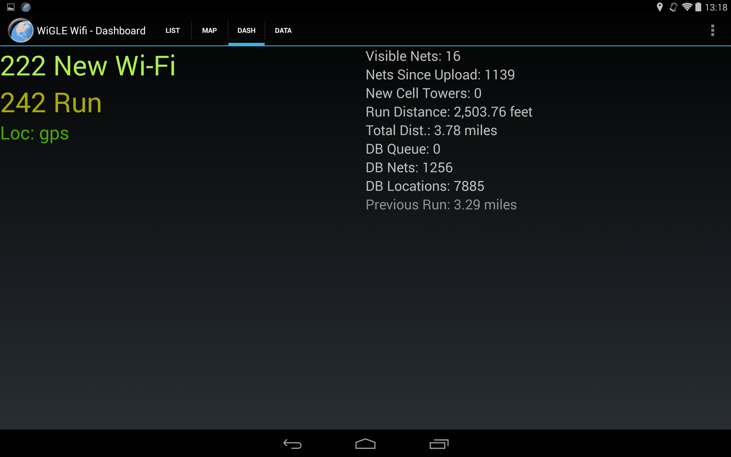
* Stores observations in a local database to monitor discovered networks
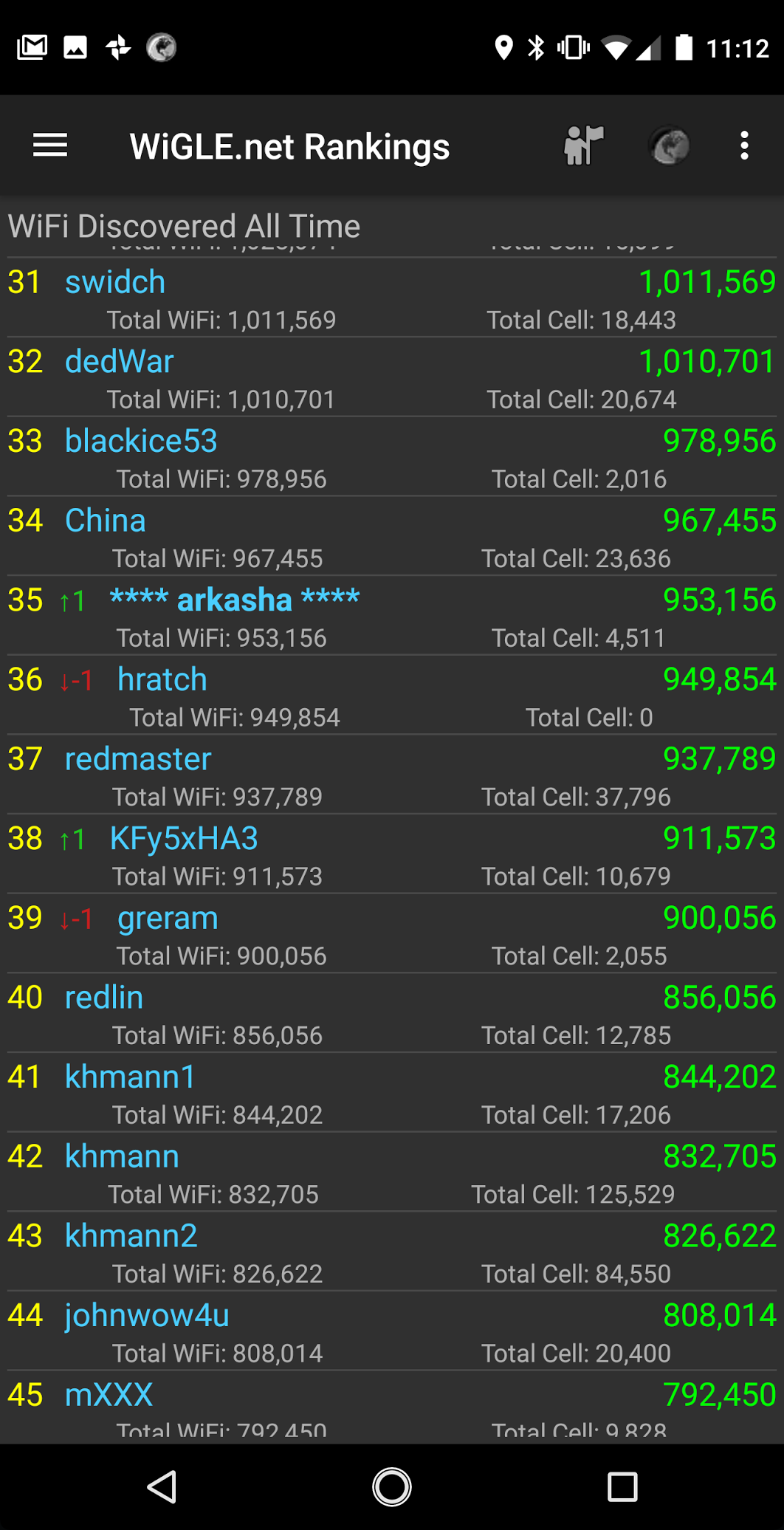
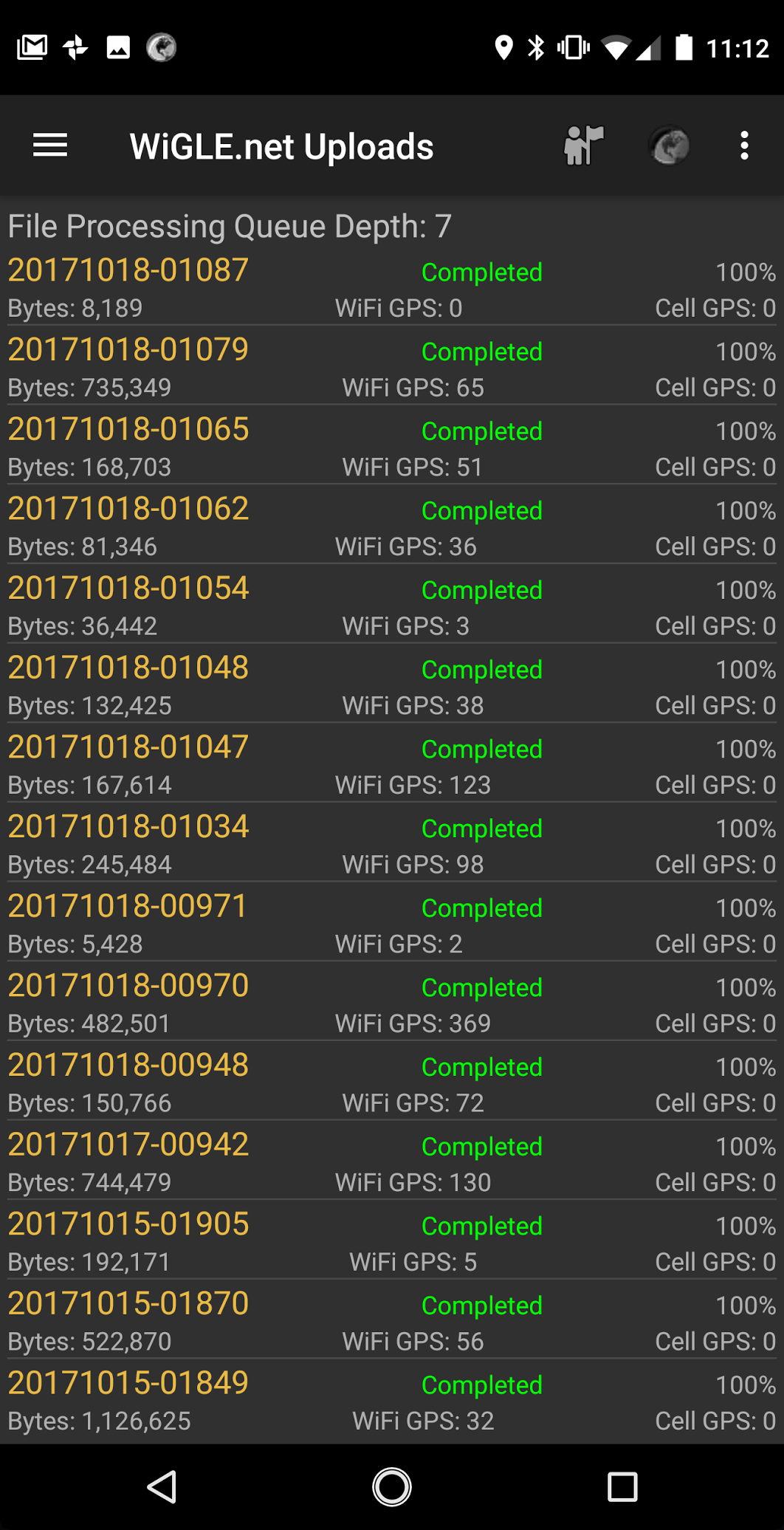
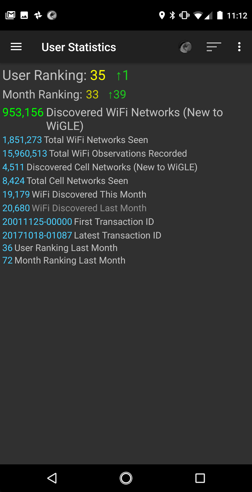
* Allows users to upload data and compete on a global leaderboard
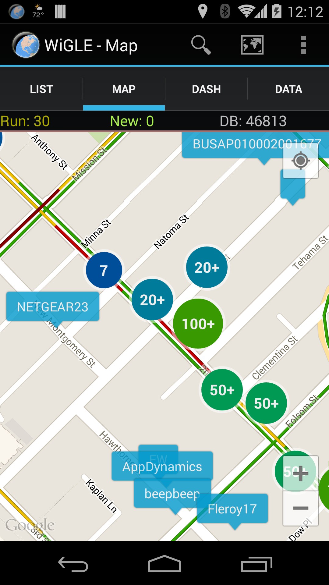
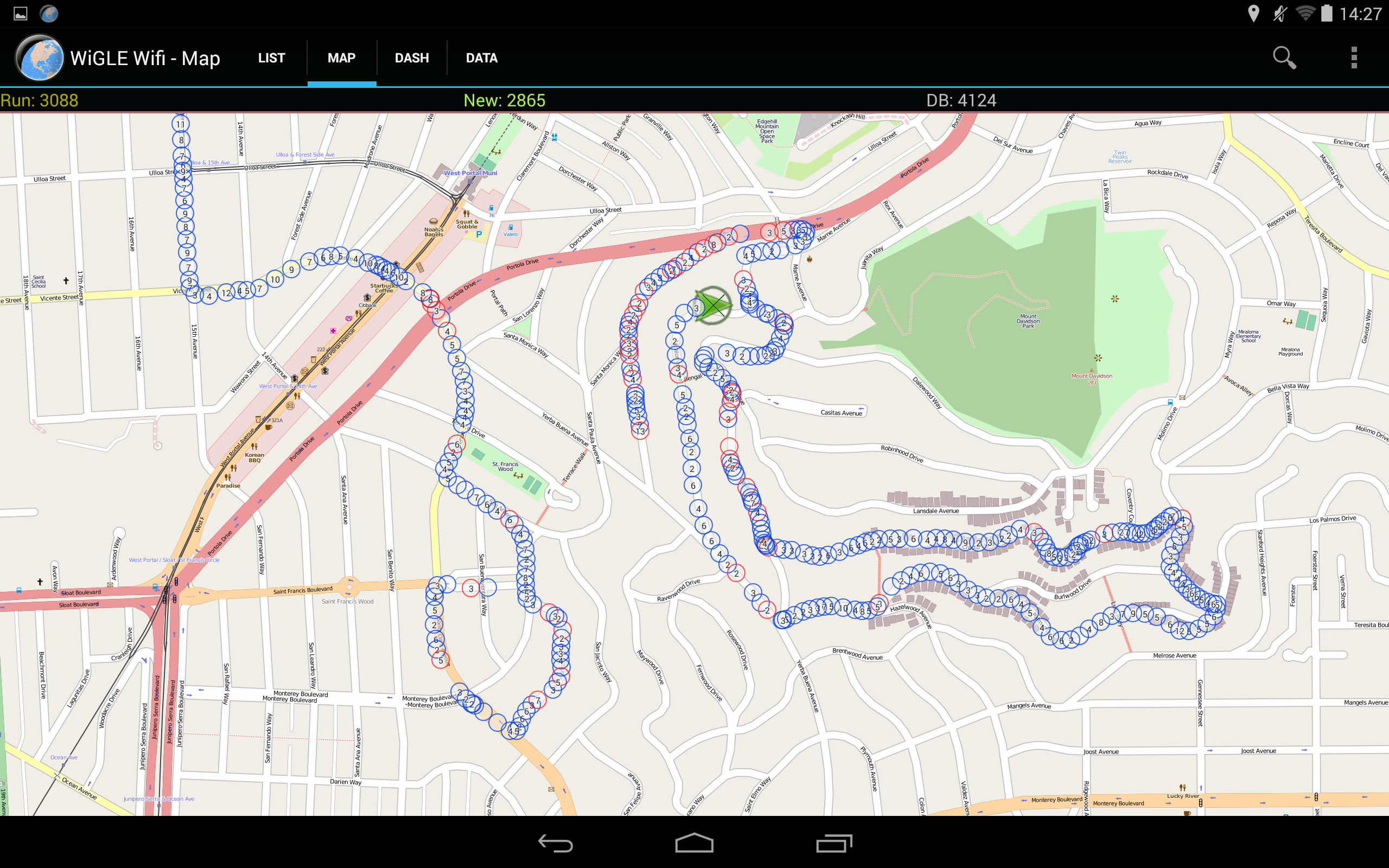
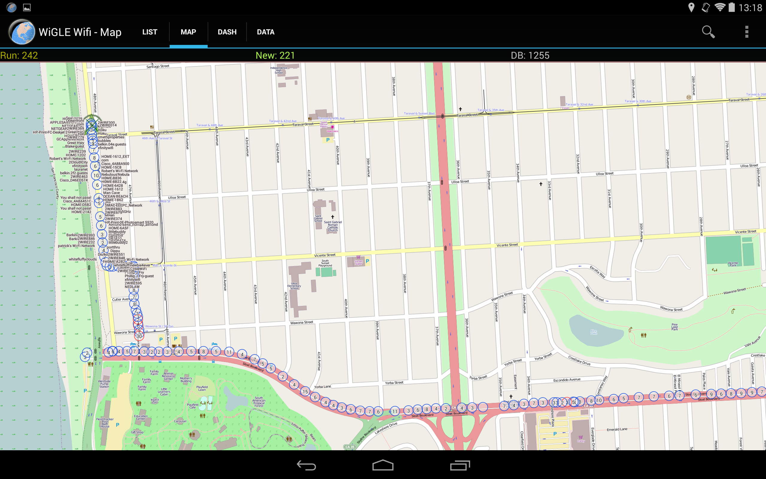
* Provides a real-time map of detected networks, enriched with overlays from the entire dataset
* Open-source and free of charge, with no advertisements (contributions are welcome)
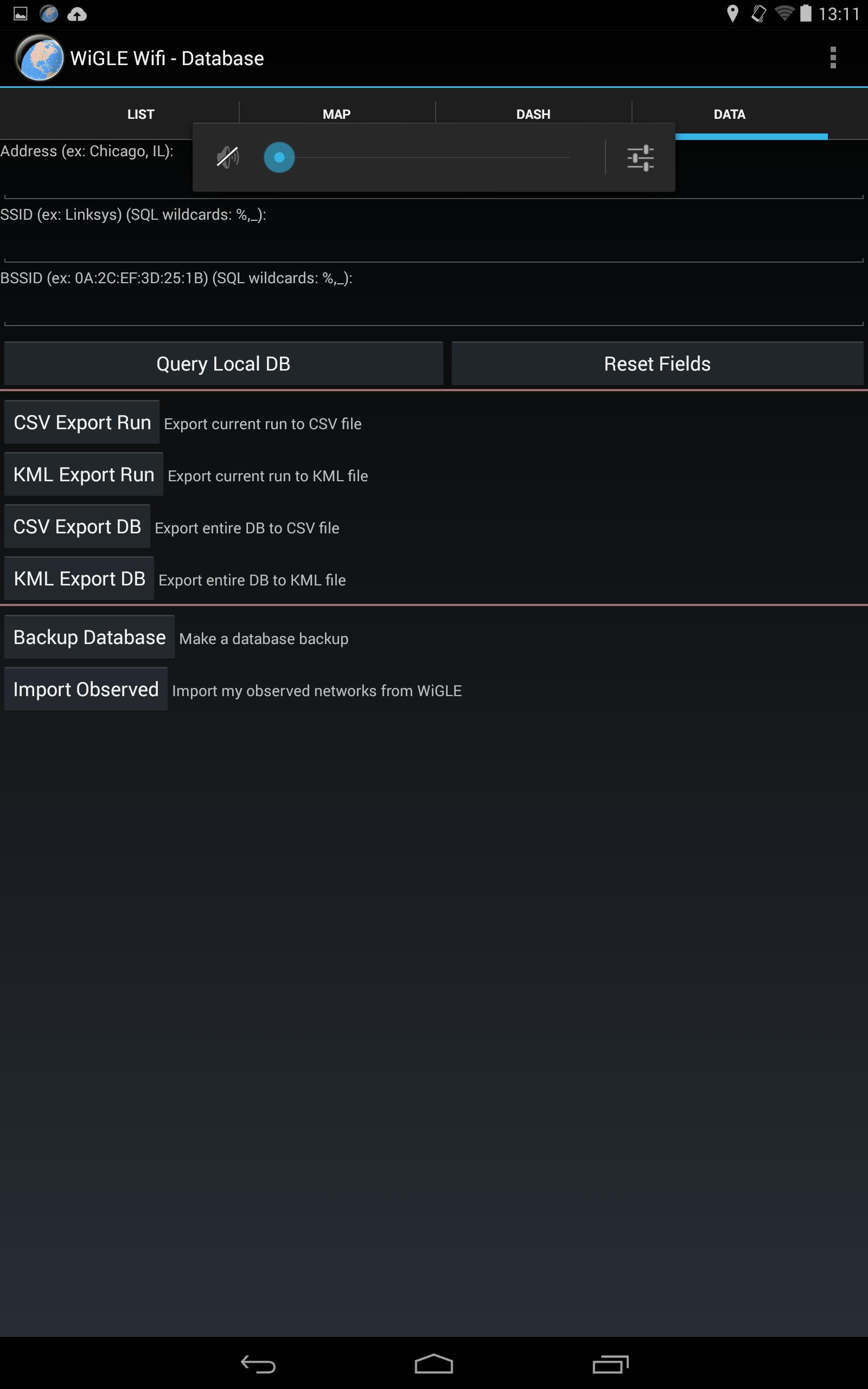
* Capability to export data to CSV files saved on an SD card (comma-separated values)
* Supports export to KML files for integration with mapping services like Google Maps/Earth
* Compatible with Bluetooth GPS through simulated locations
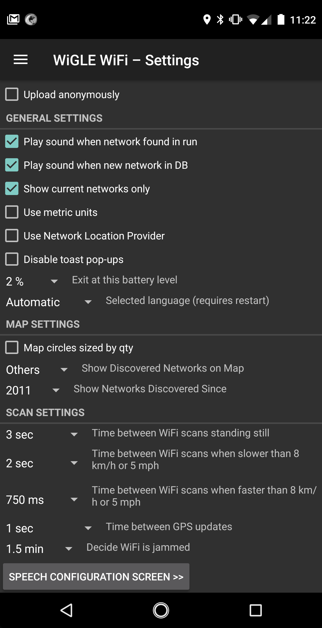
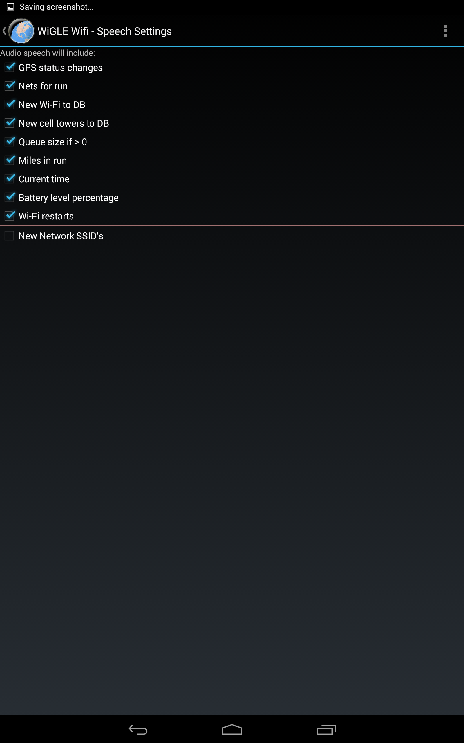
* Features audio alerts and Text-to-Speech capabilities, including a "Mute" option to disable all sound
For details about current releases, please check the relevant notes on the GitHub page.
Contributions to enhance language files and translations are encouraged through pull requests.
Keep exploring!
FAQs
What is This Thing For?
We consolidate location and information of wireless networks world-wide to a central database, and have user-friendly web and Android applications that can map, query and update the database via the web.
We currently accept files in any of:
DStumbler: text output
G-Mon: .kml, .txt output
inSSIDer: kml output
Kismac: native (.kismac), text, kml output
Kismet: .csv, .xml, .netxml, .gps, .gpsxml, .nettxt, CWGD output
MacStumbler: plist xml, wiscan format
NetStumbler: native (.ns1), text, wiscan, summary
Pocket Warrior: Text output
Wardrive-Android: kml output
WiFiFoFum: kml, kmz output
WiFi-Where: ns1, kml, csv output. Now available on Cydia (iphone/ipad jailbreak)
Wigle Wifi Wardriving: csv output
Consolidated.db: This is an sqlite file that is synced from an iphone/ipad to a host computer (prior to iOS 4.3.3 in the year 2011). OSX details. Windows details.
To have your record removed from our database, or if you have any questions or suggestions, send an email to: WiGLE-admin[at]WiGLE.net or IRC chat (with TLS) on #wigle at wigle.net:6668. If you want a record removed from the database, please include the BSSID (MAC Address) of the network in question!
Who are you people?
arkasha writes things as well as serving as cruise activities director
bobzilla is the guy who designed the DB, makes everything work, wrote the Android client, and continues to keep this project going
uhtu fixes all the things that arkasha and bobzilla do wrong
thuddwhir wrote the vector-based map generation (SquiGLE)
wos wrote the Mac OSX native client (TinGLE)
All are members of Mimezine.
How does triangulation work?
The "triangulation" is actually just an average of the latitudes and longitudes gathered using the signal strength (squared) as a weight. This is probably more correctly called "weighted-centroid trilateration." This assumes that signal strength will change at the inverse square of the distance. This is reasonable as long is you don't get a one-sided view of the network (i.e. only sample it from one side) since it will be skewed in that direction. It's worth noting that WiGLE first clusters data before trilaterating, resulting in the possibility of multiple clusters. The dot/pin on the map will go to the "best" cluster. When using the basic search, requesting detail for a specific network will show you all recent clusters up to a practical limit.
How do I Get Started?
WiGLE.net is a catalog of wireless networks based on user-submitted observations. Submissions are not paired with actual people; rather name/password identities which people use to associate their data. The project is basically a "gee isn't this neat" engine for learning about the spread of wireless computer usage.
WiGLE concerns itself with 802.11, Bluetooth, and cellular networks right now, which can be collected via the WiGLE WiFi Wardriving tool on Android, Kismet Wireless, and numerous other packages.
The first step in using WiGLE is to create a username for yourself. You don't have to submit anything other than a real email and a username and password. Validation is immediate, however new accounts are subject to a probationary period. We will not contact you (unless you send us email or chat on our message boards). Your account will give you access to our query engine, upload capabilities, maps, and software downloads. New accounts are limited in the number of queries they can make daily.
Once you've signed up, you're free to send us wireless network traces (in any of our listed formats, usually pairings of wireless sample, names and network hardware addresses (for uniqueness), data/SNR triples and GPS coordinates) or enter networks manually. Note, your username gets "credit" for these, but of course some people don't want their networks listed (for various reasons), so we delist these immediately upon request. Once you make a username, you can look at the submissions statistics page to see how users stack up.
What is this project used for?
Overall, WiGLE aims to show people about wireless in a more-technical capacity than your average static map or newspaper article.
Educating the Public: When WiGLE started in 2001 the default for WiFi was to have no encryption at all. An end user had a choice to turn on weak encryption (40-bit WEP), or pay extra for slightly less weak encryption (128-bit WEP). Most users didn't realize that their private networks could be accessed by anyone in the area (at various distances with antennas and amplifiers). WiGLE, and Wardriving in general, helped to educate users and put pressure on manufacturers to make network security better and easier. Nowadays WPA2 or WPA3 are the standard and defaults to "on" for most manufactured devices.
Research Projects: We are often contacted by graduate students and professors to provide additional access or slices of data for research projects around WiFi and security, which we attempt to help in any way we can. We've heard of research into subjects like WEP/WPA encryption distribution, information leaks from SSID probes, teaching wireless security concepts, geo-location from BSSID's and more.
Site Surveys: Security professionals use WiGLE to monitor what businesses they consult for are broadcasting over WiFi radios. If you have an insecure network you are vulnerable, whether or not it appears in WiGLE. WiGLE might let you know that an employee or attacker has set up a rogue WiFi router on your private network.
Journalism: WiGLE is a handy resource for journalists looking for data points on WiFi proliferation, statistics and security. WiGLE keeps statistics on manufacturer distribution, top SSID's, encryption modes, channel selection, geographic distribution and much more.
Washington Post
SF Gate
CNET
Wardriving: Drive, Detect, Defend (book)
Finding Usable Networks: Using the "Free Net" search WiGLE users can find legal-to-use open networks near to their current location. They can also find local government open wireless networks, a cable company wireless offering that they are already paying for, or a local coffee shop that has a network available for use.
A Fun Hobby: Many users enjoy trying to detect as many networks as possible, to compete on the leader board and see parts of their city/town that they've had no reason to visit before. Teams can compete to see which car can find the most networks in a set amount of time.
What's the License for All This?
The official legal End User License Agreement. We basically just offer no warranties on our software, and don't want our software or the data to be used for unlicensed commercial gain. If you're interested in using the data for commercial purposes, you can contact us.
What does that mean for academic/non-profit research or artistic usage?
We believe that one of the best uses for this project is to promote education, research, and awareness! Please email us at WiGLE-admin[at]WiGLE.net, include an explanation of your intended usage, needs, and a registered WiGLE username.
Commercial Use
To help fund WiGLE operations, we offer licenses to a subset of the data derived from postings that our users have permitted us to use for commercial purposes. As a matter of policy, we will not comment on future, past, or hypothetical customers. To discuss a commercial license, please email us at WiGLE-admin[at]WiGLE.net
We additionally refuse to claim or disclaim any involvement with the alleged moon landings, area 51 and 'bigfoot'.
How Can I Change My Password?
If you've forgotten your password, non-logged in users should use the password reset tool. Reset Password Tool. You can contact us via WiGLE-admin[at]WiGLE.net; include your registration information for proof of identity. Manual reset will take time (ours and yours) and we may refuse if we can't verify you - so seriously, use the reset tool.
I didn't receive a verification email - how can I activate my account?
This can happen for a number of reasons. The easiest thing to do is to use the automated system to request a confirmation email. If this isn't available or doesn't work, your account may have other problems. If you elect to email us for support on confirmation-related issues, you must include your WiGLE user name, and send the email from the address you used to register. If you do not include your username or send the email from a non-matching address, your request will be ignored.
I had this clever idea to circumvent your EULA or query limits and now my account is acting weird!
Yeah, that happens. WiGLE is a project created by security geeks and used by security geeks. If you decide to try and get around our rules, we reserve the right to do whatever we deem necessary and/or appropriate.
Creating multiple accounts to try and circumvent query limits is a violation of our policies, and probably won't work out the way you hope.
If you think that this has happened in error, if you have a non-commercial project you'd like increased access for, or if you are interested in using the data for commercial purposes, perhaps just send us email at WiGLE-admin[at]WiGLE.net instead of trying to trick the system.
What's New
Bump target to Android 14 (API level 34)
Various other bug fixes
- Version2.94
- UpdateSep 05, 2025
- DeveloperWiGLE.net
- CategoryTools
- Requires AndroidAndroid 7.0+
- Downloads576K+
- Package Namenet.wigle.wigleandroid
- Signature6b6e79f8a7534a5cfed7aca29bce7f1e
- Available on
- ReportFlag as inappropriate
-
NameSizeDownload
-
12.29 MB
-
10.42 MB
-
10.42 MB


Provides detailed Wi-Fi network information
No advertisements in the app
Easy data logging capabilities
Useful for wardriving enthusiasts
Allows for detection of Bluetooth devices
Good for mapping out areas with available networks
Supports contributions to community database
Can help pinpoint potential security vulnerabilities
Frequent crashes leading to data loss
Unintuitive user interface causing confusion
Poor GPS accuracy affecting network location results
Overly interactive and demanding excessive permissions
Captcha issues preventing user registration
Lack of features for filtering network types
Heavy battery consumption during usage
Slow map updates compared to competitors