Regrid Property App - Property information access
Unlock land data effortlessly with a map-based app that reveals property details & ownership across the US.

- 1.66.0 Version
- 1.5 Score
- 290K+ Downloads
- In-app purchases License
- 3+ Content Rating


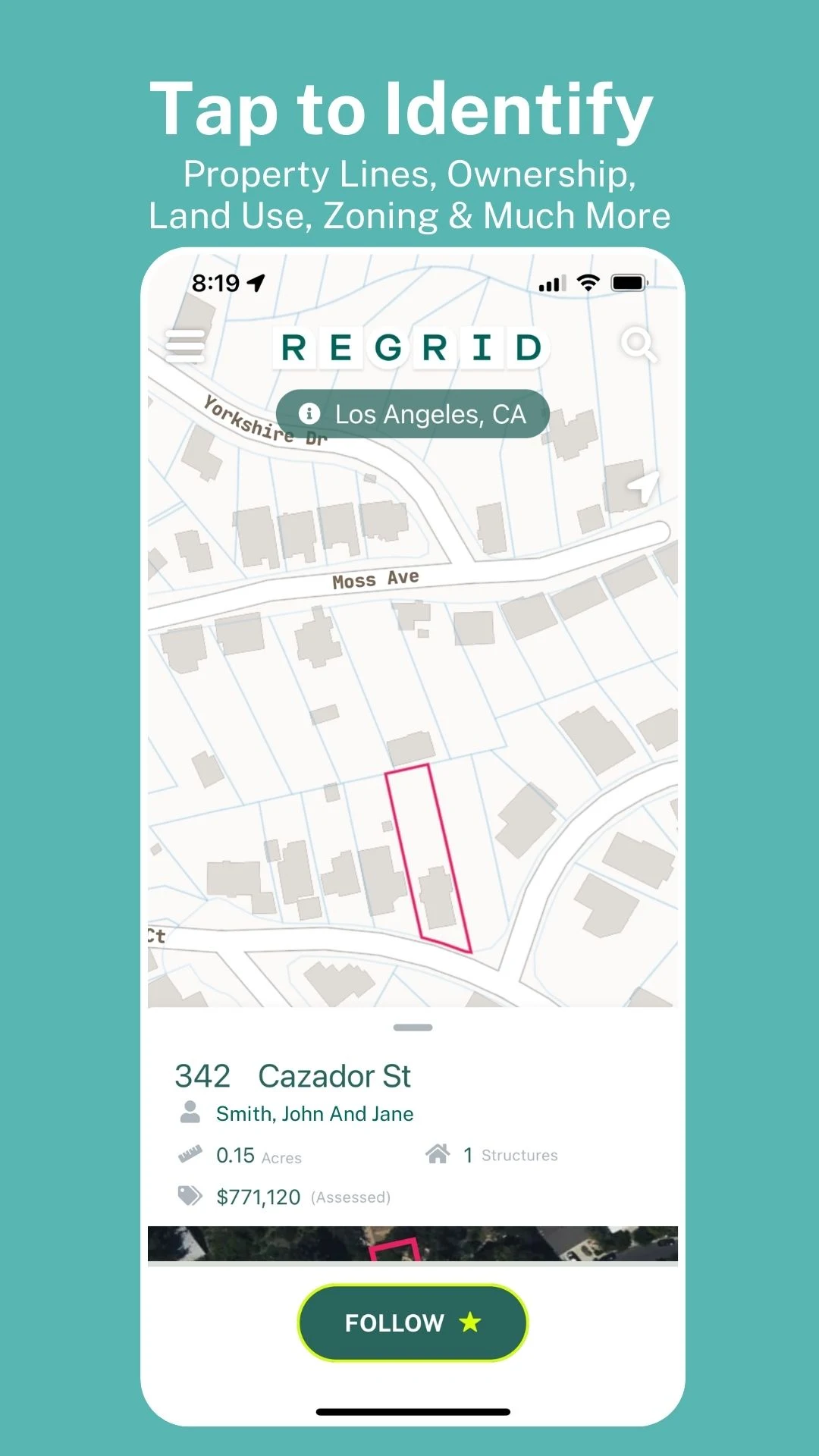
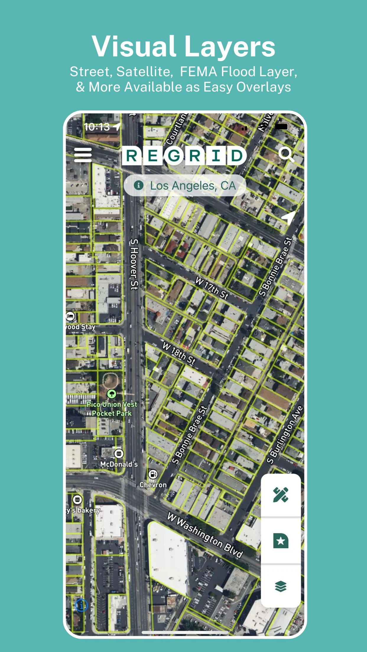

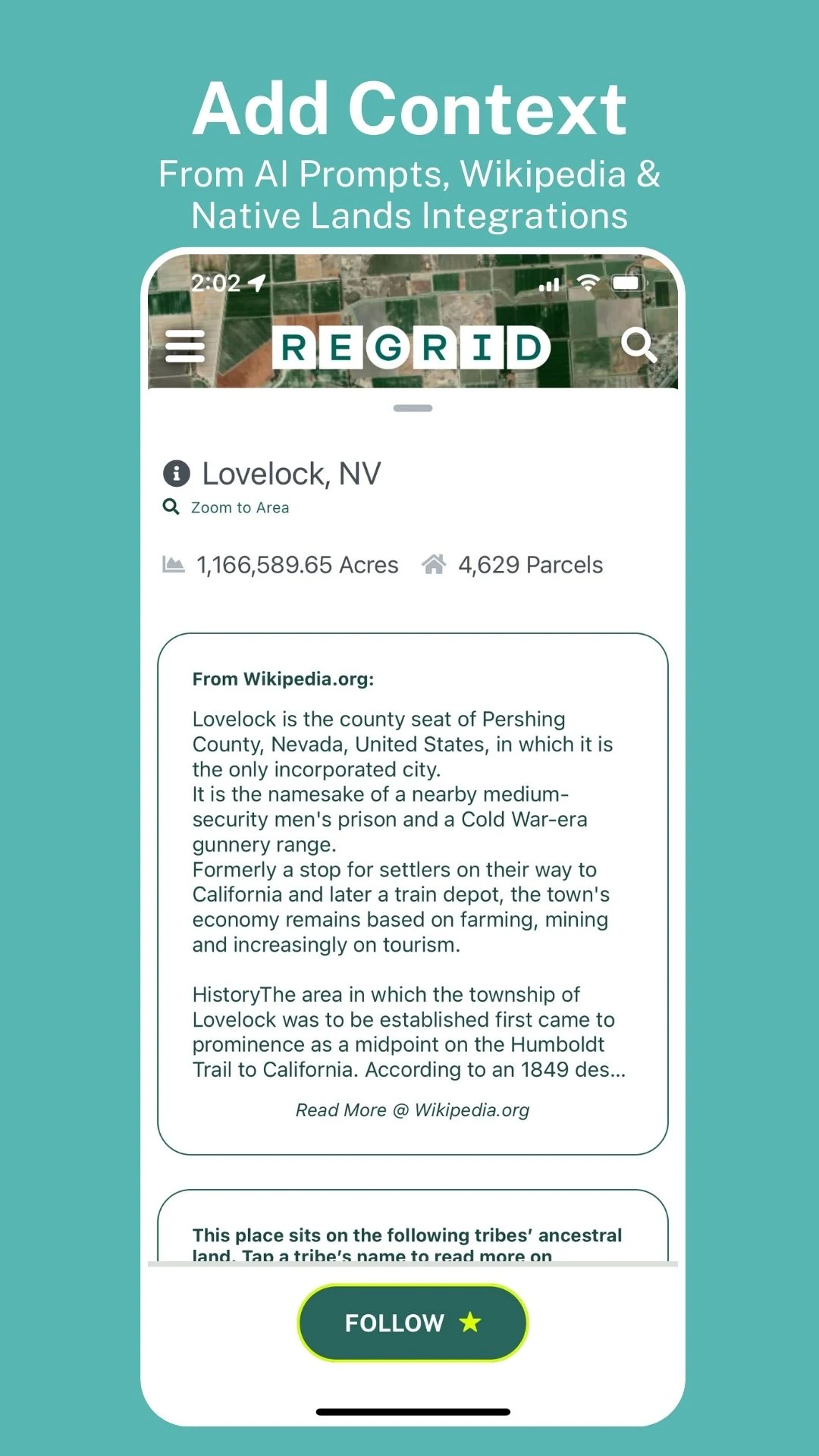
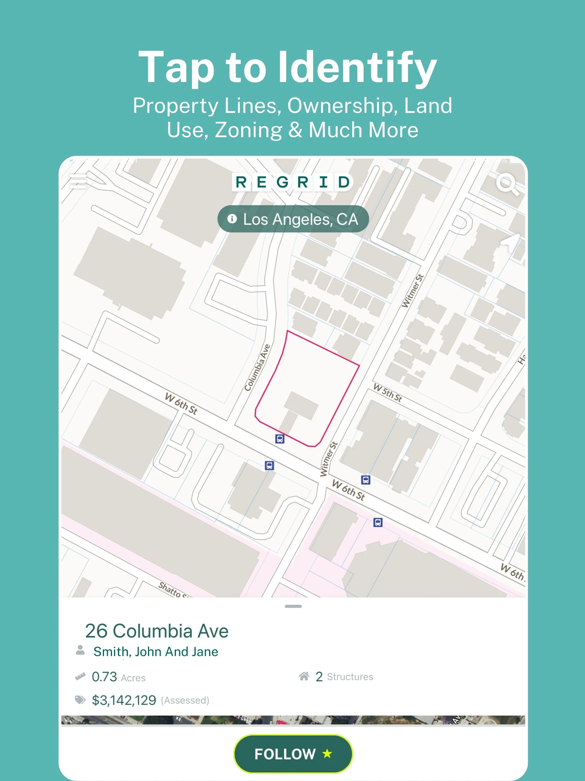
The Regrid Property App, beloved by millions, offers a map-based platform that makes land and property information accessible to anyone with a smartphone. Users can simply tap on a property to easily view data and parcel boundaries for over 157 million parcels, which represent more than 99% of the US population.
Get convenient access to various information, including:
- Lot lines/boundaries
- APN/Parcel ID/Regrid UUID
- Property Address
- Property Owner
- Acres and square footage of properties
- Sale price and date
- Mailing Address
- Property Value
- Land Use
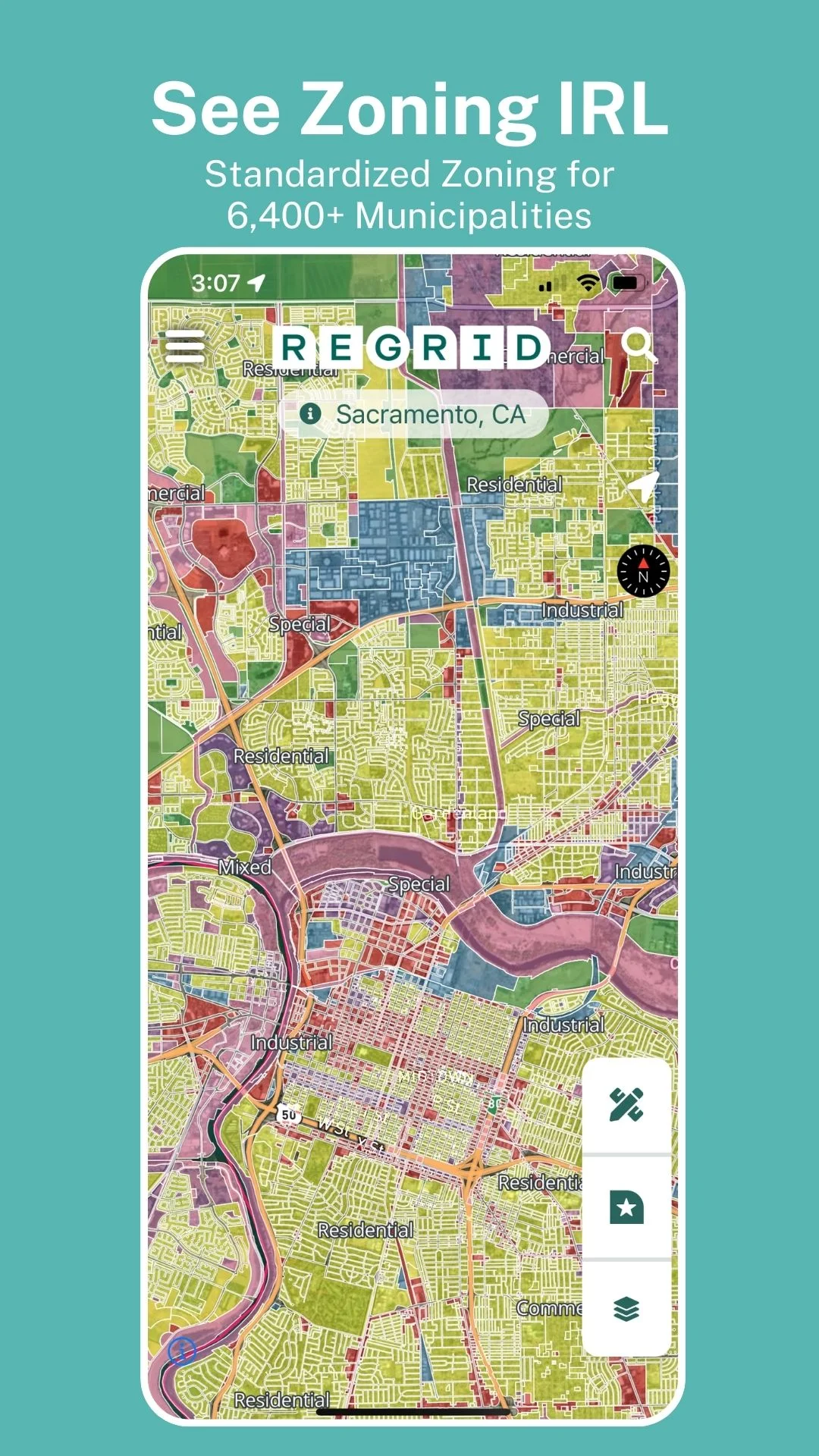
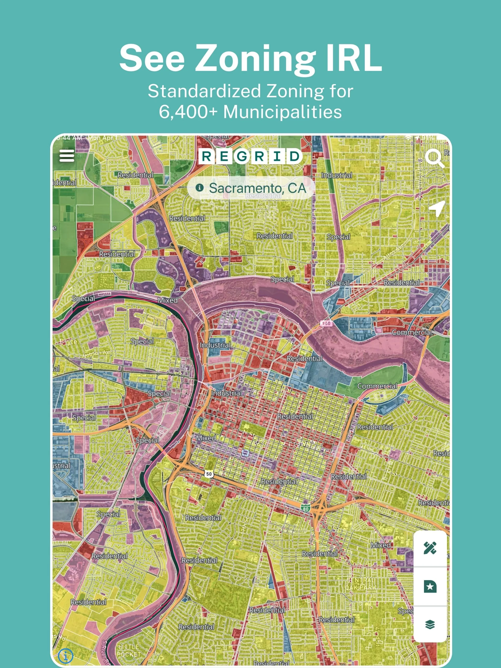
- Standardized Zoning data
- Vacancy Indicator
For free, you will have:
- Unlimited access to comprehensive public record property boundaries and details across the country (with no limits on usage) using just an email address
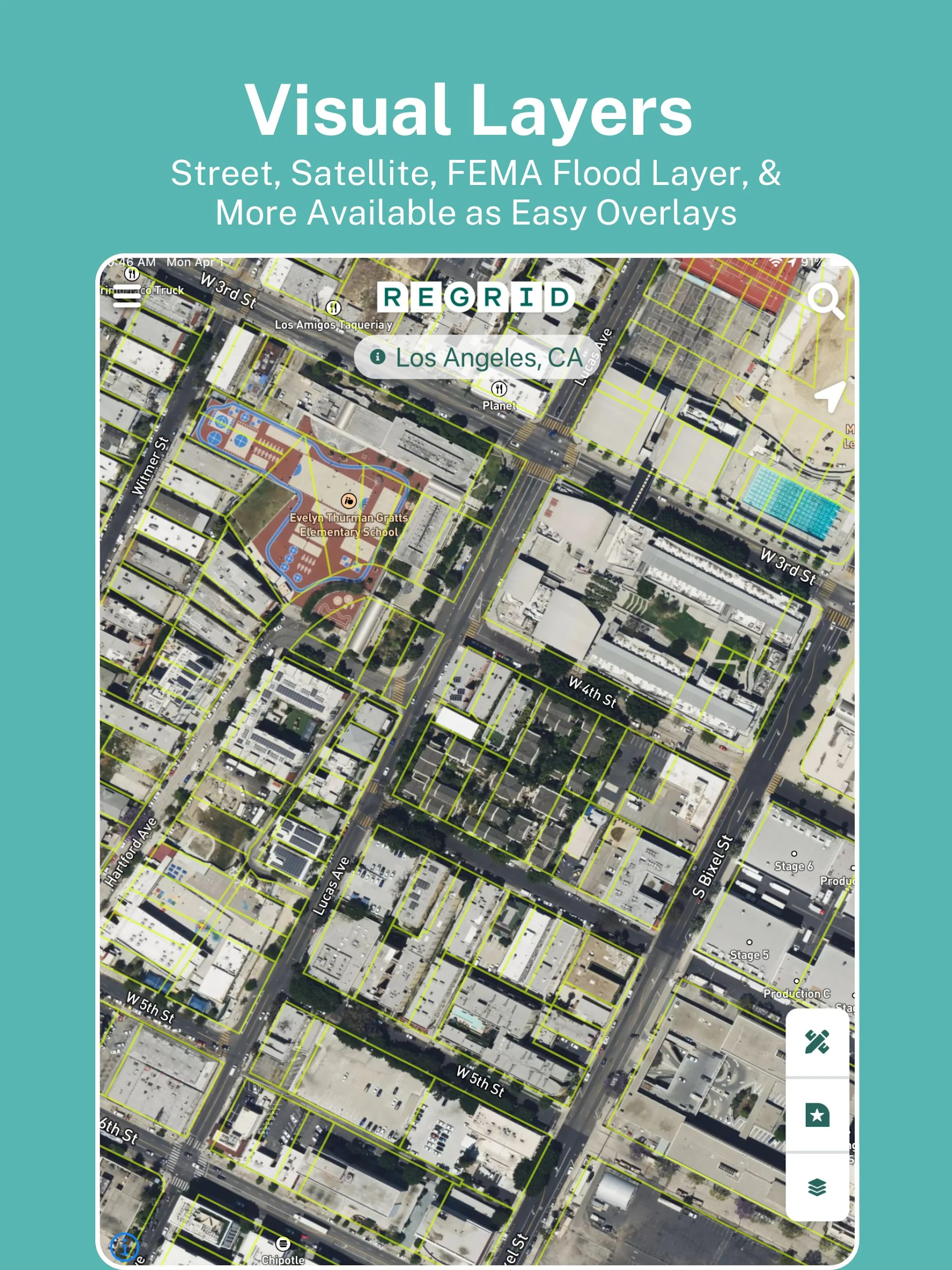
- Option to toggle between street and satellite basemaps
- Ability to search by address or location
- User-friendly property map interface
- Capability to share properties of interest
- Excellent tool for property searching, real estate applications, and finding land ownership.
If you opt for our Pro plan at $10 per month, you'll gain additional features:
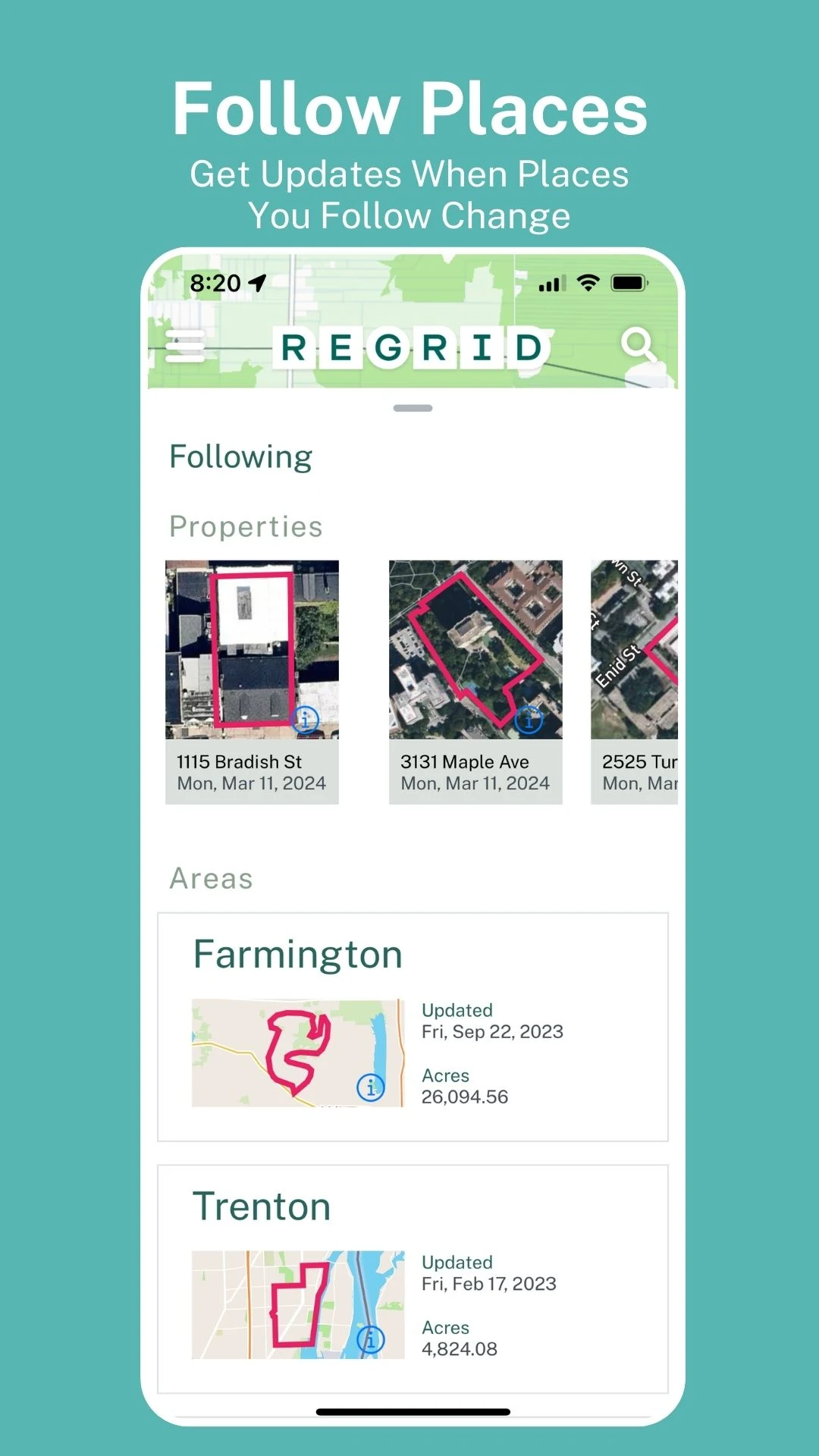
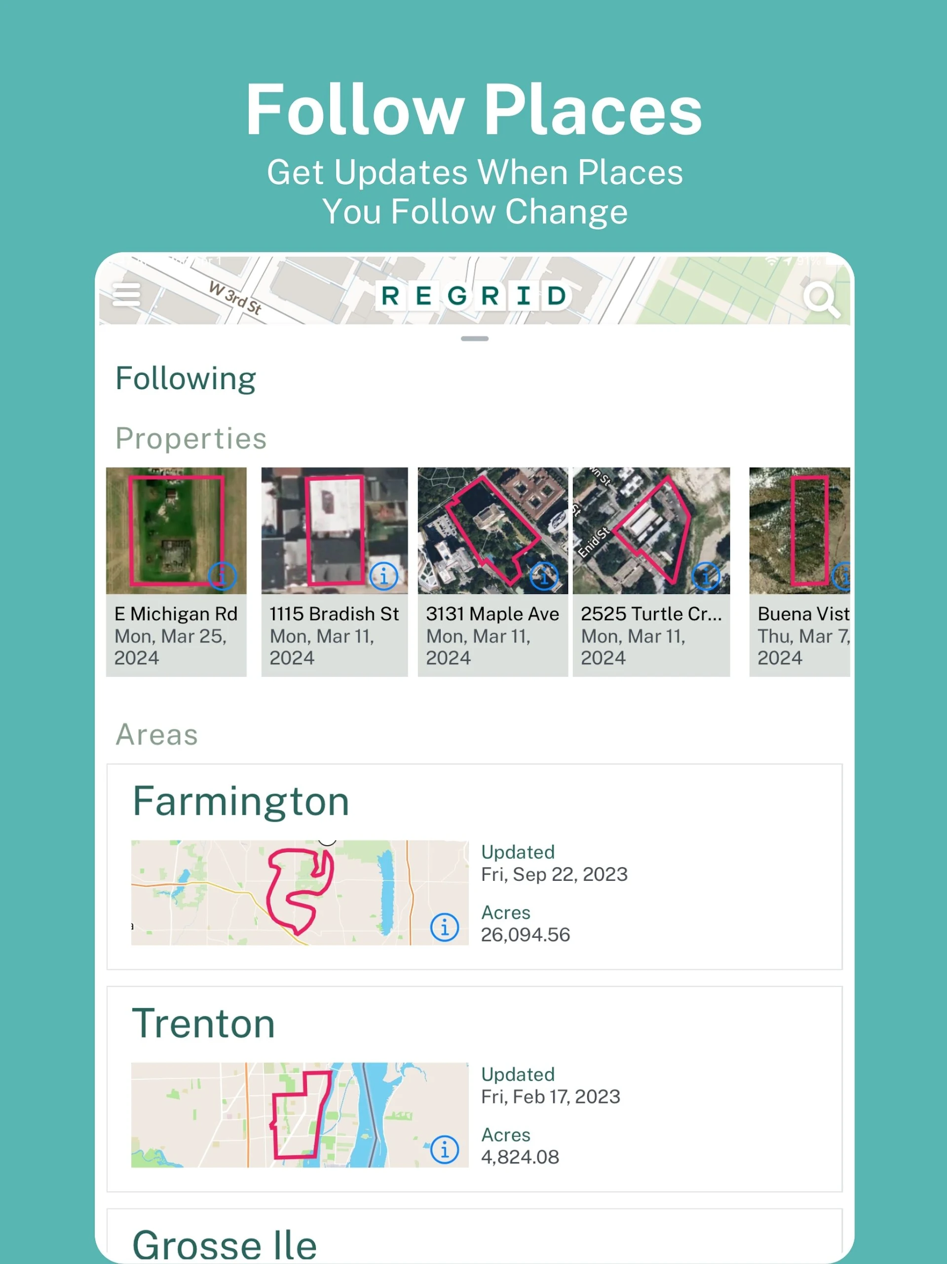
- Follow feature: compile a list of properties of interest and receive automated updates when any changes occur.
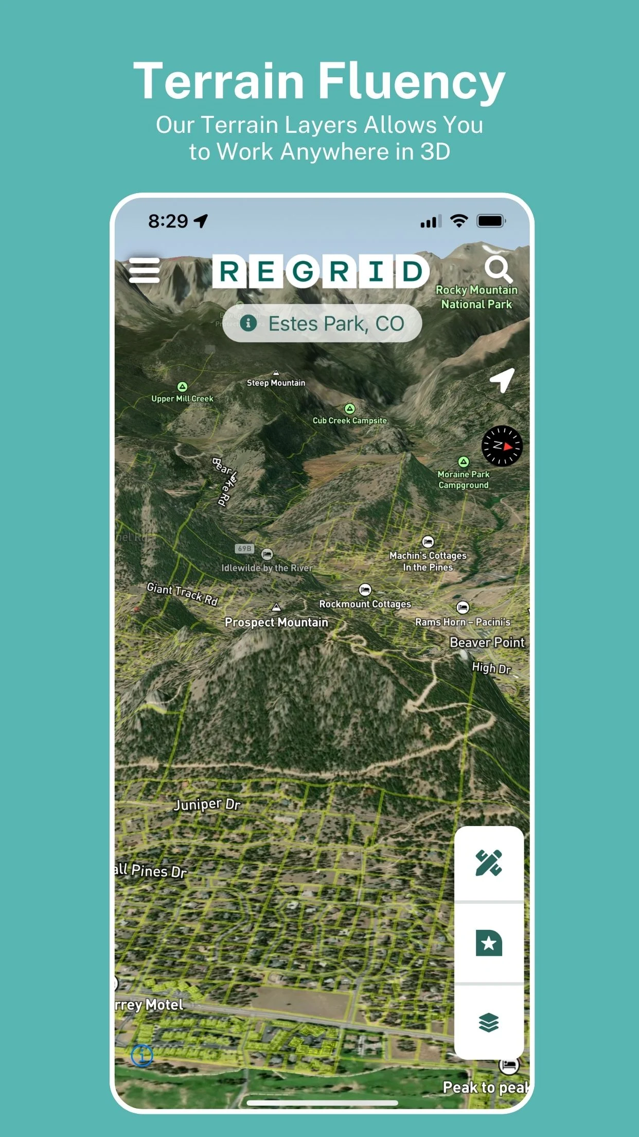
- Extra basemap layers: includes building footprints and elevation (topographic) contours superimposed on property boundaries.
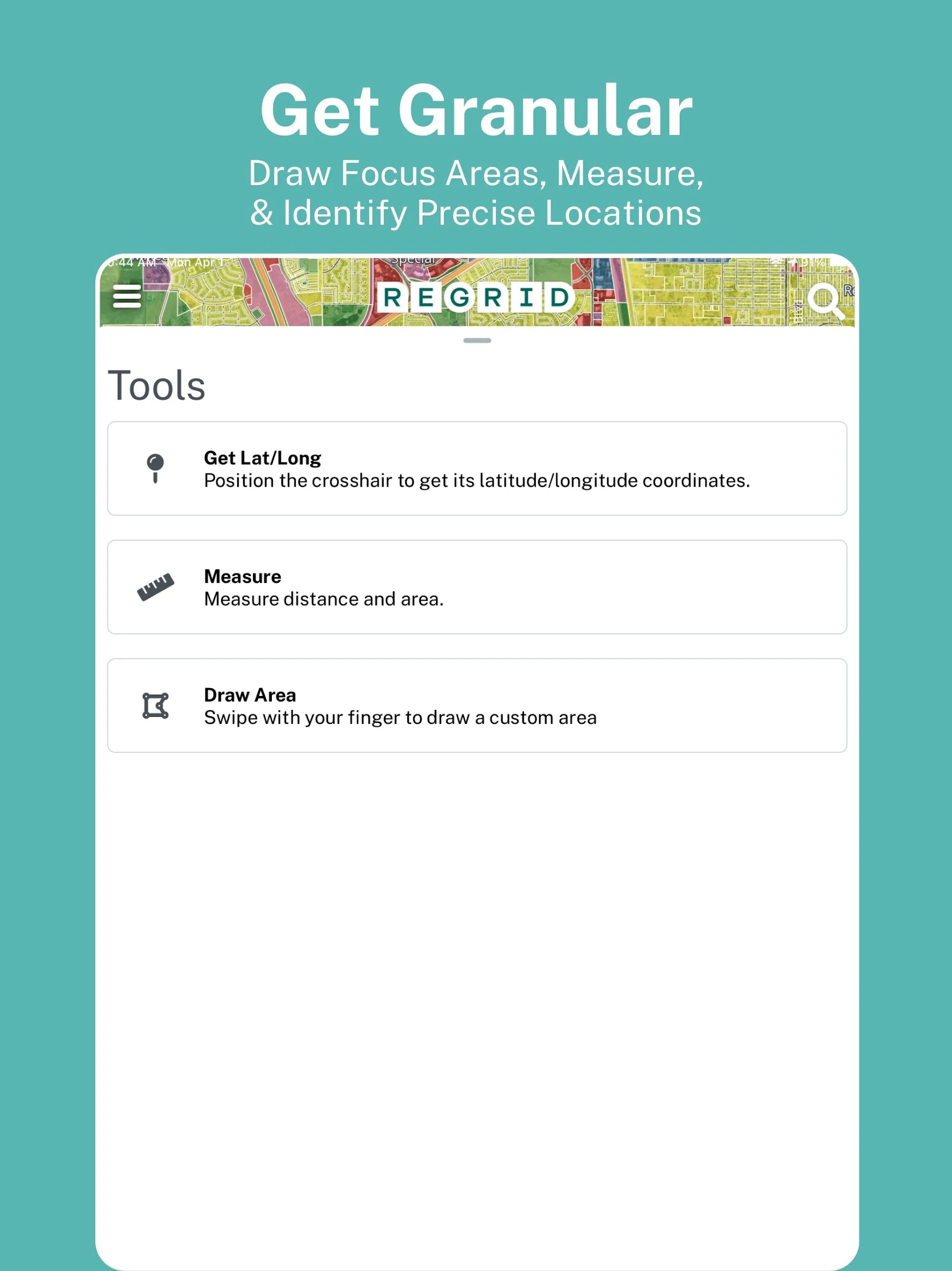
- Measurement tool to calculate linear feet, acreage, and square footage for drawn areas
- Overlay of owner names and parcel IDs directly on the map
Additionally, Pro members receive access to premium data fields:
- Vacancy details
- Land use information
- Building footprint statistics
- Residential & Vacancy indicators
Moreover, a Pro account gives full access to a variety of advanced mapping tools available online.
Parcel Data Onboarding and FAQ
Documentation and Frequently Asked Questions
Where does your parcel data come from?
We source our data directly from counties, states, municipalities and their designated vendors wherever possible. We also work with trusted partners and even digitize paper maps when needed.
How do you standardize county data generally?
The main way we make county data much easier to work with is by standardizing the column names of the raw data provided by each county. We do not standardize the values in most columns, most we keep those exactly as provided by the county, but we do make sure that every county in our system is converted to a standard table schema, with consistent column names across the nationwide dataset. Please see “What is the Regrid Parcel Schema?” question below.
In addition, we further standardize the parcel address fields using the US Postal Service database of addresses. For details on address specific standardization please see the "How do you standardize and normalize addresses?" question below.
What Coordinate Reference System (CRS) / Spatial Reference System (SRS) is your data in?
All geometries are delivered in the 2D CRS of the World Geodetic System 1984 (WGS84) with the Spatial Reference Identifier (SRID) EPSG:4326.
How do you clean parcel geometries?
We rely on authoritative data from county and county designated sources for our data. We seek to minimize unwarranted changes that would inappropriately modify this source data. That said, we take accuracy of the data seriously, including the accuracy of the spatial alignment of the data. To that end, we have the below processes to ensure the highest level of spatial accuracy of our data.
We perform a visual inspection to assess the completeness of the county.
Recognizing that imagery can itself contain spatial inaccuracies; we do not manually align parcels to imagery.
If large scale shifts, skews, or rotations are discovered we work back with the source for them to correct, or we seek alternative source.
We use standard geospatial functions to correct common errors in the individual parcel polygons and remove any polygons that can not be made valid in that process.
We also remove some slivers and overly large or detailed polygons like road sets, water or wetlands that have proven to cause issues for many users.
How do you deliver bulk data?
All bulk data is provided via SFTP as zip files of each county in the format of your choice (GeoJSON, NDGeoJSON, SQL, Shapefile, FileGDB, GeoPackage, KML, CSV), using a pull model. We organize things on a county by county basis using the county’s FIPS code (geoid in our Regrid Parcel Schema column).
What is the Regrid Parcel Schema?
We standardize column names for easy access across counties in our nationwide dataset into our Regrid Parcel Schema for tables.
We are currently at version 6 of our Regrid Parcel Schema and it standardizes the column names for approximately 80 county provided data columns, and 25 Regrid provided data columns. This schema is applied to 100% of our dataset. A data dictionary is available: https://docs.google.com/spreadsheets/d/14RcBKyiEGa7q-SR0rFnDHVcovb9uegPJ3sfb3WlNPc0/edit#gid=1010834424
Do you have a specific attribute for a specific county?
A current, detailed list of every county in our data set and what data fields we have for each is always available at the following URL. This spreadsheet can be downloaded as a CSV for closer analysis: https://docs.google.com/spreadsheets/d/1rvRYv6_ppZlwbmyi2kbzemot6FOEm2EEPdHPyENTQPE/
Why do my files have columns not in the Regrid Parcel Schema?
Every county has our schema columns, so any code or process can rely on those columns (also called attributes in GIS software) being present. However, most counties also provide attributes that do not map into one of our Regrid Parcel Schema columns, so we keep those attributes and include them on the end of our schema columns using whatever name is provided by the county. In many tools you can control what attributes are retained during import or merging, so we suggest folks working across multiple counties just keep the schema columns or a sub set of them and leave what we call "custom columns" off entirely to get a uniform set of columns. Going back and reviewing those custom columns can reveal interesting information provided by the counties, but not provided very often in other counties.
Nationwide dataset clients also have access to a 'schema-columns-only' directory by default, which will not have any of the county custom columns and will always just be the columns listed in our current parcel schema. If you do not receive the full nationwide dataset, please just let us know and we can provide you a 'schema-columns-only' version of the counties you receive. Regrid Parcel Schema and technical data dictionary
How can I explore the custom columns for each county?
We work with all of our counties in a PostgreSQL database, each county in its own table. That makes managing the custom columns from each county much easier. Most database servers provide a way to search the column names of the tables in a database. For example, in Postgres you would do it this way:
SELECT table_name, column_name FROM information_schema.columns
WHERE table_schema = public and
column_name ~ juri
order BY table_name, column_name;
Also, directly browsing the data on a place-by-place process of areas or regions you are interested in can be very useful. DBeaver is a cross platform, multi vendor database client that can render geographic data.
Why do Shapefile attribute names not match the Regrid Parcel Schema column names?
Some of our Regrid Parcel Schema column names are longer than the Esri Shapefile format allows and the column names in your attribute table will be truncated to the first 10 characters of the Regrid Parcel Schema column names.
When was your data last updated?
On average 94% of our parcels have been refreshed in the last 12 months, with most of those in the last 6 months. We target approximately 600 counties that are generally fast growing and populous for more frequent updates. Some of these are targeted for updates as frequently as four times per year. We work on a rolling update schedule, refreshing county data directly for 100 - 300 counties per month, usually grouped by state.
Monthly we share, both in machine readable format and via a monthly update email, what counties have been updated, and what states are in the pipeline for the upcoming quarter. Here is an example of our Monthly Data Update Email. Regrid tracks the date of last refresh from the county in the ll_last_refresh attribute.
Our USPS related attributes are updated monthly for our entire data set. Several other Regrid generated attributes are also updated outside of updates available from the parcel data source provider. These updates do not impact the ll_last_refresh attribute.
A detailed listing of every county in our data set and the date we last refreshed directly from the county is available in the Regrid coverage report. This report can be downloaded as a CSV: Regrid Attribute Completeness Report
How do you provide data updates?
Please see our guide on data updates
How do I keep my data up-to-date?
Please see our guide on data updates
What software can I use to work with your data?
Editing or working with most of our data requires software for working with geographic and geospatial data The OSGeo project provides free and open source desktop software to work this kind of data called QGIS.
There are other free and paid software options for working with geospatial data, but all of it has a learning curve. We are not able to provide support for those 3rd party software applications. For QGIS at least, the best options for learning are via the many community developed tutorial videos and texts.
We suggest starting with the GeoPackage (geoPKG, .gpkg) formatted files to use in QGIS or any geospatial software.
What about Google Earth?
We provide KML/KMZ options for Google Earth and Google Earth Pro, but neither of those applications support editing our data, only viewing the data. If you need to make changes to the data you get from us, you will need a desktop application like QGIS discussed above.
How large is the nationwide dataset?
The nationwide dataset is approximately 400-800 GB uncompressed, varying by file format, storage method, attribute tier, and other factors.
- Version1.66.0
- UpdateAug 07, 2025
- DeveloperRegrid
- CategoryMaps & Navigation
- Requires AndroidAndroid 5.0+
- Downloads290K+
- Package Namecom.loveland.pr
- Signatureded9c8231890061a5f50f04d0a4d1d51
- Available on
- ReportFlag as inappropriate
-
NameSizeDownload
-
49.22 MB
-
47.79 MB
-
47.43 MB


User-friendly for identifying property lines
Comprehensive database for property ownership information
Quick access to parcel data on mobile devices
Supports both free and paid versions with useful features
Effective for construction and real estate professionals
Allows users to contribute community information
Accurate GPS tracking on well-covered areas
Useful for outdoor activities like hunting and off-road biking
Great customer support and responsive developers
Property line accuracy can be inconsistent
Limited functionality in the free version
Dependency on outdated satellite imagery
Search function often yields inaccurate results
Challenging to use offline compared to competitors
Frequent glitches and app freezes after updates
Property transfer information may not be current
Potential high cost of subscription versus actual usage
Misleading marketing regarding surveying capabilities