OS Maps - GPS mapping & navigation
Navigate trails, track routes, and discover hidden gems in nature

- 5.0.4.1312 Version
- 2.8 Score
- 1M+ Downloads
- In-app purchases License
- 3+ Content Rating

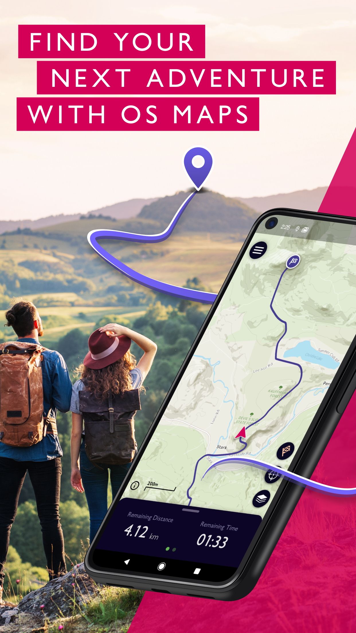


Discover the outdoors on your terms, while prioritizing safety with OS Maps. Whether you're into hiking, biking, or running, OS Maps offers a plethora of incredible trails across the USA.
What should I do if I forget my password?
If you're trying to log into your account and receiving an error message relating to your password then you can use the 'Forgot your password?' option on the login page or to reset your password.
Web:
1. Visit OS Maps web & select 'Forgot password'
2. Enter the email address associated with your OS Maps account
3. Select 'Send verification code'
4. Open your email inbox & copy the code in the email (check your junk folder if you can't see an email from Ordnance Survey)
5. Paste or type the code into the 'Verify Code' box & select 'Verify Code'
6. Select 'Change password'
7. Enter a new password
8. Resetting password on OS Maps app
Mobile App:
1. Select 'Log in'
2. Select 'Forgot password'
3. Enter the email address associated with your OS Maps account
4. Open your email inbox and click the link to reset your password (check your junk folder if you can't see an email from Ordnance Survey)
5. Enter your email address & select 'Send verification code'
6. Return to your email inbox & copy the code in the email
7. Return to the browser page & paste or enter the code, then tap 'Verify code'
8. Select 'Change password'
9. Enter a new password
OS Maps does not allow certain special characters to be used in your password - % @ $ or £ signs.
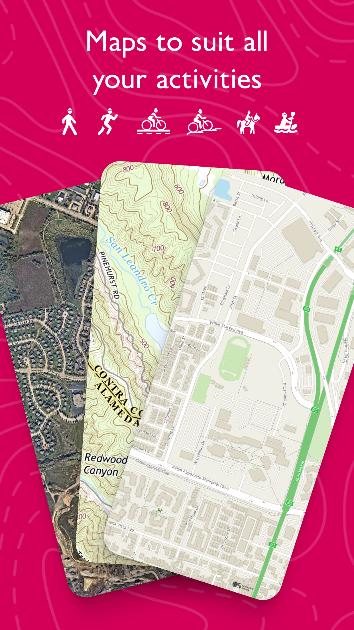
Key Features That Make OS Maps Stand Out:
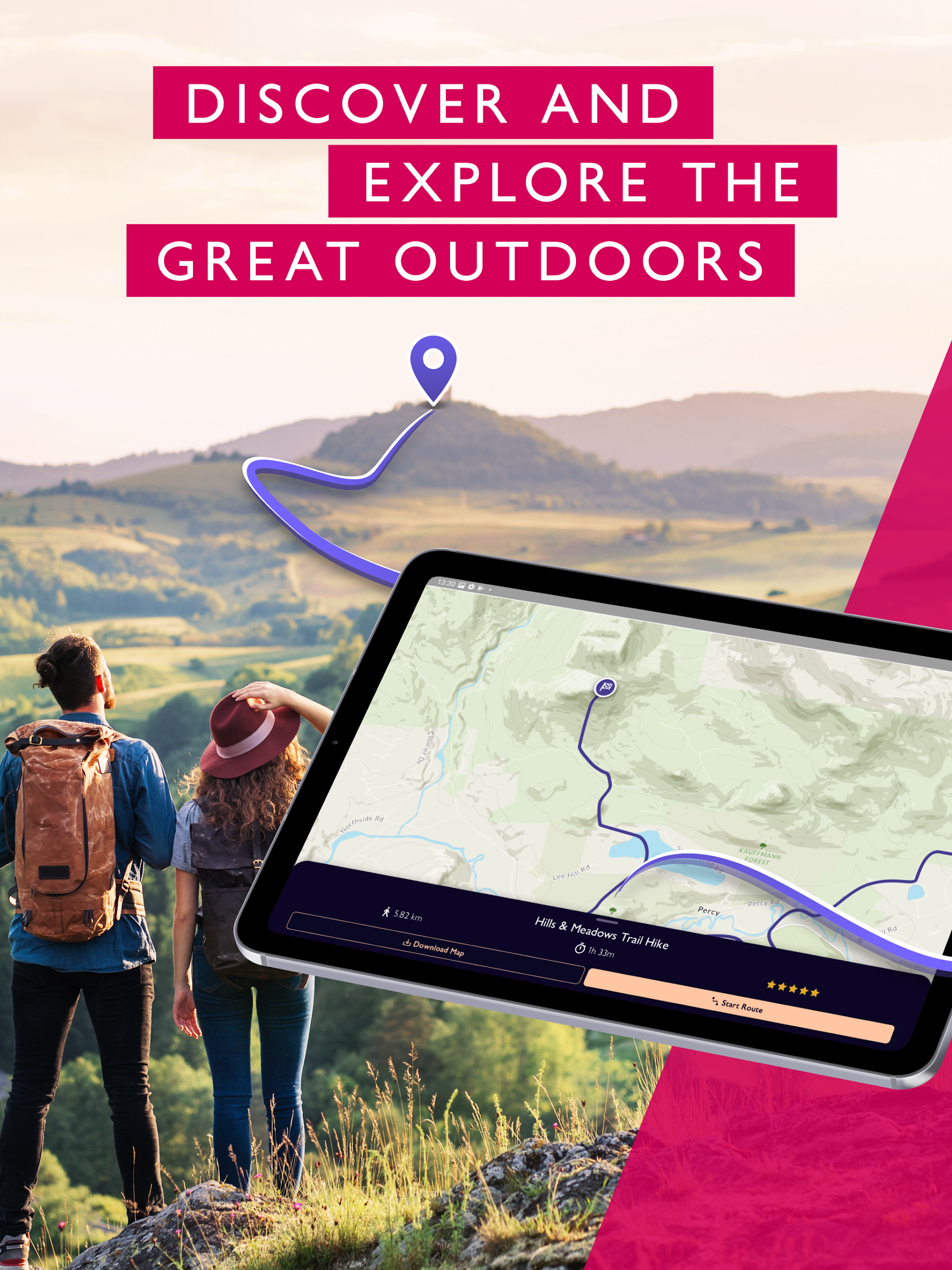
• EXPLORE NEW TERRITORY, EMBARK ON FRESH ADVENTURES
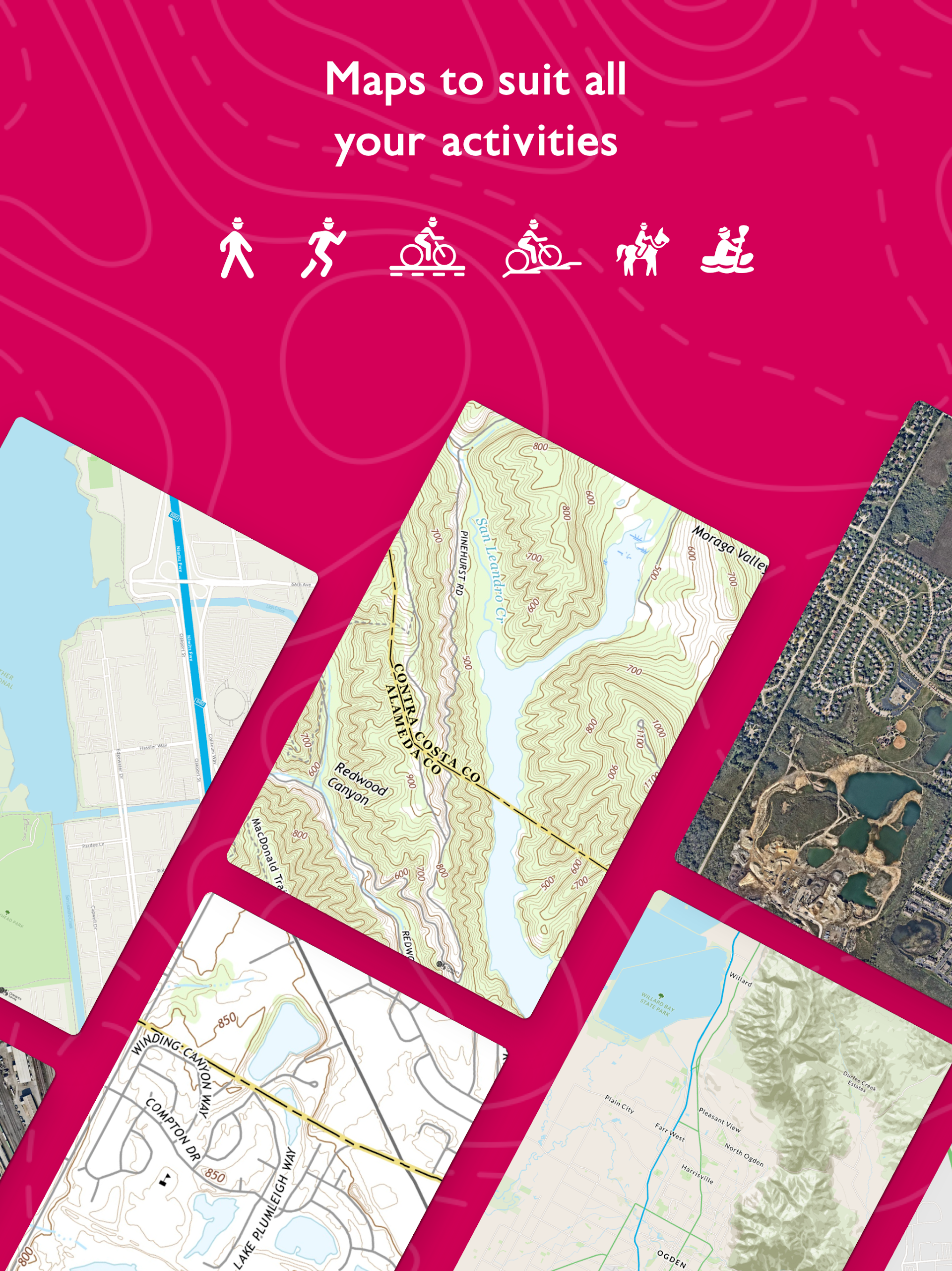
Unleash your adventurous spirit by planning unlimited trails using detailed and updated maps nationwide. Choose from various map layers tailored to every activity, including topographic and aerial maps.
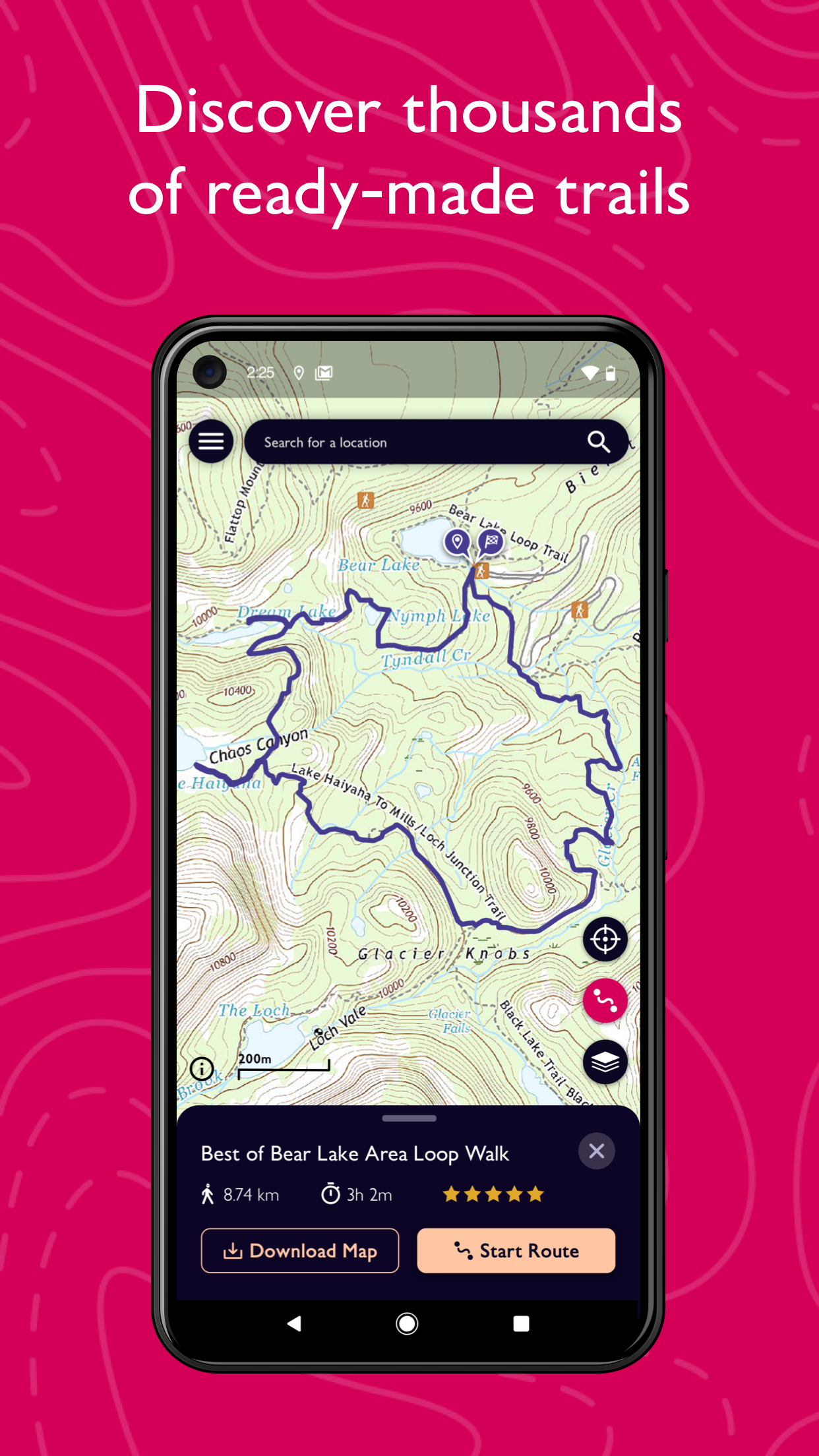
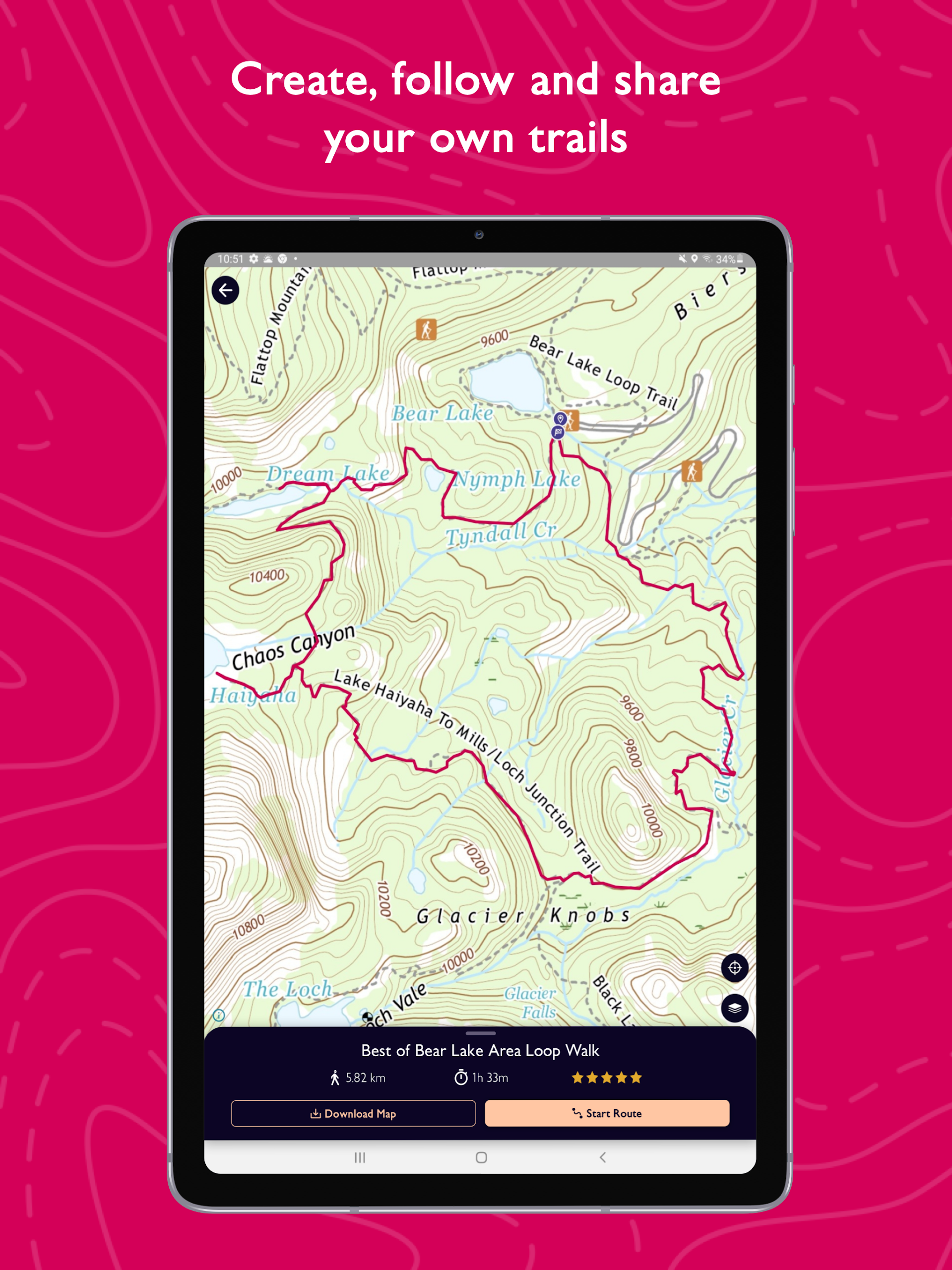
• TRAILS AT YOUR DISPOSAL
Easily locate top-rated trails in your area recommended by fellow outdoor enthusiasts, or chart your own trail to share, follow, and record your journey.
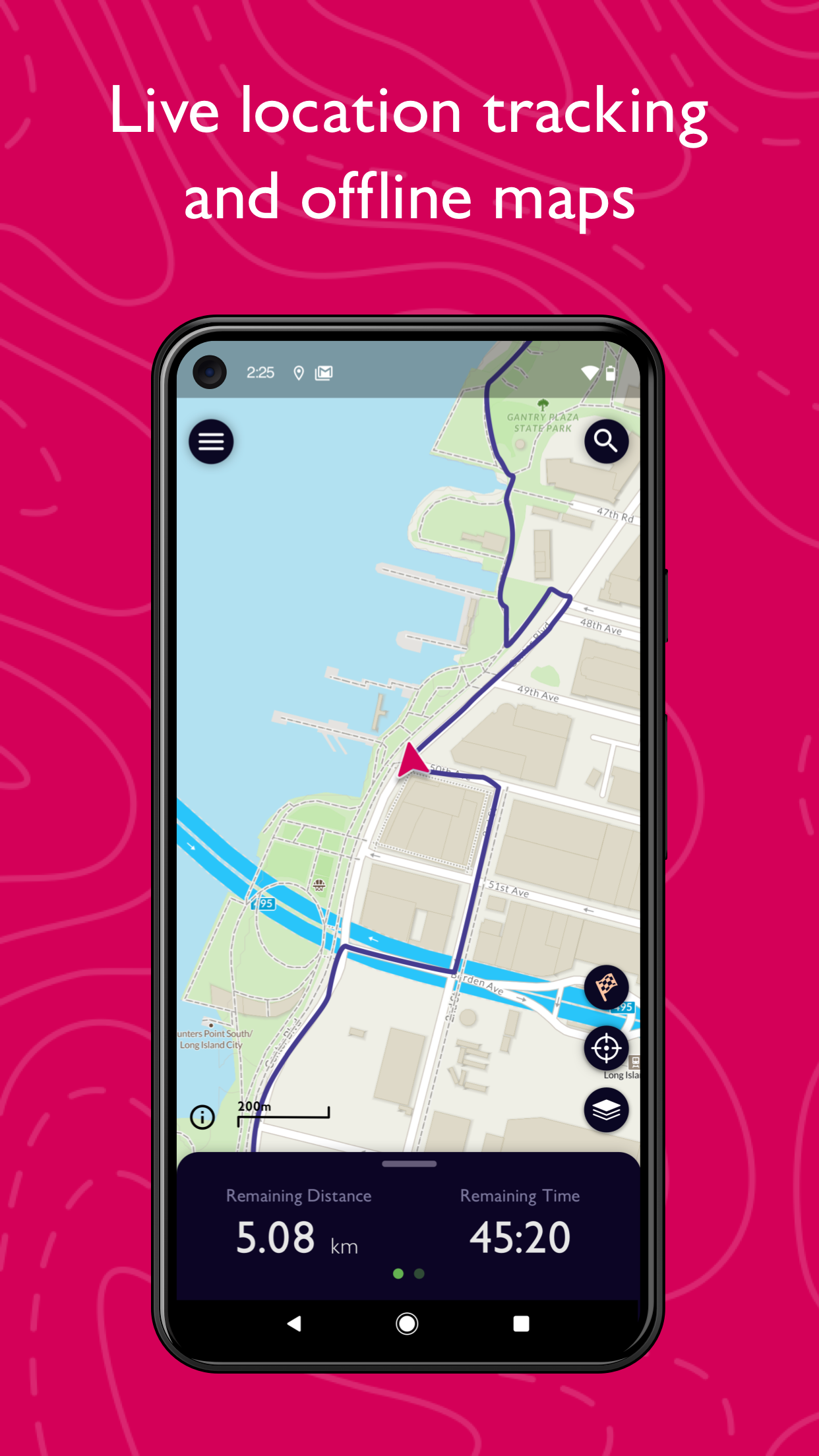
• ACCESS & DOWNLOAD MAPS OFFLINE
Don't fret about poor cell reception; download your preferred areas for offline access. View saved maps and routes without internet connection, and export favorite trails and routes to your GPX device.
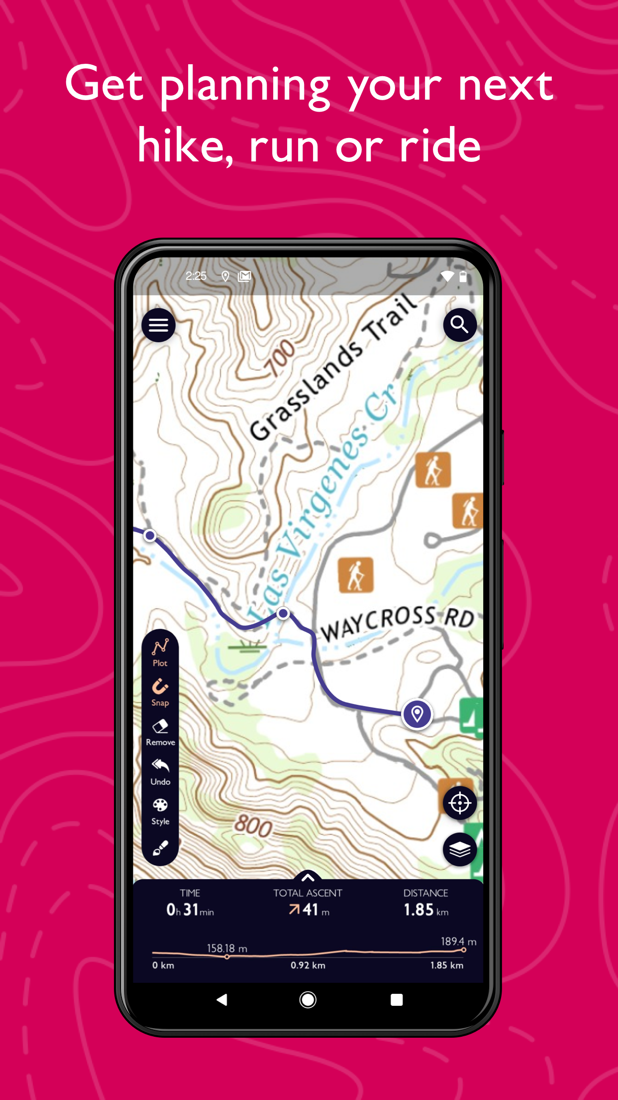
• CUSTOMIZABLE TRAIL MAPS FOR EVERY ACTIVITY
Pick from diverse map layers to plan activities and discover trails with intricate topographic maps or delve into the landscape's minutiae with breathtaking aerial views. Immerse yourself in a 3D world via desktop with 3D map layers.
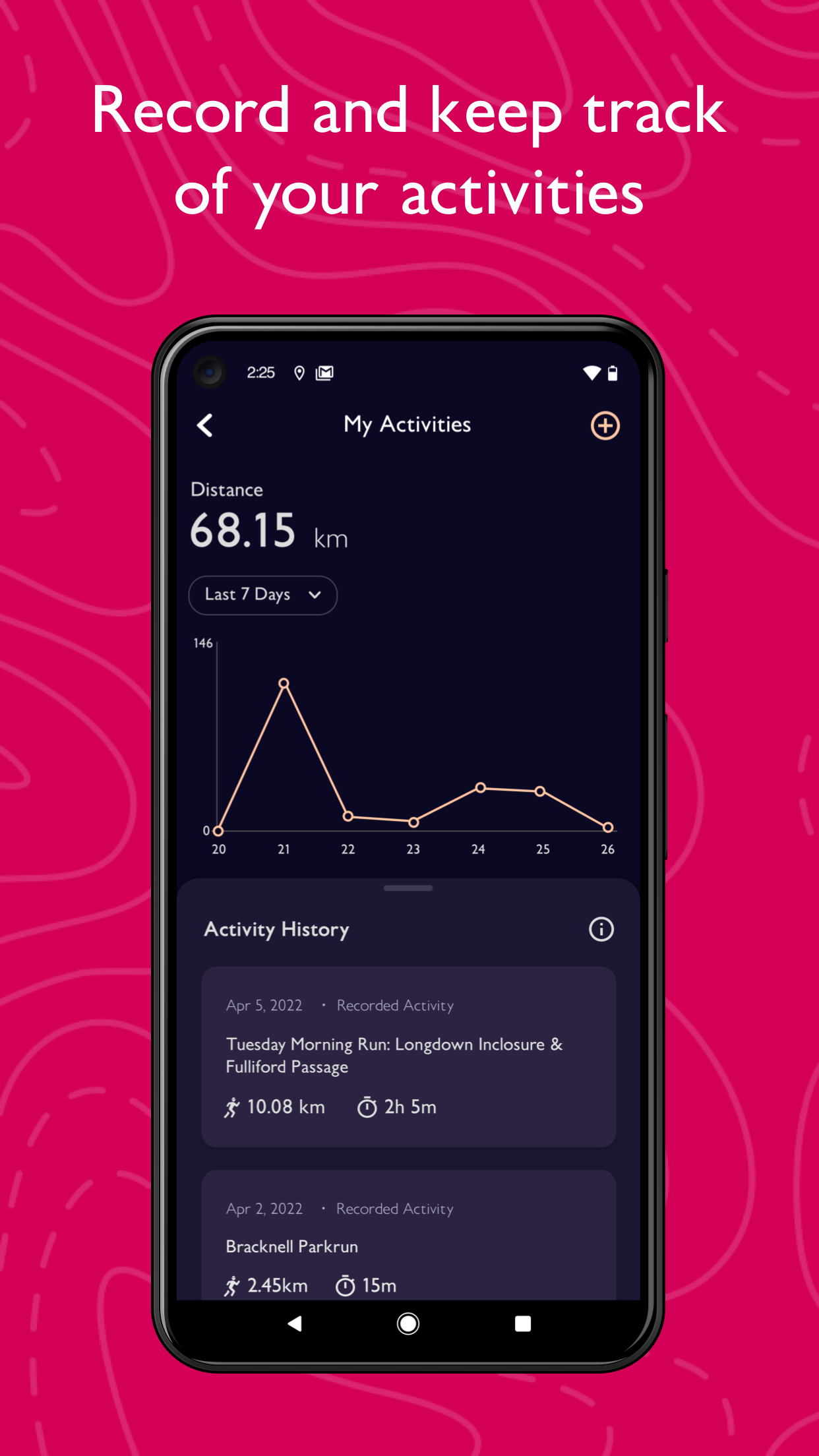
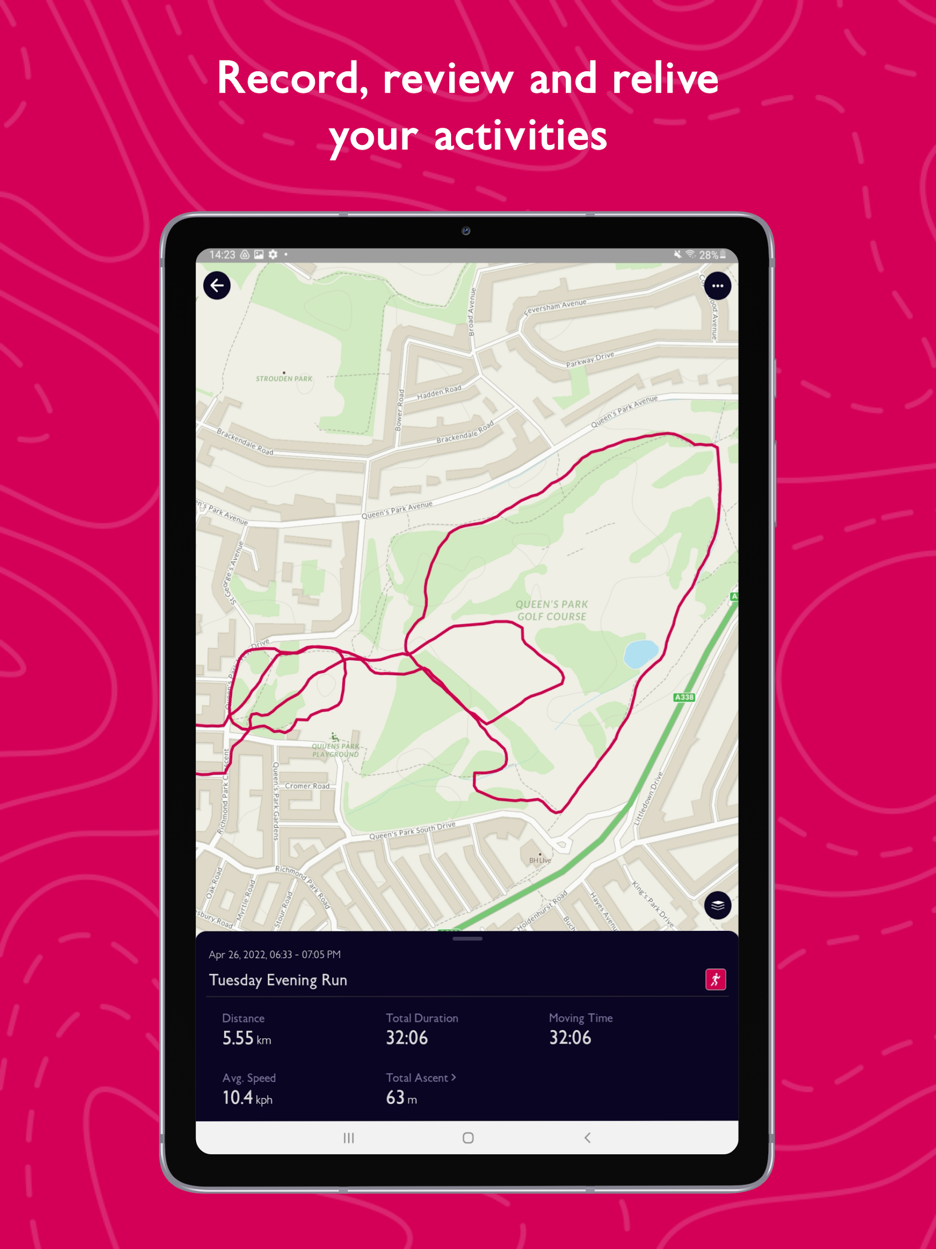
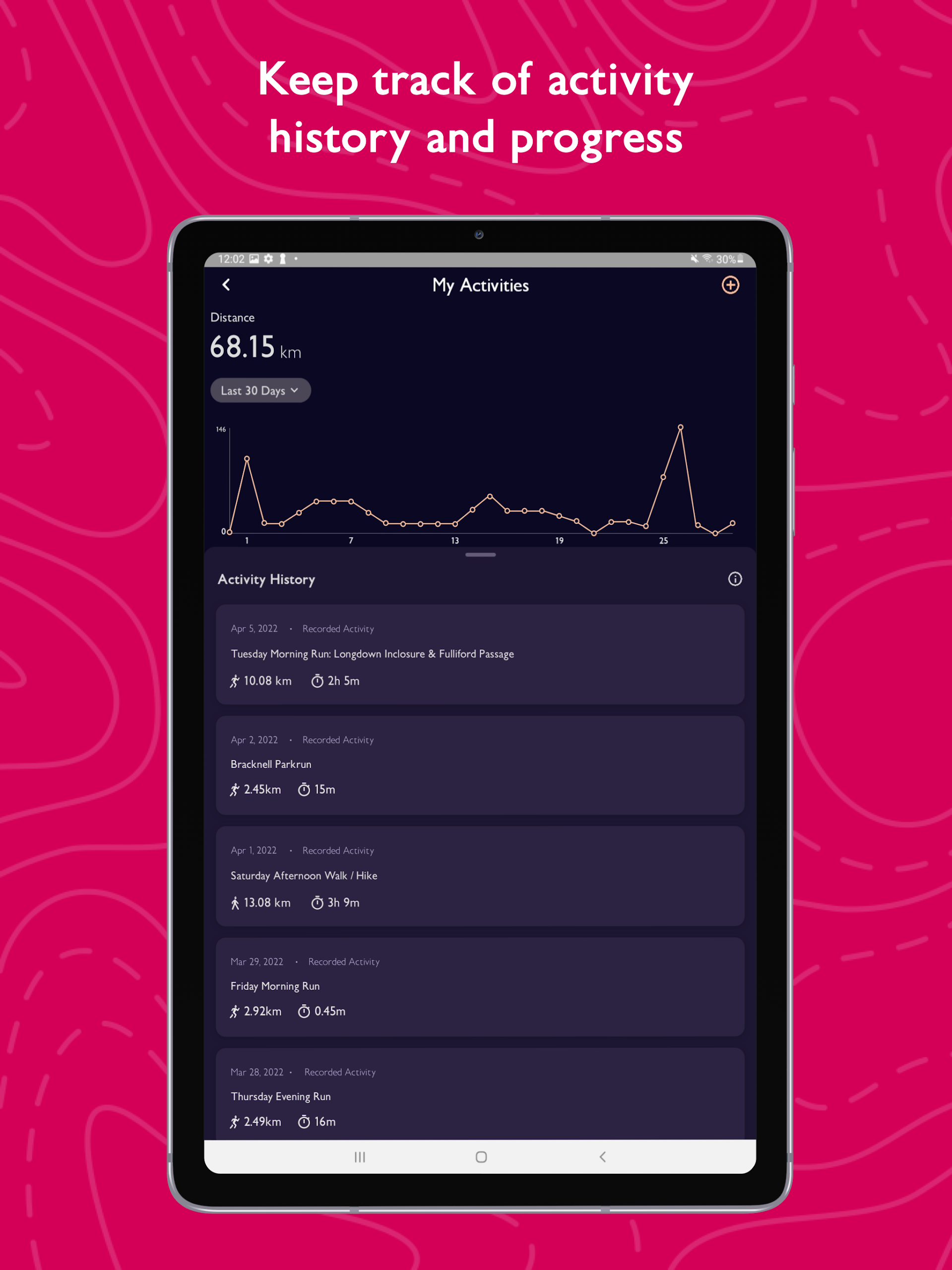
• CAPTURE, RETRACE & REVEL IN YOUR ACTIVITIES
Employ the activity tracking feature and activity history dashboard to document each thrilling adventure. Reflect on past escapades and review your performance stats.
• ENJOY A SAFE OUTDOOR EXPERIENCE
Benefit from real-time GPS location tracking and stay OnCourse with off-route alerts. Download and share trails, routes, and maps with others.
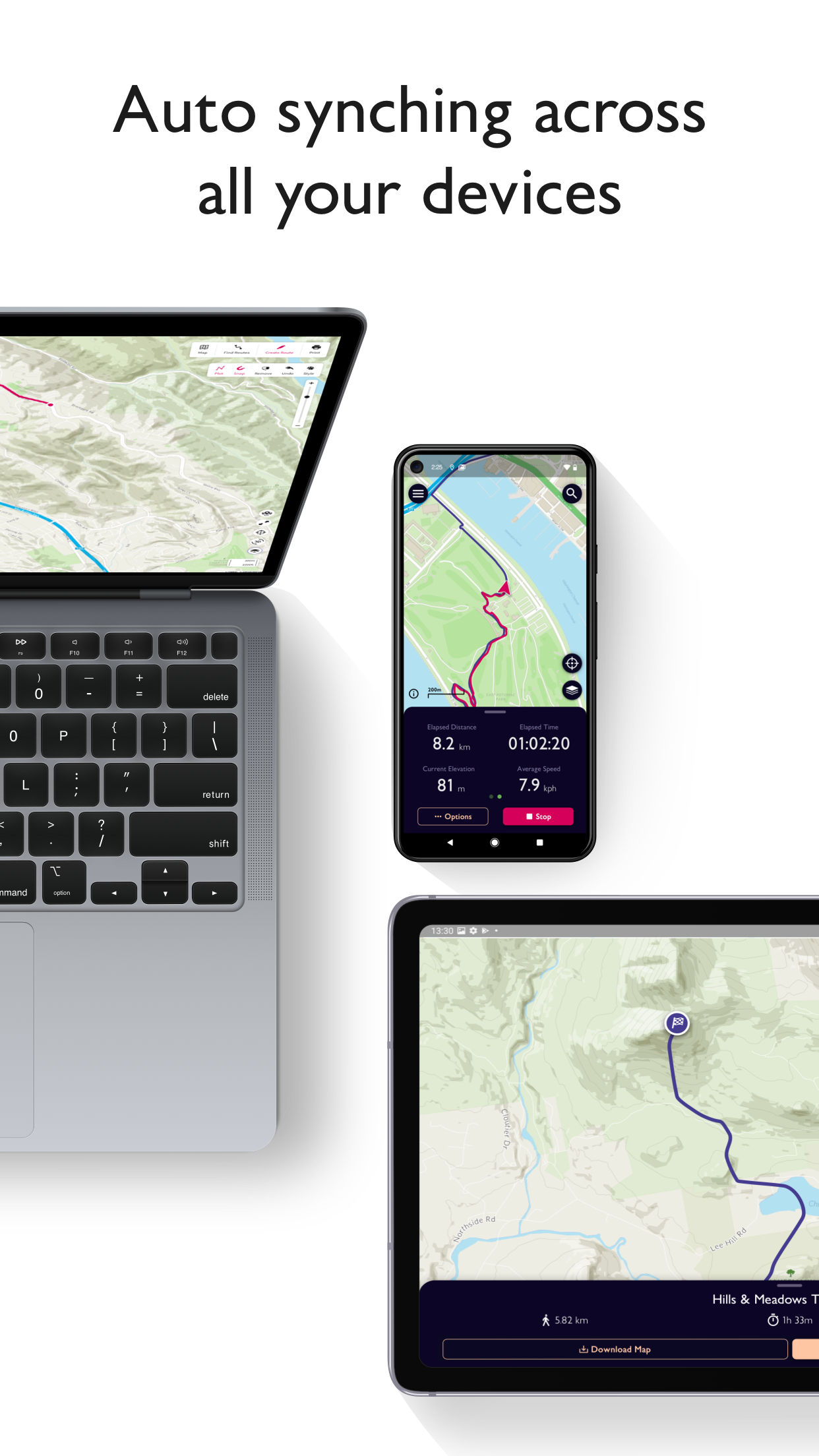
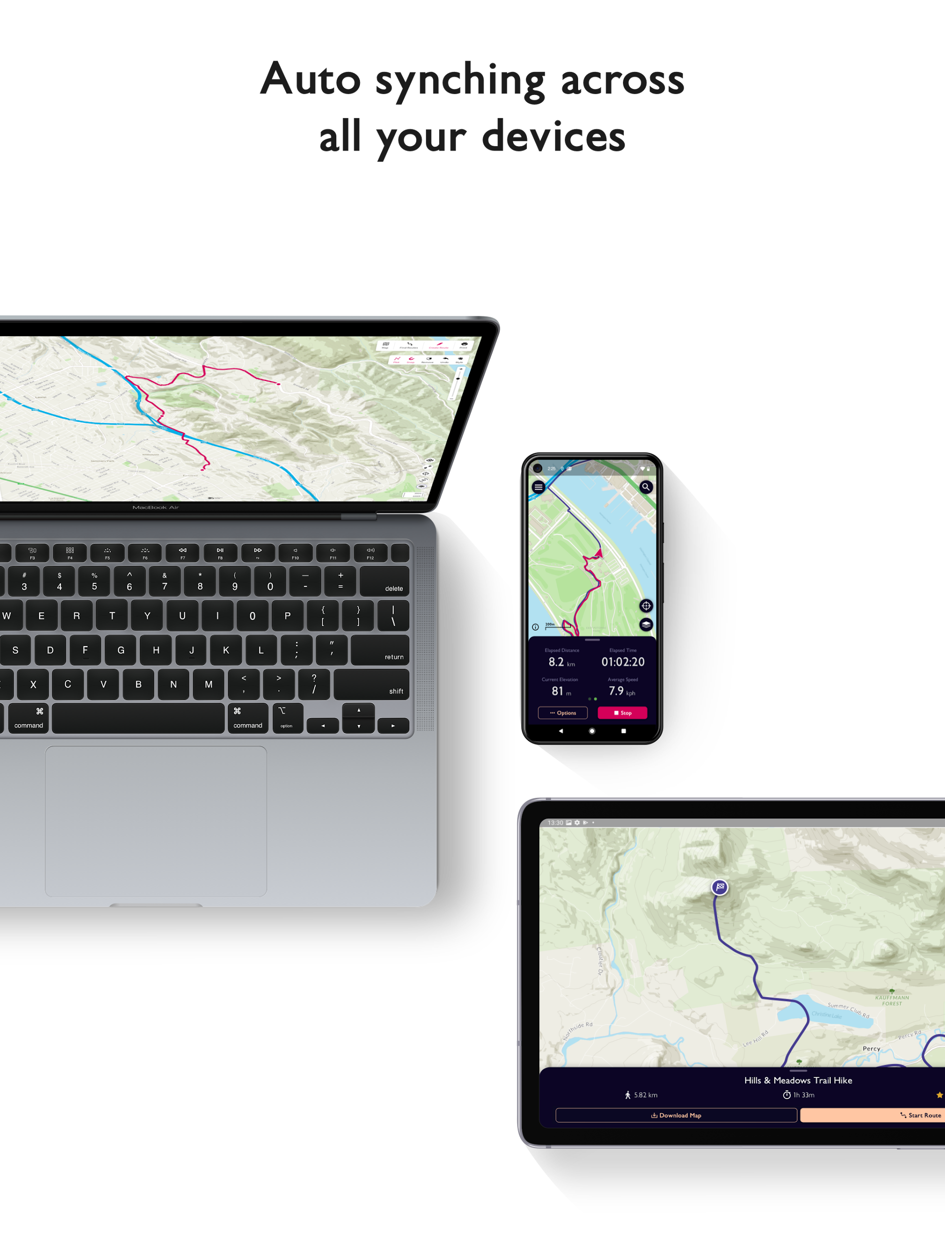
• UNIVERSAL DEVICE COMPATIBILITY
Transition seamlessly from laptop to hilltop! View, create, and sync your routes and activities with one account across multiple devices. Plan on desktop, track and capture your activities on mobile devices or compatible Wear OS gadgets.
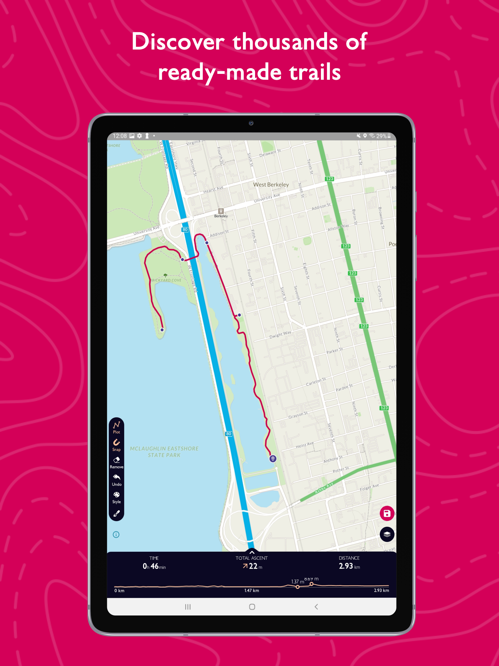
• EFFORTLESS PLANNING
Leverage OS Maps as your off-road GPS tracker with automatic 'snap-to-path' functionality, facilitating easy route planning with waypoints connected by the shortest distance.
• UNLIMITED PRINTING
Print hard copies of trails and maps for quick reference during your adventures.
• USEFUL INFORMATION
Monthly subscriptions available at $4.99, and annual subscriptions at $28.99. Note that constant GPS use can significantly drain battery life.
Finding Routes:
OS Maps features over a million ready-made routes, supplied by recommended route partners and the community of OS Maps users. You can find these routes on both web and mobile app versions of OS Maps.
1. To start searching for a new route, you can use the ‘Find routes’ option, under the Main Menu, or by using the ‘Find Routes’ icon

2. From the 'Find Routes' screen you will be given various filter options for the type of route you are looking for based on activity type, Recommended or All Routes, Distance or Time, Difficulty and Rating.
3. Adjust the filters based on the type of route you’re looking for and you will see matching routes appear on the map screen.

4. Routes matching your criteria are shown as pins on the map. A purple dot represents a cluster of routes, zoom in or click on a purple dot to see the individual routes in that area.

5. Click on a route marker to see a brief summary of the route including the name, distance and estimated duration of the route. For more detail, select ‘View Details’ to see it on the map as well as some additional information.

You can also export a GPX file of the route to load onto a GPS device, view a 3D fly-through and the option to share a route with friends or family via a route URL
6. If you like the look of a route, you can also add it to your favourites list by using the heart icon. This will sync across devices so you can easily access the route in the mobile app, to download and follow later.

7. To get back to the map screen and see more routes, just click the arrow in the top left corner of the screen.
- Version5.0.4.1312
- UpdateDec 27, 2024
- DeveloperOrdnance Survey Ltd
- CategoryMaps & Navigation
- Requires AndroidAndroid 5.0+
- Downloads1M+
- Package Nameuk.co.ordnancesurvey.osmaps
- Signature26ed8251d4947079a13a88f919ab6f0c
- Available on
- ReportFlag as inappropriate
-
NameSizeDownload
-
48.47 MB
-
52.52 MB
-
63.36 MB


Accurate mapping data
Occasional unstable map display