LandGlide - Property data & maps
Unlock property insights with GPS pinpointing & over 158 million parcel records for effortless land searching.

- 4.8.4 Version
- 1.4 Score
- 921K+ Downloads
- In-app purchases License
- 3+ Content Rating


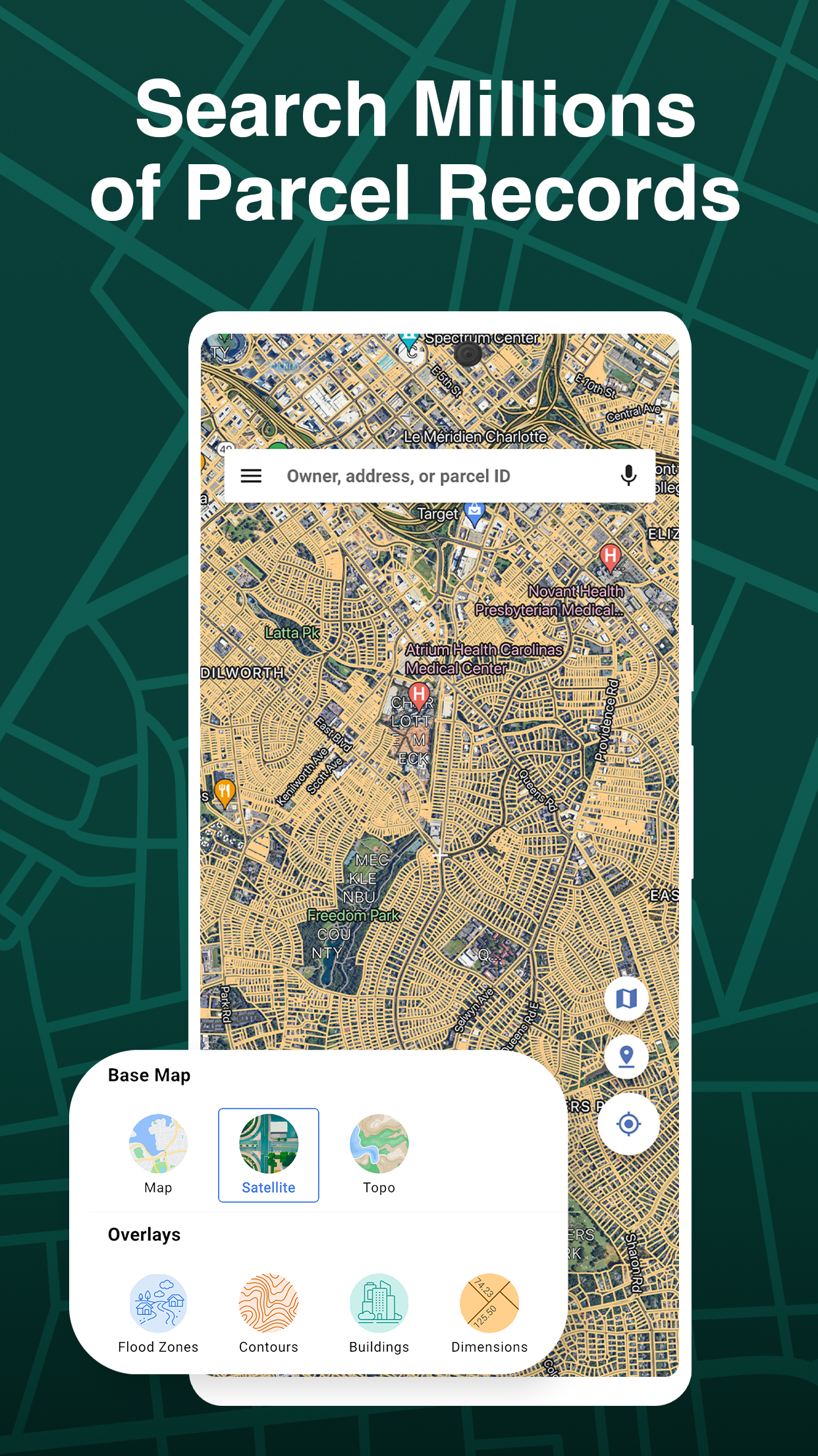
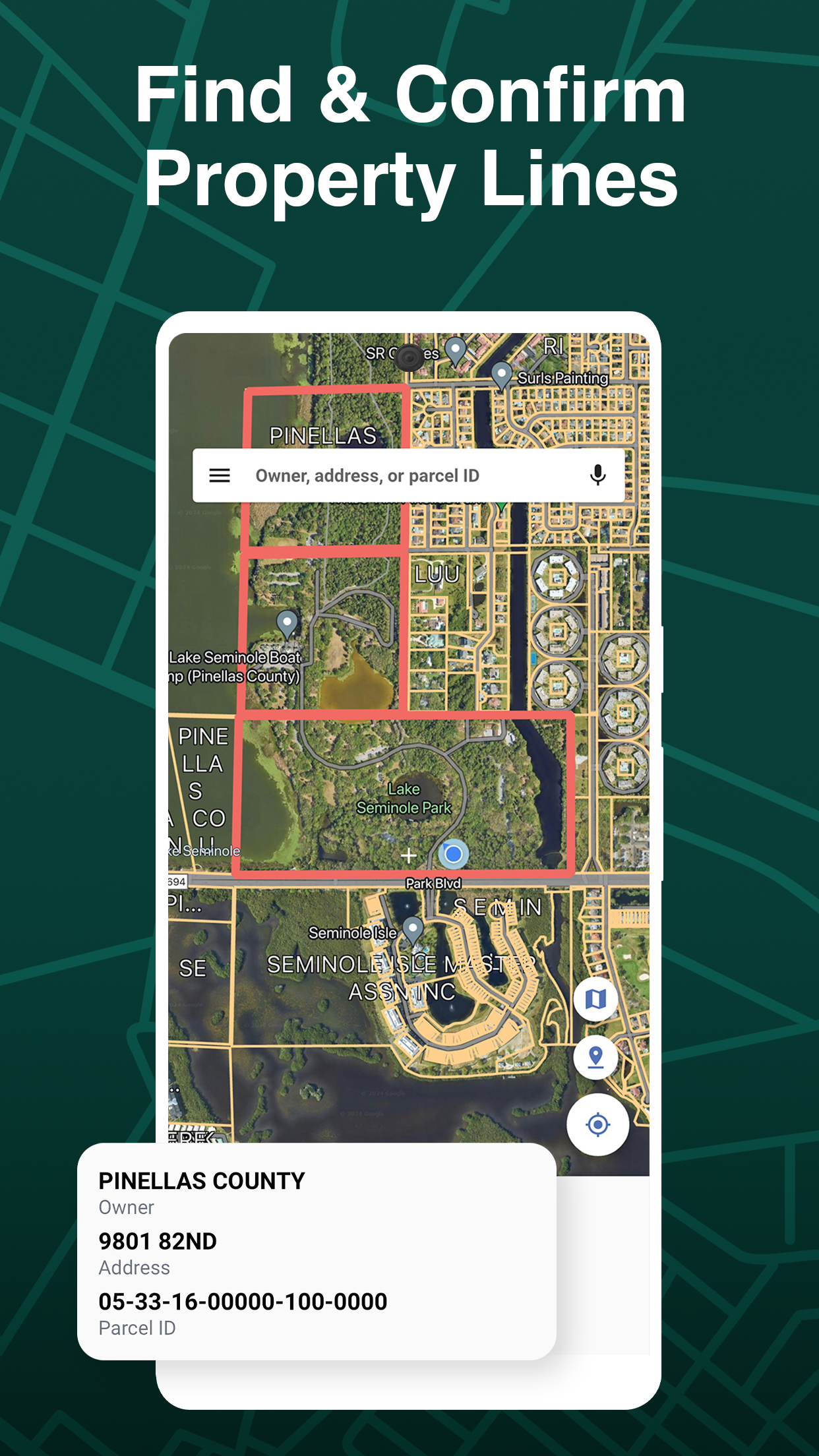


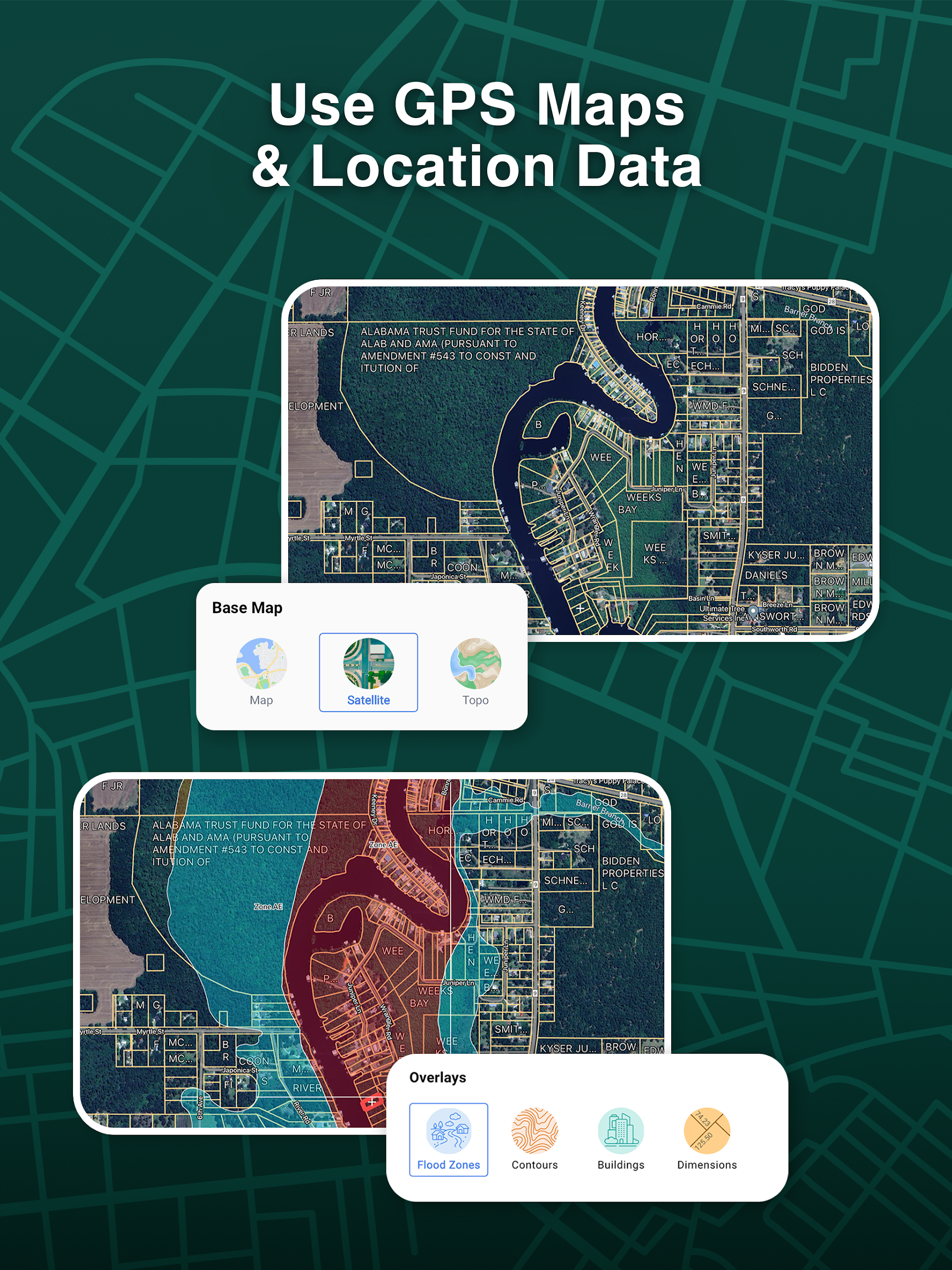


With LandGlide®, you can access essential information regarding property boundaries, real estate details, parcel information, and homes available for sale by their owners. LandGlide stands out as the leading property data tool, providing the most sophisticated and extensive data related to land, parcels, and property line maps. Searching for properties is simpler than ever thanks to our intricate parcel maps.
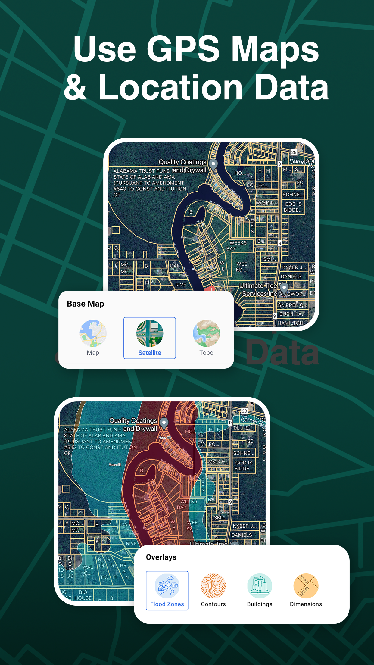
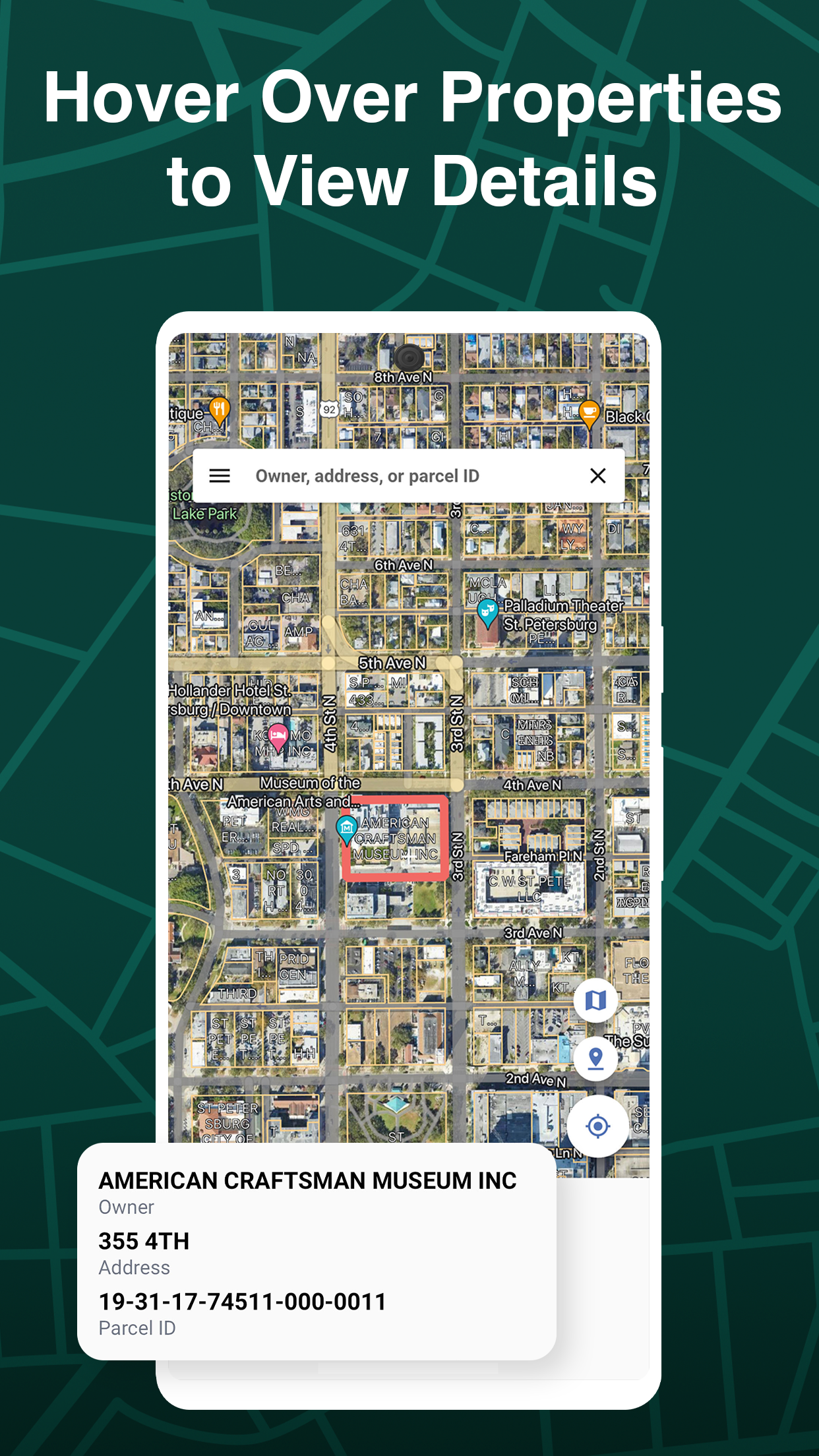
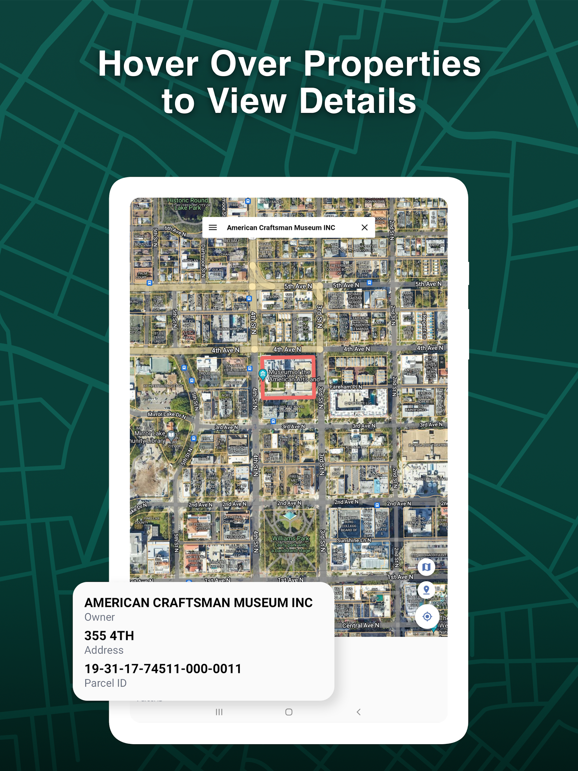
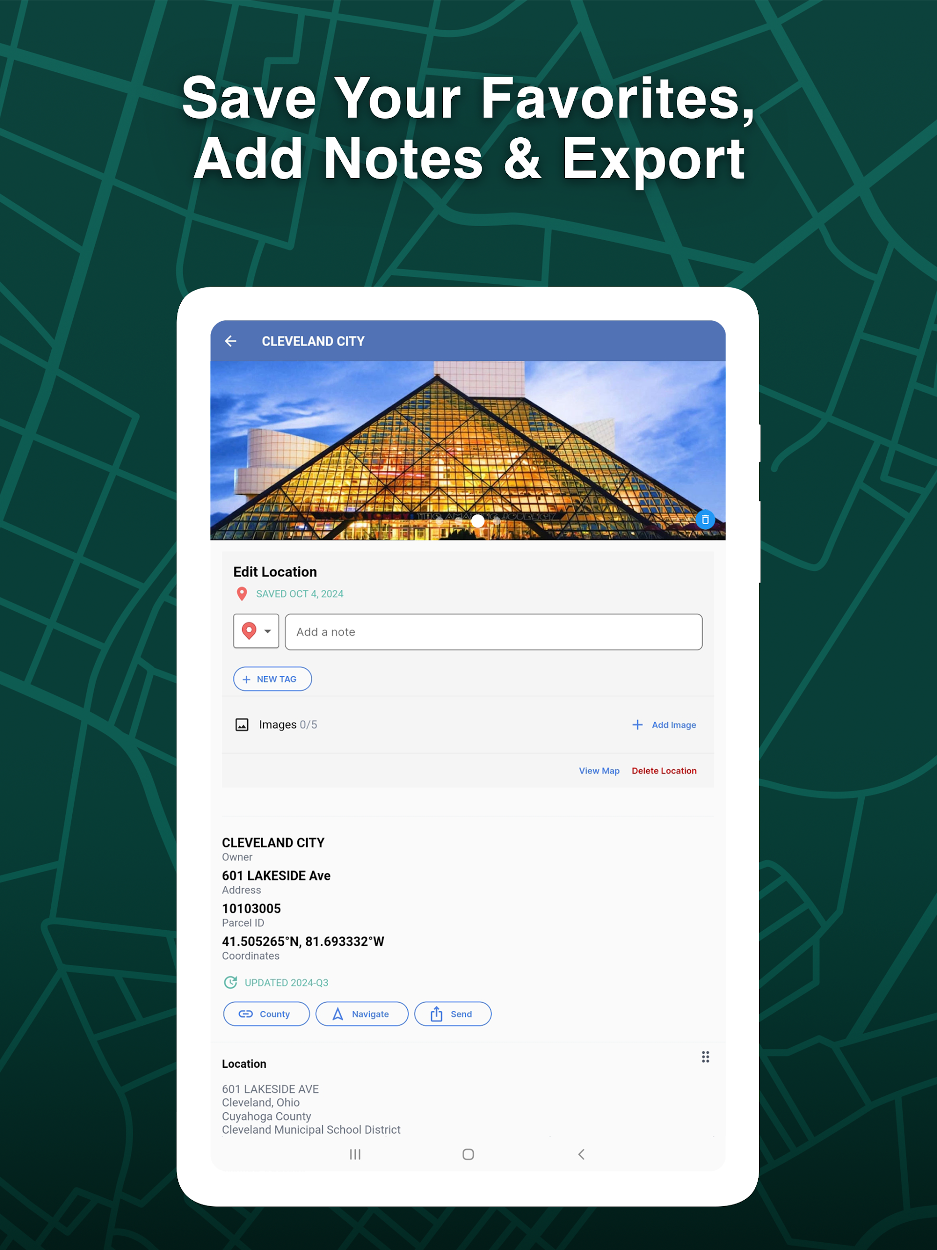
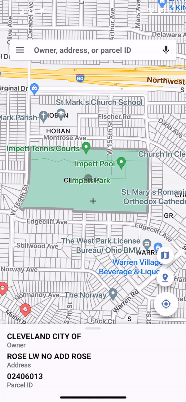
Utilize GPS technology to locate yourself precisely, obtain vital parcel information, and determine property lines from any location. You can easily look up properties by owner, address, or parcel number, and by hovering over any property, you can immediately view relevant details. Additionally, LandGlide enables you to save favorite locations, make notes, upload photos taken either in the field or office to specific properties, and export all necessary property data. Searching for a property or home has never been more convenient when using LandGlide across any device.
LandGlide facilitates access to over 158 million parcel records spread across more than 3,200 counties, encompassing over 99% of the U.S. population.
Access comprehensive property and parcel map data along with insights using LandGlide today.
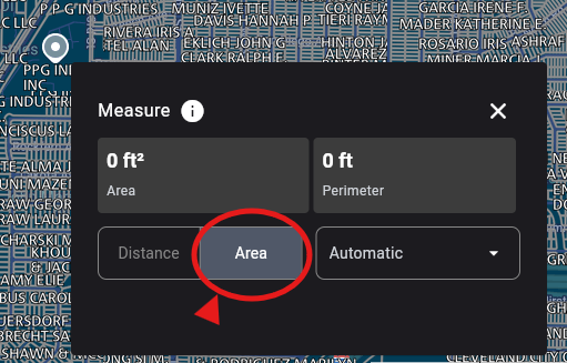
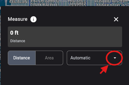
How to use the Measure feature?
LandGlide’s Measure tool allows you to measure the distances between points of your choice on the map and calculate the area and/or perimeter of an area you define.
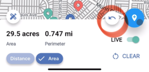
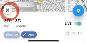
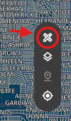
To start, from the mobile app, tap the Map icon on the right side of the map and then tap the Measure icon. By default, you’ll be measuring the distance between points, but you may select the ‘Area’ button at the bottom left to see both the area and perimeter.
Choose your first point by scrolling the crosshairs to a point on the map you would like to start. When you have the crosshairs on your first point, tap the Drop Point icon on the bottom right of the map. This will mark your spot with a dot labeled 1 in it to indicate it is your starting point. Scroll through the map again until you have the crosshairs on your second point. Tap the Drop Point icon to set your second point. The distance will now appear in the measurement bar at the bottom of the screen. Continue this process until the desired measurement area is defined. You can tap on the measurement to copy the information to the clipboard.
To calculate Area and Perimeter, add at least 3 points to the Map and select Area in the Measurement Display bar. The area and perimeter displayed will update as you continue to add points. You may continue this process until the area you wish to measure is complete. You can tap on the measurement to copy the information to the clipboard.

Make a mistake or drop a pin inadvertently at any point; you can correct this by either using the Undo arrow next to the Drop Point icon to remove the last pin or tapping Start Over in the lower right corner to remove all the pins and start again.
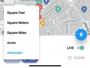
You can change the units of measurement displayed by tapping the Measure button at the bottom left of the map. If you select Automatic, it will automatically adjust the units based on the magnitude of the measurement. For example, if you measure something that is 10 feet long, you’ll see the units in feet, but then when you measure something that’s 100 miles long, it will “automatically” change the units to miles rather than feet.
For web users, the Measure icon is the crossed pencil and rule icon on the right side of the map.
To measure the Distance between points, click on the Measure icon and click Distance in the box that appears. Click anywhere on the map to drop a point. Continue to click to drop points until you have all your points set to show the calculated distance.
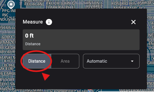
To get an area measurement, click on Area in the Measure box and set your points the same as you would for measuring distance, by just clicking the points on the map.
You can change the units of measurement by clicking the drop-down box to the right of Area. Here you can see the available units of measurement to use.
When you are done with either measurement on screen, click the Clear just at the bottom of the box to clear the measurements off the screen
Property Finder
- Access property records from over 158 million parcels nationwide
- Locate the parcel map for nearly any property
Property Data for Real Estate Professionals
- Parcel information is available both online and offline for your convenience
- Up-to-date details can be obtained through our property finder
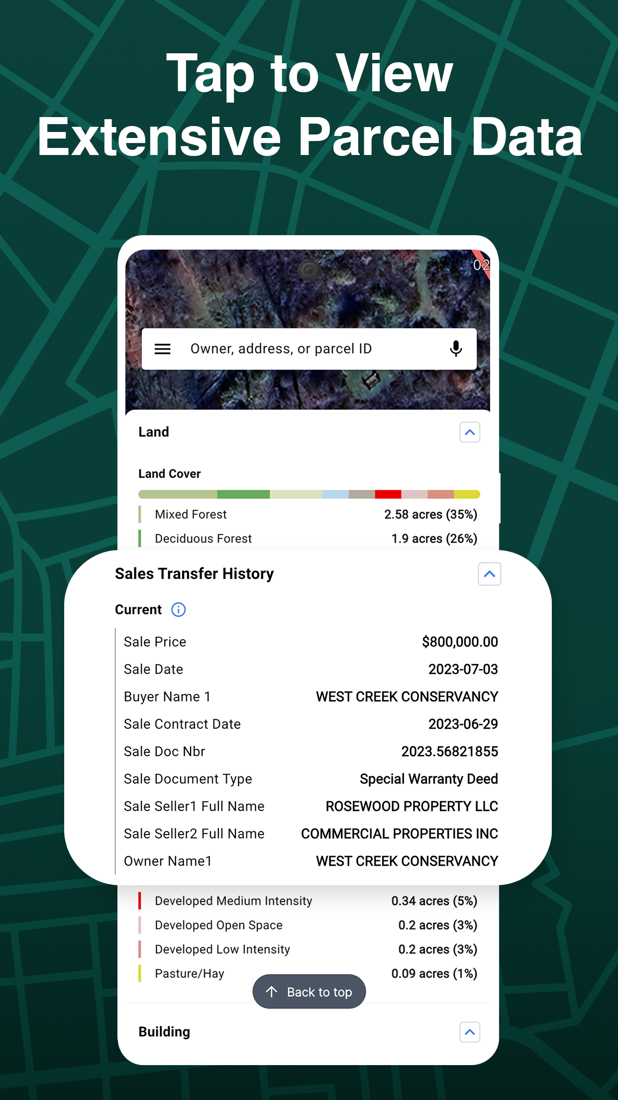
- Information regarding property ownership, acreage, square footage, building descriptions, and more for your property or home search
- Instantly see owner details, situs and mailing addresses, market and sale prices, transfer dates, acreage, building specifications, land usage, school district information, elevation, and other relevant data
Begin with a free trial that allows access to millions of parcel records across the country. Enjoy your first seven days for free, followed by a fee of $9.99 per month or $99.99 per year thereafter.
- Version4.8.4
- UpdateMar 27, 2025
- DeveloperReal Estate Portal USA
- CategoryBusiness
- Requires AndroidAndroid 6+
- Downloads921K+
- Package Namecom.reportallusa.landglide
- Signature1c29d9b5fbc162352d939546c2f79b9e
- Available on
- ReportFlag as inappropriate
-
NameSizeDownload
-
101.91 MB
-
101.66 MB
-
77.00 MB


Tons of Info
Multi-Device Support
Costs Money
Not Always Accurate
Some Glitches