eMap HDF - Advanced weather tracking
Experience high-resolution storm radar & detailed weather layers for accurate forecasts, alerts, & local conditions!
- 2.4.7 Version
- 3.2 Score
- 236K+ Downloads
- In-app purchases License
- 3+ Content Rating


eMap HDF is a precise predictive storm radar that utilizes NOAA Doppler technology along with a weather visualization feature.
The weather application offers the following layers as provided by the National Weather Service (NWS) and NOAA:
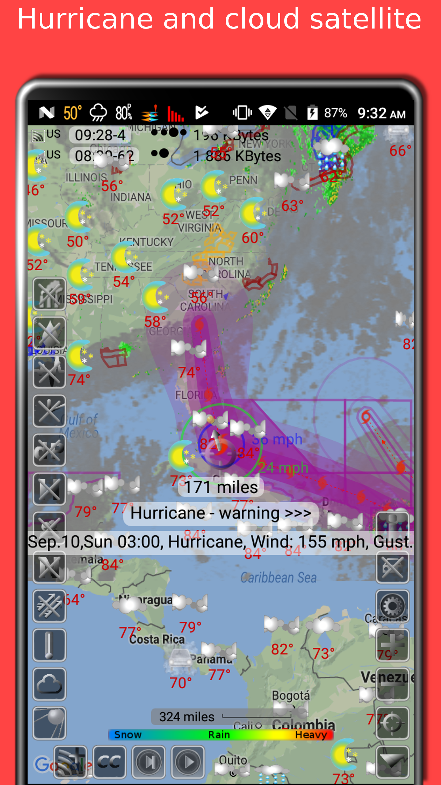
- Radar for snow and rain
- Alerts for severe weather, including a tornado tracker as well as warnings for heavy rainfall and winds
- A map showing lightning strikes
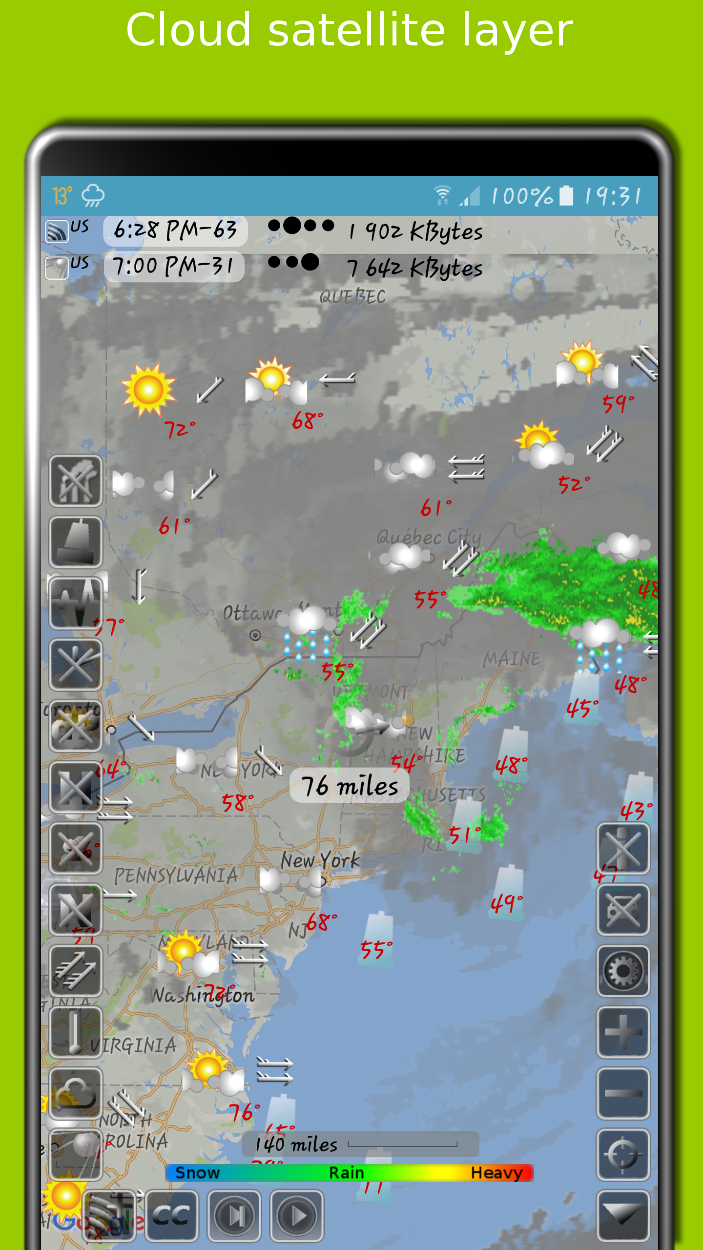
- Satellite imagery of cloud cover
App permissions
Location
approximate location (network-based)
precise location (GPS and network-based)
Wi-Fi connection information
view Wi-Fi connections
Other
view network connections
full network access
control vibration
prevent device from sleeping
Global layers include:
- Tracking for typhoons (tropical storms, cyclones) and hurricanes, sourced from GDACS
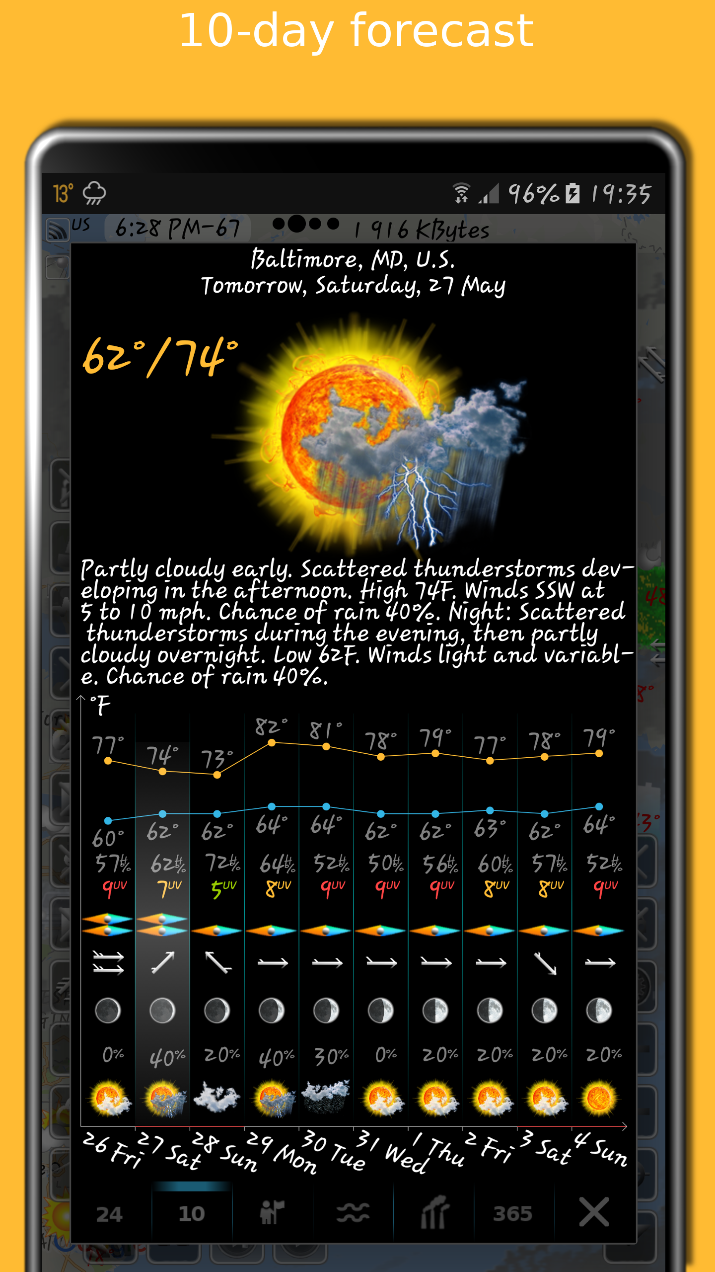
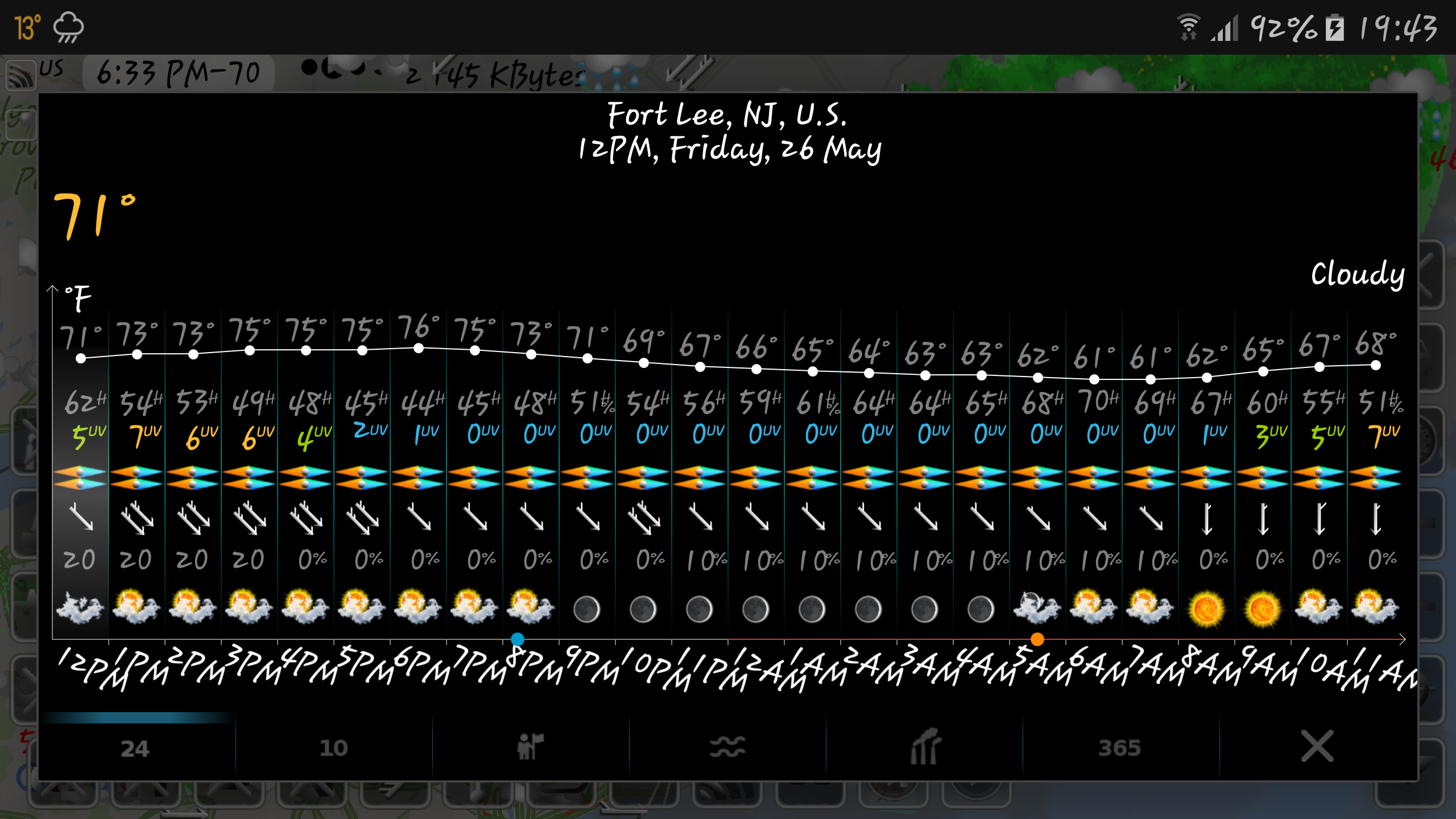
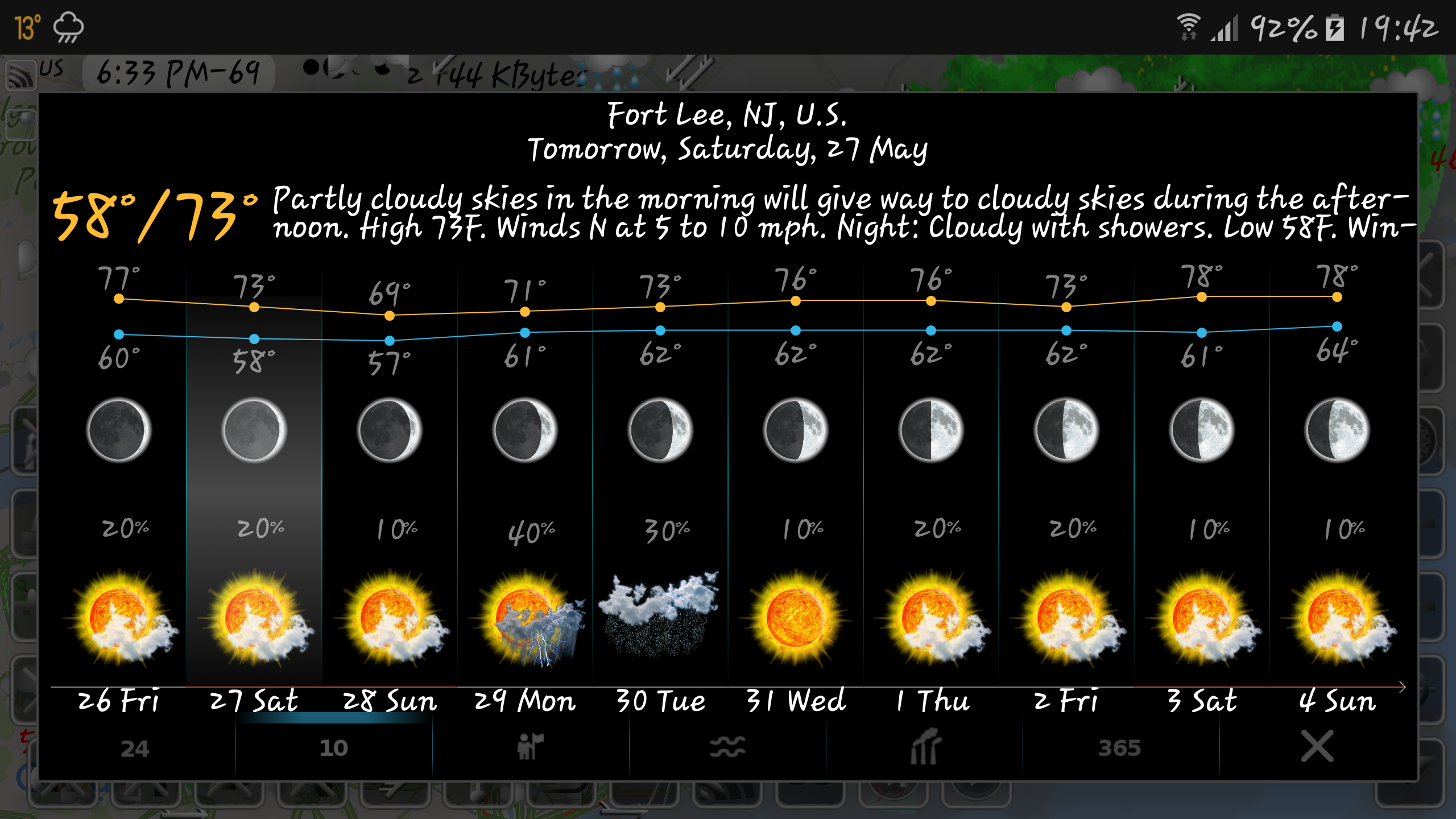
- A reliable 10-day weather forecast
- An hourly weather prediction for the next 24 hours
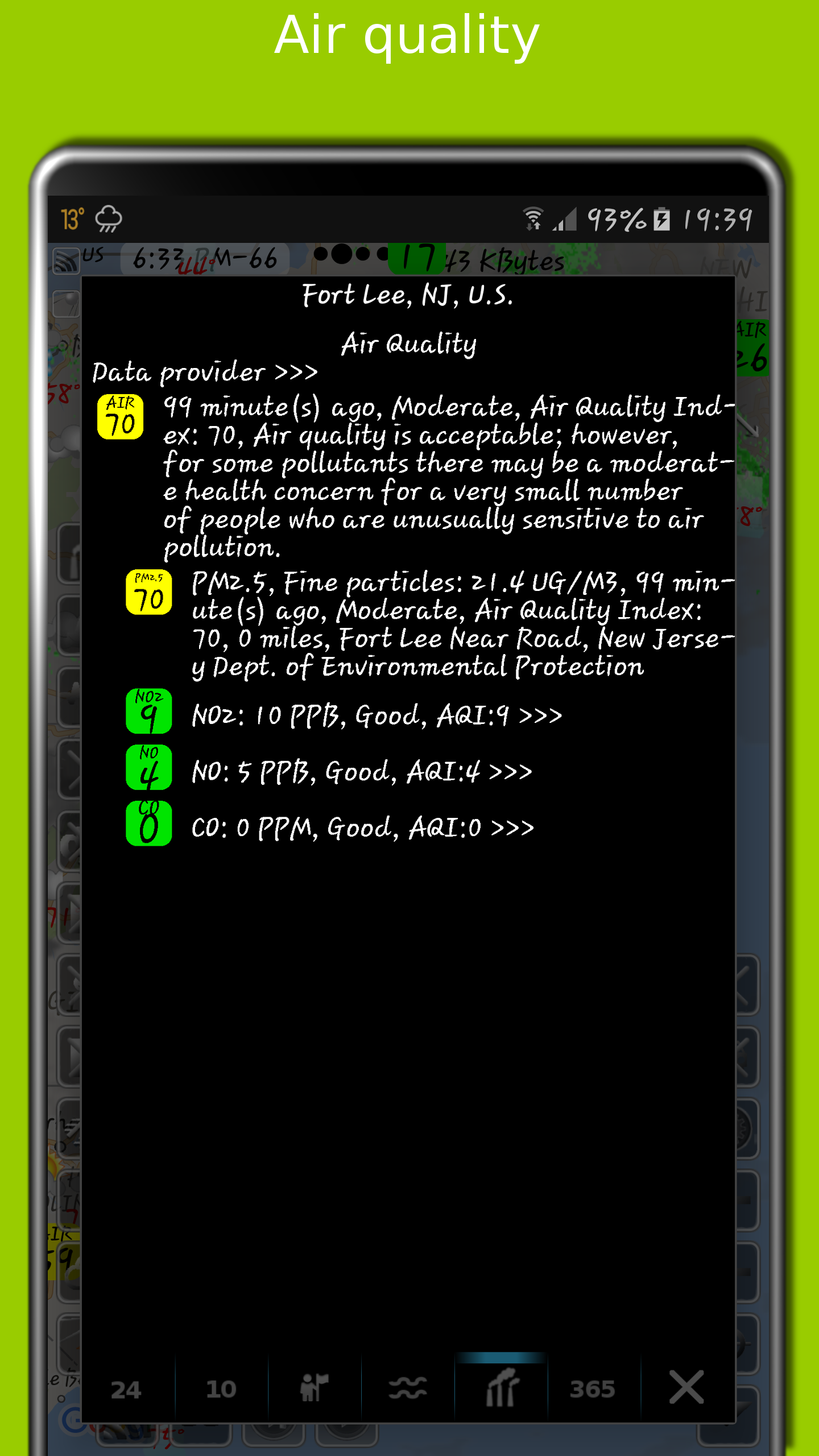
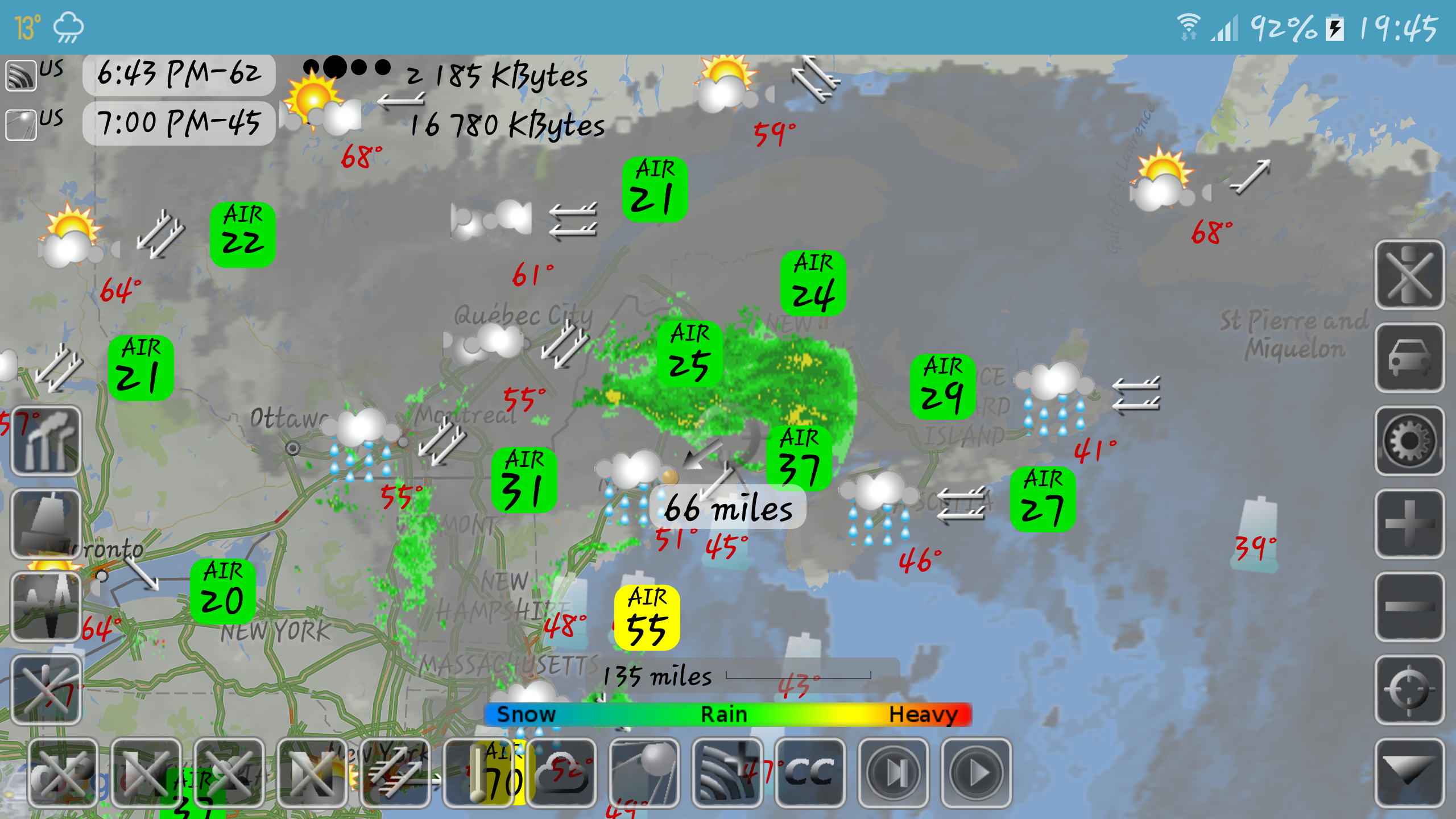
- Insights on air quality and pollution levels
- A map displaying earthquakes
- A map illustrating temperature variations
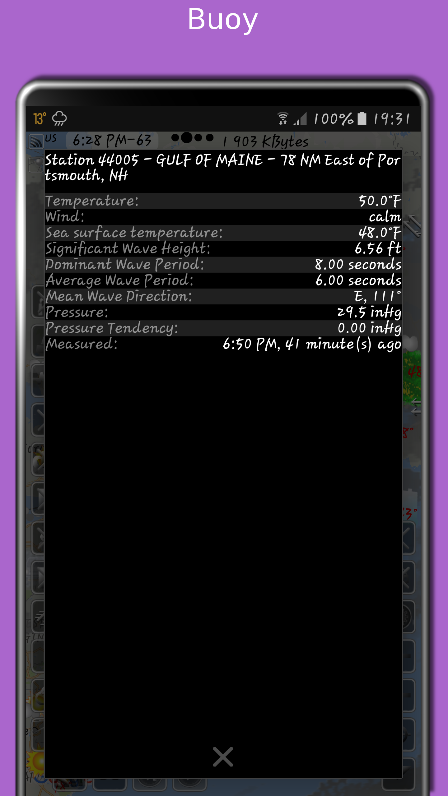
- Sea surface temperatures derived from buoy and satellite data
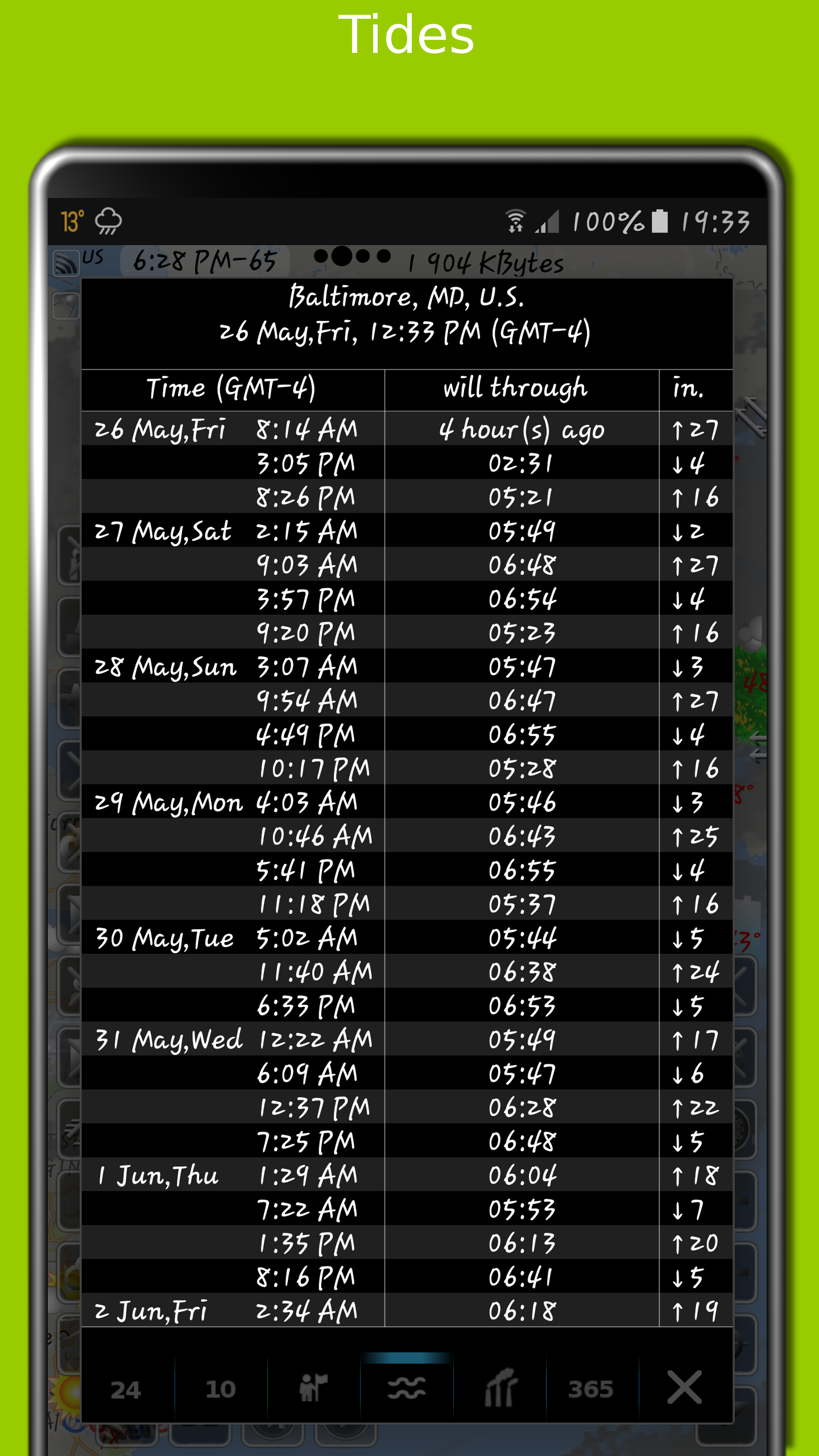
- Tide information
- Local time indications in various cities
- Population statistics of urban areas
- Traffic conditions
- Infrastructure represented by buoys
- Dew point information
- Humidity levels
- Wind direction and speed visuals
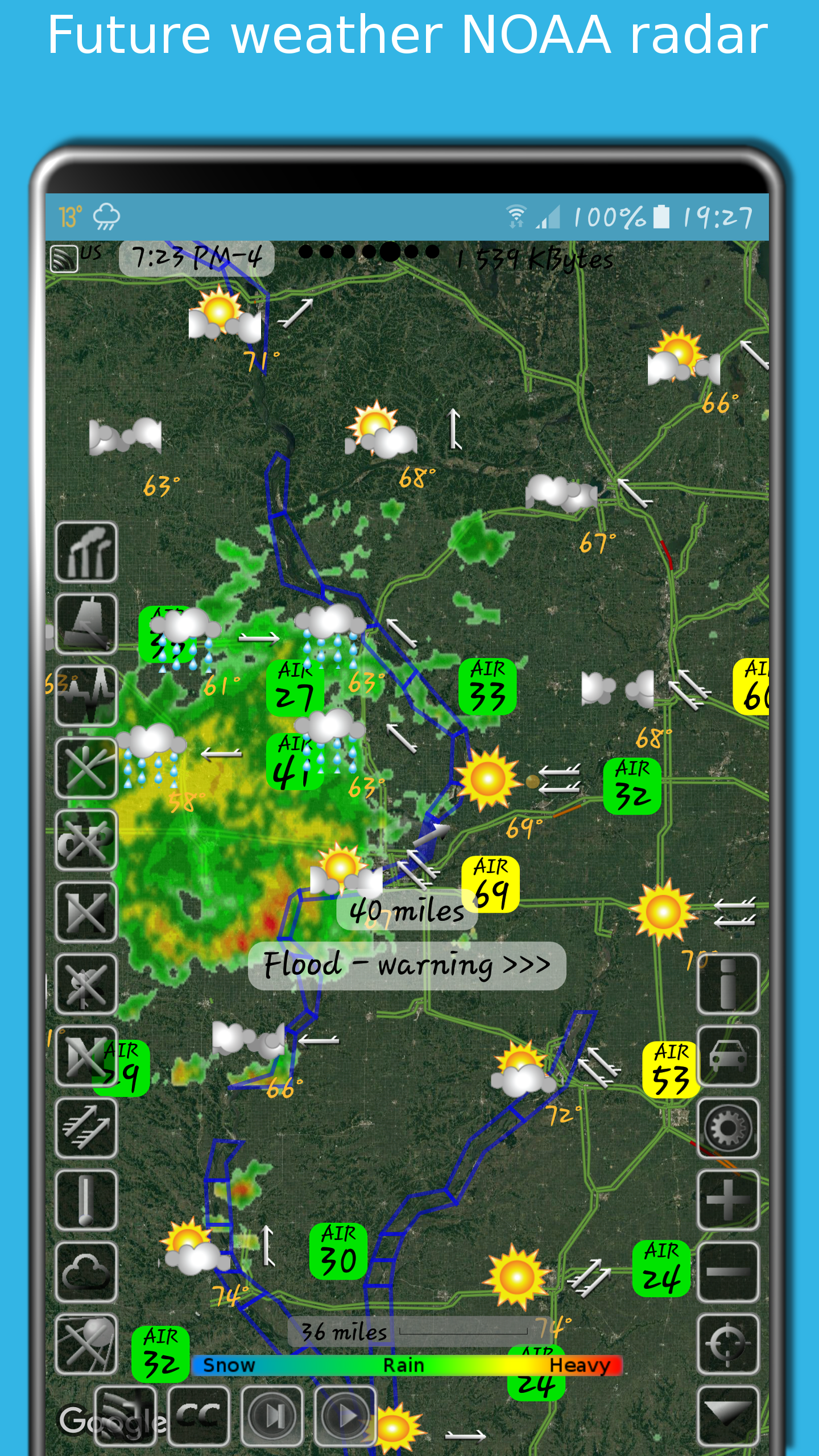
The storm radar application provides an hour-long outlook for rain and snow, broken down into five-minute intervals. The NOAA radar maintains a history of weather patterns covering six hours.
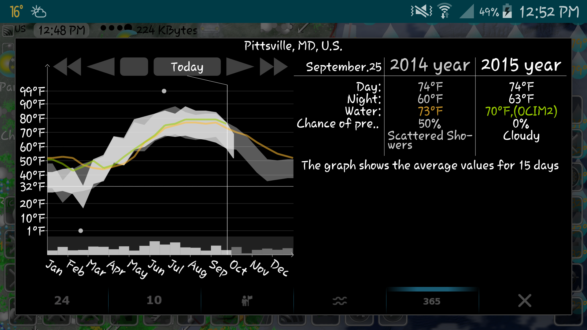
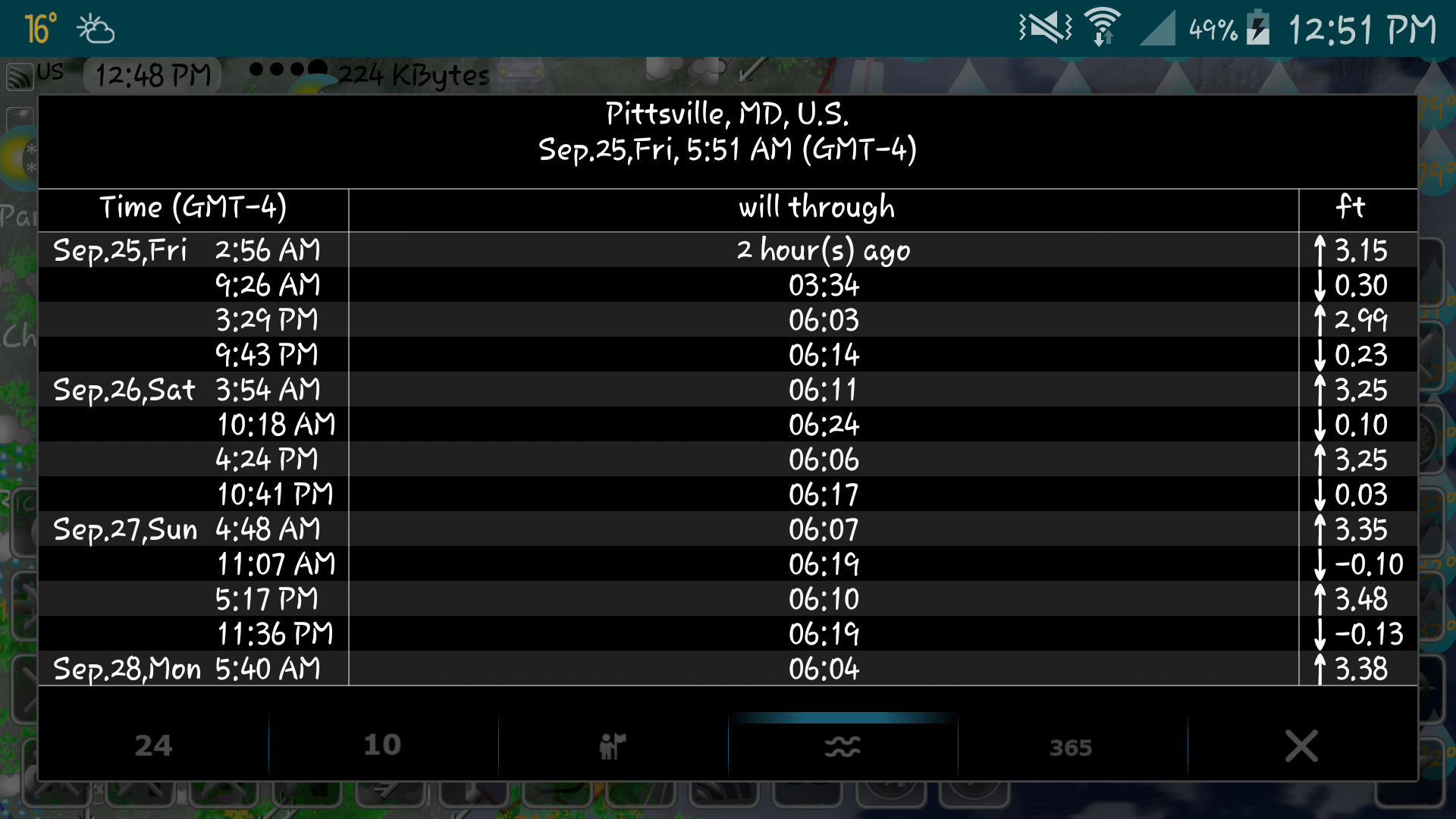
Tide data encompasses more than 10,000 tidal stations across the US, UK, Canada, and other regions, with projections available for several months ahead. The application tracks the user's current location to display nearby tides.
Data concerning earthquakes can be filtered based on their magnitude and depth, using information sourced from USGS.
A distance measurement feature allows users to calculate the space between two locations in both miles and kilometers.
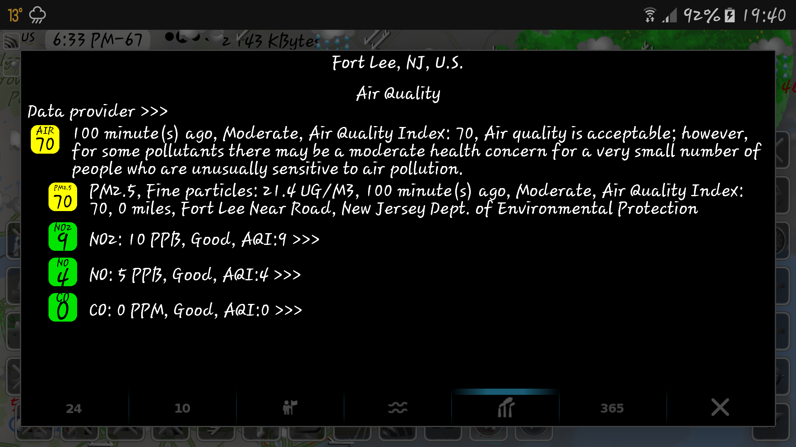
The air quality feature presents data on pollutants such as ozone (O3), fine particulate matter (PM2.5), coarse particulate matter (PM10), nitrogen dioxide (NO2), nitrogen oxides (NOx), carbon monoxide (CO), among others, collected from various agencies including AirNow and Copernicus.
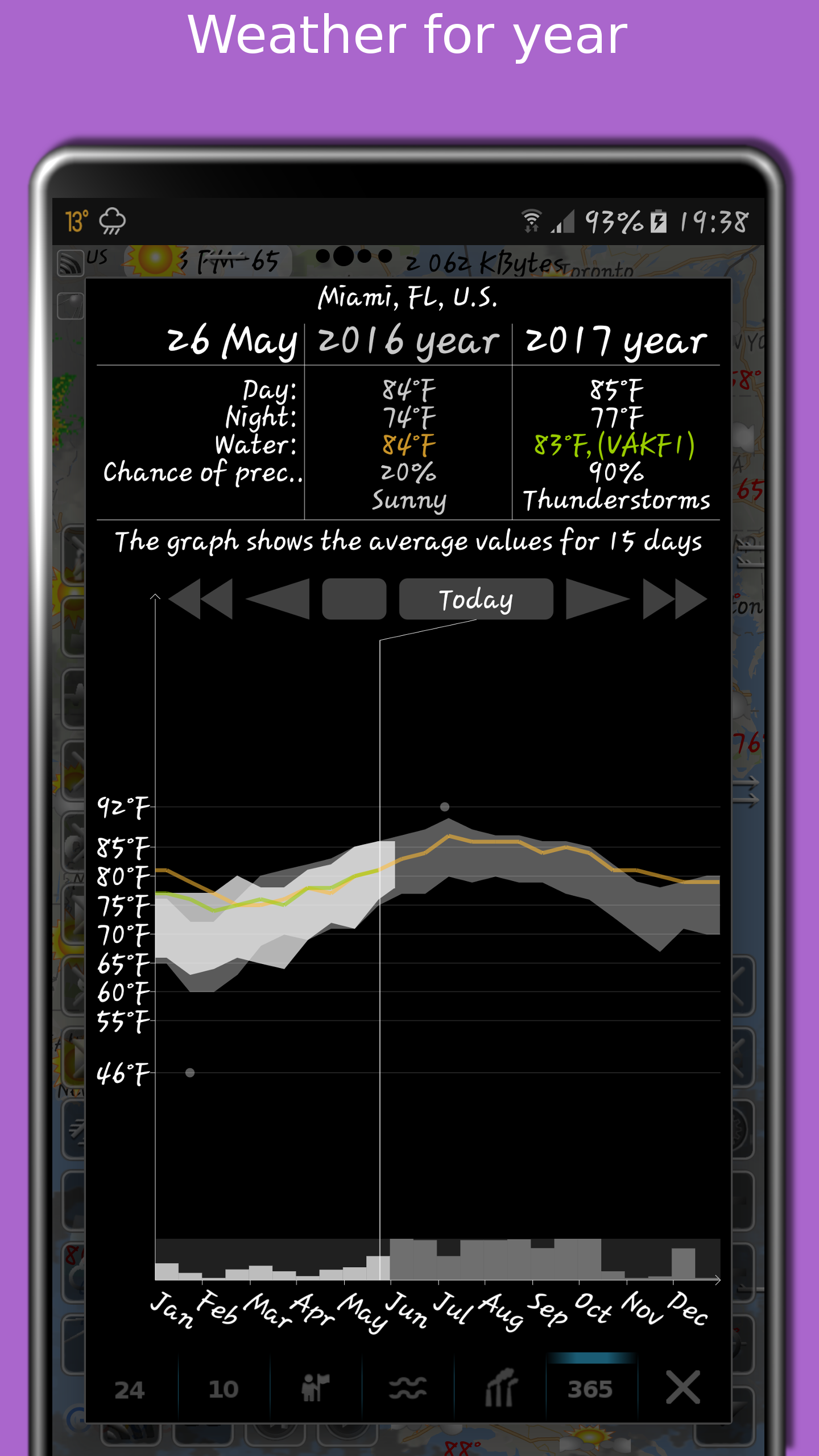
Utilizing the Doppler radar app, users can press and hold any spot on the map to view current weather conditions and access historical data spanning recent years. This archive provides details such as sea and air temperatures, precipitation levels, and cloud coverage. Travel-related weather information assists in planning journeys by comparing present conditions with those of previous years.
By clicking the "CC" button and switching to "10" or "24," users can instantly see either a 10-day or a 24-hour forecast displayed directly on the map.
eMap HDF also provides updates on road traffic conditions. The forecast covers not just temperature and precipitation but additional metrics like humidity, wind attributes, dew point measurements, roadway visibility, and feels-like temperature readings.
The information available through eMap HDF is intended solely for informational purposes and should not be relied upon for navigational activities.
- Version2.4.7
- UpdateMar 25, 2025
- DeveloperElecont Software
- CategoryWeather
- Requires AndroidAndroid 7.0+
- Downloads236K+
- Package Namecom.Elecont.Map
- Signature68676220e15116f0da999b43866fad72
- Available on
- ReportFlag as inappropriate
-
NameSizeDownload
-
20.13 MB
-
18.20 MB
-
10.00 MB


Detailed weather information
Includes various map types
Solid performance
Provides 10-day forecasts
Have to pay to remove the ads
Inaccuracies in certain areas