Bus Nearby - אוטובוס קרוב
Find nearby bus stops and routes effortlessly

- 2.20.5 Version
- 2.8 Score
- 736K+ Downloads
- In-app purchases License
- 3+ Content Rating

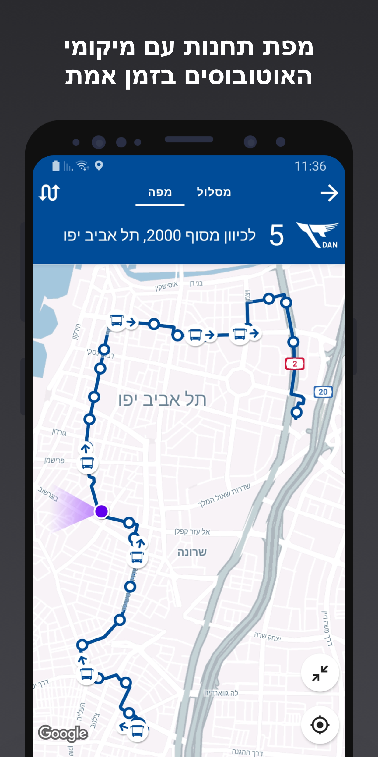
The advanced and accurate public transportation application in Israel uses the GPS installed on buses and trains to provide precise arrival times and real-time updated navigation routes.
Navigate with Ease: The Ultimate Public Transportation App in Israel
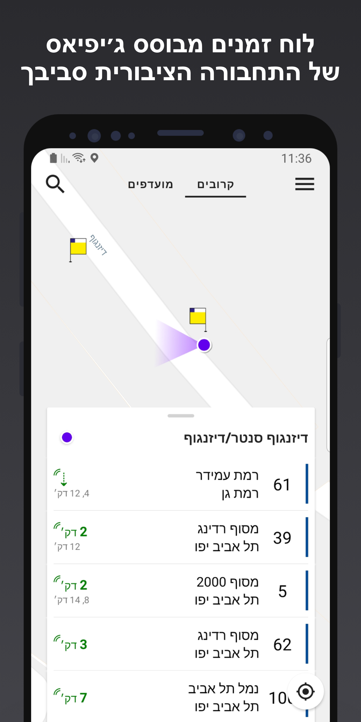
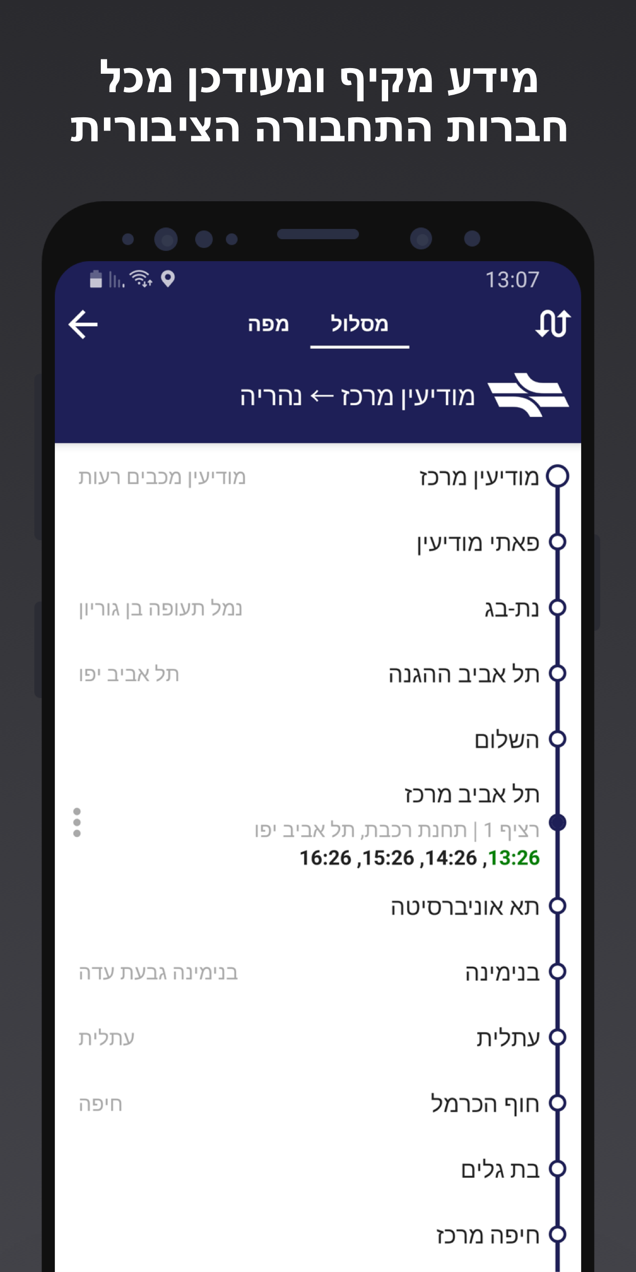
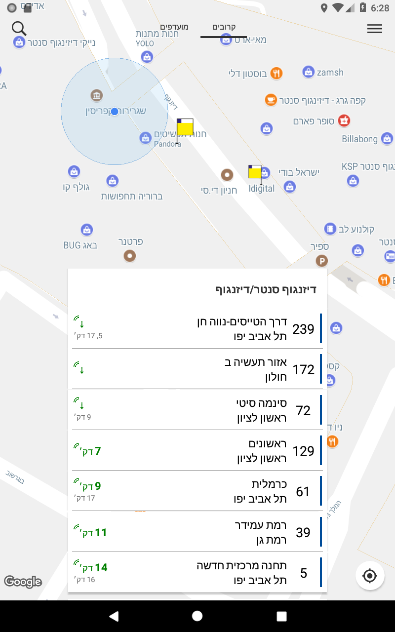
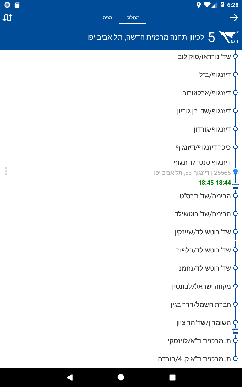
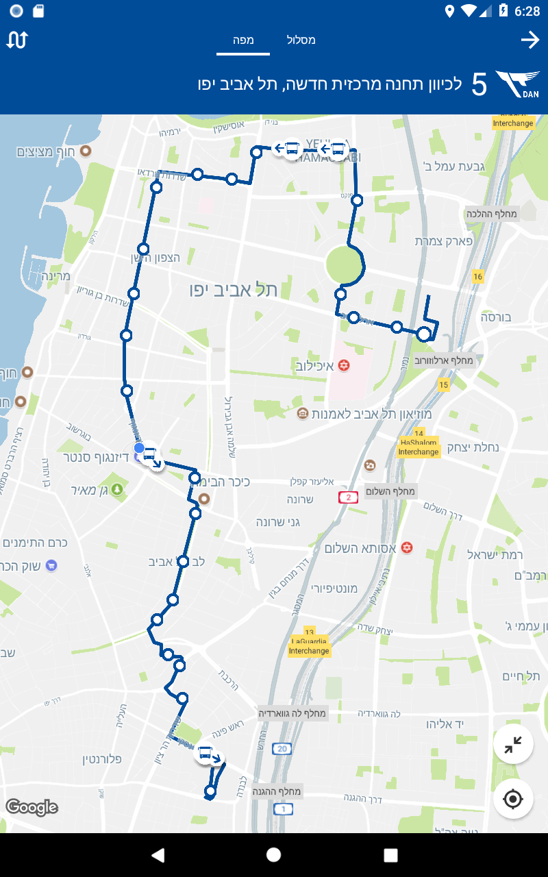
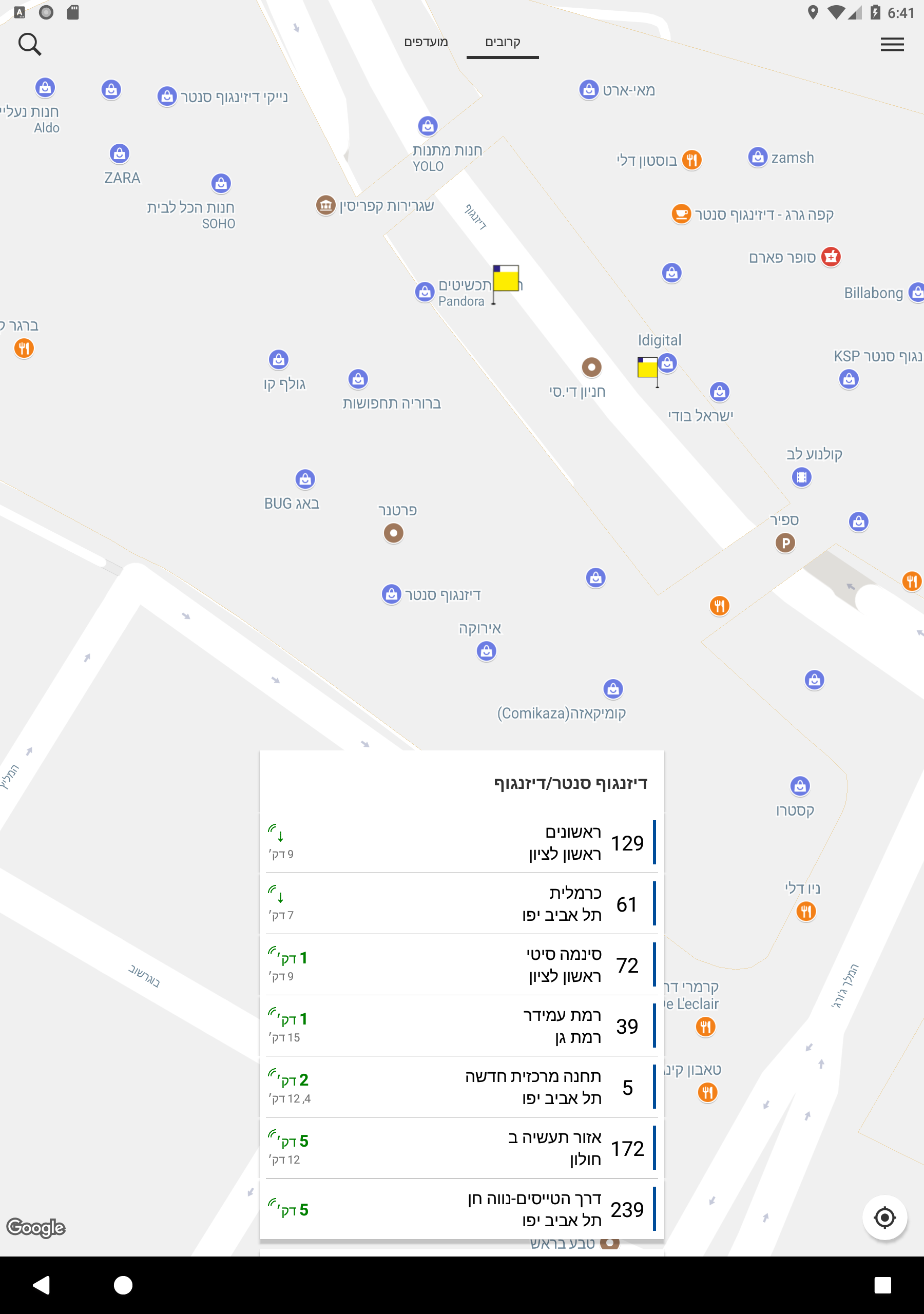
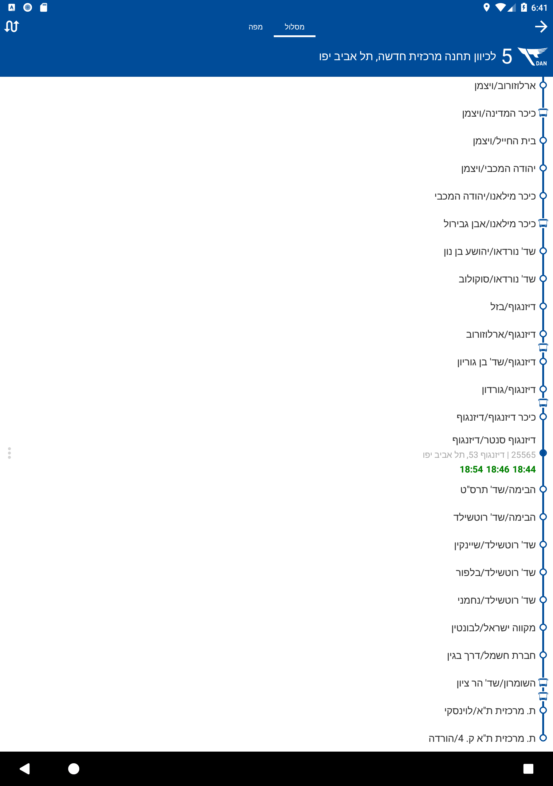
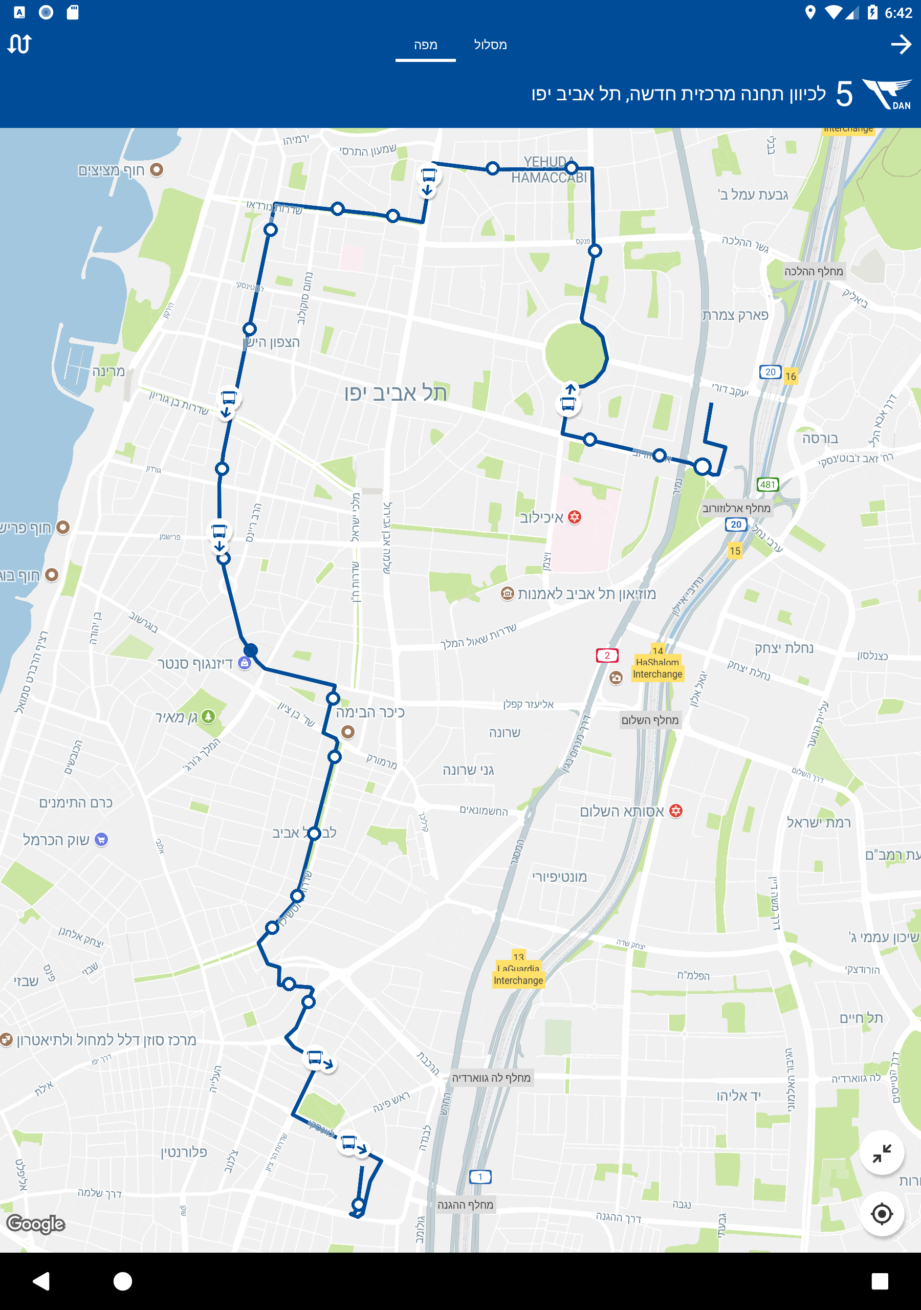
The platform simplifies commutes with detailed route maps, schedules for each station, travel directions, and real-time bus positioning along the route, all readily available on the main screen or through a convenient search function. The green times indicate real-time updates based on the vehicle's GPS, while the black times reflect the planned schedule or future trips without real-time data.
Additionally, this service offers comprehensive coverage of various public transport operators, including night and student lines, ensuring comprehensive travel planning. Locations for reloading Rav-Kav cards are also provided, adding convenience to the travel experience.
How does it work?
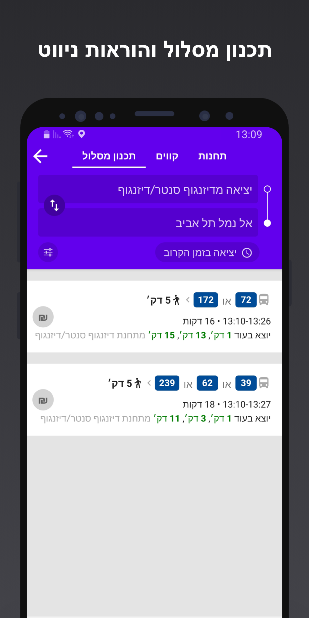
The app will locate bus and train stations around you and immediately display the arrival times of the routes at the stations. Use the search feature (by clicking on the magnifying glass at the top of the screen) to search for possible arrival routes from point to point and get accurate navigation directions for each route and fare details.
Choosing a line on the main screen or through the search will take you to the specific line screen where you can see exactly where the bus is on the map and receive detailed information about the route, station schedules, travel directions and alternatives, as well as real-time bus locations along the route.
In the bus info section, you can find comprehensive and up-to-date information on all the public transportation lines, night lines, and student lines operated by Egged, Egged Taavura, Israel Railways, Dan, Dan Badarom, Dan Beer-Sheva, Kavim, Metropoline, Superbus, Afikim, Tnufa, Extra, Nateeve Express, Beit Shemesh Express, Nazareth Transport & Tourism, UNBS, GB Tours, Galim, Golan, Eilot, Carmelit, Shared Taxis, Naim Basofash - Tel Aviv weekend service, Emek Hafar Lines, Kfir - Jerusalem Light Rail, Tel Aviv Light Rail, and operators of public transportation in East Jerusalem. The map in the app also shows locations of multi-line card reloading stands.
The arrival times of the displayed routes in the app in green are accurate times based on the GPS devices installed in the buses. Black times are based on planned timetable of future trips or when real-time information is not available.
For further information and support, feel free to contact us via Instagram, Facebook, and email through the menu on the main screen of the app.
- Version2.20.5
- UpdateDec 26, 2024
- DeveloperHopon Mobility LTD
- CategoryMaps & Navigation
- Requires AndroidAndroid 6+
- Downloads736K+
- Package Namecom.mosko.bus
- Signature1082d94203e059bdfd3be66dc27448ac
- Available on
- ReportFlag as inappropriate
-
NameSizeDownload
-
77.39 MB
-
43.01 MB


Real-Time Updates
Comprehensive Coverage
Dependence on GPS Accuracy