Altimeter GPS: Altitude Meter - Accurate altitude tracking
Elevate your outdoor adventures with precise elevation readings, weather updates & location sharing for every explorer!
- 1.4.8 Version
- 1.1 Score
- 357K+ Downloads
- In-app purchases License
- 3+ Content Rating

Are you in search of an application that measures your altitude with precision? Do you enjoy activities like hiking, skiing, mountain biking, or other outdoor adventures? If so, meet the perfect companion for your exploration—GPS Altimeter, designed to enhance your outdoor experiences.
GPS Altimeter is your essential tool for reaching new heights!
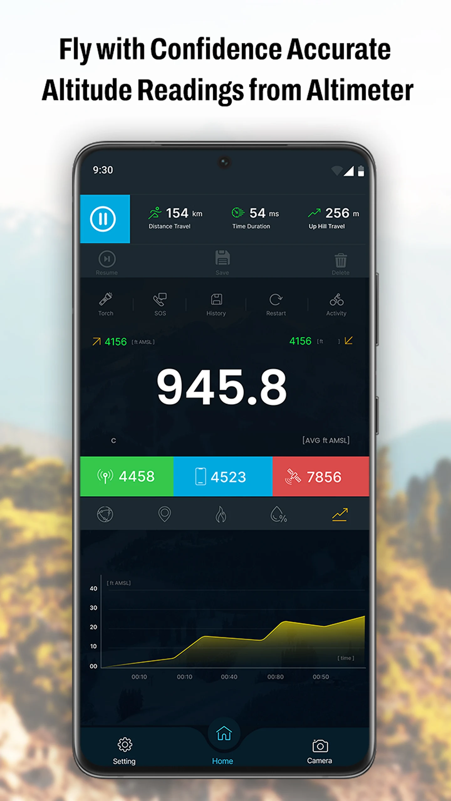
This altimeter app helps you check your elevation level effortlessly. It displays your altitude while you're traveling or participating in outdoor pursuits such as hiking or mountain biking. The GPS altitude tool allows for accurate tracking of your current location, elevation, latitude, and longitude at any moment and anywhere.
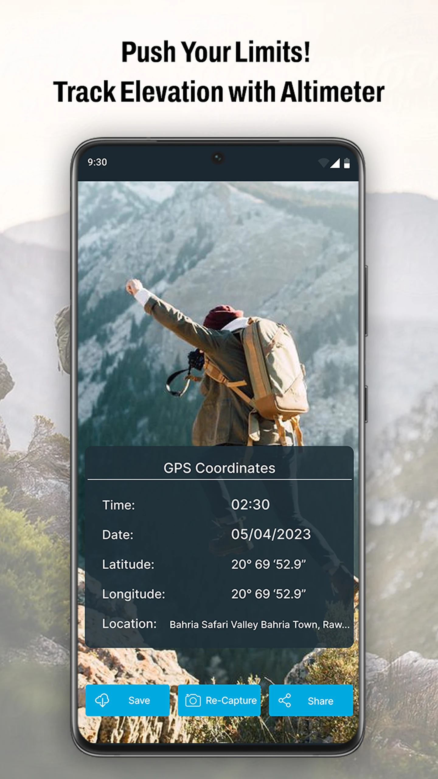
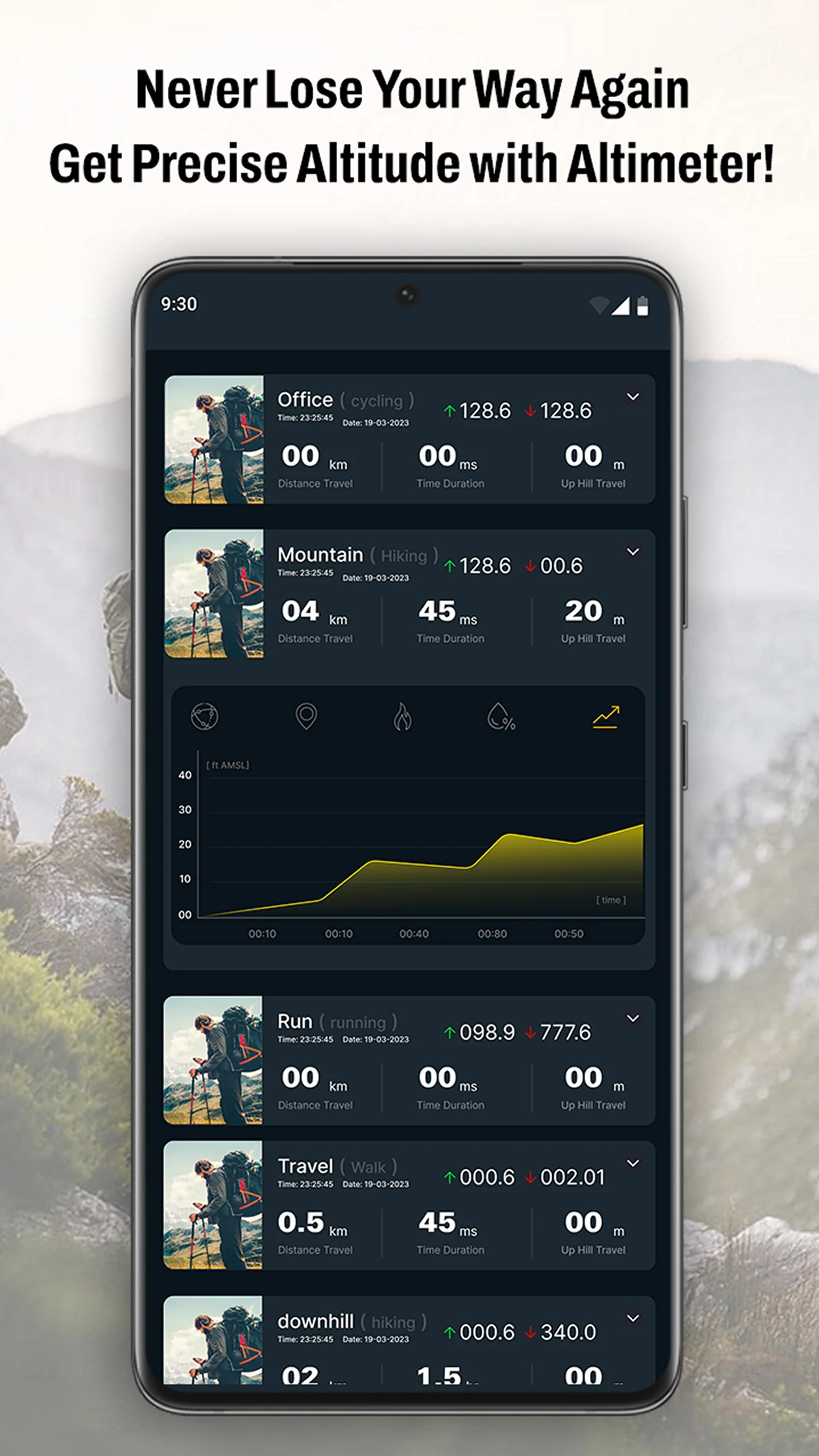
You can monitor your altitude and elevation with great accuracy whenever you need. As you progress on your journey, it tracks your elevation. Additionally, this app lets you view your latitude, longitude, and the name of your current location, making it simple to share your spot with friends.
🧭Features of the GPS Altimeter - Altitude:🧭
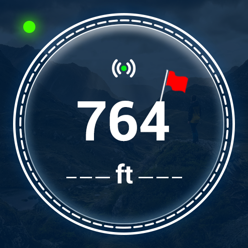
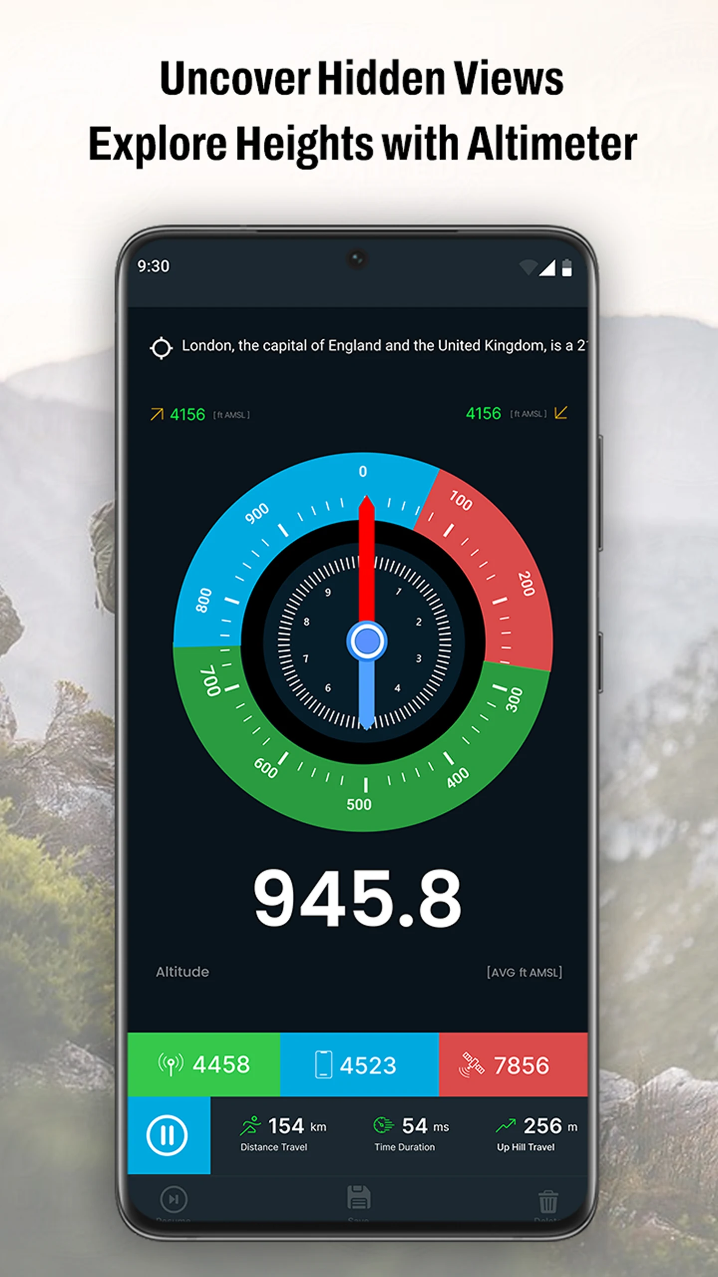
🕛 Precise Altimeter
🕛 Intelligent GPS Altimeter
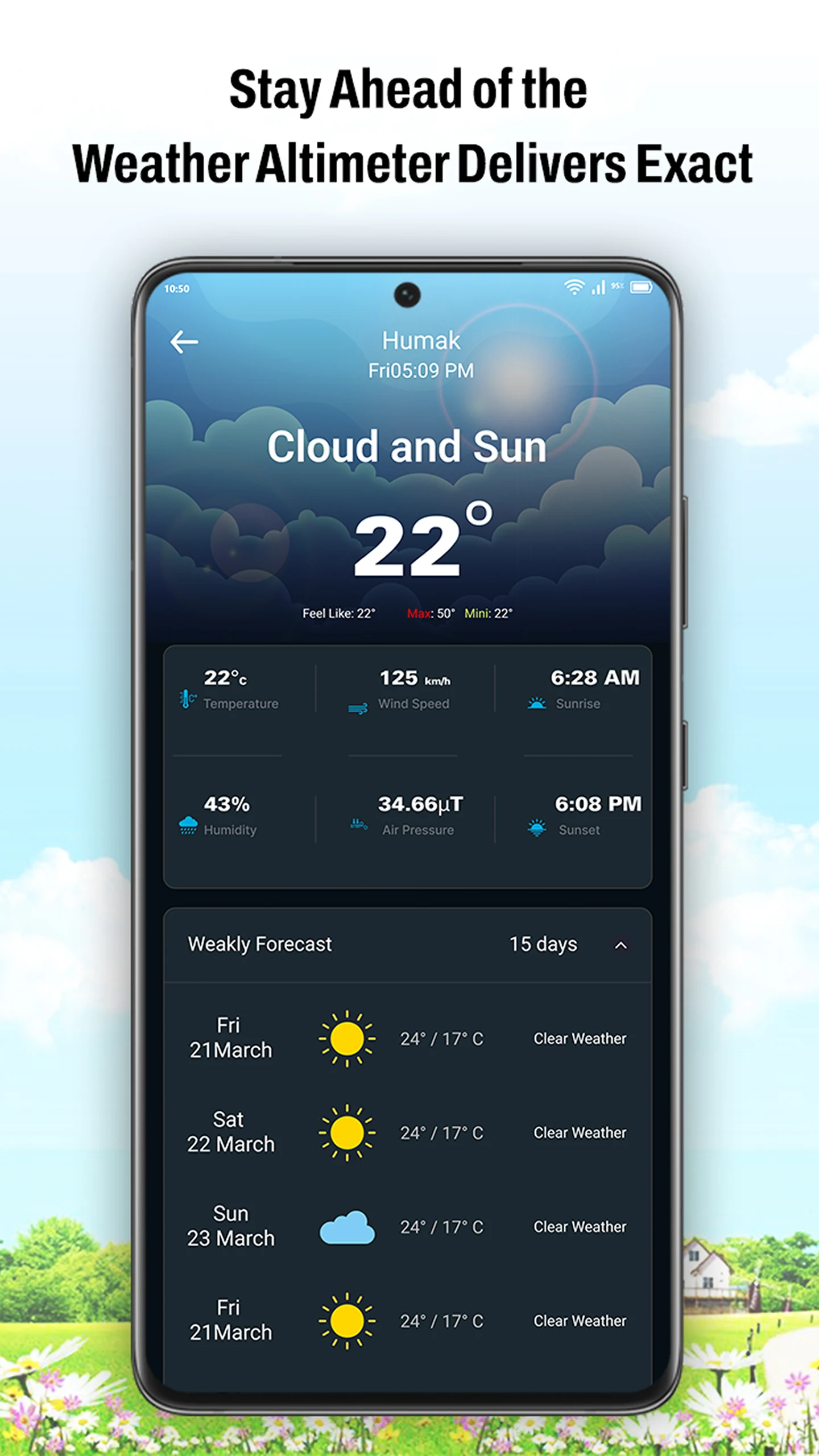
🕛 Weather updates
🕛 Current location information
🕕 Precise Altimeter:
The Precise Altimeter feature in our GPS Altimeter app provides accurate data on how high you are above sea level. Whether you're climbing a mountain or airborne in a plane, this function utilizes advanced GPS technology to deliver exact altitude measurements, ensuring you remain informed and safe during your journeys.
🧭Intelligent GPS Altimeter:
This feature merges GPS data with various sensors within your device to yield a more stable and trustworthy reading of your elevation. It's ideal for hikers, climbers, and anyone needing reliable altitude information while on the move.
🧭Weather Information
The weather component within the GPS Altimeter app provides real-time weather updates based on your location. It delivers details about current conditions, such as temperature, humidity, and wind speed, allowing you to plan your activities more effectively. This ensures that you stay safe and prepared for any sudden weather changes during your outdoor endeavors.
With Intelligent GPS Altimeter, you receive much more than just altitude data. Furthermore, you can utilize the integrated camera feature to capture photographs of your experiences and store them conveniently within the app's gallery, enabling you to reminisce about your adventures and share memories with others.
Title: A Reliable and Feature-Packed Outdoor Companion for Elevation Tracking and Beyond
What makes GPS Altimeter truly stand out is its seamless integration of precision altitude measurement, real-time weather intelligence, and practical tools that elevate any outdoor adventure from routine to extraordinary. From the moment I launched the app during a recent hike, I was impressed by its swift and accurate GPS calibration, delivering precise elevation data that consistently matched known trail markers—a critical feature for safety and navigation in unpredictable terrain. The intelligent altimeter doesn’t just rely on GPS; it smartly combines sensor data from my device to ensure stability even in areas with weaker signals, providing peace of mind when I needed it most.
The real-time weather updates proved invaluable, alerting me to sudden temperature drops and wind shifts that helped me adjust my plans proactively. But what truly sets this app apart is its thoughtful addition of a built-in camera and gallery, allowing me to capture and geotag moments without switching apps, creating a digital scrapbook of my journeys with precise altitude and location context. Whether I’m skiing, mountain biking, or simply exploring new trails, this app feels like a trusted guide—functional, intuitive, and rich with features that cater to both practical needs and the sheer joy of adventure.
FAQ:
• Q: How accurate is the altitude measurement, especially in remote areas?
A: The app leverages advanced GPS technology and complementary device sensors (like barometers, if available) to deliver highly reliable elevation data. While no consumer-grade tool is perfect, it performs exceptionally well even in off-grid locations, with minimal drift compared to standalone altimeters.
• Q: Can I use the app without cellular data or Wi-Fi?
A: Yes! The core altimeter and GPS tracking functions rely solely on satellite signals, making them fully functional offline. Weather updates, however, require an internet connection to fetch the latest data.
• Q: How does the photo gallery feature enhance the experience?
A: It allows you to capture geotagged photos directly within the app, automatically linking each image to your altitude, coordinates, and location name. This makes it easy to document and share adventures with precise contextual details, enriching your memories and stories.
• Q: Is the weather feature detailed enough for serious outdoor planning?
A: Absolutely. It provides real-time metrics like temperature, humidity, and wind speed—essential for assessing conditions before and during activities like hiking or climbing. Pairing altitude with weather data helps users make informed, safety-conscious decisions.
- Version1.4.8
- UpdateOct 25, 2025
- DeveloperWallet Passes Alliance
- CategoryTools
- Requires AndroidAndroid 7.0+
- Downloads357K+
- Package Namecom.smart.gps.altimeter.altitude.elevation.app
- Signature657e5361be6ca80ca71410a2e67b265c
- Available on
- ReportFlag as inappropriate
-
NameSizeDownload
-
11.68 MB
-
8.58 MB


User-friendly interface for outdoor activities
Precise altitude and elevation measurements
Offline functionality for remote areas
Well-suited for hiking and trekking enthusiasts
Offers GPS coordinates tracking
Provides real-time weather updates
Low data usage and installation space required
Inaccurate altimeter readings
Constant intrusive ads and paywall for premium features
Limited unit options; defaults to metric
Clunky and non-intuitive user interface
Requires camera access without clear reason
Poor compass functionality
Dependency on network connectivity affects usability
Cannot calibrate or change pressure units easily
Confusing navigation with features not working as expected